
World maps printed between 1600 and 1699, the century of the great atlas makers: Hondius, Blaeu, Visscher and Sanson. Each is restored from a named library scan and ready to print at 300 dpi.
The world on maps of the 1600s
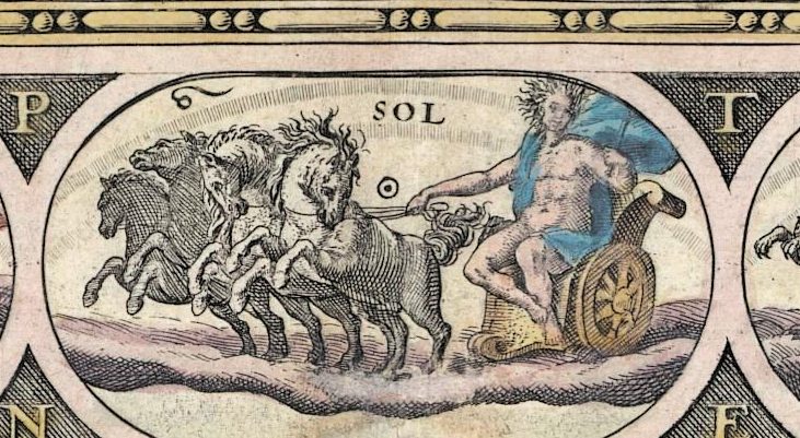
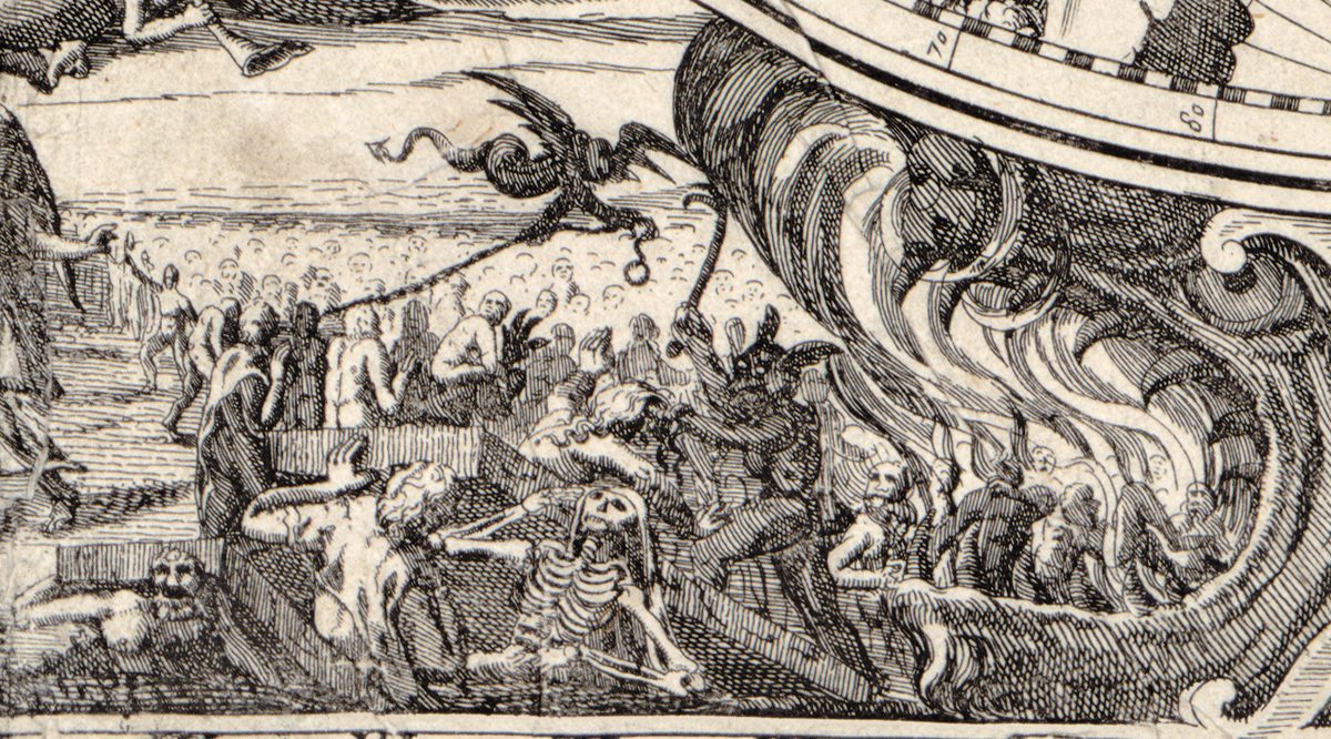
The seventeenth century belongs to the atlas publishers. In Amsterdam, the Hondius family, Willem Blaeu, Johannes Janssonius and the Visschers made the world map into a showpiece: two hemispheres framed by planets, seasons or scenes from scripture. Blaeu set Sol and his horses at the head of his map; Geylekerck’s map of 1618 has Eden along the top and the Last Judgment along the bottom. In Paris, Nicolas Sanson and his nephew Pierre Duval drew plainer, more scholarly sheets, and in London John Seller and Robert Morden published their own.
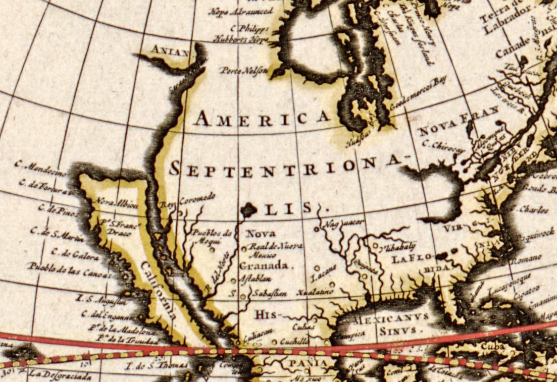
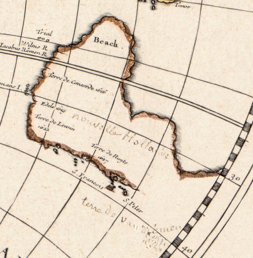
Two shapes mark the century. California is drawn as an island on sheet after sheet, from Danckerts and Tavernier’s chart of 1628 to Visscher’s of about 1690. And Australia appears for the first time as a coast: Dutch ships charted its north, west and south shores, which the maps letter Hollandia Nova or Nouvelle Hollande, while the east coast stays blank until the next century.
The 1600s maps in this collection
- Mercator and Hondius, Orbis terrae, 1602: Mercator’s world, enlarged and engraved by Jodocus Hondius and printed in Paris by Jean Le Clerc, with wind charts, a lunar chart and an armillary sphere around it.
- Geylekerck, 1618, published by Janssonius in Amsterdam, with Eden, the Last Judgment and the four seasons around the hemispheres.
- Danckerts and Tavernier, Paris 1628: a chart of the whole world “after the latest reports of the English, the Dutch and others”, with Hudson’s bay marked as a great ocean discovered in 1612.
- Blaeu’s Nova totius terrarum orbis of about 1635, dedicated to the Amsterdam burgomaster Cornelis Hooft, his map of 1645, and the Hondius maps of 1641 and 1655.
- Nicolas Sanson’s Mappe-monde of 1651 and Hydrographie of 1652, and later editions of his world printed in London (1680), Rome (1684) and Amsterdam (about 1696) — the last still signed “Par M. Sanson” almost thirty years after his death.
- Duval’s Carte universelle du commerce, 1677, a world map of the sea routes to the West and East Indies; Seller’s Novissima totius terrarum orbis tabula, about 1675, with a diagram of the Copernican system; and Morden and Berry’s map of about 1690.
- Visscher’s Orbis terrarum nova et accuratissima tabula, about 1690, and Rosaccio’s wall map, engraved with the date 1597 and catalogued by the Library of Congress as about 1643: ten sheets, 103 × 180 cm.
Between the 1500s and the 1700s
Set beside the 1500s, the copper plate has replaced the woodcut and the great southern continent has shrunk to the charted fragments of New Holland. In the 1700s the ornament thins, longitudes are corrected from astronomical observation and California slowly returns to the mainland. The island has its own collection: California as an island.
Choosing and printing a 1600s map
Sizes run from 39 cm for Blaeu’s map of about 1635 to 187 cm for Rosaccio’s wall map. Most of the double-hemisphere sheets print cleanly to 51–62 cm, and Danckerts’s chart, Morden’s map and the London Sanson to 89–97 cm. The sheets are landscape, close to 4 : 3 in proportion, and several are hand coloured as the libraries hold them.
Questions
What did the world map look like in the 1600s?
Usually two hemispheres side by side. Europe, Africa and Asia are close to their modern shapes; California is an island; the north of America is still open to guesswork; and Australia is only the north, west and south coasts charted by Dutch ships. Around the hemispheres the publishers added planets, seasons, elements and scenes from scripture.
Why is California an island on seventeenth-century maps?
The island passed from map to map, and Dutch, French and English publishers repeated it for most of the century: it is on Danckerts and Tavernier’s chart of 1628, Sanson’s map of 1651, Seller’s of about 1675 and Visscher’s of about 1690. The Jesuit Eusebio Kino later showed on foot that California is joined to the continent, yet some publishers kept the island well into the 1700s.
Who were the great mapmakers of the 1600s?
In Amsterdam, the Hondius family, Willem Blaeu, Johannes Janssonius and the Visschers; in Paris, Nicolas Sanson and Pierre Duval; in London, John Seller and Robert Morden. All of them have maps on this page.
How large can I print a 1600s world map?
From 39 cm to 187 cm at 300 dpi, depending on the sheet; most print cleanly to 51–62 cm. Each listing gives the largest clean size, calculated from the scan and never from an upscale.
Other centuries: 1500s · 1700s · 1800s · All antique world maps