Antique World Map 1645 — Blaeu, Novvelle et Exacte Description

Description
An old world map of 1645, with the seasons and twelve nations around it
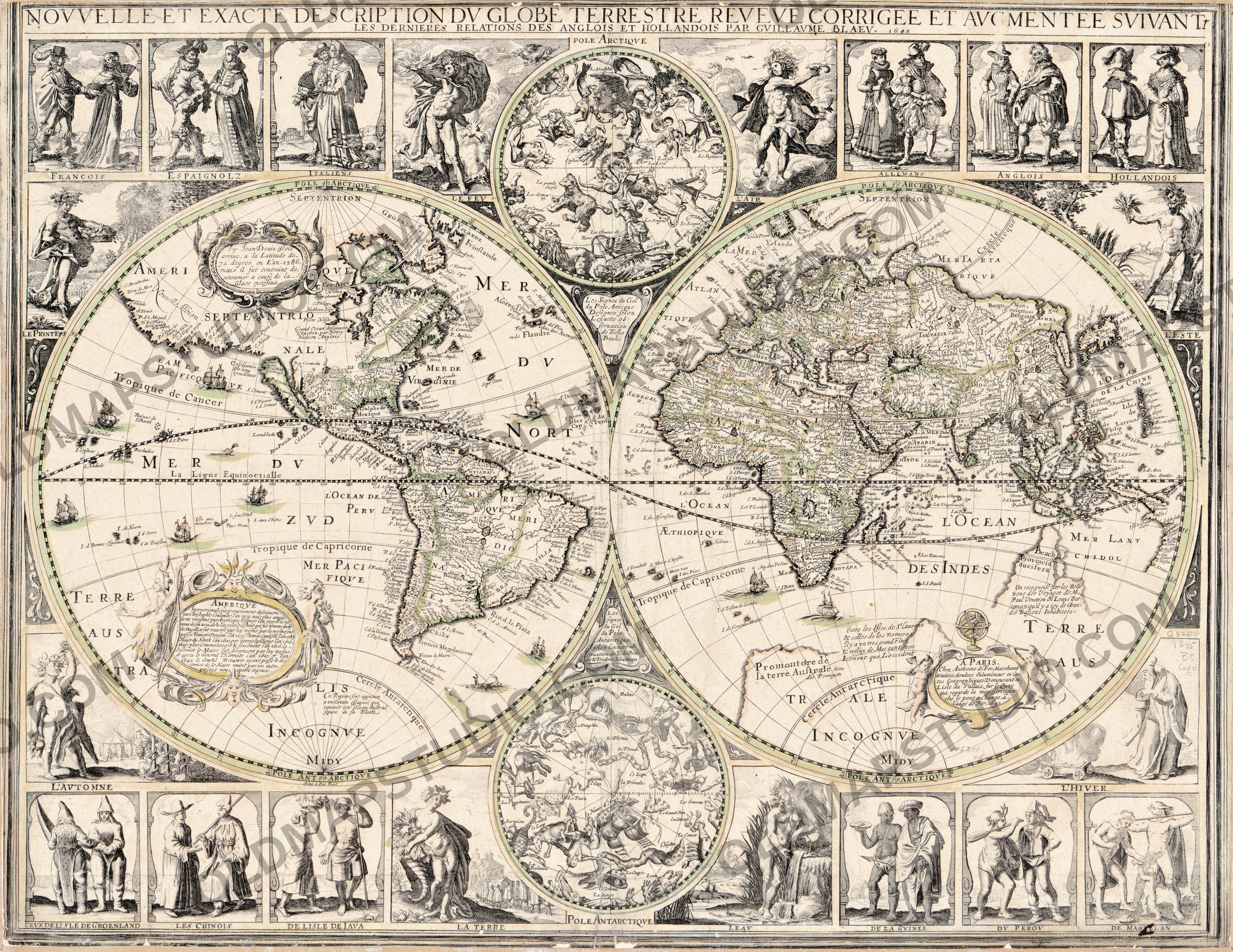
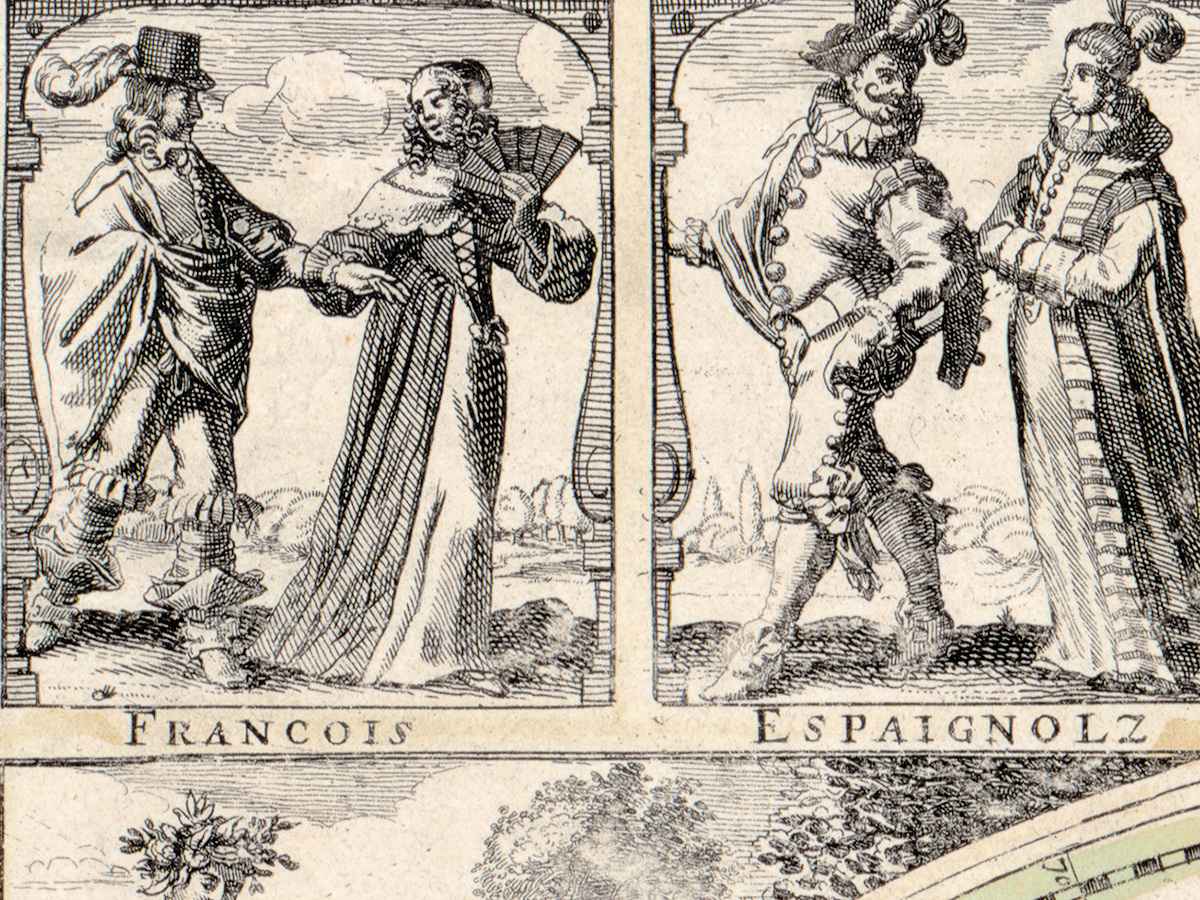
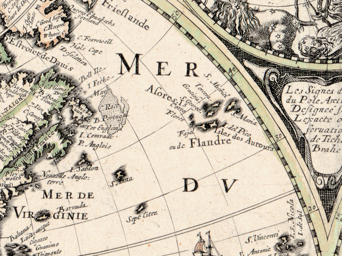
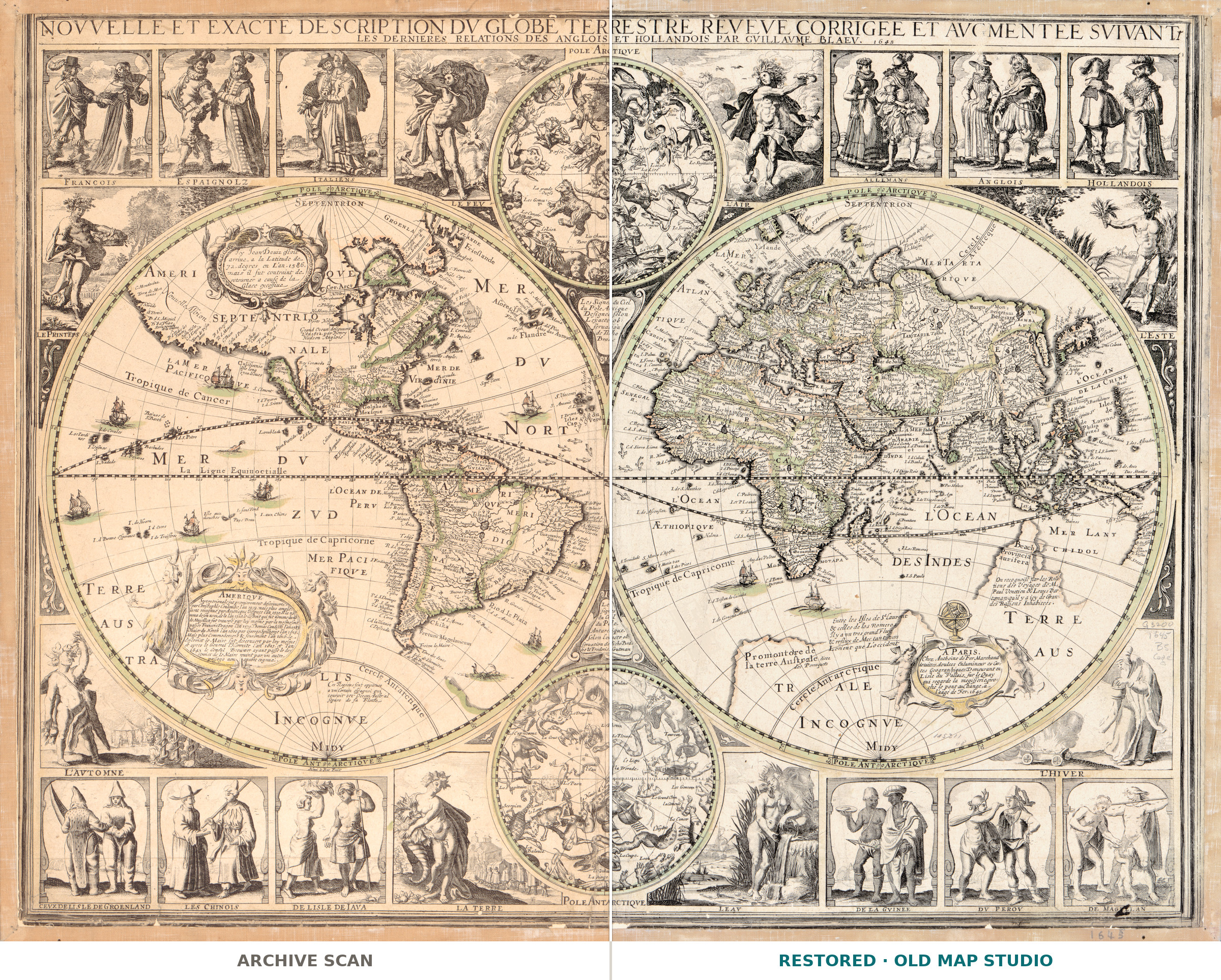
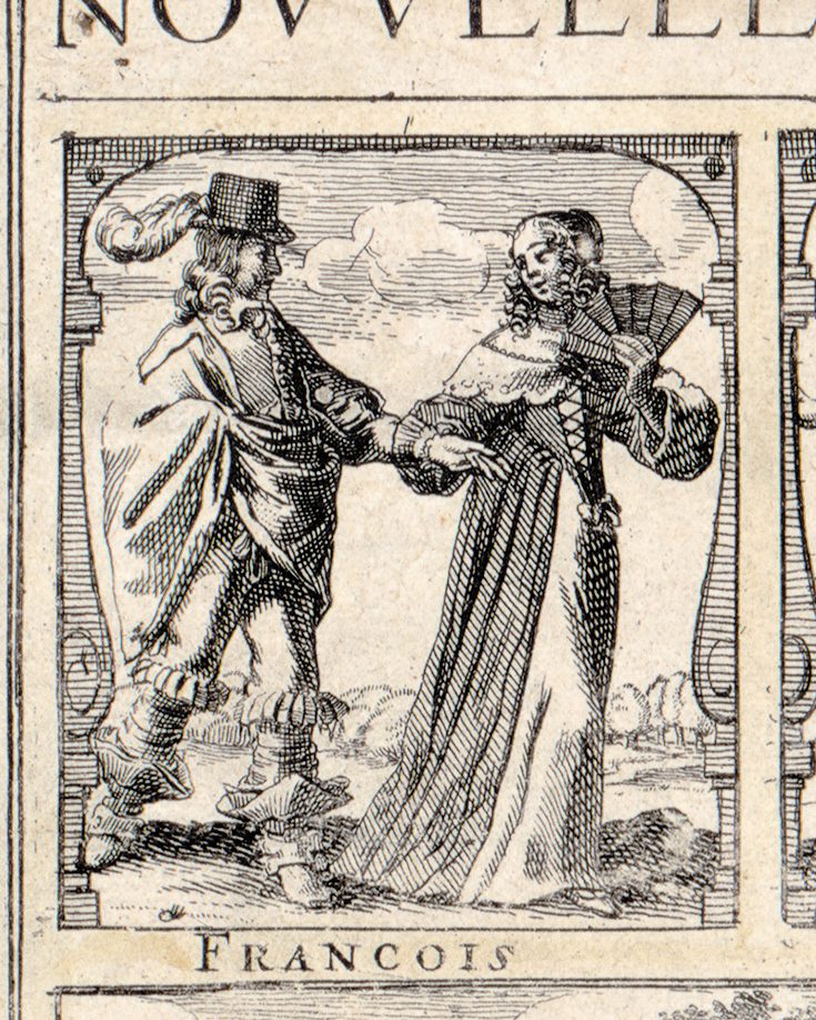
In 1645 a Paris printseller published the whole world framed by its peoples. Along the top border stand figures in the dress of six European nations — French, Spanish, Italian, German, English and Dutch. Along the bottom are the people of Greenland, China, Java, Guinea and Peru, and the Magellanic people of the far south of America. Between them, the two hemispheres are surrounded by the seasons, the elements and two small charts of the stars.
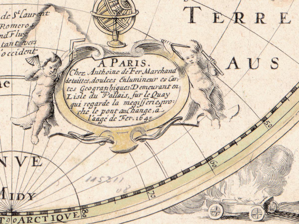
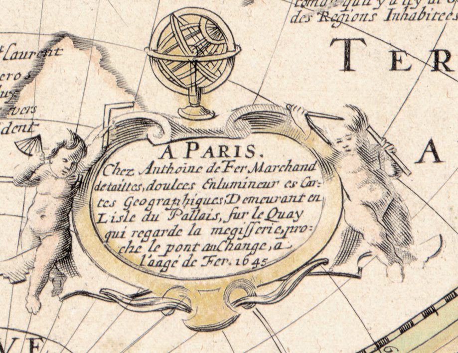
The imprint names the publisher: Anthoine de Fer, who calls himself a seller of copperplate prints and an Enlumineur es Cartes Geographiques — a colorist of maps — on the quay of the Île du Palais facing the Mégisserie, near the Pont au Change, at the sign of the Iron Age, a l'aage de Fer. A year earlier, in 1644, de Fer and another printseller, Nicolas Berey, had bought the copperplates of Christophe Tassin for 3,500 livres. His wife, Geneviève Hourlier, later ran the business until 1687, when she handed it to their son Nicolas de Fer.
The title promises a description reveve corrigee et avgmentee svivant les dernieres relations des Anglois et Hollandois, “revised, corrected and enlarged after the latest reports of the English and Dutch,” by Gvillavme Blaev — Willem Janszoon Blaeu of Amsterdam. The Library of Congress lists both Blaeu and Claes Jansz. Visscher, and adds a note citing Rodney Shirley's survey of printed world maps: “According to Shirley, the map is based on one by Visscher, rather than Blaeu.” The Library holds Visscher's Amsterdam world map in copies dated 1639 and 1652, with the same scheme of seasons, elements, notes, two star charts and twelve peoples, captioned there in Latin. Copying was an old habit: the History of Cartography notes that Paris publishers imported, counterfeited or plagiarized Dutch maps for half a century, from 1580 to 1630.
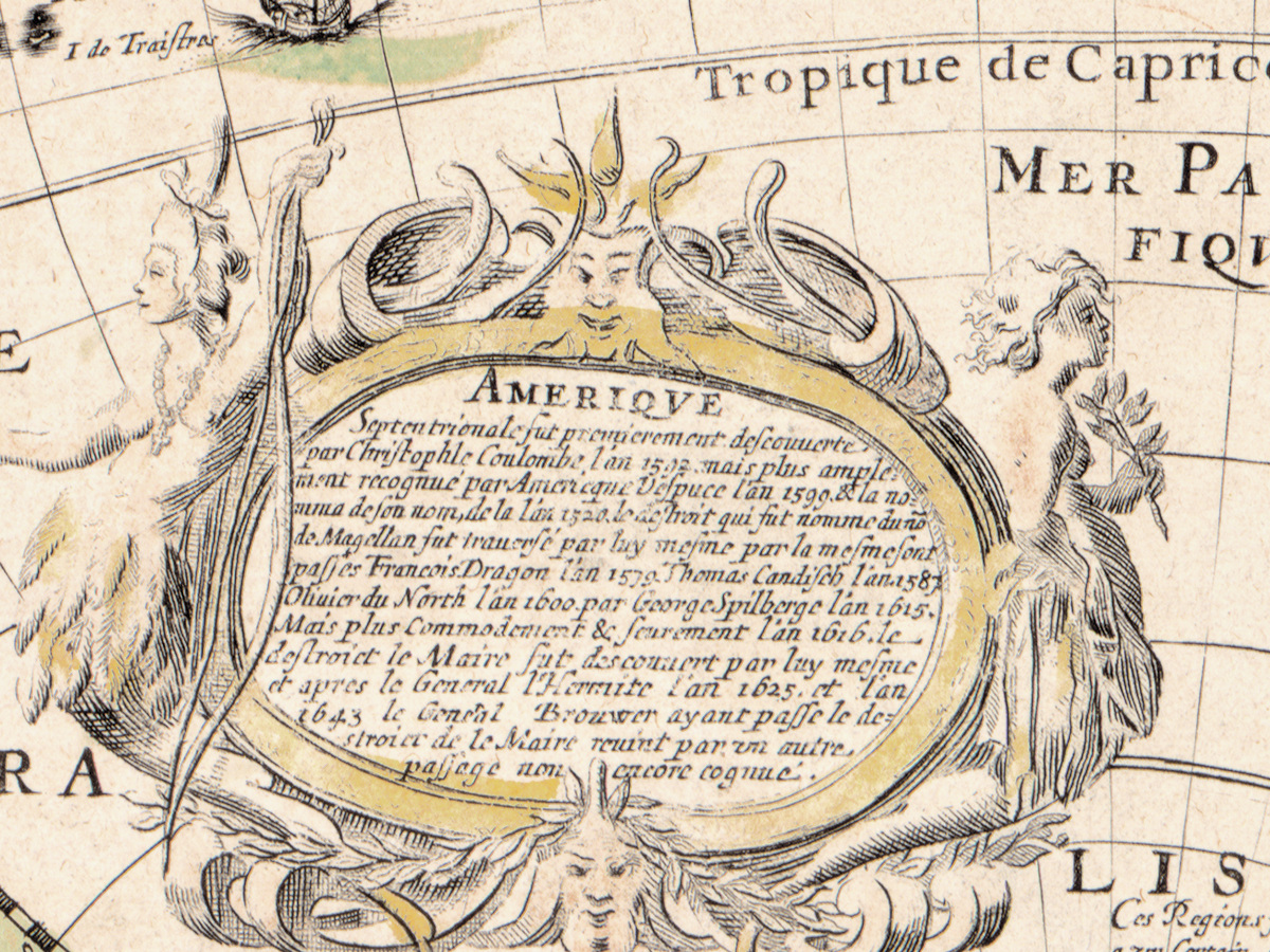
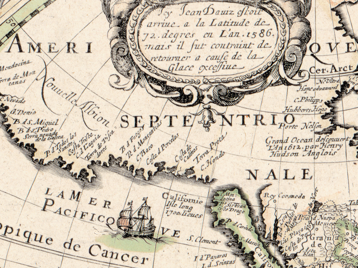
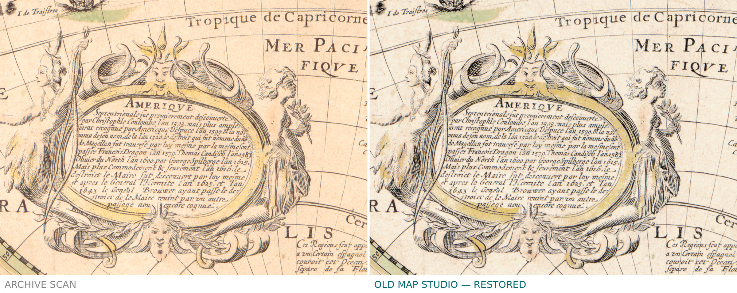
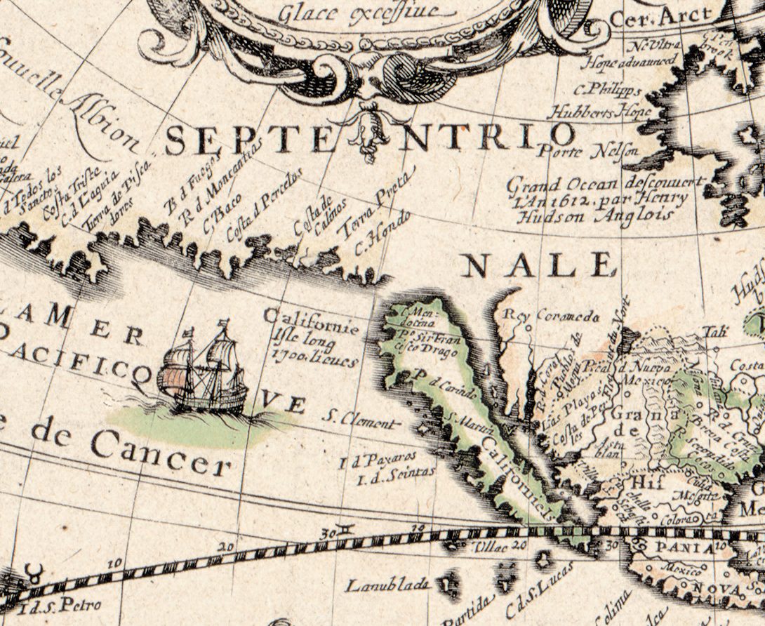
California is an island here, Californie Isle long 1700 lieues, with Nouvelle Albion on the coast to the north. Two cartouches name voyages behind the map: one in the Arctic says that John Davis reached 72 degrees in 1586 and was forced back by la Glace excessiue; the one for America lists the passages through the Strait of Magellan and the Le Maire Strait down to General Brouwer in 1643 — news only two years old when the sheet was dated.
What to look for on the sheet
- The imprint, held up by two putti under an armillary sphere on the great southern land at the bottom of the eastern hemisphere: A Paris. Chez Anthoine de Fer … a l'aage de Fer. 1645.
- The twelve peoples: Francois first, at top left, De Magellan last, at bottom right.
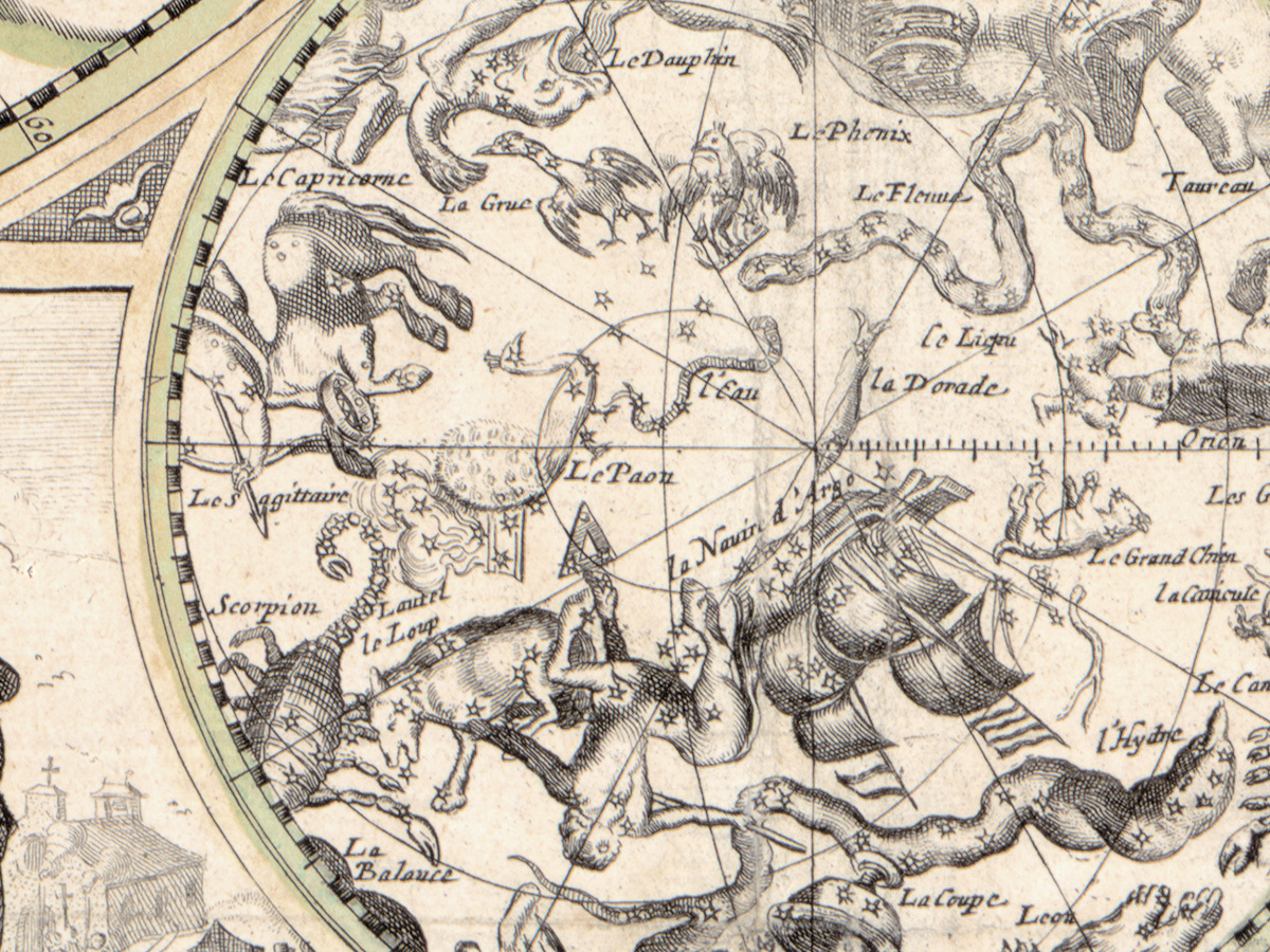
- The northern star chart at top center, with French names for the constellations and a note that it follows Lexacte obseruation de Ticho Brahe; its southern partner sits at the bottom.
- Seasons and elements: spring at the left side, winter at lower right, and the elements beside the star charts — La Terre and Leav flank the southern one along the bottom.
- The Library of Congress copy is lightly colored and mounted on cloth, with pin holes in all four corners.
One Dutch map could pass through many Paris imprints. The History of Cartography follows Jodocus Hondius's double-hemisphere world map of 1617 through Paris versions by Honervogt and Tavernier from 1625, van Lochom in 1636, Berey in 1641 and Jollain in 1655. De Fer's sheet belongs to the same traffic between Amsterdam and Paris: a Dutch design with a French title, French captions and a Paris address.
Your file
| Original | Willem Janszoon Blaeu and Claes Jansz Visscher, published by Antoine de Fer, Paris, 1645 |
| Sheet | 45 × 58 cm, two hemispheres of 26 cm |
| Scan | full sheet 6807 × 5247 px; the map inside the trimmed border 6640 × 5130 px. From the library's own scan, not an upscale |
| Print size at 300 dpi | the map prints to 56 cm (22 in), the full sheet with margins to 57 cm (22 in) |
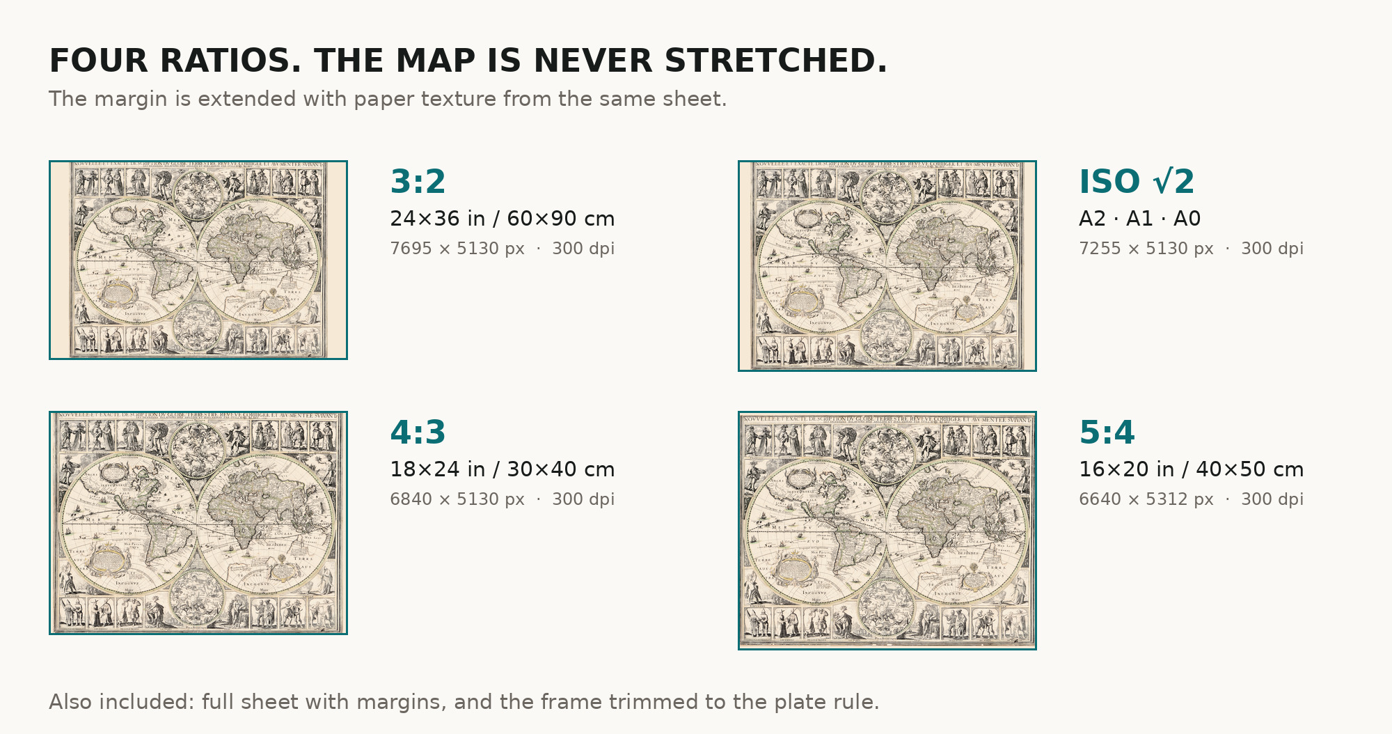
| You download | six ZIP archives: full sheet, trimmed, 3:2, 4:3, 5:4 and ISO A |
| Inside each one | one JPEG at 300 dpi, the restoration passport as a PDF, a READ ME |
How to print
- Pick the archive whose proportions match your frame, so nothing is cropped or stretched.
- Ask for matte fine-art paper, printed in sRGB with auto-enhancement off.
- Where to print it: print shops near you and checked prices at online labs.
Source and rights
Library of Congress, Geography and Map Division, call number G3200 1645 .B5, LCCN 2017585787. The Library states the content is free to use and reuse, crediting the division. Its record is candid about this copy: mounted on cloth, with pin holes in all four corners. One change of ours is worth naming: a stamp of November 1907 lay across the engraving south of the Cape of Good Hope and was lifted. There is no TIFF master in the package. Catalogue record: Library of Congress →
Features
- French
Attachments
Reviews
No reviews found
See also
-
 Antique World Map 1655 — Hondius, Nova Totius Terrarum Orbis
-
Antique World Map c. 1675 — Seller, Novissima Totius Orbis
-
Antique World Map 1709 — Moll, A New and Correct Map
-
Antique World Map 1757 — The Earth's Western Planisphere
-
Antique World Map 1799 — Chart of the World
-
Antique World Map 1541 — Fries, Typus Orbis Ptolemaei