
Instant digital download
Antique maps, restored — not just scanned
Every sheet starts as a library scan and is worked by hand: stains, foxing and library stamps removed, paper tone rebuilt, folds closed. The engraving itself is never retouched and never cropped. You get six print-ready files and a passport that lists what was done.
- Six files per map · 300 dpi · prints up to 92 cm
- Public-domain originals — holder and shelfmark named on every map
- from $14.90 per map · download in minutes, print anywhere
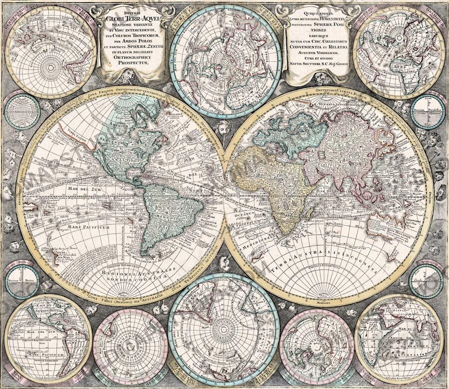
The difference
A scan is not a print file
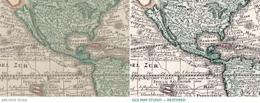
Same copper plate, same 300 dpi. On the left, the archive scan exactly as the library publishes it. On the right, our master.
What we remove
Yellowing and green cast, damp stains and foxing, dust, scanner edges, fold shadows, torn paper at the margins — and library stamps outside the plate, decided sheet by sheet.
What we never touch
The engraved line, the lettering, the period hand colouring and the plate mark. Nothing is redrawn, nothing is sharpened into a halo, and the border is never cropped away.
Measured, not eyeballed
Fifteen numbers per sheet — black point, white point, evenness, stains, noise and sharpness against the source. The passport inside your download lists every one.
One purchase, six files
What is in every download

- Full sheet — margins, plate mark and all, exactly as the paper is
- Trimmed to the plate rule — for framing edge to edge
- Four standard ratios — 3:2, 4:3, 5:4 and ISO A, margin extended with paper from the same sheet
- 300 dpi, sRGB with embedded profile — the largest clean size is stated on every map
- Restoration passport (PDF) — the source, the holder, the shelfmark and every measurement
- Personal-print licence included · commercial licence +$49
No shipping, no waiting
How it works
Pick your map
Every listing shows the full sheet, details at 1:1 and the largest size it prints cleanly.
Pay by card or PayPal
Prices in US dollars; euro, pound and zloty are shown too.
Download at once
Your link works immediately after payment — five downloads, and the files are yours to keep.
Print anywhere
At home, at a local print shop or at an online lab. We give you the size; you choose the paper.
Provenance
Every map says where it came from
We restore public-domain originals from named library collections, and we say which one, with its shelfmark, on the listing and inside the passport. No anonymous files, no scans taken from other sellers.
| Map | Holding institution | Shelfmark / file ID | Rights |
|---|---|---|---|
| Sanson, 1680 | Library of Congress, Geography & Map Division | G3200 1680 .S22 · LCCN 2017585707 | Public domain |
| Moll, 1706 | Boston Public Library, Leventhal Map & Education Center | G1015 .C65 1630 · commonwealth:7h14b1855 | Public domain |
| Stieler, 1816 | ETH-Bibliothek Zürich | Rar KS 326 · e-rara 28284119 | Public Domain Mark |
| Moll, 1709 | National Library of Scotland | EMW.X.032(3) · nls:78057218 | CC BY 4.0 |
At 300 dpi
The detail you are actually buying
Crops at full resolution, straight from the files you download.


Before you buy
Questions we get
Is this a physical print?
No — you buy the files and print them yourself, at home or at any print shop. That is why a museum-quality map costs $14.90 and not $190.
How large can I print it?
Every map states its largest clean size at 300 dpi. Nothing is upscaled to fake a bigger number.
Can I use it for a client or a product?
Personal printing is included. For client work, packaging or resale of printed goods, add the commercial licence (+$49). Reselling the file itself is not allowed.
What if the file is wrong?
Write to us and we fix it or refund it. Digital goods cannot be returned once downloaded, but a broken file is our problem, not yours.
Old Map Studio restores antique maps from the collections of national libraries and archives and publishes them as high-resolution files you can print yourself.
Every sheet is worked by hand — stains, foxing and fold lines removed, torn edges rebuilt, colour corrected — while the texture of the original paper is deliberately kept. Files are 300 DPI in the common frame proportions, so the same download works for a desk print or a 92 cm wall piece.