Antique World Map c. 1690 — Visscher, Orbis Terrarum Nova Tabula

Description
An antique world map by Nicolaes Visscher, Amsterdam, c. 1690
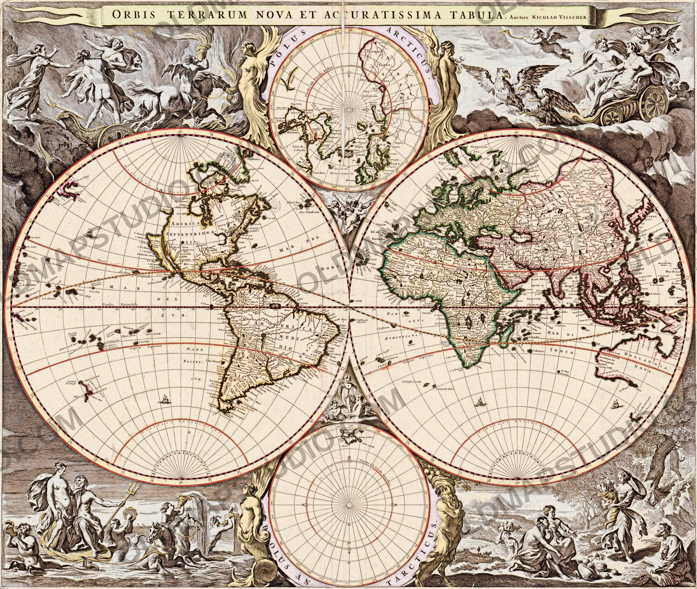
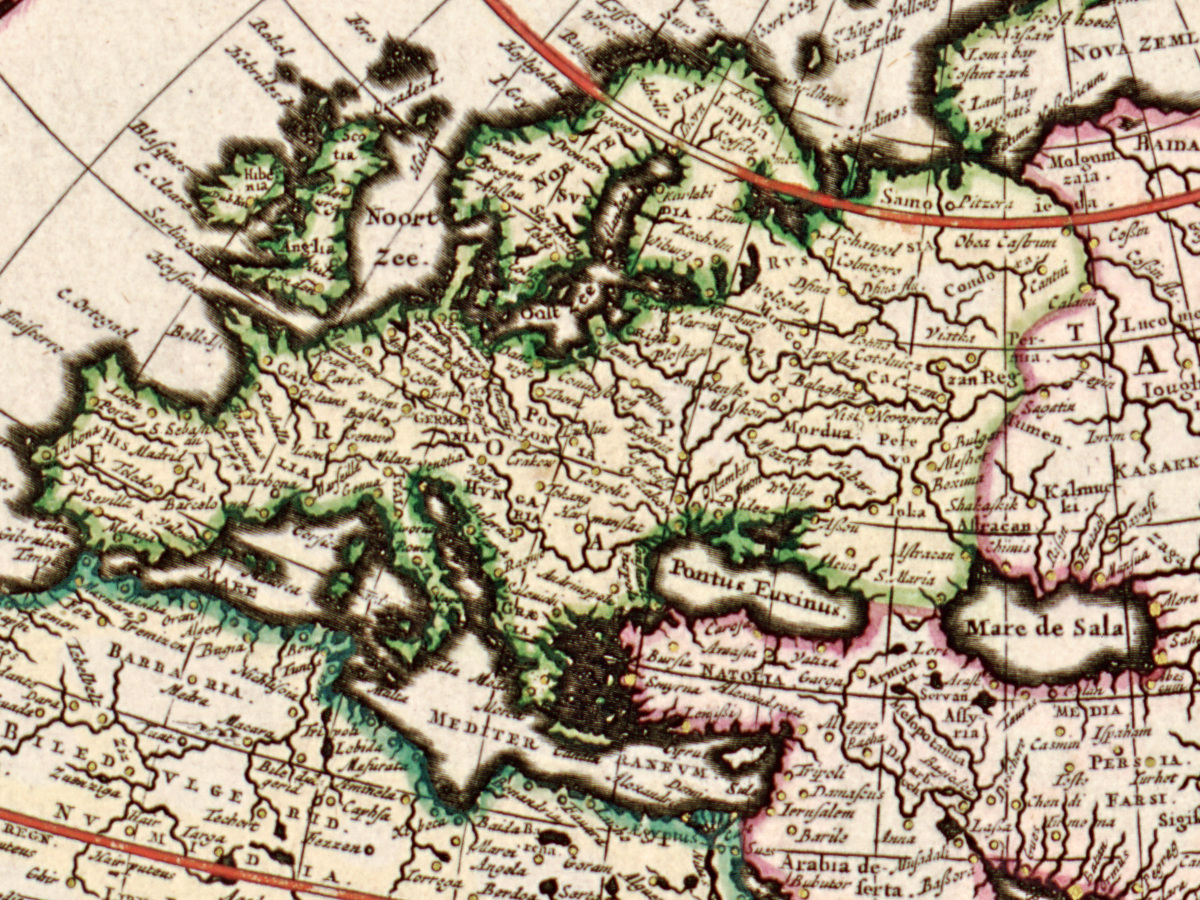
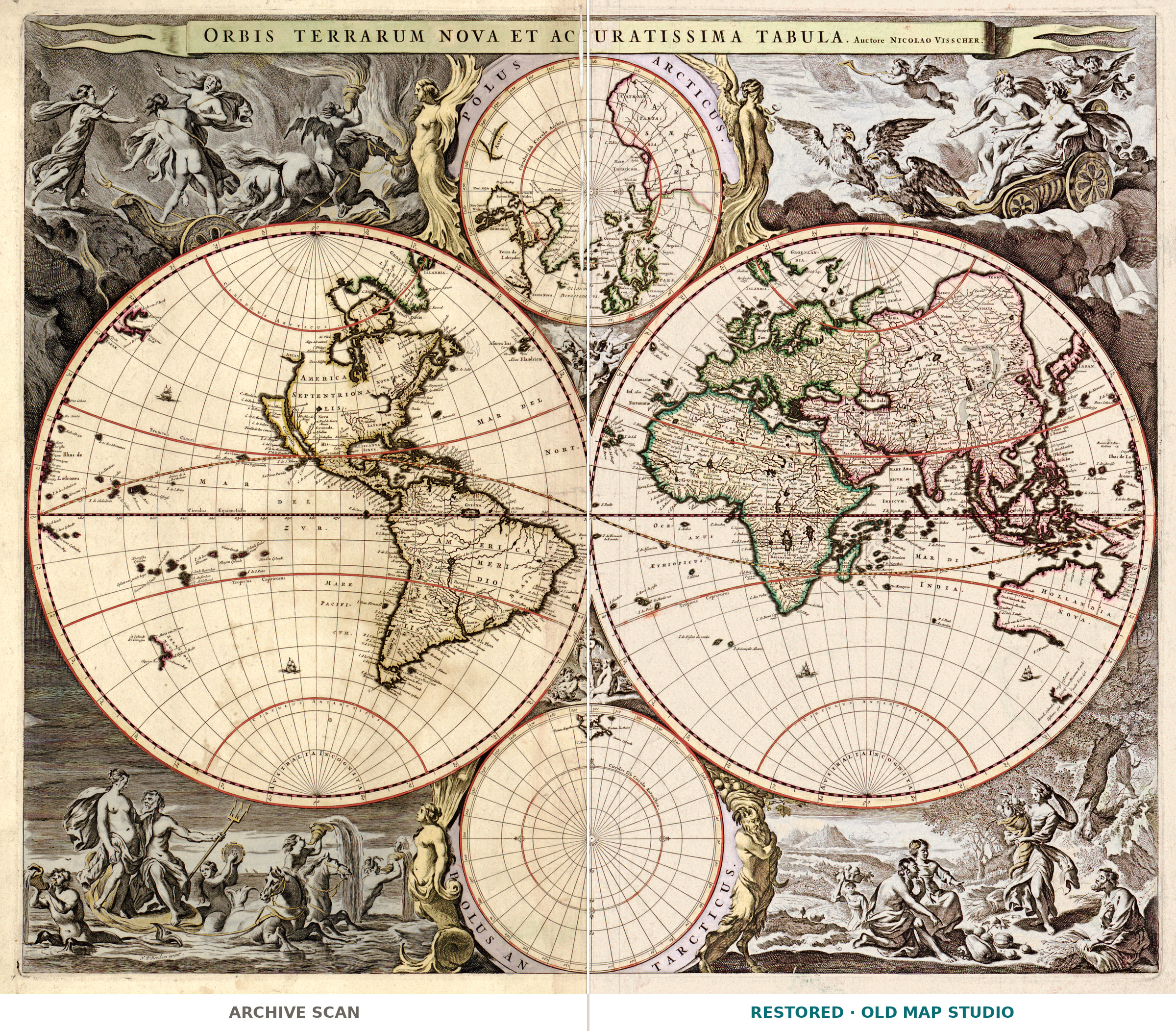
This hand-colored double-hemisphere map is Orbis terrarum nova et accuratissima tabula, “a new and most accurate map of the world”. The banner across the top names its author: Auctore NICOLAO VISSCHER. The Library of Congress catalogues its copy as published in Amsterdam by Nicolaes Visscher, “[1690?]”, and notes that the map appears in Visscher’s Atlas minor. Each hemisphere is 28 cm across, on a sheet of 50 × 62 cm.
Two heads of the Amsterdam Visscher firm were called Nicolaes. The Library of Congress names the younger one (1649–1702) as maker and describes him as “the third generation of a prominent mapmaking family”; after his death his widow, Elizabeth, kept the business going until 1726. Other libraries holding the same map, among them Princeton, Stanford and Yale, credit his father, Nicolaes Visscher I (1618–1679), and date it 1658. The Leventhal Map Center in Boston writes that the map “first appeared in Jan Jansson’s 1658 Novus Atlas” and was later reused, unchanged, in atlases compiled by the Visscher family and in composite atlases. This sheet, from the Atlas minor, is therefore most likely a later printing of that plate.
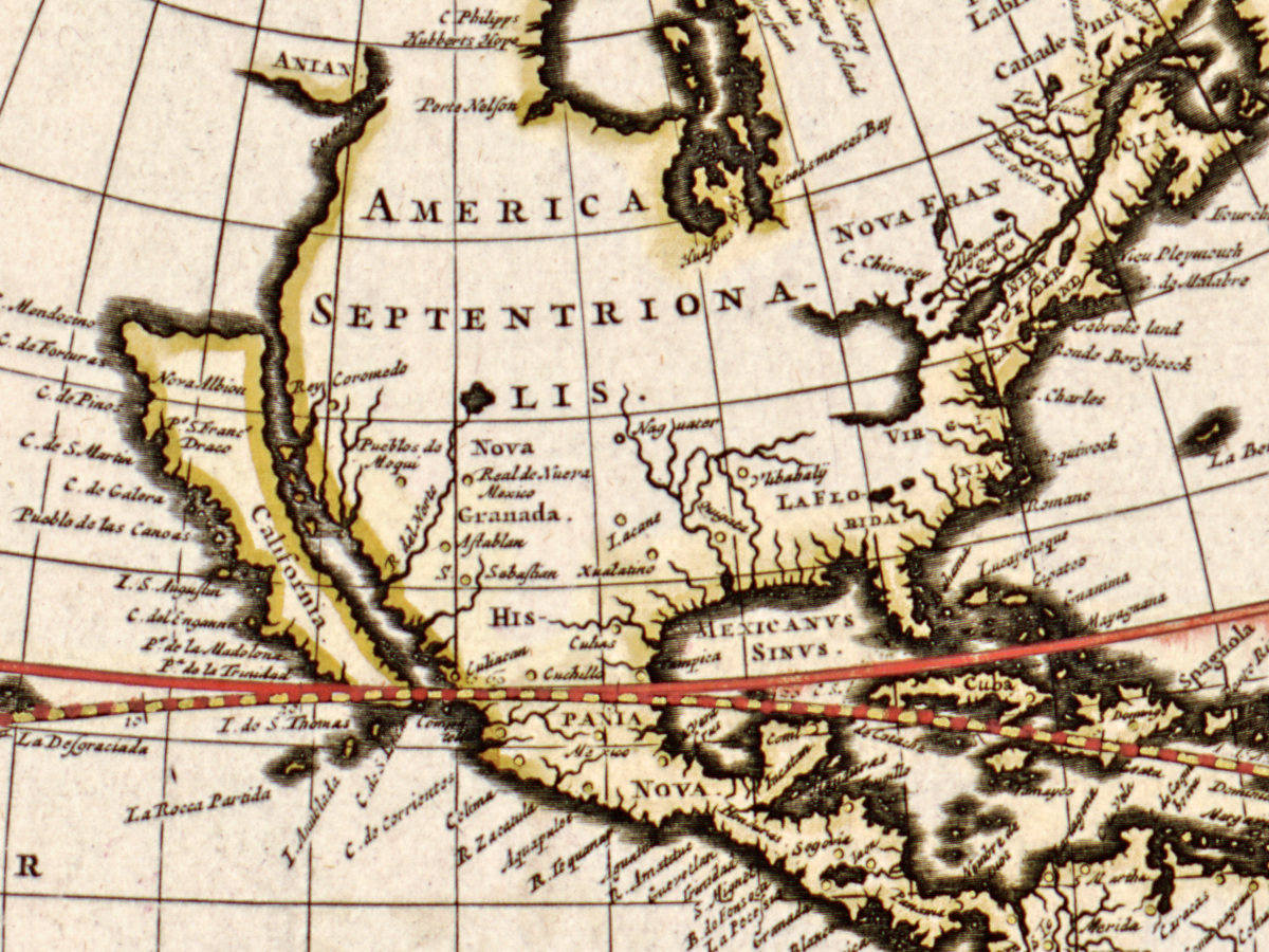
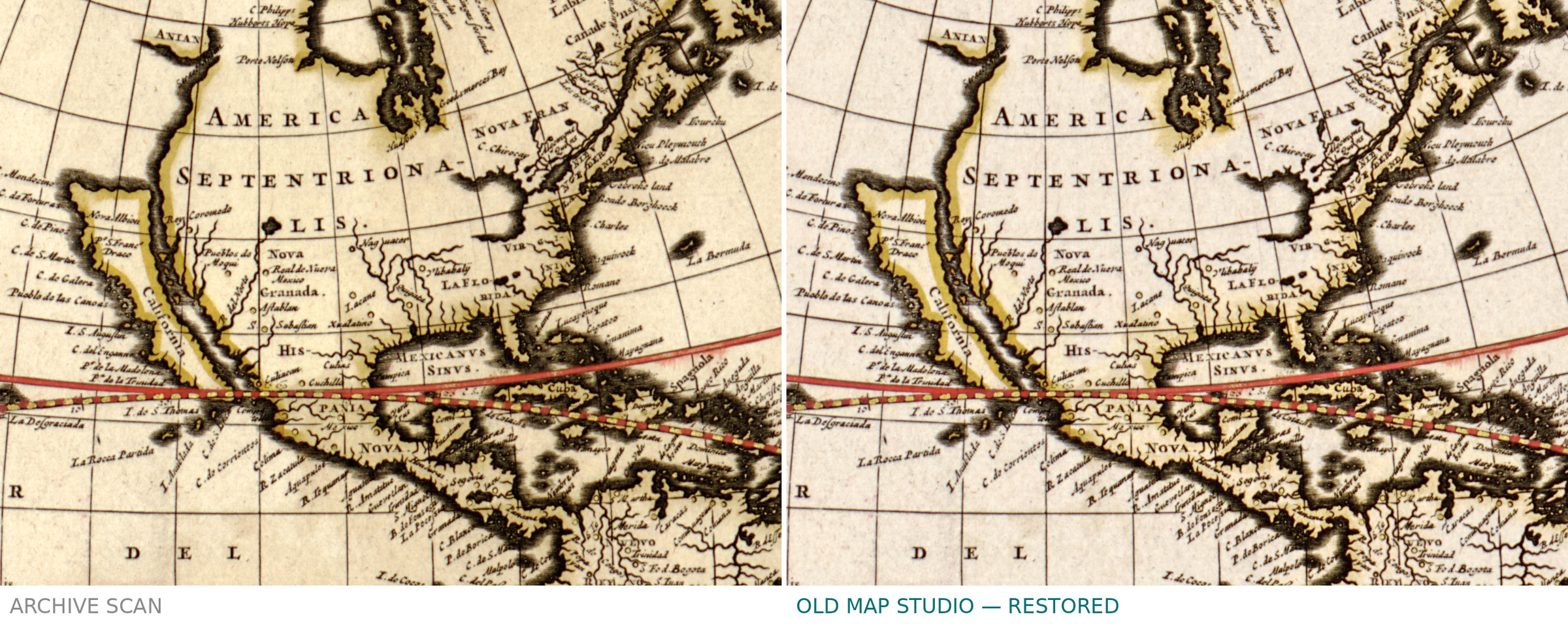
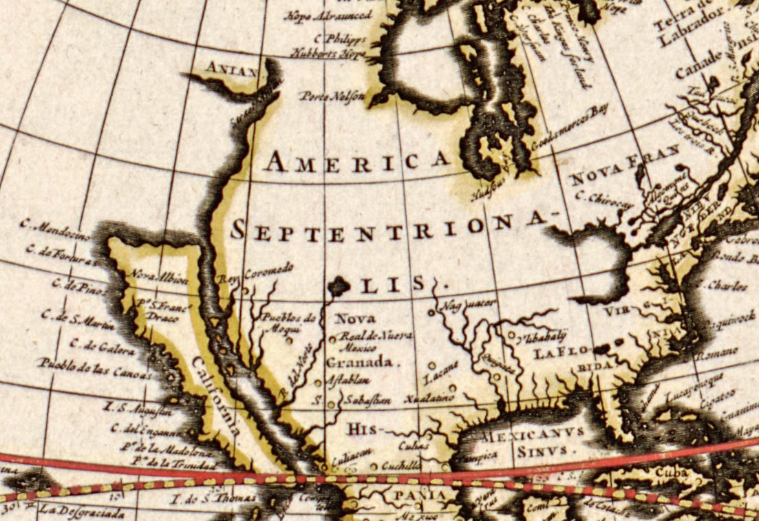
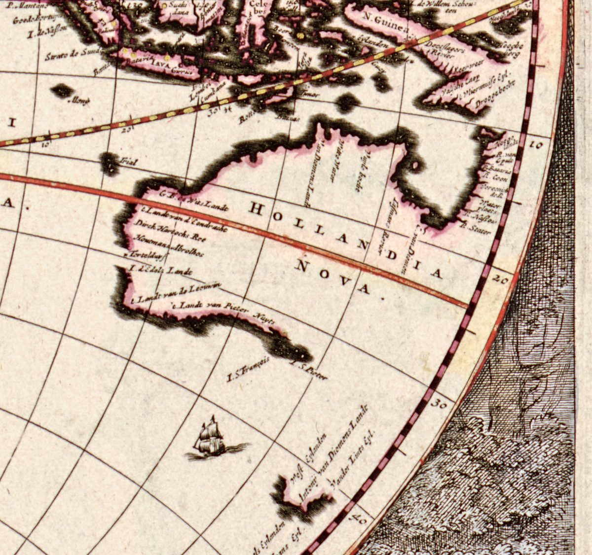
The geography is that of the mid-seventeenth century. California is drawn as a large island, with Nova Albion written on it, and the coast of North America runs north to a strait marked ANIAN, a passage that did not exist. In the Southern Hemisphere the map shows the coasts charted by Dutch ships, among them those found by Abel Tasman in 1642–44. HOLLANDIA NOVA, Australia’s north, west and south coasts, is drawn with gaps and no east coast at all. To the south-east the map shows the south coast of Antonij van Diemens Landt (Tasmania), and further east a short stretch of coast lettered ZELANDIA and NOVA, New Zealand, where the names of Tasman’s anchorage and of C. Maria van Diemen are written along the shore.
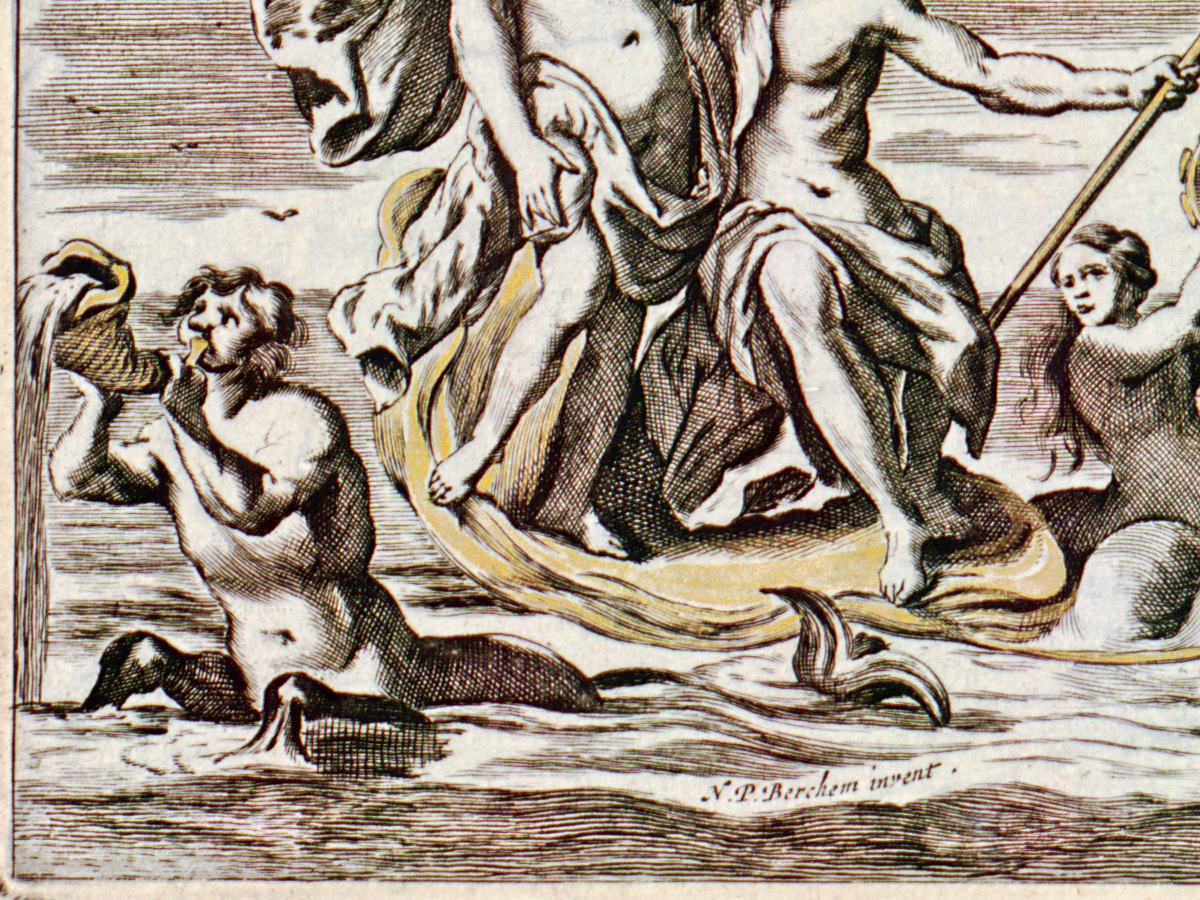
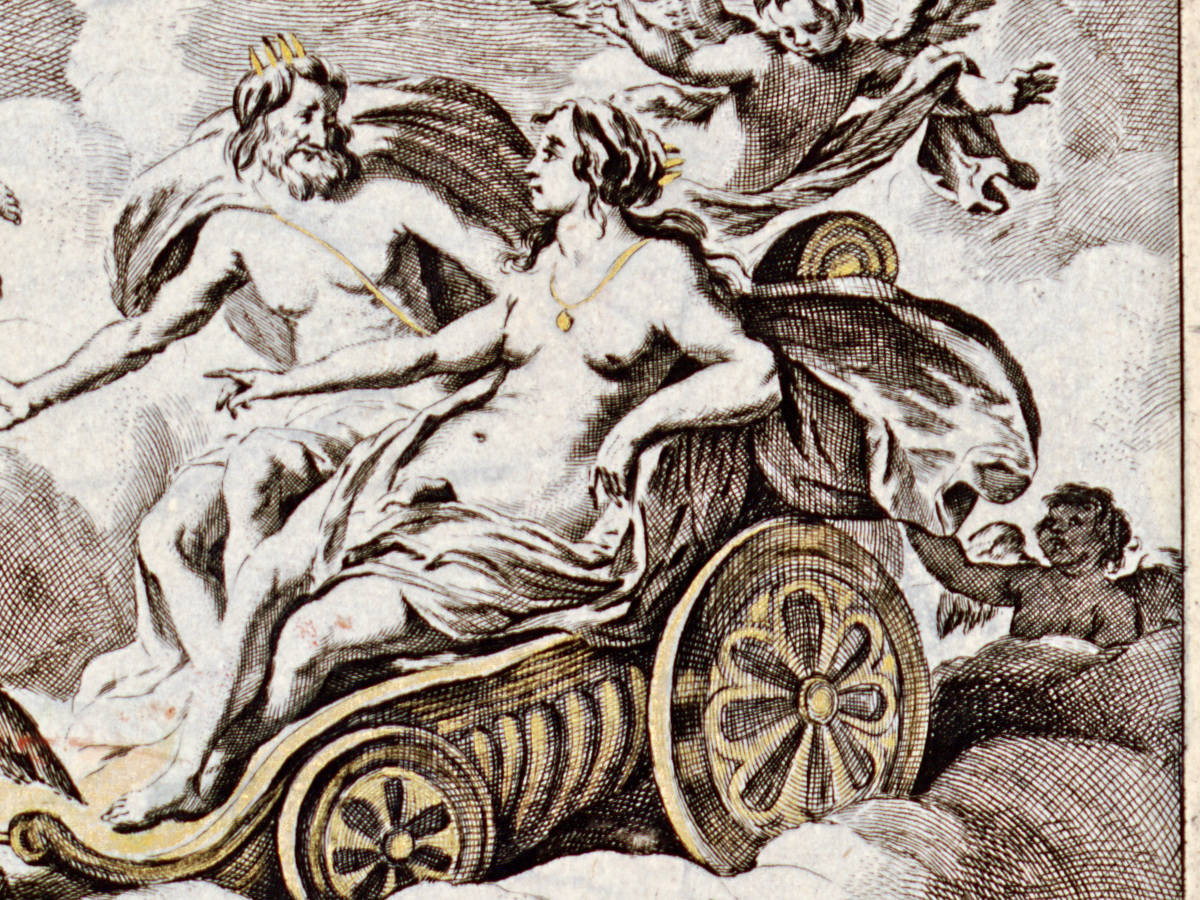
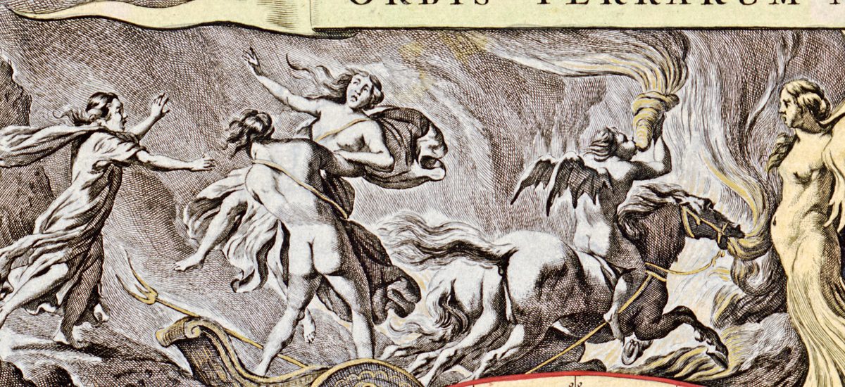
The decoration fills every space around the circles. A lower-left signature, N.P. Berchem invent., names the Dutch painter Nicolaes Pietersz Berchem as its designer; Stanford’s record names the engraver as Jan de Visscher. Four mythological scenes fill the corners, which the Leventhal Map Center describes as “suggestive of the four basic elements”: the rape of Persephone amid flames, Zeus carried through the sky in an eagle-drawn chariot, Poseidon and his train emerging from the sea, and Demeter receiving the fruits of the land. Between the hemispheres two small circles show the regions around the North and South Poles.
What to look for on the sheet
- Upper left: Hades carrying off Persephone amid flames; upper right: Zeus in a chariot pulled by two eagles.
- Lower left: Poseidon with his trident, sea horses and tritons; the small signature N.P. Berchem invent. sits in the waves below them.
- Lower right: Demeter among harvesters, with sheaves, melons and a cornucopia.
- California as an island at the left of the western hemisphere, and the strait ANIAN above it.
- Dutch-charted coasts at the lower right of the eastern hemisphere and on the left edge of the western one: HOLLANDIA NOVA, Tasman’s Antonij van Diemens Landt and his ZELANDIA with NOVA.
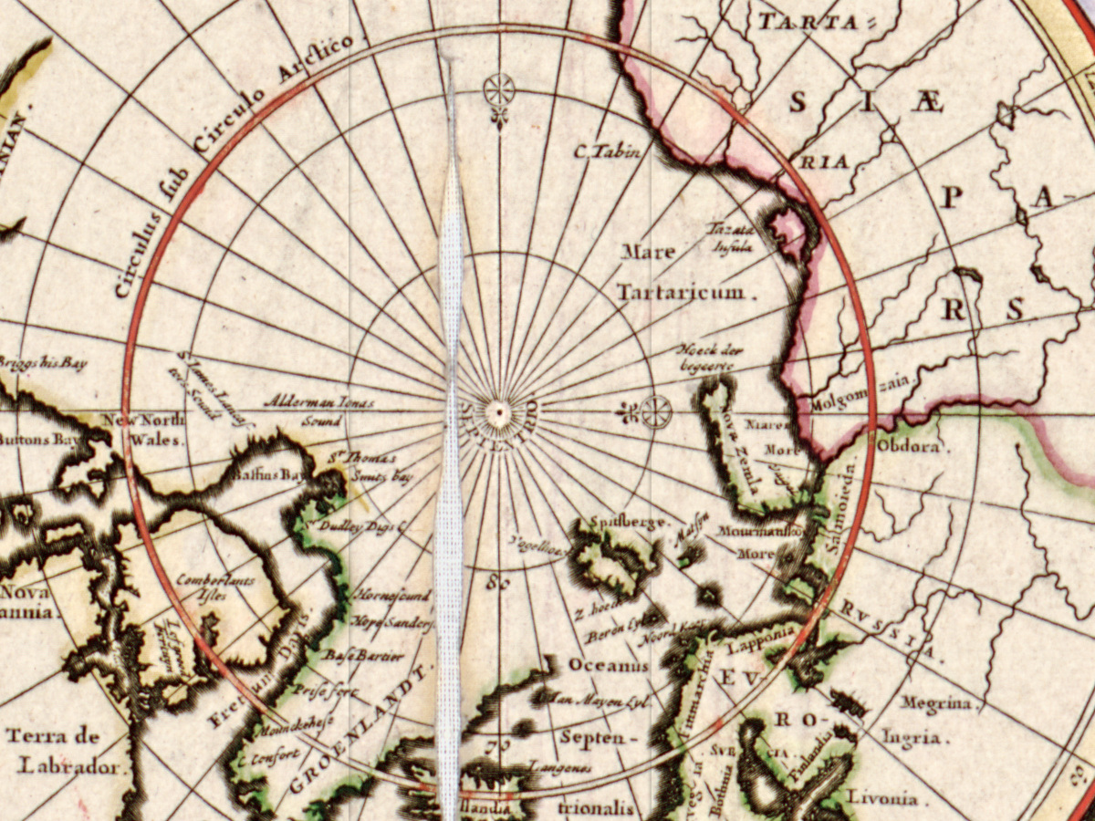
- The polar circles, POLUS ARCTICUS at the top and POLUS ANTARCTICUS at the bottom, the southern one almost empty apart from the tip of South America.
The Library of Congress notes that its copy is folded vertically in half, with minor losses along the upper half of the fold, and mounted on cloth; the gap is easy to see in the title banner. Catalogues date the plate differently: the Huntington Library gives 1658 but records that one bibliographer placed it around 1680.
Everything on this sheet: full record
Every inscription on the sheet
The names below are given letter for letter as they appear on this scan, with the capitals and punctuation of the sheet; the long s is written as s. Outside the circles everything legible is listed; inside them only the circle lines, the large names and the names discussed in the story. Latin is translated in [square brackets]. Where a word is faint or hidden, this is said.
- Banner across the top: ORBIS TERRARUM NOVA ET ACCURATISSIMA TABULA. Auctore NICOLAO VISSCHER. [A new and most accurate map of the world. Author: Nicolaes Visscher]
- Lower left, in the waves under Poseidon: N.P. Berchem invent. [N. P. Berchem designed it]
- Lower right, beside the head of the seated bearded man: two faint lines of small script; only the endings Visscher and sculp… can be made out on this scan (Stanford’s record reads the engraver’s credit as J. de Visscher).
- Around the northern polar circle: POLUS ARCTICUS. [the Arctic pole]; at its center SEPTENTRIO [the north]; along the inner circle Circulus sub Circulo Arctico; names include Streat Anian and ANIAN., Mare Tartaricum. [the Tartar Sea], GROENLANDT., Nova Britannia., New North Wales., New South Wales., Buttons Bay, Port Nelson, Spitsberge, OCEANVS DEVCALEDONIVS. [the Deucaledonian Ocean] and Hibernia [Ireland].
- Around the southern polar circle: POLUS ANTARCTICUS. [the Antarctic pole]; at the center a word partly hidden by the pole mark, of which …ERIDIES is legible; along the inner circle Circulus sub Circulo Antarctico.; at the top Fretum Magellanicum [Strait of Magellan], Fretum le Maire [Le Maire Strait], Staten Eylandt and C. Hoorn [Cape Horn].
- Western hemisphere, large names: AMERICA SEPTENTRIONA-LIS. [North America], split over three lines; MAR DEL NORT. [the North Sea, i.e. the Atlantic]; MAR DEL ZVR. [the South Sea, i.e. the Pacific], spread across the ocean; MEXICANVS SINVS. [Gulf of Mexico]; Ilhas de Ladrones [Islands of Thieves, the Marianas]; on California California and Nova Albion; north of it ANIAN; near its right edge, for the Azores, Alias Flandricæ [otherwise the Flemish islands].
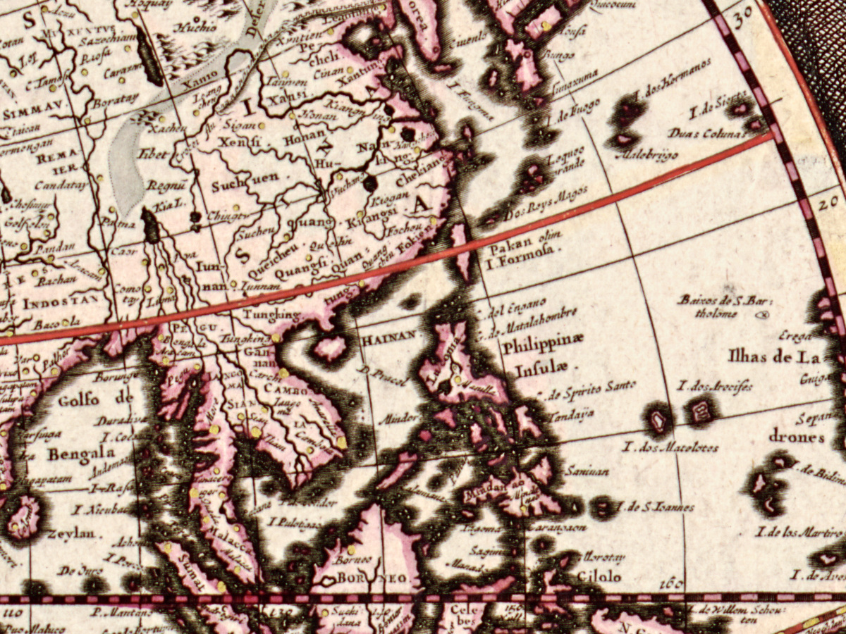
- Eastern hemisphere, large names: HOLLANDIA NOVA. [New Holland]; Antonij van Diemens Landt; Xamo Desertum [the Xamo desert], written twice along the band; Corea; Mare de Sala (the Caspian); ÆTHIOPICUS. in the South Atlantic; MAR DI INDIA. [the Indian Sea]; Ins. olim Fortunatæ [islands formerly called Fortunate, the Canaries].
- New Zealand, at the left edge of the western hemisphere: ZELANDIA and NOVA along the coast, with C. Maria van Diemen, ’t Eylandt dri Coningen and, partly covered by the dark shading of the coast, …bel Tasmans Rede [Abel Tasman’s anchorage], …oordenaers Bay [Murderers’ Bay] and Clippige hoe… [rocky point].
- Lines of both hemispheres: Circulus Æquinoctialis [the equator], Tropicus Cancri, Tropicus Capricorni, and along the lower arcs AVSTRALIA INCOGNITA [the unknown southern land], once in each hemisphere.
Some things on the sheet do not agree with each other or with the catalogues. The banner gives the maker only as Nicolao Visscher, without saying which of the two men of that name is meant, which is why libraries disagree. The polar circles are labeled Circulus sub Circulo Arctico and Circulus sub Circulo Antarctico. rather than with the plain name of the circle. New Zealand lies at the far left edge of the western hemisphere, while Tasmania, reached on the same voyage, lies at the far right edge of the eastern one, so the two coasts stand at opposite ends of the sheet.
Editions and other known copies
- Library of Congress, Geography and Map Division, G3200 1690 .V5 (LCCN 2006627252): “[Amsterdam] : Nicolao Visscher, [1690?]”; hand colored; two hemispheres each 28 cm in diameter on a sheet 50 × 62 cm; “Appears in the author’s Atlas minor. Amsterdam, 1690?”; maker recorded as Nicolaes Visscher, 1649–1702. This is the copy reproduced here.
- Leventhal Map Center, Boston Public Library: a record with the same call number and LCCN, “[Amsterdam?] : Nicolao Visscher, [1690?]”, shown in the exhibition Journeys of the Imagination (2006). Its description says the map “first appeared in Jan Jansson’s 1658 Novus Atlas”. Whether this is a separate copy or a record of the same sheet is not clear from the record.
- Princeton University Library, Historic Maps: imprint “[Amsterdam] : [J. Jansson], [1658]”; maker recorded as Nicolaes Visscher, 1618–1679.
- Stanford University Libraries, Glen McLaughlin Collection of California as an Island, McLaughlin 1207: “[Amsterdam]: N. Visscher, [1658]”; hand colored; hemispheres 28 cm; names Berchem as designer and Jan de Visscher as engraver.
- Huntington Library, 093:057 M: dated 1658, with the note that Kashnor dates it about 1680; cites Shirley 406.
- Osher Map Library, Smith Collection, 11511.0014: in the Atlas Minor sive Geographia Compendiosa, Amsterdam, “ex Officina Nicolai Visscher”, dated 1689.
- Yale University Library: dated 1658, publisher Jan Jansson; maker recorded as Nicolaes Visscher, 1618–1679.
- University of Michigan Library, Clark Library: dated [1658?]; hemispheres 28 cm on a sheet 54 × 62 cm.
- None of these records names states of the plate. The dates run from 1658 to [1690?], and the attribution is split between Nicolaes I and Nicolaes II.
Catalog entries and sources
Library of Congress LCCN 2006627252, call number G3200 1690 .V5; Leventhal Map Center record in Digital Commonwealth; Princeton HMC01.6899; Stanford McLaughlin 1207; Huntington 093:057 M; Osher 11511.0014; Shirley 406, as cited by Stanford and the Huntington.
Sources for the story and this record: the Library of Congress catalogue record; the Leventhal Map Center (Boston Public Library) description; the catalogue records of Princeton, Stanford, Yale, the Huntington Library, the Osher Map Library and the University of Michigan.
This copy
- Hand colored: the coastlines are edged in color (green for Europe, pink for Asia, yellow for America), the circles and tropics are drawn over in red, and the four corner scenes and the caryatids are touched with yellow.
- A vertical fold runs down the middle of the sheet. At the top it has opened into a gap: in the title banner between AC and CURATISSIMA, and down into the northern polar circle, where the woven cloth of the backing shows through.
- Faint vertical lines run through the lower polar circle and the center of the sheet.
- Small reddish smudges can be seen in places inside the hemispheres, for example near the Tropic of Cancer at the left edge of the western one.
- The plate mark is visible on all four sides, with a margin of plain paper outside it.
Your file
| Original | Nicolaes Visscher, Orbis terrarum nova et accuratissima tabula, [Amsterdam]: Nicolao Visscher, [1690?]; hand colored, two hemispheres each 28 cm in diameter on a sheet of 50 × 62 cm |
| Scan | full sheet 6897 × 5824 px; the map inside the trimmed border 6685 × 5652 px |
| Print size at 300 dpi | the map prints to 56 cm (22 in), the full sheet with margins to 58 cm (23 in) |
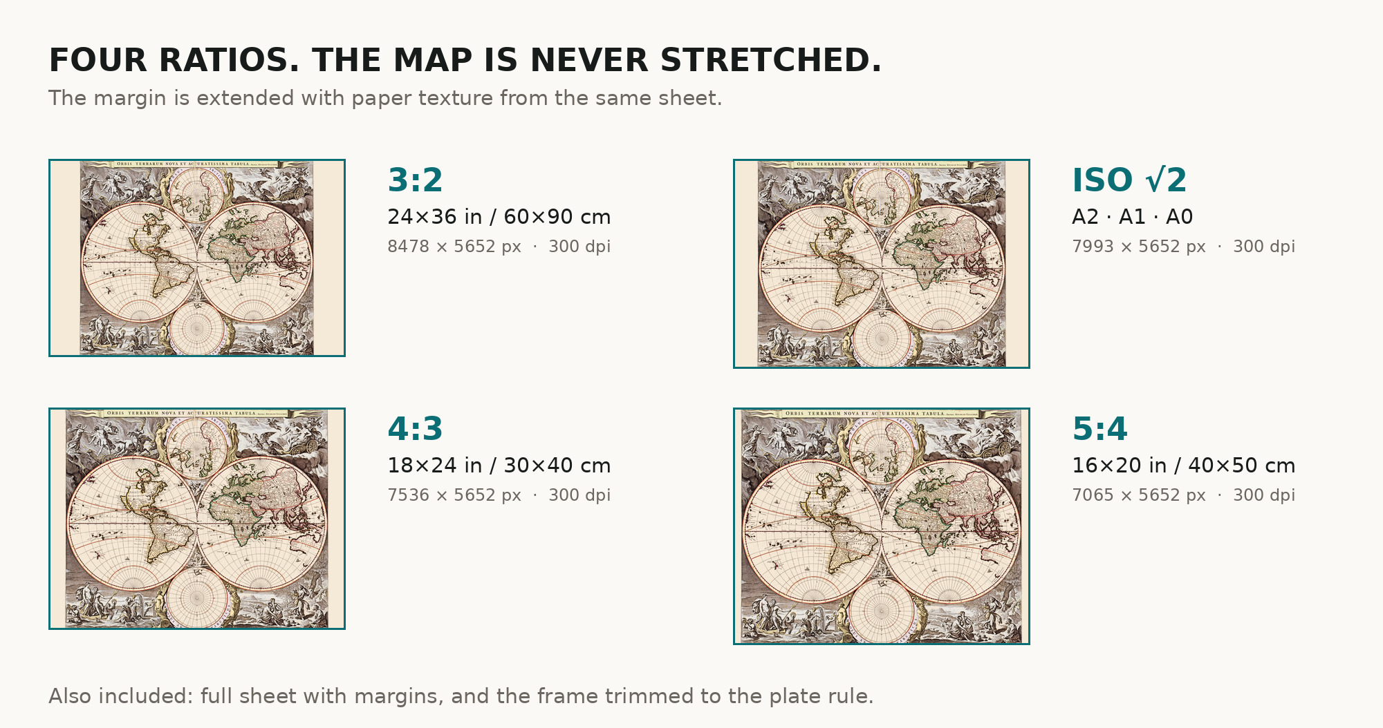
| You download | six ZIP archives: full sheet, trimmed, 3:2, 4:3, 5:4 and ISO A |
| Inside each one | one JPEG at 300 dpi, the restoration passport as a PDF, a READ ME |
How to print
- The sheet is horizontal. At 300 dpi the map prints to 56 cm. Pick the archive whose proportions match your frame; ask for matte fine-art paper in sRGB with auto-enhancement off.
- Where to print it: print shops near you and checked prices at online labs.
Source and rights
The scan comes from the Library of Congress, Geography and Map Division, call number G3200 1690 .V5. The Library presents the item as free to use and reuse; the map itself is in the public domain. The record does not name the printing technique. There is no TIFF master in the package. Catalogue record: Library of Congress →
Features
- Latin
Attachments
Reviews
No reviews found
More maps from the 1600s
-
 Antique World Map c. 1690 — Morden & Berry, To Capt. John Wood
-
Antique World Map c. 1696 — Sanson, Mappe-monde
-
Antique World Map 1684 — Sanson, Mappa Mondo
-
Antique World Map 1680 — Sanson, A Mapp of All the World
-
Antique World Map 1677 — Duval, Carte Vniverselle du Commerce
-
Antique World Map c. 1675 — Seller, Novissima Totius Orbis