Antique World Map — Turin Mappa Mundi, Jomard Facsimile
Description
An antique world map: the Turin mappa mundi in Jomard’s facsimile
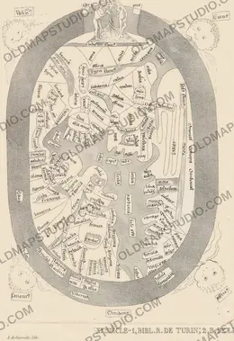
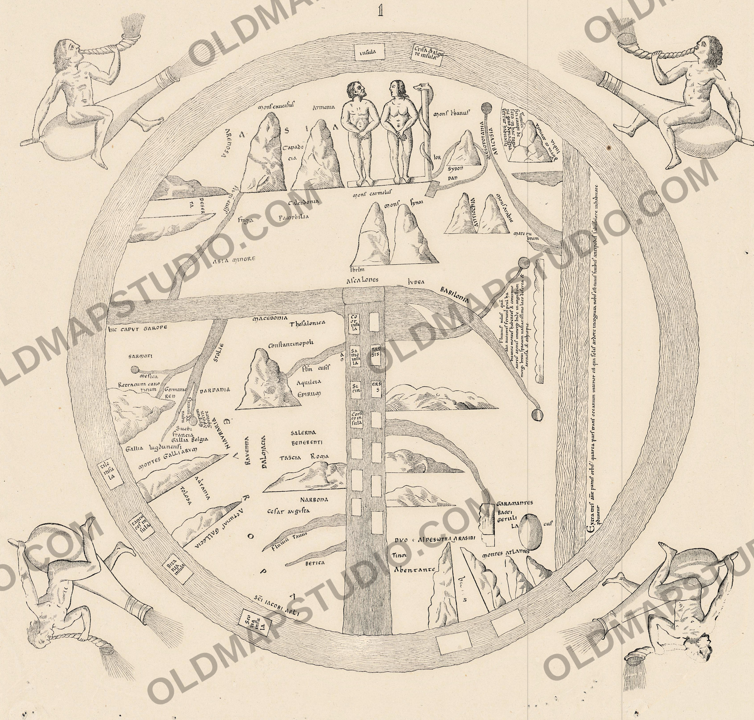
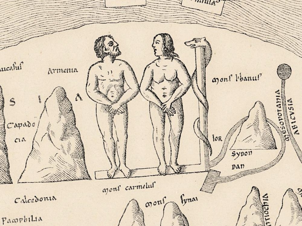
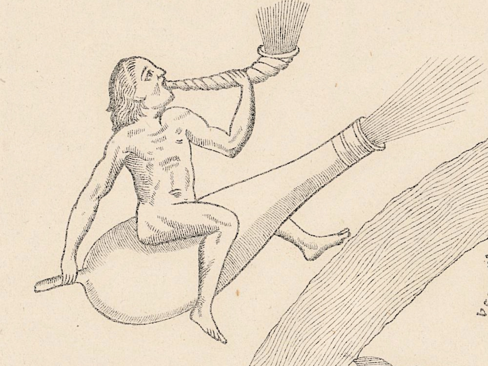
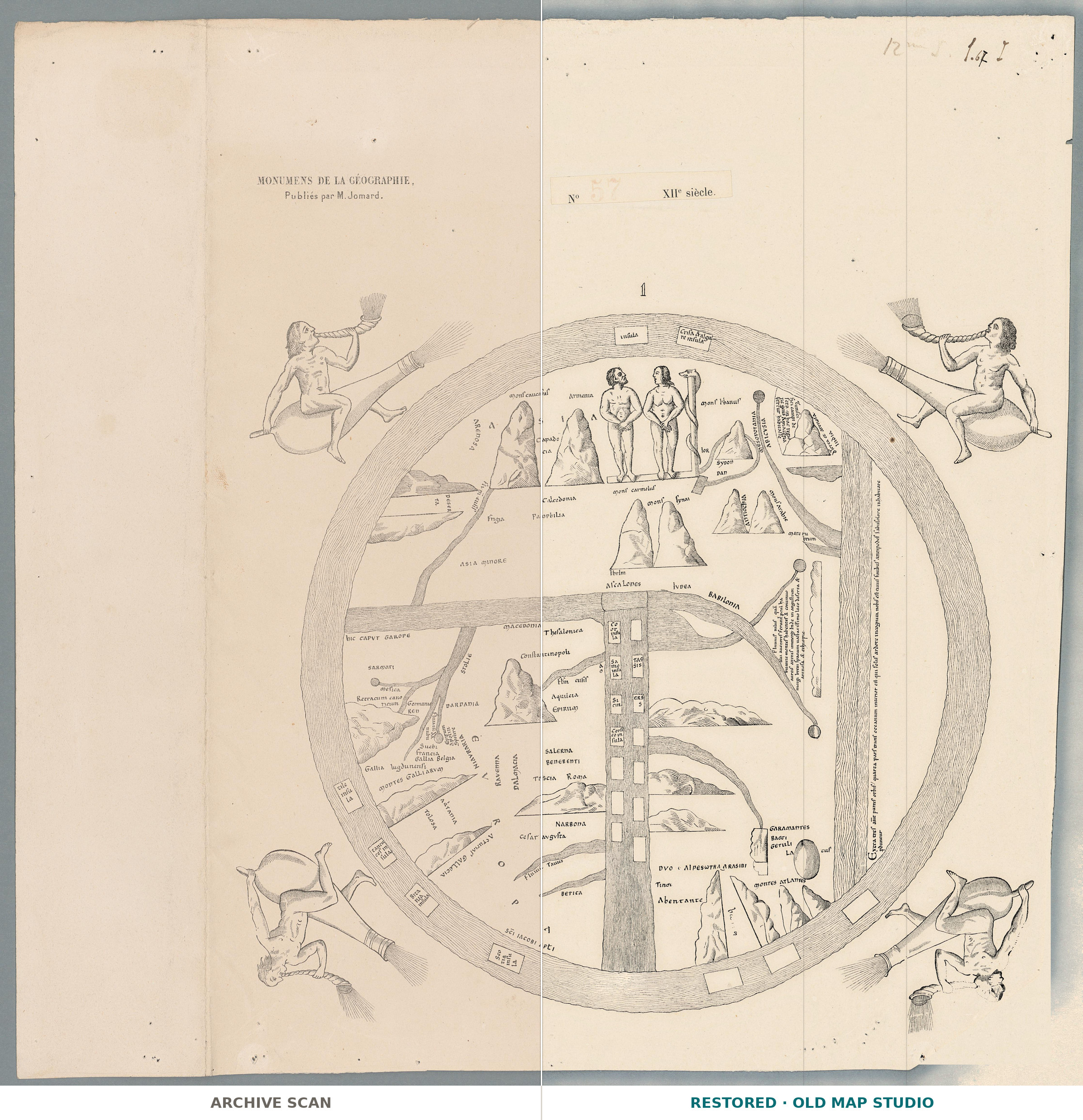
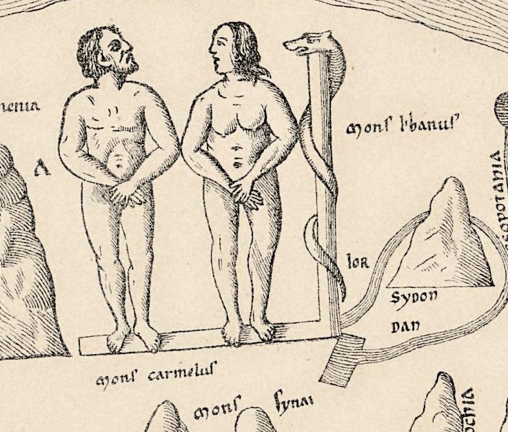
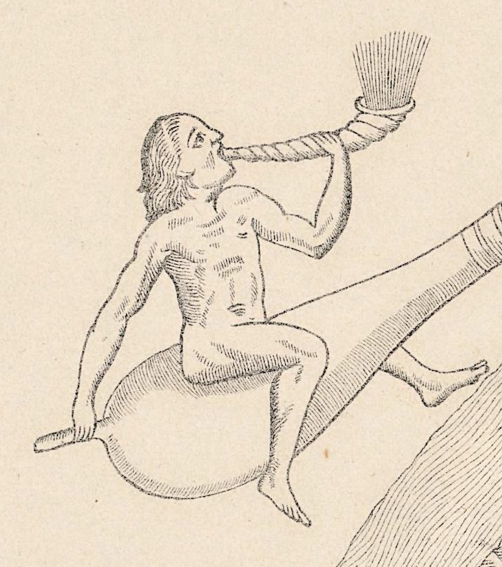
The world on this sheet is a circle ringed by Ocean, with east at the top. There Adam and Eve stand on a narrow bar, the serpent coiled round a post beside Eve. The Mediterranean drops from the center as a straight band lined with small rectangular islands, and in the four corners naked wind figures sit astride bags and blow horns.
A slip above the map reads No 57 XIIe siècle, and the library record calls the plate [Mappemonde de Turin]. The Enciclopèdia Catalana describes the world map of the Turin Beatus, a manuscript of the work of Beatus of Liébana, as circular, with the four cardinal winds riding on inflated skins in the corners, Adam, Eve and the serpent in Paradise, and a fourth continent after the text of Isidore; it places the manuscript around 1100 at the earliest and reports the view that it was copied in Girona. The map here shows the same features, though neither the record nor the sheet names the manuscript.
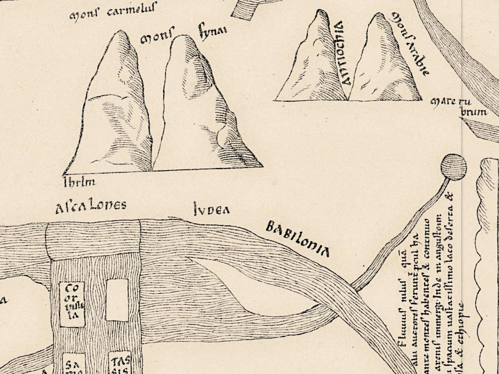
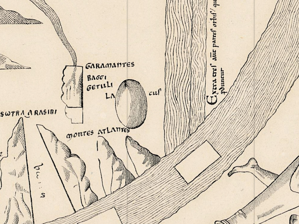
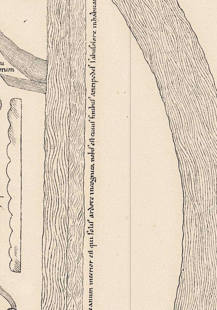
The History of Cartography traces the large Beatus maps, fourteen of which survive, to a lost prototype of 776–86 and names a fourth continent beyond the ocean as their main characteristic, quoting its legend from the Turin manuscript: the Antipodeans are said to live there. Here the legend runs up the right edge, beginning Extra tres aūt partes orbis quarta pars trans oceanum. Jerusalem, Ihrlm, is only a name at the foot of mons synai; no city is drawn on the map.
The sheet itself was printed in the nineteenth century as a plate of Les monuments de la géographie, in which Edme-François Jomard (1777–1862) published old maps in facsimile at the size of the originals. The Bibliothèque nationale de France names him the first curator of the map department created at the Royal Library in Paris in 1828. The first instalment of the atlas had appeared by 1842 and more followed through 1862, according to the Royal Geographical Society of South Australia. The Geneva record notes “Dessin de Jomard” and Paris, Duprat, [18--?]; its date field reads 1800, which we repeat in the specifications as given.
What to look for on the sheet
- Adam and Eve on their bar at the top, the serpent wound round the post beside Eve, mons carmelus below them.
- The wind figures in the corners, each astride a bag and blowing a horn, with a second, long banded tube beside it; the two lower figures are upside down.
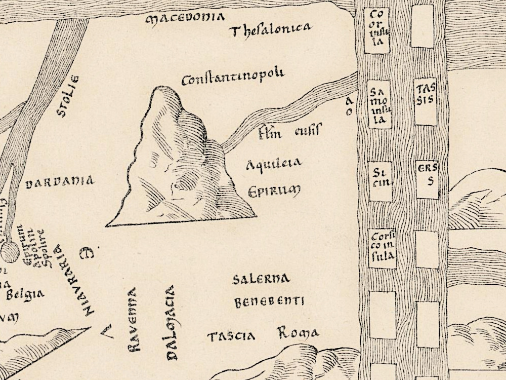
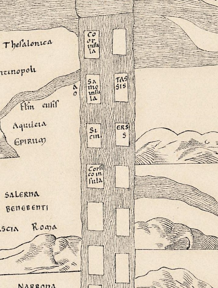
- The Mediterranean with fourteen island frames, only six of them named, among them Samo insula and Corsico insula.
- Ihrlm at the foot of mons synai, with BABILONIA written along the water below.
- The legend of the fourth part up the right edge and, beside it, a long note on the Nile beginning Fluuius nilus.
- In the wedge at the upper right, gens Amazona fertur habitasse [the Amazon people is said to have lived here].
David Woodward, in the same volume, credits Jomard with a rival facsimile atlas of thirty medieval world maps. The manuscript is in Turin, where the library burned in 1904; the scholars cited by the Enciclopèdia Catalana disagree on whether the codex was damaged.
Everything on this sheet: full record
Every inscription on the sheet
The map imitates a medieval book hand that mixes uncial capitals with small letters. Names are given letter for letter, in capitals where the sheet uses them, with the long s printed as s; a letter under a bar of abbreviation keeps its bar (aūt). Inside the circle only the clearer names are listed, and long legends are quoted only as far as they could be read with confidence.
- Upper margin, printed: MONUMENS DE LA GÉOGRAPHIE, Publiés par M. Jomard. To the right, on a pasted slip: No 57, the number in red, and XIIe siècle. [twelfth century]. Upper right corner: a faint pencil note beginning 12, and in ink a number beginning 1. with the letter I, not read with confidence.
- Above the circle: the plate number 1.
- Ocean band at the top: insula and Crisa & algure insula.
- Paradise and the East: Adam, Eve and the serpent, without names; around them Armenia, mons caucasus, mons carmelus, IOR, SYDON, DAN and MESOPOTANIA.
- Asia, upper left: the letters A S I A spread across the mountains; ARENOSA, Capado-cia on two lines, Calcedonia, Frigia, Pamphilia, ASIA MINORE and DESER-TA.
- The Near East: mons synai over two peaks, Ihrlm [Jerusalem] at their foot, ASCALONES, IVDEA, BABILONIA; ANTIOCHIA and mons Arabie on two further peaks; mare ru-brum [the Red Sea].
- Upper right, in a wedge-shaped field: a note ending in hac regio-ne gens Amazona fertur habitasse [in this region the Amazon people is said to have lived], its first words not read with confidence; beside it a label ending india.
- Right side: a long legend on the Nile beginning Fluuius nilus and ending arenosa & ethiopie.
- Right edge, beyond a strip of water, the legend of the fourth part: Extra tres aūt partes orbis quarta pars trans oceanum interior est … naming the antipodes and ending pdūtur [outside the three parts of the world there is a fourth part, beyond the ocean; the Antipodeans are said to live there].
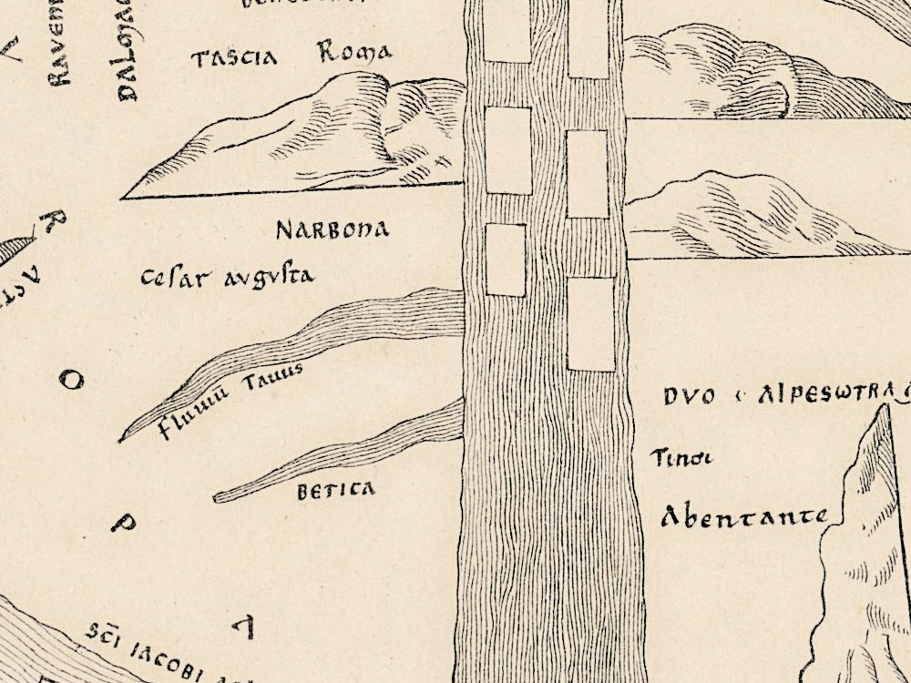
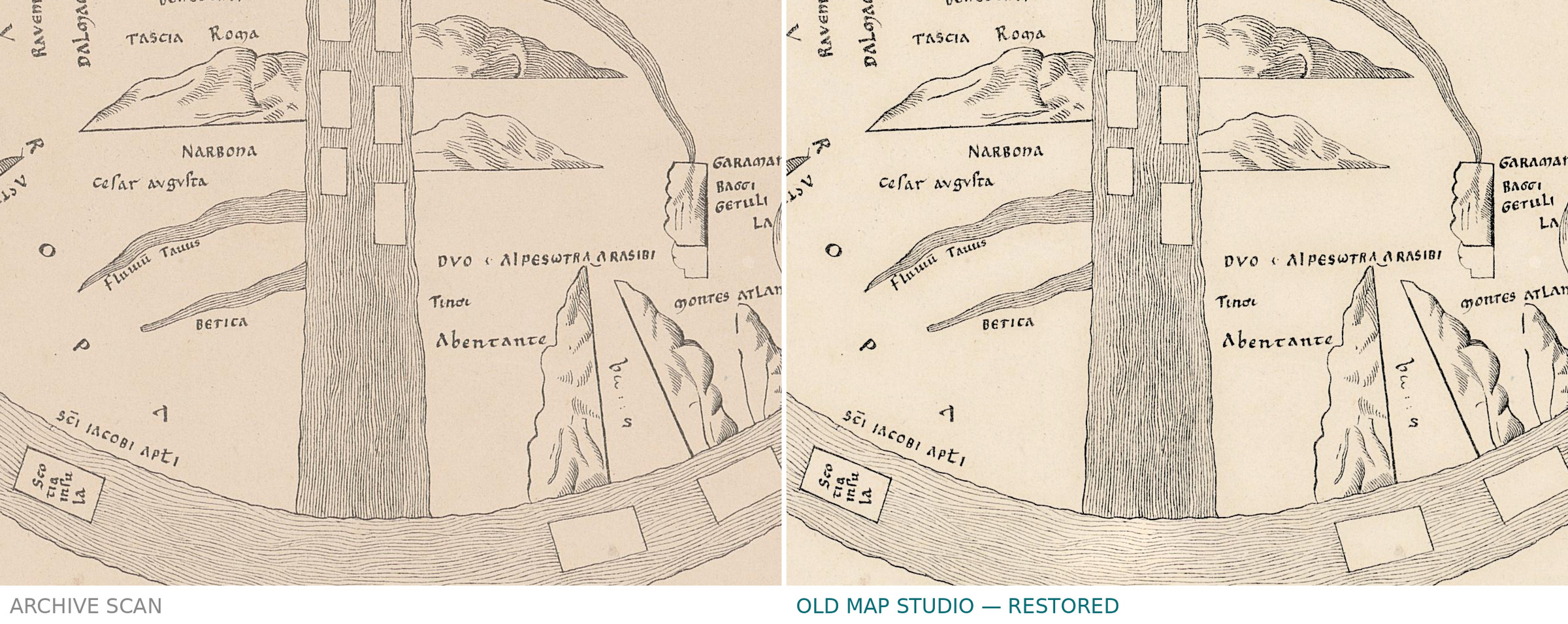
- Europe, lower left: a line beginning hic CAPVT, its last word not read with confidence; SARMATI, Germania, DARDANIA, MACEDONIA, Thesalonica, Constantinopoli, Aquileia, Suebi, francia, Gallia Belgia, Gallia lugdunensi, montes GALLIARVM, TOLOSA, GALLECIA, RAVENNA, SALERNA, BENEBENTI, Roma, NARBONA, Cesar augusta, BETICA; the letters of EVROPA spread down the left.
- Africa, lower right: GARAMANTES, GETULI, Abentante, montes ATLANTES, and an oval lake with LA and cus written on either side of it.
- The Mediterranean: Coor insula, Samo insula, Sicin, Corsico insula, TASSIS and ERS / S; eight of the fourteen frames are empty.
- Ocean band, left and bottom: tile insula, a frame beginning tancu not read with confidence, Brita-nia insula, Sco-tia insula, and along the inner edge SCI IACOBI APLI [of Saint James the Apostle]; three frames at the lower right are empty.
- The four wind figures in the corners carry no names.
The sheet and its records do not agree in three places. The slip gives the twelfth century, while the Geneva record has 1800 in its date field and [18--?] in the imprint. The same record gives the language as Italian, although every name on the map is Latin. And MESOPOTANIA is spelled with an N. Jerusalem, Rome and Constantinople appear only as names, without any drawing of a city.
Editions and other known copies
- Bibliothèque de Genève, BGE Musée cartogr. 1/57: this copy, published on e-rara under the Public Domain Mark, DOI 10.3931/e-rara-91525. The DOI record gives the title as Monuments de la géographie ou Recueil d’anciennes cartes européennes et orientales … / [Mappemonde de Turin], with the creator as [s.n.], and notes “1 carte ; 36 x 36 cm”, “Dessin de Jomard” and “Paris : Duprat, [18--?]. - 13”; its publication year field reads 1800 and its language code is Italian.
- Bibliothèque nationale de France: Les monuments de la géographie … publiés en fac similé de la grandeur des originaux par M. Jomard, Paris, Duprat, [1846-1862], one large folio volume. The record lists copies, among them in the map department (GE CC-1232, two bound copies, one of them in the Réserve; GF 912.22 JOMA m, plates in a portfolio), at the Société de Géographie (FOL-SG D2-83 and D2-83 (BIS)) and at the Arsenal (FOL-NF-10149). It does not list single plates.
- Royal Geographical Society of South Australia: a copy of the atlas, which the Society describes as hand coloured lithographic plates; it gives 1854 as the official date of the work, the first instalment by 1842 and further ones through 1862. That description belongs to its copy.
- Armand d’Avezac, Inventaire et classement raisonné des “Monuments de la géographie”, Paris, E. Donnaud, 1867; recorded in the libraries of the French Ministry of Defence.
- The manuscript map: Turin, Biblioteca Nazionale Universitaria, I.II.1, given in The History of Cartography with the old shelfmark D.V.39; Jim Siebold’s monograph on the map gives folios 38v–39 and 39 × 27.5 cm and dates it to the first quarter of the twelfth century, while his list of Beatus codices gives folios 45v–46, 372 × 296 mm and 1150; the two do not agree. Neither the Geneva record nor the sheet names this manuscript as Jomard’s model.
- None of these records names states of the plate. The dates differ: 1800 in the date field of the Geneva record and [18--?] in its imprint, [1846-1862] at the Bibliothèque nationale de France, 1842 to 1862 for the instalments according to the Royal Geographical Society of South Australia.
Catalog entries and sources
- e-rara (Bibliothèque de Genève), DOI 10.3931/e-rara-91525, read through DataCite; the e-rara page itself could not be opened.
- Bibliothèque nationale de France, catalogue général, notice FRBNF40701189.
- David Woodward, “Medieval Mappaemundi”, The History of Cartography, volume 1, chapter 18.
- Enciclopèdia Catalana, Catalunya romànica, “Beatus de Torí (Girona)”.
- Jim Siebold, monograph on the Turin Beatus map, myoldmaps.com.
- World History Commons, “The Turin Beatus Map of the World”.
- Bibliothèque nationale de France, “Edme-François Jomard (1777-1862) et l’aide aux voyageurs”.
- Royal Geographical Society of South Australia, “Jomard Atlas 1854”.
This copy
- An uncolored print on cream paper; the series heading is printed in the upper left margin and the plate number on a slip pasted at the right.
- No printer’s or lithographer’s line is visible on the sheet.
- The lower right corner of the sheet is cut at an angle, and a small triangle of background shows there.
- Faint vertical lines run down the sheet, and small dark spots lie in the margins.
- Parts of the lower right wind figure are drawn only in dotted outline.
- In the restoration the paper tone was evened; the printed lines were not touched.
Your file
| Original | Edme-François Jomard, Les monuments de la géographie, Paris: Duprat, [18--?]; plate [Mappemonde de Turin], 13 in the record; 36 × 36 cm; Bibliothèque de Genève, BGE Musée cartogr. 1/57 |
| Scan | full sheet 4468 × 4482 px; the map inside the trimmed border 3395 × 3245 px |
| Print size at 300 dpi | the map prints to 28 cm (11 in), the full sheet with margins to 37 cm (15 in) |
| You download | six ZIP archives: full sheet, trimmed, 3:2, 4:3, 5:4 and ISO A |
| Inside each one | one JPEG at 300 dpi, the restoration passport as a PDF, a READ ME |
How to print
- The sheet is small: print it at 300 dpi at the size above and do not let the shop scale the file up.
- Pick the archive whose proportions match your frame, and ask for matte fine-art paper, sRGB, auto-enhancement off.
- Where to print it: print shops near you and checked prices at online labs.
Source and rights
The file is made from the Bibliothèque de Genève scan published on e-rara, shelfmark BGE Musée cartogr. 1/57, DOI 10.3931/e-rara-91525, under the Public Domain Mark. The library asks that reproductions name the author, the place and the DOI: Edme-François Jomard, Bibliothèque de Genève, 10.3931/e-rara-91525. The record does not state the printing technique or the coloring. The paper tone was evened; the printed lines were not touched. The lower right corner of the sheet is cut at an angle, so a small triangle of background shows inside the trimmed frame. There is no TIFF master in the package. Catalogue record: e-rara (Bibliothèque de Genève) →
Questions
How large can I print it?
The map to 28 cm (11 in) on the long side at 300 dpi, the full sheet with margins to 37 cm (15 in), from the scan’s own resolution, not an upscale.
Is this a medieval manuscript?
No. It is a nineteenth-century facsimile from Jomard’s atlas of a world map that the slip above it dates to the twelfth century. The record calls it the Turin map; neither the record nor the sheet names the manuscript.
Why does the specification say 1800?
The library record gives 1800 in its date field and [18--?] in the imprint; according to the Royal Geographical Society of South Australia, the first instalment of the atlas had appeared by 1842 and more followed through 1862. We repeat the record’s date and add no dating of our own.
Why is east at the top?
The large Beatus maps are all oriented to the east, according to The History of Cartography. Here Paradise, with Adam and Eve, stands at the top of the circle.
Who are the figures in the corners?
The four cardinal winds. The Enciclopèdia Catalana describes them on the Turin map as riding on inflated skins; on this sheet each sits astride a bag and blows a horn, and the two lower figures are drawn upside down.
Features
- Latin
Attachments
Reviews
No reviews found