Antique World Map — Sanudo’s Mappa Mundi, Jomard Facsimile
Description
An antique world map: Sanudo’s mappa mundi in Jomard’s facsimile
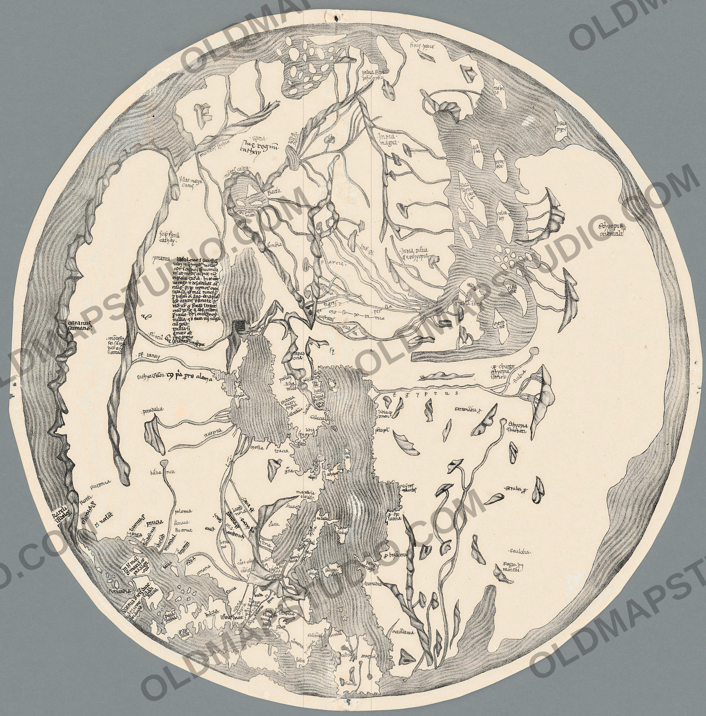
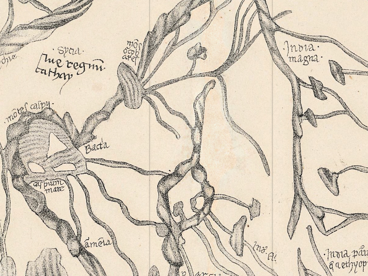
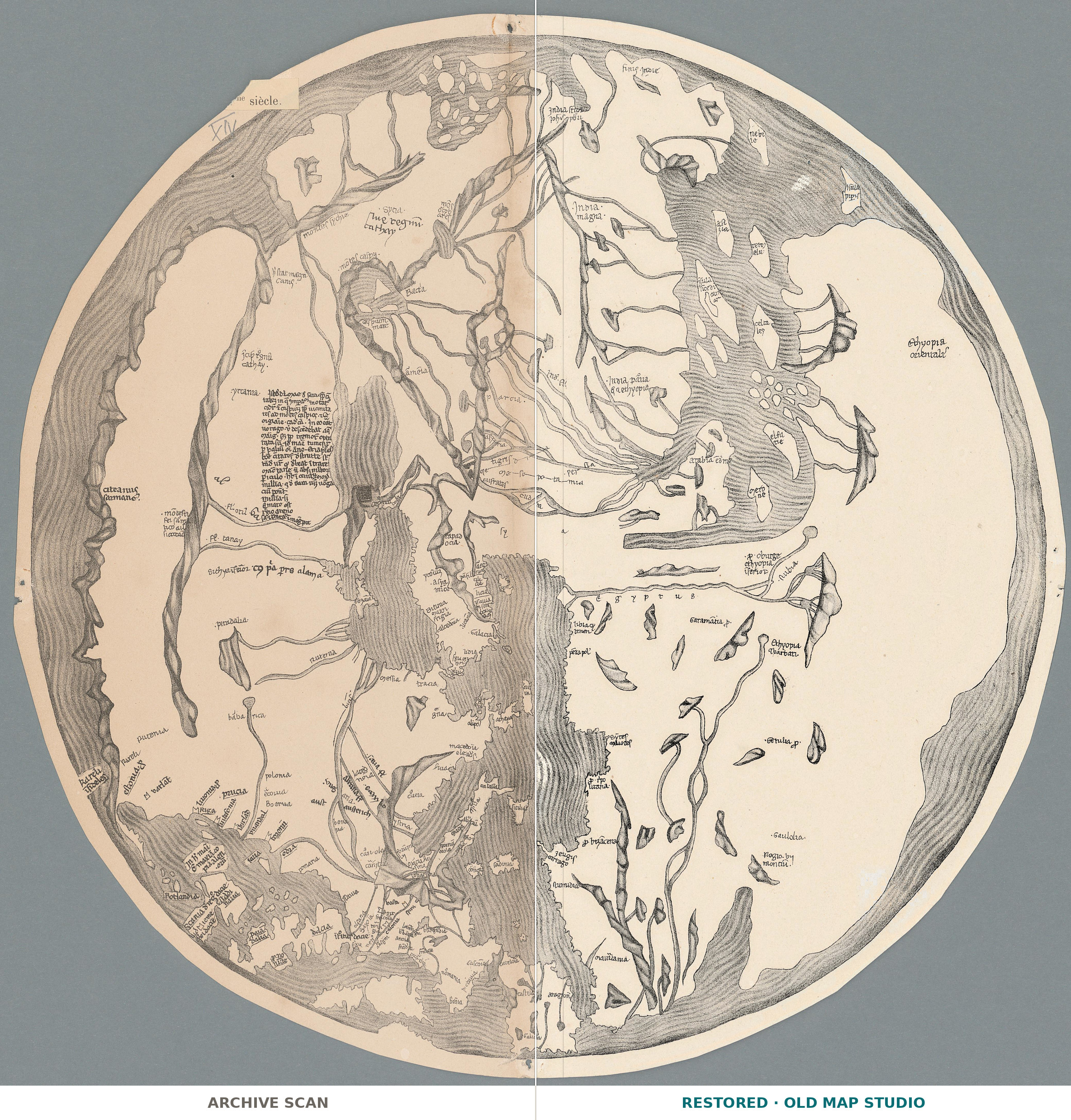
The world on this sheet is a circle inside a ring of Ocean drawn as rippling waves, with east at the top. Europe fills the lower left, Africa the lower right, and the Mediterranean rises from the bottom edge toward the center. At the upper left a bold legend reads hic regnū cathay [here is the kingdom of Cathay], and beside a river h[ic] stat magn[us] canis [here is the Great Khan]. At the top, finis Indie marks the end of India, beside an eastern sea scattered with small oval islands.
![The north-east of Asia: hic regnū cathay [here is the kingdom of Cathay] above mōtes caspy and the closed caspium mare, and to the left, beside a river, h[ic] stat magn[us] canis [here is the Great Khan].](/images/story/sanudo-jomard-cathay-and-the-great-khan.jpg)
The Geneva record calls the plate [Mappemonde de Sanudo] and names Marinus Sanutus as its author. Marino Sanudo of Torcello (c. 1260–1338) was a Venetian statesman and geographer, according to the 1911 Encyclopaedia Britannica. He began the Secreta fidelium crucis in 1306 and presented the whole work to Pope John XXII in September 1321. It carried a map of the world, a map of Palestine, a chart of the Mediterranean, the Black Sea and the coasts of western Europe, and plans of Jerusalem, Antioch and Acre; the encyclopedia holds the maps to be probably, in the main at least, the work of the chart-maker Pietro Vesconte.
Cortney Berg, writing in Material Culture Review in 2022, notes that nine of the twenty surviving copies of the book contain maps; in the four copies she studies, they are attributed to Vesconte’s workshop, the charts firmly and the other maps less certainly. Their world maps are all oriented to the east, with Europe at the bottom left, and their coastlines resemble those of portolan charts; The History of Cartography places the moment portolan charts began to influence world maps in the early fourteenth century. On the world map of the London copy, British Library Add MS 27376, Berg counts nine rhumb lines running from each of sixteen points on the rim. On this sheet there are none.
![The top of the circle, the far east: an eastern sea scattered with small oval islands, the legend India … iohīs pbri [of John the Priest], India magna and finis Indie [the end of India].](/images/story/sanudo-jomard-india-and-eastern-islands.jpg)
The sheet itself is a plate of Les monuments de la géographie, in which Edme-François Jomard (1777–1862) published old maps in facsimile at the size of the originals, as the record puts it. The Bibliothèque nationale de France names him the first curator of the map department created at the Royal Library in Paris in 1828. The record gives Paris, Duprat, [18--?] and the number 13; its date field reads 1800, which the specifications repeat as given. Neither the record nor the sheet names the manuscript that Jomard copied.
What to look for on the sheet
- At the upper left, hic regnū cathay in bold letters, and lower down a second, smaller legend ending cathay.
- mōtes caspy above caspium mare, the Caspian drawn as a closed sea, with Bacta beside it.
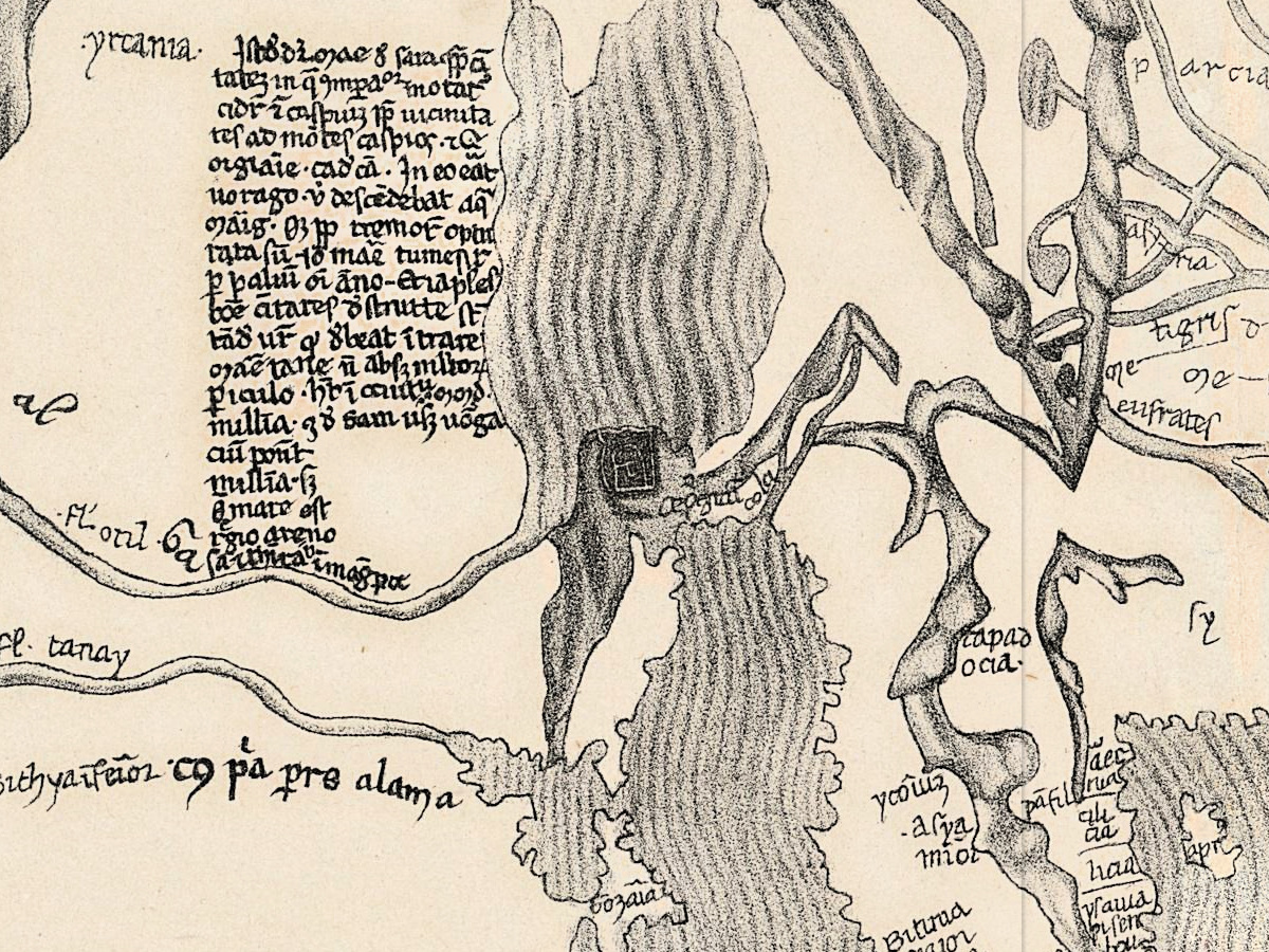
- The longest legend on the map: about twenty lines of abbreviated Latin beside yrcania, naming the mōtes caspios.
- At the top, a legend that begins India and ends iohīs pbri [of John the Priest], with India magna below it and finis Indie to the right.
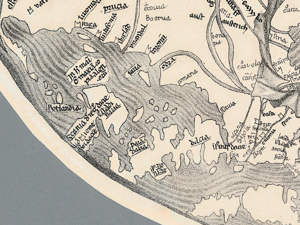
- In northern Europe, Riga, prucia [Prussia], estonia and, framed at the very edge, Kareli īfideles [the infidel Karelians].
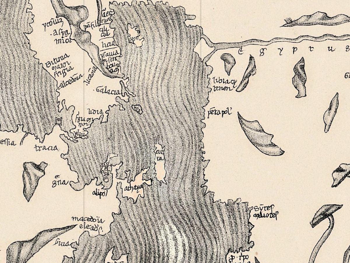
- egyptus spelled out letter by letter along the Nile, which runs up to Nubia.
![Northern Europe at the lower left: Riga, prucia [Prussia] and estonia on the Baltic, Kareli īfideles [the infidel Karelians] framed at the edge, polonia and Boemia inland, Scania and dacia across the sea.](/images/story/sanudo-jomard-baltic-riga-prussia.jpg)
David Woodward, in The History of Cartography, credits Jomard with a facsimile atlas, a rival to the Viscount of Santarém’s, that contained thirty medieval world maps. By 1911, the Britannica notes, the book had been printed entire only once, by Bongars in 1611.
Everything on this sheet: full record
Every inscription on the sheet
Names are given letter for letter, with the sheet’s abbreviation marks, placed as in standard transcription; words in square brackets are our expansion or translation. The sheet is read with east at the top. Only names that can be read with certainty at the full resolution of the scan are listed; doubtful letters are left out, not guessed.
- The top of the circle, the east: finis Indie [the end of India]; a legend that begins India and ends iohīs pbri [of John the Priest]; India magna [Greater India]; beside them an eastern sea scattered with small oval islands, none of them named.
- The upper left, the north-east of Asia: hic regnū cathay [here is the kingdom of Cathay] in bold letters; a second, smaller legend lower down, ending cathay; h[ic] stat magn[us] canis [here is the Great Khan], beside a river; mōtes caspy [the Caspian mountains]; caspium mare [the Caspian Sea], drawn as a closed sea; Bacta.
- Beside yrcania: the longest legend on the map, about twenty lines of abbreviated Latin; of its words, mōtes caspios [the Caspian mountains] can be read with certainty.
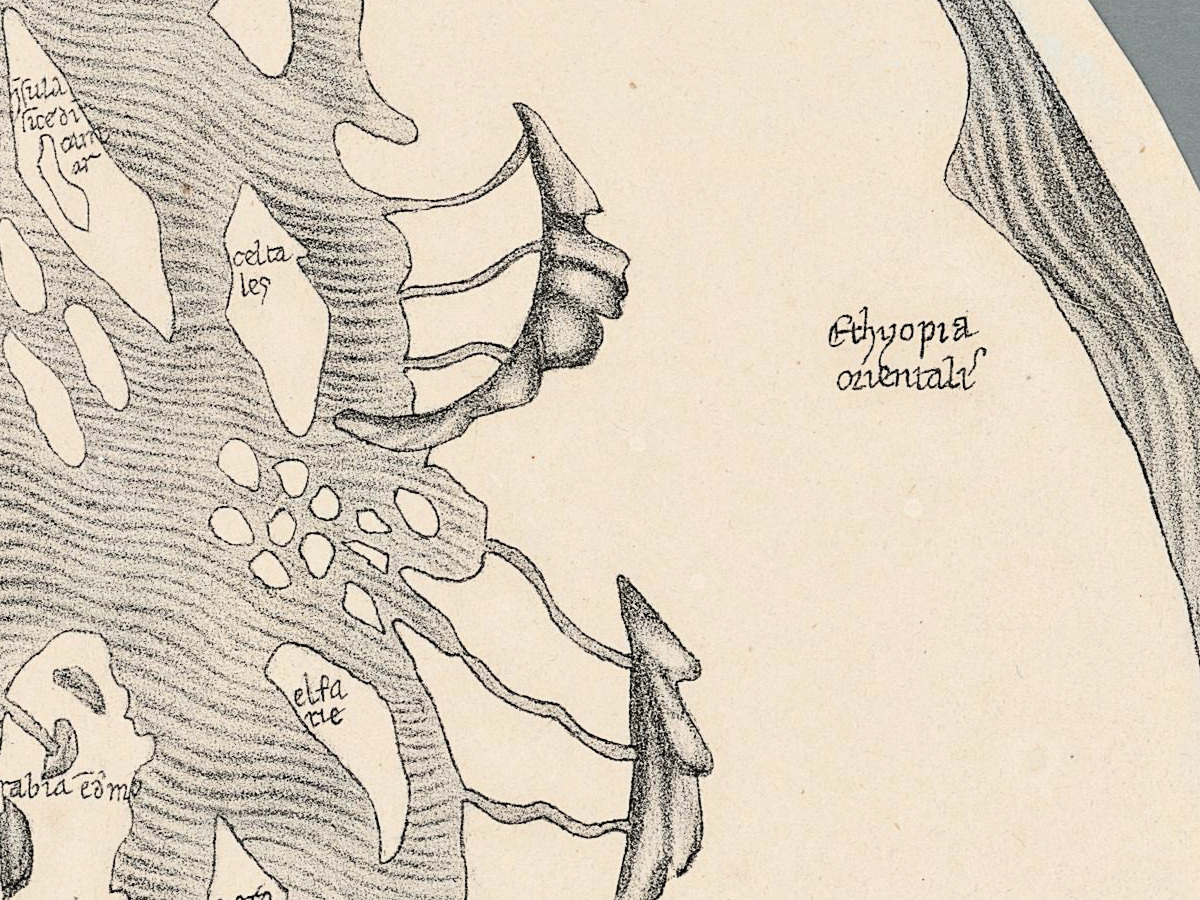
- The Indian Ocean, down the right side: islands, among them celta les and elfa rie, and a ring of small oval islands; on the far shore Ethyopia orientali[s] [eastern Ethiopia].
- Africa, at the lower right: egyptus, spelled out letter by letter along the Nile; Nubia; ethyopia īferior [lower Ethiopia]; Garamātia p.; on the coast p. bizacena and zeugis cartago [the district of Zeugis and Carthage].
- The middle of the Mediterranean: tracia, macedōia and achaya on the European side; Galacia and lidia in Asia Minor; Sicilia; ystria at the head of the Adriatic.
- Northern Europe, at the lower left: Riga, prucia [Prussia] and estonia on the Baltic; framed at the very edge, Kareli īfideles [the infidel Karelians]; inland polonia and Boemia; across the sea Scania and dacia [Denmark]; the river odra [Oder].
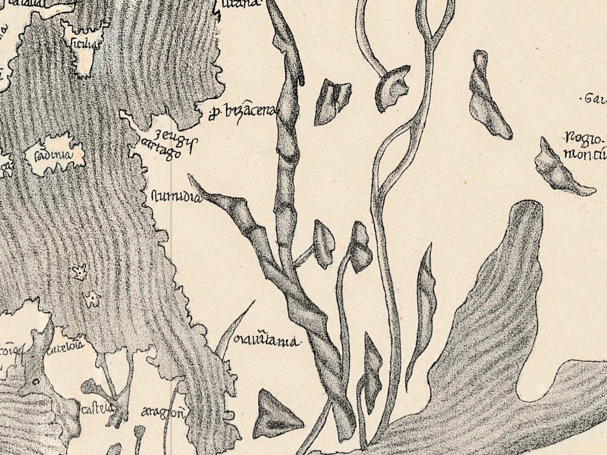
- Western Europe, at the foot of the circle: frācie [France] with burgūdia, picādia and nōmania; gascōia and pictauia; colonia, spira and basila; in Iberia castela, aragon, catelōia and galicia; on the African side maūtania and Numidia.
Differences on the sheet itself: Cathay is named twice, once in a bold legend and once in a smaller one lower down. No rhumb lines are drawn anywhere on the sheet.
Editions and other known copies
- Bibliothèque de Genève, BGE Musée cartogr. 1/72 — this copy. [Mappemonde de Sanudo], from Jomard’s Monuments de la géographie, “publiés en fac similé de la grandeur des originaux par M. Jomard”, Paris: Duprat, [18--?], number 13 in the record; 1 map, diameter 34 cm; creator in the record: Sanutus, Marinus; scan on e-rara, Public Domain Mark.
- Bibliothèque nationale de France — Jomard’s atlas as a whole, dated in its catalogue Paris, Duprat, [1846–1862].
- The manuscripts: according to Cortney Berg, maps are found in nine of the twenty surviving copies of Sanudo’s book. She studies the London copy, British Library Add MS 27376, which the British Library catalogue describes as fourteenth-century maps illustrative of Sanuto’s work on Palestine.
- The printed edition: by 1911 the whole Secreta fidelium crucis had been printed only once, by Bongars in 1611, in the Gesta Dei per Francos, according to the 1911 Encyclopaedia Britannica.
- Stanford University Libraries: a printed world map after Pietro Vesconte from the Bongars edition of 1611.
The record does not say which manuscript Jomard reproduced, and none of the sources above names one; what is said here about the manuscripts rests on their descriptions.
Catalog entries and sources
Bibliothèque de Genève: shelfmark BGE Musée cartogr. 1/72; e-rara record 26117835, scan file 26117836; DOI 10.3931/e-rara-91509; the record’s date field reads 1800, and its DataCite entry gives the language as it, Italian, while the inscriptions on the sheet are in Latin. Bibliothèque nationale de France: catalogue record FRBNF40701189 for the atlas. British Library: Add MS 27376.
Sources for the story and this record: the Bibliothèque de Genève record on e-rara and its DataCite entry; the 1911 Encyclopaedia Britannica, article on Marino Sanuto; Cortney Berg, “Sanudo’s Vision, Vesconte’s Expertise, and the Ghost Hand: Reception of the Maps in the MS Additional 27376”, Material Culture Review 94 (2022); David Woodward, “Medieval Mappaemundi”, The History of Cartography, volume 1, chapter 18; the British Library catalogue; the Bibliothèque nationale de France on Jomard and its record of the atlas; the Royal Geographical Society of South Australia on its copy of the atlas; the Stanford University Libraries record of the 1611 printed world map.
This copy
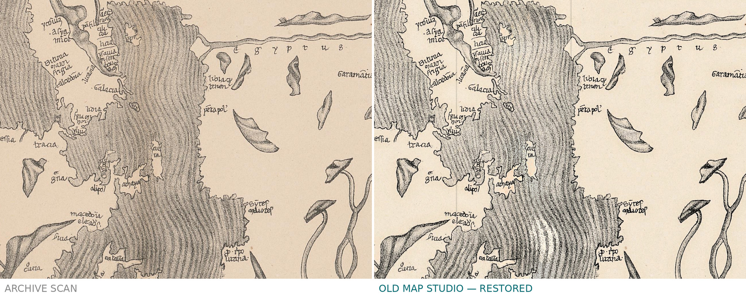
The sheet is printed in black and grey on cream paper, without color: the seas are shaded with wavy lines and the land is left plain. A fold runs down the middle, with a fainter vertical crease to the left of it, and near the top edge, above the islands of the eastern sea, there is a small hole in the paper. On the archive scan a pasted label at the upper left read …me siècle., its first part cut away, with XIV written beside it in pencil; both were removed from the print file, and under the label the ring of Ocean was continued with the texture of the same ring. The grey-blue background around the round sheet is the scanner’s, taken back from the archive scan.
Your file
| Original | Edme-François Jomard, Les monuments de la géographie, Paris: Duprat, [18--?]; plate [Mappemonde de Sanudo], 13 in the record; 1 map, diameter 34 cm; Bibliothèque de Genève, BGE Musée cartogr. 1/72 |
| Scan | 4161 × 4217 px, the whole scan frame: the round sheet and the grey-blue background around it |
| Print size at 300 dpi | the map and the full sheet both print to 35 cm (14 in) |
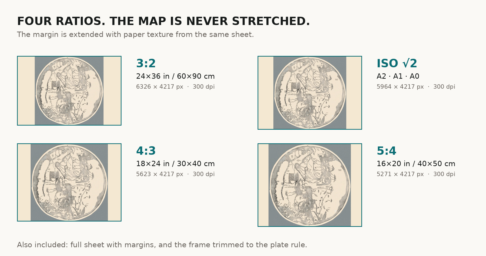
| You download | six ZIP archives: full sheet, trimmed, 3:2, 4:3, 5:4 and ISO A |
| Inside each one | one JPEG at 300 dpi, the restoration passport as a PDF, a READ ME |
How to print
- The sheet is small and round, and the file almost square: print it at 300 dpi at the size above and do not let the shop scale the file up.
- Pick the archive whose proportions match your frame, and ask for matte fine-art paper, sRGB, auto-enhancement off.
- Where to print it: print shops near you and checked prices at online labs.
Source and rights
The file is made from the Bibliothèque de Genève scan published on e-rara, shelfmark BGE Musée cartogr. 1/72, DOI 10.3931/e-rara-91509, under the Public Domain Mark. The library asks that reproductions name the author, the place and the persistent identifier: Marinus Sanutus, Bibliothèque de Genève, 10.3931/e-rara-91509. The record does not state the printing technique or the coloring. A pencil number, XIV, and a pasted label at the upper left were removed, and under the label the ring of Ocean was continued with the texture of the same ring. The grey-blue scanner background around the round sheet was taken back from the archive scan pixel for pixel, the paper tone was evened and the tone step along the central fold was softened. The printed lines of the map were not touched. There is no TIFF master in the package. Catalogue record: e-rara (Bibliothèque de Genève) →
Questions
How large can I print it?
To 35 cm (14 in) at 300 dpi, from the scan’s own resolution, not an upscale. The frame takes in the whole sheet, so the map and the full sheet print to the same size.
Is this a medieval manuscript?
No. It is a nineteenth-century facsimile from Jomard’s atlas of the world map in Marino Sanudo’s book, which Sanudo presented to the pope in 1321. Neither the record nor the sheet names the manuscript Jomard copied.
Who drew the original map?
The record names Sanudo, the author of the book. The 1911 Encyclopaedia Britannica holds the maps to be probably, in the main at least, the work of Pietro Vesconte; Cortney Berg reports that they are attributed to Vesconte’s workshop, the world maps less certainly than the charts.
Why is east at the top?
The world maps in the four copies of Sanudo’s book that Berg studies are all oriented to the east, with Europe at the bottom left, she notes. On this sheet India and finis Indie stand at the top of the circle.
Why does the specification say 1800?
The library record gives 1800 in its date field and [18--?] in the imprint; according to the Royal Geographical Society of South Australia, the first instalment of the atlas had appeared by 1842 and more followed through 1862. We repeat the record’s date and add no dating of our own.
Features
- Latin
Attachments
Reviews
No reviews found