Antique World Map 1858 — Minard, Emigrants of the Globe
Description
An antique world map of emigration in 1858, Paris, 1862
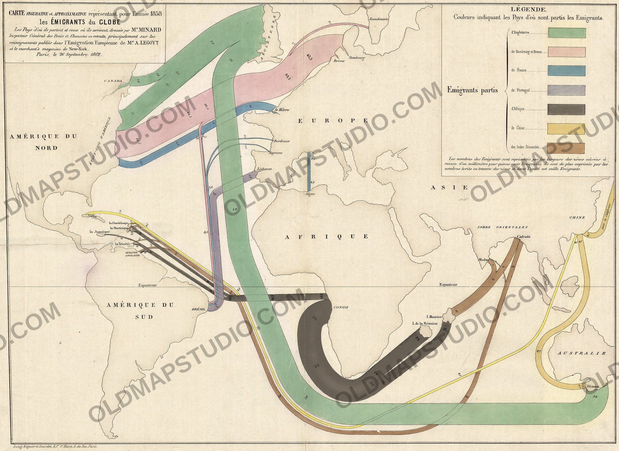
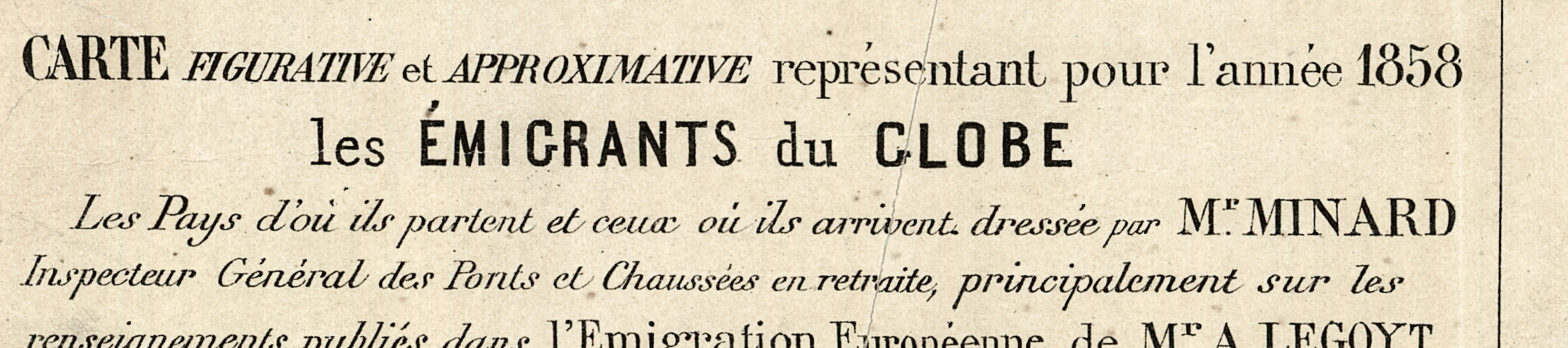
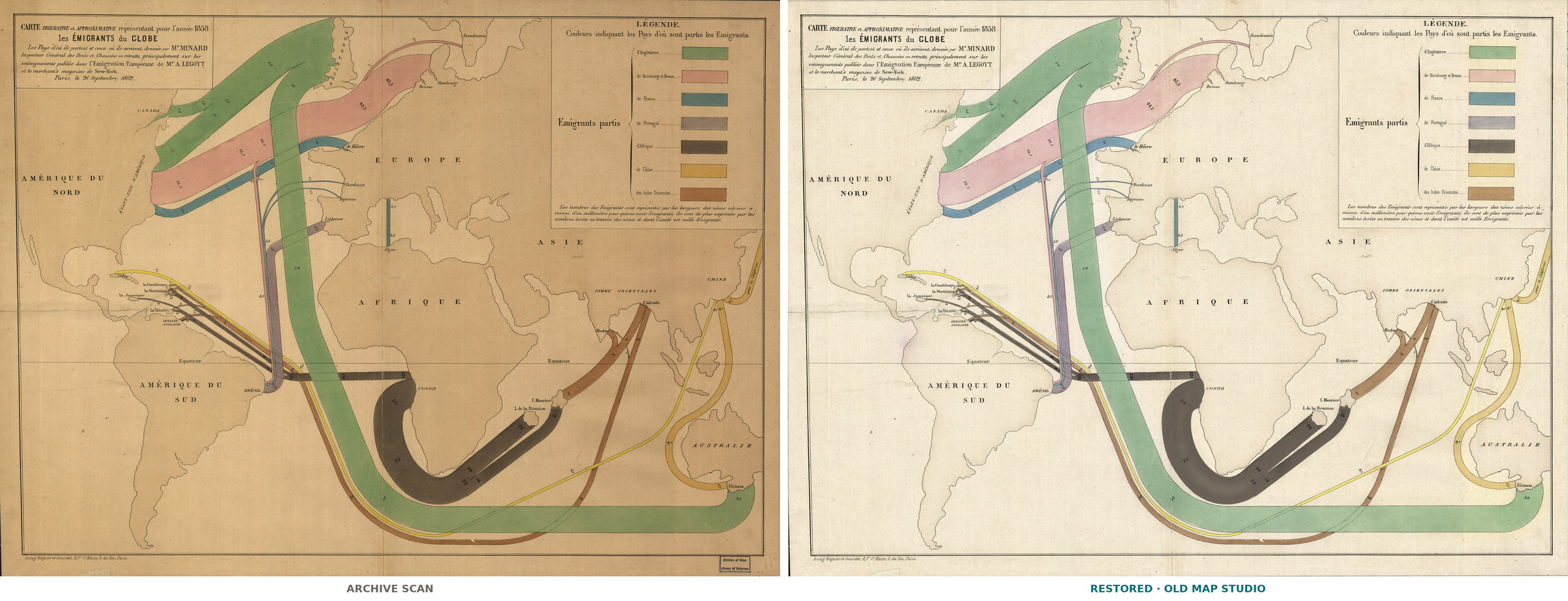
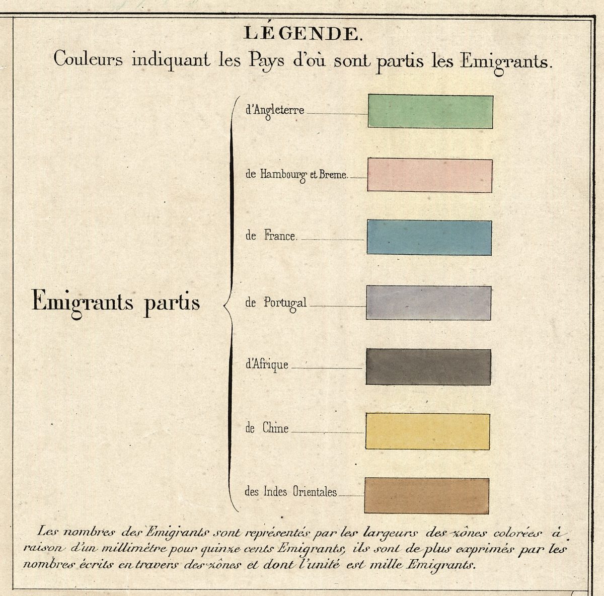
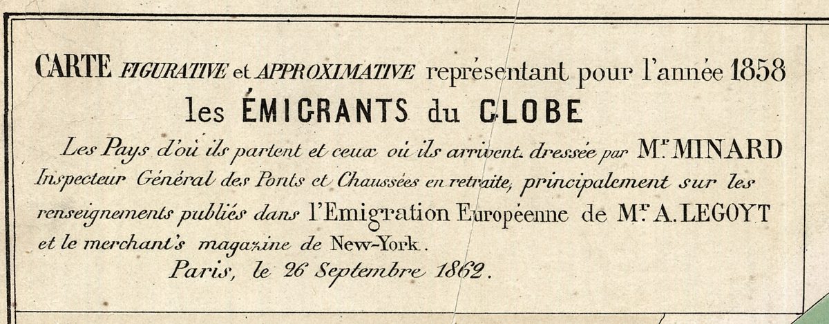
On this map people move like rivers. Bands leave Europe, Africa and Asia, each as wide as the number of emigrants it carries. The legend in the upper right states the rule: one millimeter of width for every fifteen hundred emigrants, with the figure in thousands written across each band. The title reads CARTE FIGURATIVE et APPROXIMATIVE représentant pour l’année 1858 les ÉMIGRANTS du GLOBE – a figurative and approximate map of the world’s emigrants in the year 1858, the countries they leave and those where they arrive.
Its author, Charles Joseph Minard (1781–1870), was an engineer. Born in Dijon, he spent his career in the Ponts et Chaussées, France’s civil engineering corps, became its Inspector General in 1846 and retired in 1851, according to the statistician Michael Friendly; his first graphic tables date from 1844. Friendly notes that Minard carefully labeled such works cartes figuratives et approximatives: where the data and exact geographic position conflicted, he gave priority to the data. Here the continents are plain outlines, and the only line of the grid is the Equator.
The title also names the data. Minard worked principalement – principally – from the figures in Alfred Legoyt’s study of European emigration and in the merchant’s magazine de New-York. Legoyt’s book, L’émigration européenne, appeared in Paris in 1861 with an appendix on African, Indian and Chinese emigration, the same streams from outside Europe that run across this sheet. The Library of Congress record lists Legoyt among the map’s contributors. The sheet is dated Paris, le 26 Septembre 1862, four years after the year it describes.
The Library of Congress map blog reads the routes: heavy movement from northern Europe into the United States; British emigrants to Canada, the United States and Australia; Africans leaving Central Africa for Réunion and Mauritius, at the time French and British colonies; flows of Africans into the Caribbean; and lines from China and South Asia. In 1858, the blog notes, slavery had not yet been abolished everywhere, so these flows include forced migration and indentured servitude. The same blog says Minard “is widely regarded as the first cartographer who mastered the art of the flow map.”
What to look for on the sheet
- The British band leaving ANGLETERRE: 50 thousand cross the North Atlantic and split into 18 for CANADA and 32 for the United States, while a band of 36 rounds Africa to Victoria in Australia.
- The pink band from Hambourg and Breme, 48 thousand once 2.7 thousand from Scandinavie have joined it; 44.5 thousand reach the United States and 3.5 thousand turn south to Brazil.
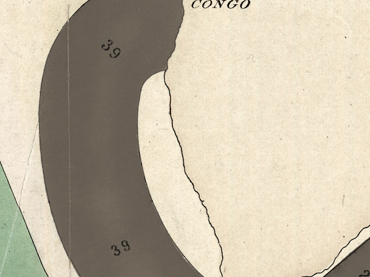
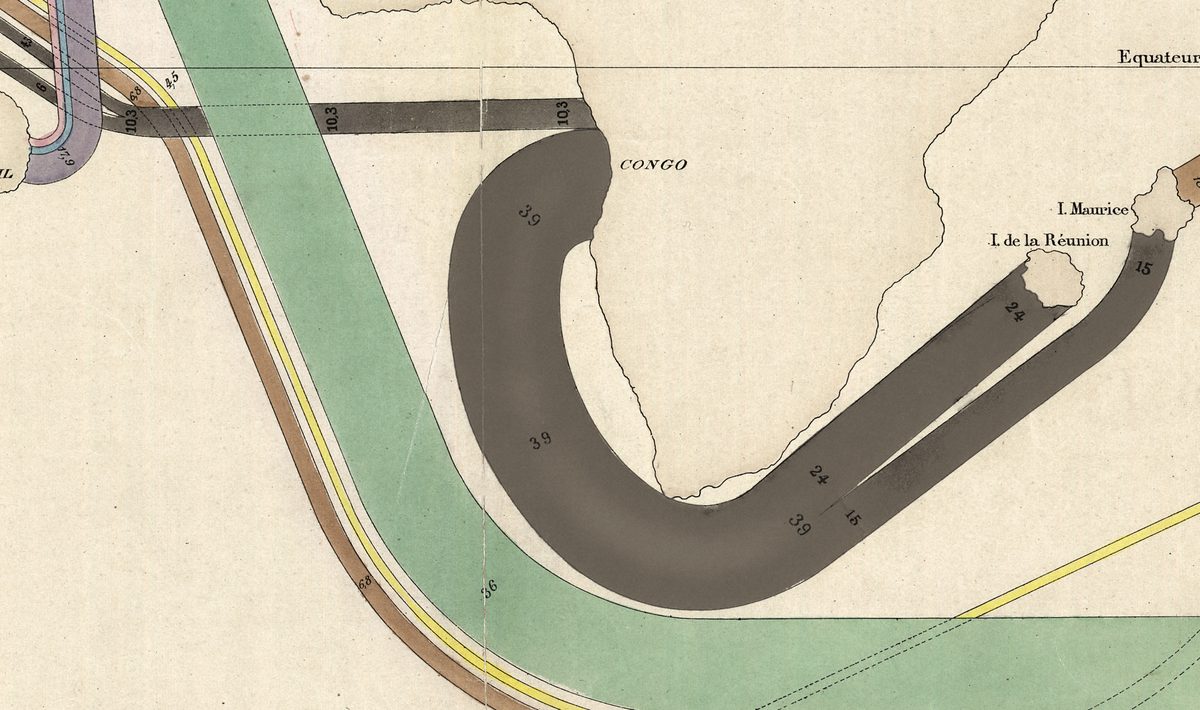
- The dark band of 39 thousand that rounds the Cape of Good Hope and divides into 24 for I. de la Réunion and 15 for I. Maurice.
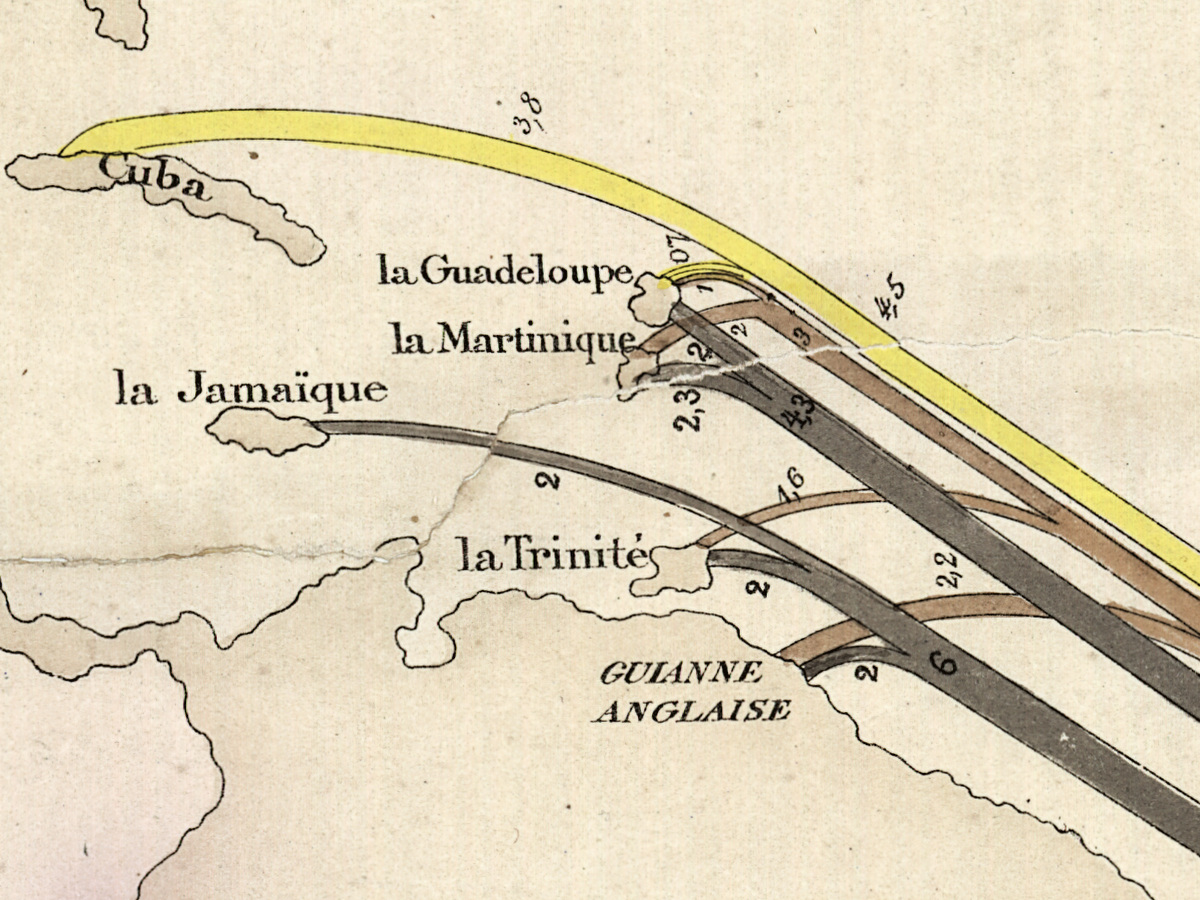
- Brown bands from Calcuta and Madras to Mauritius and across the Atlantic to the Caribbean; yellow bands from CHINE to Australia, to Cuba, and one lettered pour la Californie.
- A short blue bar from France to Alger, marked 4.8 thousand at both ends.
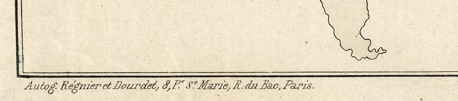
- Below the frame at lower left, the imprint Autog. Régnier et Dourdet – the Paris firm the record lists as Regnier et Dourdet.
Minard’s graphic work is best preserved at the École nationale des ponts et chaussées in Paris, which, Friendly writes, holds the most complete collection of it, including a copy of this map. Sandra Rendgen published that collection as The Minard System (2018). The Library of Congress copy is hand colored, fold-lined and mounted on cloth, 51 × 69 cm, and is kept under G3201.E27 1858 .M5; your file is made from its scan.
Everything on this sheet: full record
Every inscription on the sheet
Inscriptions are given letter by letter, with the spelling, accents, capitals and punctuation of the sheet, read on the scan at full size; a slash marks a new line. Small superscript letters, with the dot under them, are written on the line (as in Mr). The figures on the bands are in thousands of emigrants and keep the decimal comma of the sheet; a few very small figures that cannot be read with certainty are left out. French texts are followed by a translation in [square brackets].
- Upper left, title box: CARTE FIGURATIVE et APPROXIMATIVE représentant pour l’année 1858 / les ÉMIGRANTS du GLOBE / Les Pays d’où ils partent et ceux où ils arrivent. dressée par Mr MINARD / Inspecteur Général des Ponts et Chaussées en retraite, principalement sur les / renseignements publiés dans l’Emigration Européenne de Mr A. LEGOYT / et le merchant’s magazine de New-York. / Paris, le 26 Septembre 1862. [Figurative and approximate map showing for the year 1858 the emigrants of the globe, the countries they leave and those where they arrive, drawn up by Mr Minard, retired Inspector General of Bridges and Roads, principally from the information published in Mr A. Legoyt’s European Emigration and the merchant’s magazine of New York. Paris, 26 September 1862.]
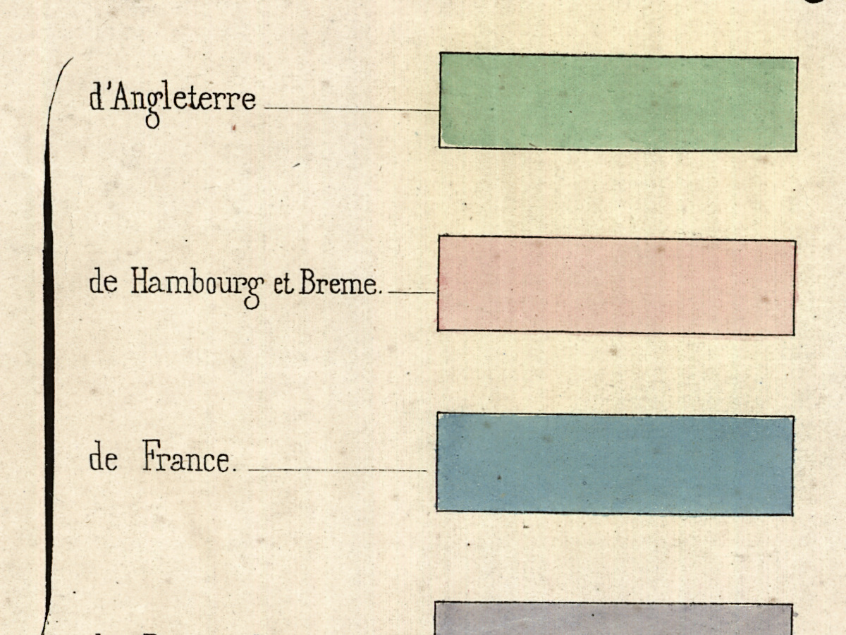
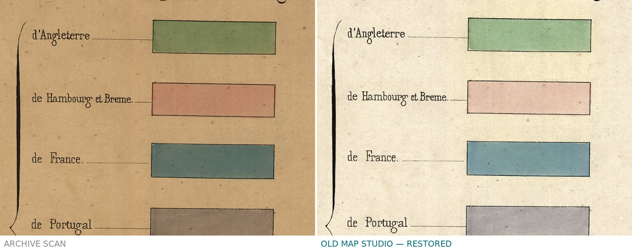
- Upper right, legend box: LÉGENDE. / Couleurs indiquant les Pays d’où sont partis les Emigrants. [Legend. Colors showing the countries the emigrants left from.] To the left of a brace, Emigrants partis [Emigrants departed]; to its right seven labeled color samples: d’Angleterre (green), de Hambourg et Breme. (pink), de France. (blue), de Portugal (grey-violet), d’Afrique (dark grey), de Chine (yellow), des Indes Orientales (brown).
- Legend box, below the samples: Les nombres des Emigrants sont représentés par les largeurs des zônes colorées à raison d’un millimétre pour quinze cents Emigrants, ils sont de plus exprimés par les nombres écrits en travers des zônes et dont l’unité est mille Emigrants. [The numbers of emigrants are represented by the widths of the colored zones, at the rate of one millimeter for fifteen hundred emigrants; they are also expressed by the numbers written across the zones, whose unit is one thousand emigrants.]
- Continents and regions: AMÉRIQUE DU NORD, AMÉRIQUE DU SUD, EUROPE, AFRIQUE, ASIE, AUSTRALIE, CANADA, ÉTATS-UNIS D’AMÉRIQUE, ANGLETERRE, Scandinavie, CONGO, BRÉSIL, GUIANNE ANGLAISE, INDES ORIENTALES, CHINE; the single grid line is lettered Equateur twice, across South America and in the Indian Ocean.
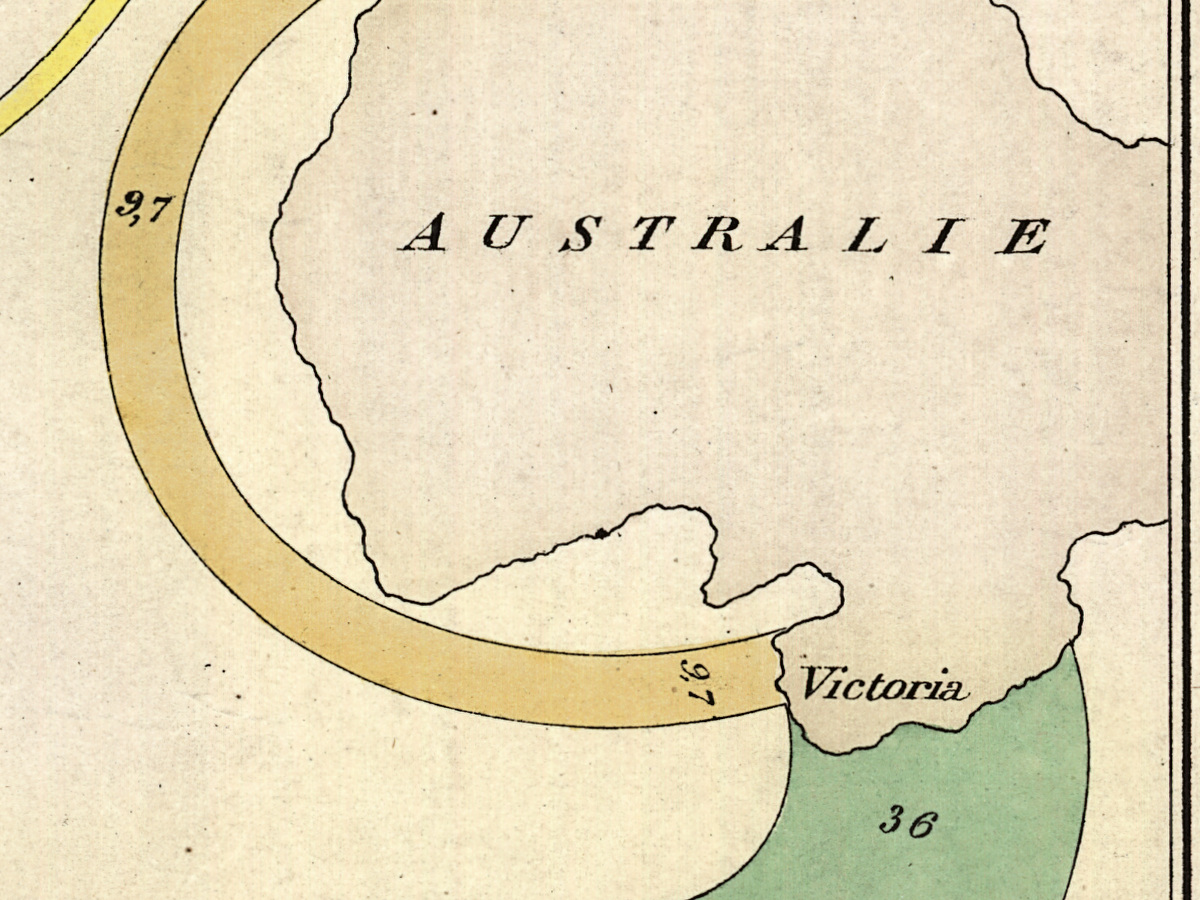
- Ports and islands: Hambourg, Breme, le Hâvre, Bordeaux, Bayonne, Lisbonne, Alger; in the Caribbean Cuba, la Guadeloupe, la Martinique, la Jamaïque, la Trinité; in the Indian Ocean I. Maurice and I. de la Réunion; Madras and Calcuta; in Australia Victoria.
- Green band (England): 50 across the North Atlantic, dividing into 18 for Canada and 32 for the United States; 36 south through the Atlantic, round the Cape of Good Hope and along the lower edge to Victoria.
- Pink band (Hamburg and Bremen): 45,3 from the German coast, joined by 2,7 from Scandinavia to make 48,0; it reaches the United States as 44,5, and a branch of 3,5 runs south to Brazil.
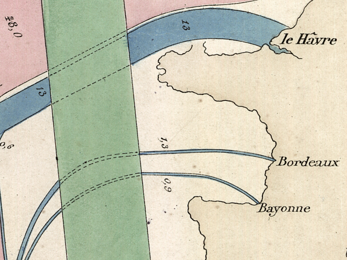
- Blue bands (France): 13 from le Hâvre, reaching the United States as 12,4 after a branch of 0,6; 1,3 from Bordeaux and 0,9 from Bayonne, which run south with that branch as a thin line marked 2,8 to Brazil; and a short bar to Alger marked 4,8 at both ends.
- Grey-violet band (Portugal): from Lisbonne to Brazil, marked 11,6 at the bend off the Iberian coast.
- Dark grey bands (Africa): from the Congo coast 10,3 westward across the Atlantic to the Caribbean islands and the Guianne Anglaise, where the separate strands carry figures such as 2 and 6; and 39 south round the Cape, dividing into 24 for the I. de la Réunion and 15 for the I. Maurice.
- Brown bands (East Indies): 7 from Madras and 9 from Calcuta, joined as 16 to the I. Maurice; 5,8 from Calcuta south, crossing to the Atlantic as 6,8 and ending at the Caribbean islands in small branches such as 1,6 and 2,2.
- Yellow bands (China): from the south China coast 4,5 across the Indian Ocean and the Atlantic to the Caribbean, ending 3,8 at Cuba; 9,7 to Victoria in Australia; and 8,7 north-east, lettered pour la Californie [for California].
- Where bands cross, the band underneath is continued in dashed lines.
- Lower left, below the frame: Autog. Régnier et Dourdet, 8, Pe Se Marie, R: du Bac, Paris.
The sheet is consistent in its arithmetic: 18 and 32 make the British 50, 45,3 and 2,7 make the 48,0 from Hamburg and Bremen, which divides again into 44,5 and 3,5; 12,4 and 0,6 make the 13 from le Hâvre, 24 and 15 the African 39, 7 and 9 the 16 from India to Mauritius. The spelling of names is the sheet’s own: Calcuta with one t, GUIANNE ANGLAISE, Breme without an accent beside le Hâvre with a circumflex, and zônes and millimétre in the legend. The title is spelled ÉMIGRANTS; the Library of Congress record transcribes it with garbled accents (dóu, oú).
Editions and other known copies
- Library of Congress, Geography and Map Division, G3201.E27 1858 .M5 (this copy): “Paris : Charles Joseph Minard, 1862”; “1 map : hand col. ; 51 x 69 cm”; “Fold-lined, mounted on cloth”; contributors Charles Joseph Minard (1781–1870), Alfred Legoyt (1815–1885) and Regnier et Dourdet (Firm).
- École nationale des ponts et chaussées, Paris, 3384/C161: entered in Michael Friendly’s catalogue of Minard’s graphic works as no. 36, “lith. (685 x 508), 26 September 1862”. The school’s own record was not opened for this file.
- David Rumsey Map Collection, 10134.002: depicted 1858, published 1862, Regnier et Dourdet; 70 × 51 cm.
- In the trade: a copy offered by Daniel Crouch Rare Books (inventory 14871), Paris, Regnier et Dourdet, 1862, 528 by 740 mm, “signed “Ch. J. Minard” in ink to title, mounted on linen”.
None of these records names a second edition or state of the sheet, and Friendly’s catalogue has a single entry for this emigration map. The dimensions differ from record to record (51 × 69 cm, 685 × 508 mm, 70 × 51 cm, 528 × 740 mm); each is given here as its holder states it.
Catalog entries and sources
- Library of Congress: LCCN 98687134; call number G3201.E27 1858 .M5.
- École nationale des ponts et chaussées: 3384/C161 (as cited by Friendly).
- Friendly, catalogue of Minard’s graphic works: no. 36.
- David Rumsey Map Collection: 10134.002.
Sources for the story and this record: the Library of Congress catalog record and its map blog post on colonization and slavery in Charles Minard’s flow maps (2021); Michael Friendly, “Visions and Re-Visions of Charles Joseph Minard” (Journal of Educational and Behavioral Statistics, 2002), his Minard biography and his catalogue of Minard’s works; Sandra Rendgen, The Minard System (Princeton Architectural Press, 2018); the Europeana record of Alfred Legoyt, L’émigration européenne, son importance, ses causes, ses effets (Paris, Guillaumin, 1861); the exhibition texts of the Instituto Nacional de Estadística, Madrid, and of the CCCB, Barcelona; the David Rumsey Map Collection; Daniel Crouch Rare Books.
This copy
The scan shows the Library of Congress copy whole, with its margins and the double frame line. It is hand colored in seven washes that match the seven samples of the legend. Thin crease lines cross the paper: one runs from the top edge down through the title box and on across North America; another crosses the Caribbean beside la Martinique; a vertical one crosses the band from the Congo and runs on south through the Atlantic. The paper is evenly toned, with small scattered specks. No library stamp or handwritten note is visible on the scan; the cloth backing named in the record cannot be seen from the front.
Your file
| Original | Paris, 1862 (the year mapped: 1858), Library of Congress G3201.E27 1858 .M5; sheet 51 × 69 cm |
| Scan | full sheet 8616 × 6376 px; the map inside the trimmed border 8381 × 6109 px |
| Print size at 300 dpi | the map prints to 70 cm (28 in), the full sheet with margins to 72 cm (28 in) |
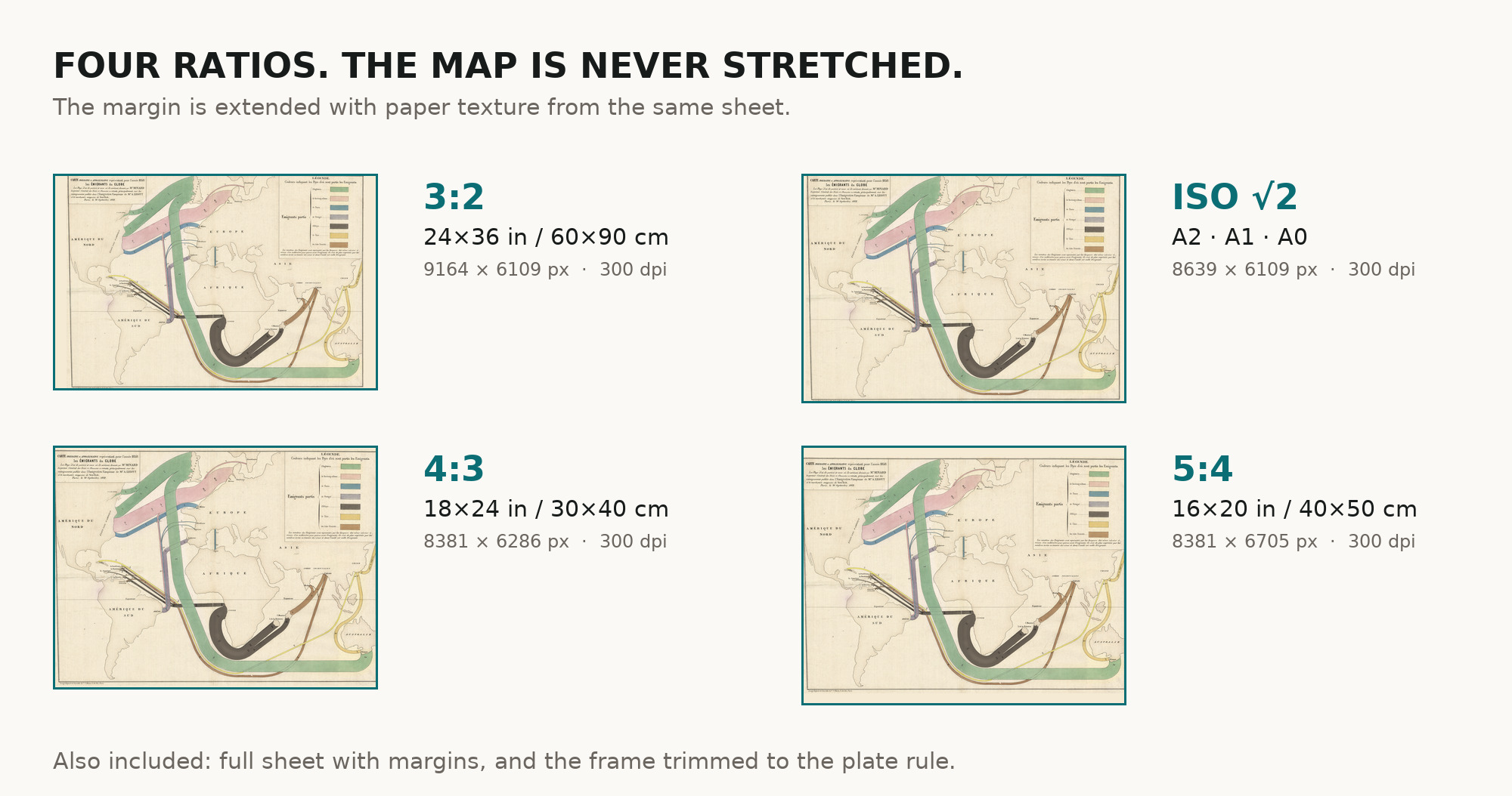
| You download | six ZIP archives: full sheet, trimmed, 3:2, 4:3, 5:4 and ISO A |
| Inside each one | one JPEG at 300 dpi, the restoration passport as a PDF, a READ ME |
How to print
- At 300 dpi the map prints to 70 cm. Pick the archive whose proportions match your frame; ask for matte fine-art paper in sRGB with auto-enhancement off.
- Where to print it: print shops near you and checked prices at online labs.
Source and rights
The file is made from the Library of Congress scan; the Geography and Map Division states that its digitized collections are free to use and reuse. The record describes the map as hand colored but does not name the printing technique. There is no TIFF master in the package. Catalogue record: Library of Congress →
Features
- French
Attachments
Reviews
No reviews found
More maps from the 1800s
-
 Antique World Map 10th c. — Istakhri and Ibn Hawqal, Lelewel 1852
-
Antique World Map 1850 — Burr, Mercator's Projection
-
Antique World Map c. 1850 — Bartholomew, British Empire in One View
-
Antique World Map c. 1867 — Drioux, Planisphère
-
Antique World Map 1848 — Johnston, Zoological Geography
-
Antique World Map 1848 — Johnston, Botanical Geography