Antique World Map 10th c. — Istakhri and Ibn Hawqal, Lelewel 1852
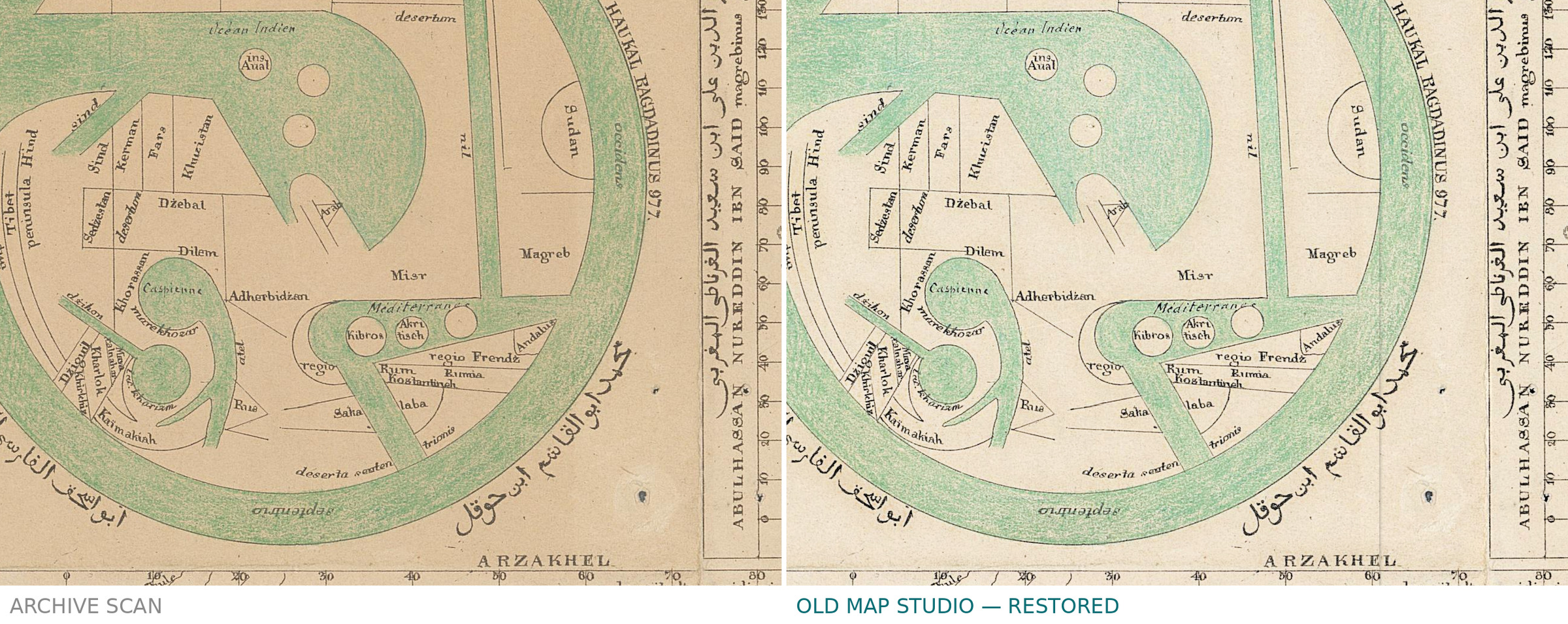
Description
An antique world map from Lelewel’s atlas: al-Istakhri’s round world
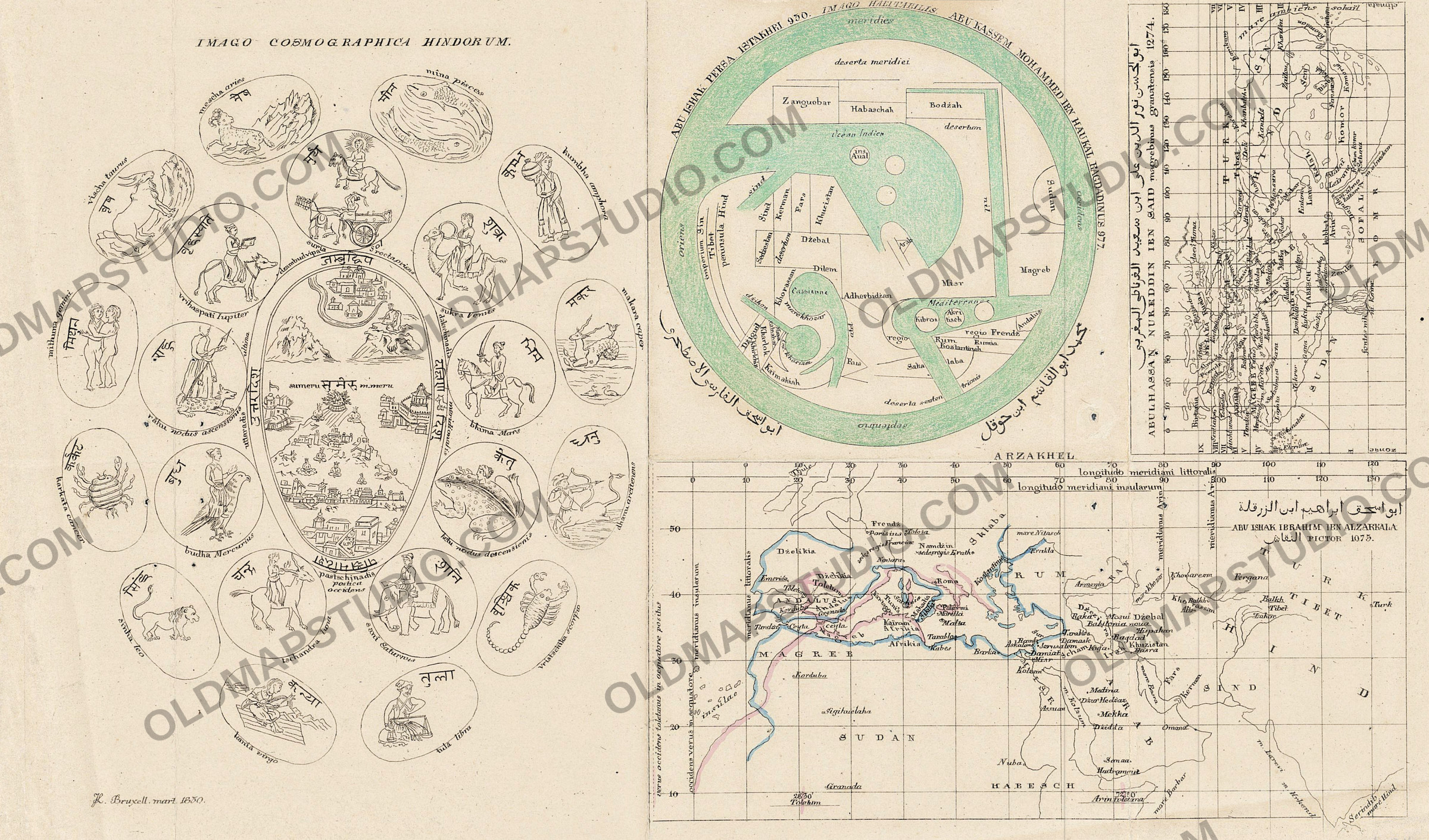
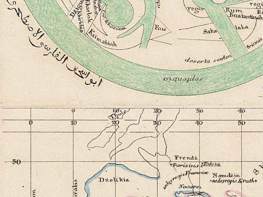
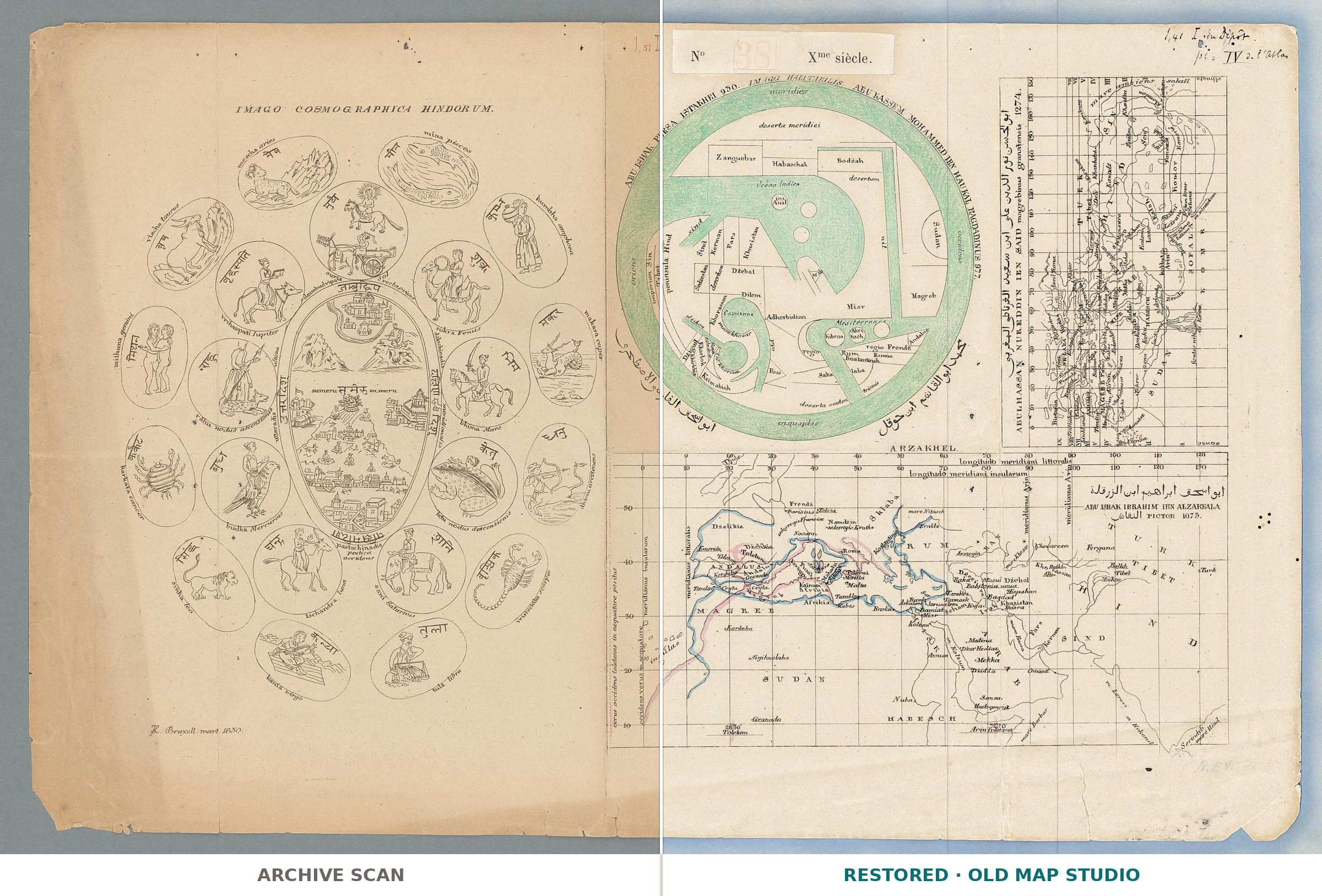
Four pictures of the world share this sheet. At the top, right of center, is a round map with south at the top: meridies stands at the top of its green band of ocean and septentrio at the bottom. The title around it, ABU ISHAK PERSA ISTAKHRI 950. IMAGO HABITABILIS. ABU KASSEM MOHAMMED IBN HAUKAL BAGDADINUS 977., names two tenth-century geographers, al-Istakhri and Ibn Hawqal; their names are repeated in Arabic around the lower half of the circle.
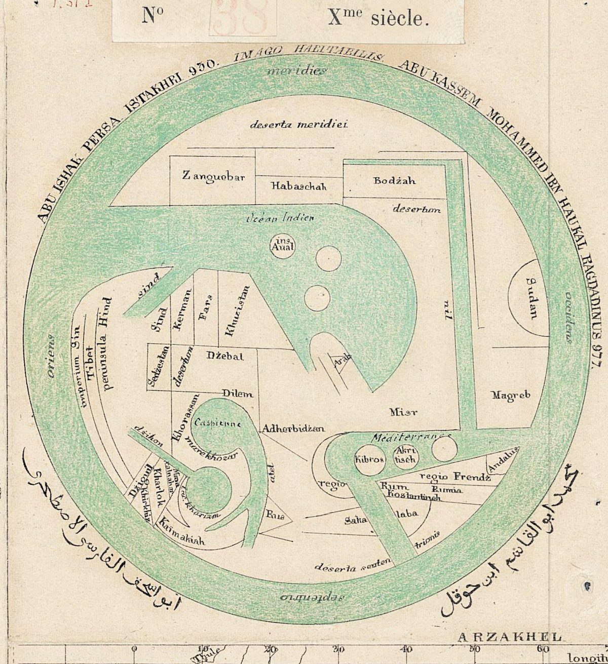
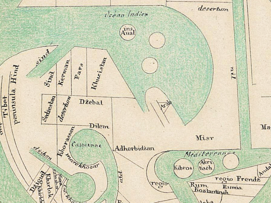
Gerald R. Tibbetts, in The History of Cartography, describes al-Istakhri’s world as a circle surrounded by the Encompassing Sea, with the two main seas reaching in from the east and the west toward the center. The maps of this school, he writes, cover the Islamic empire as it appeared in the tenth century, and Ibn Hawqal revised al-Istakhri’s text at the author’s request. Here the two seas are green gulfs: the Océan Indien from the east and the Mediterranean, with Kibros as a round island, from the west.
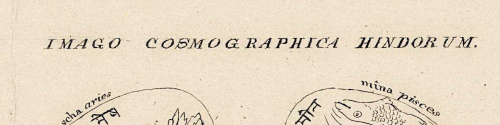
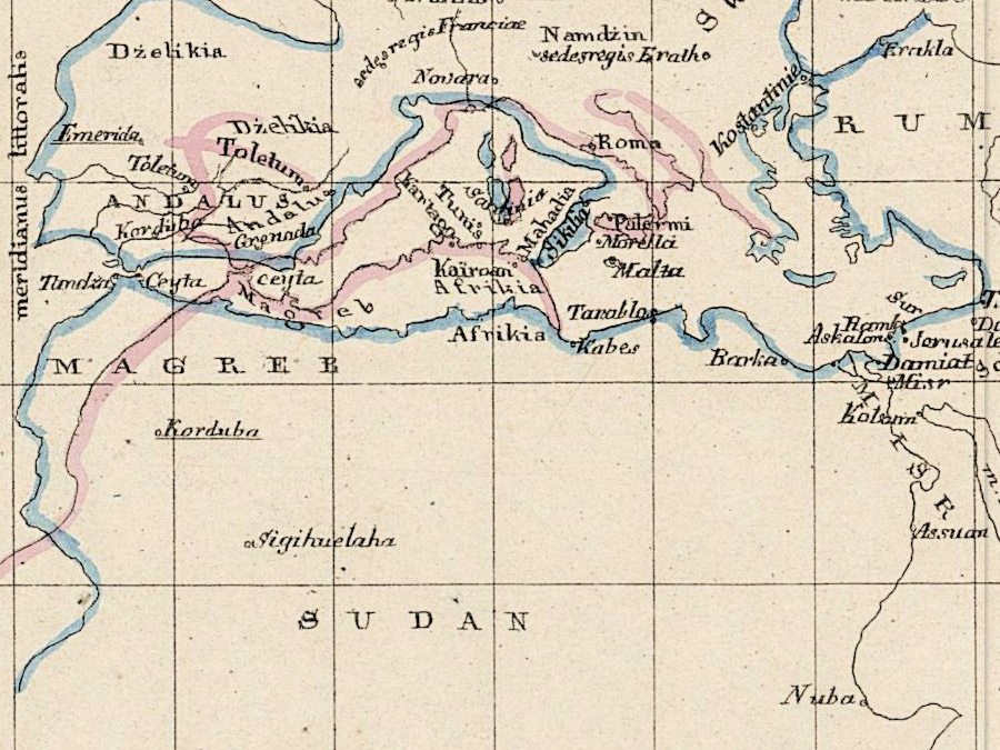
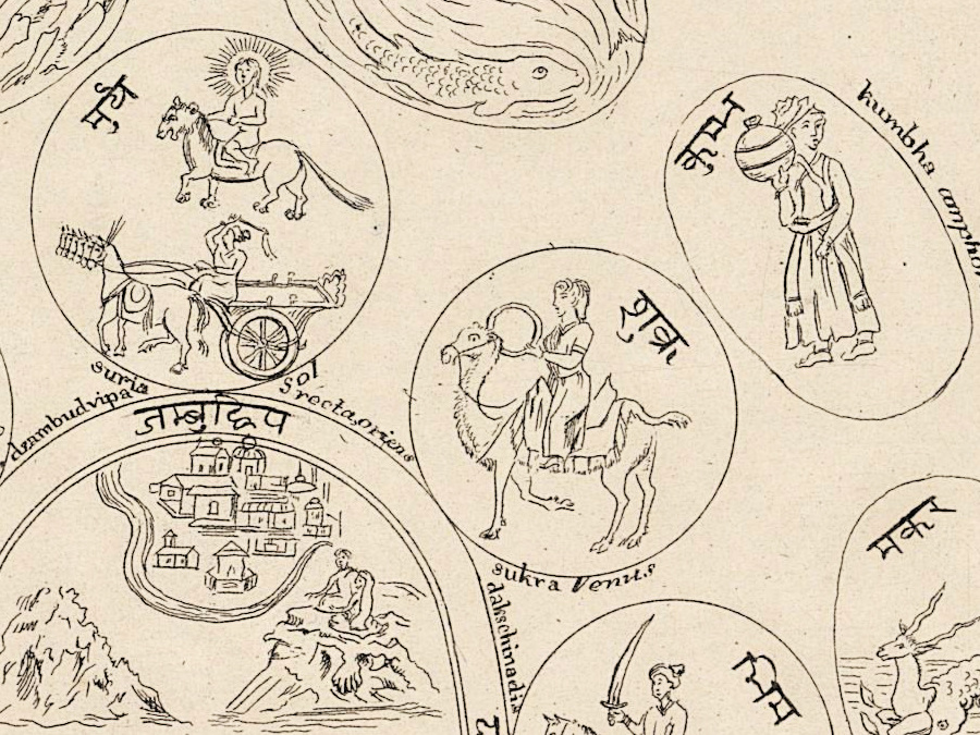
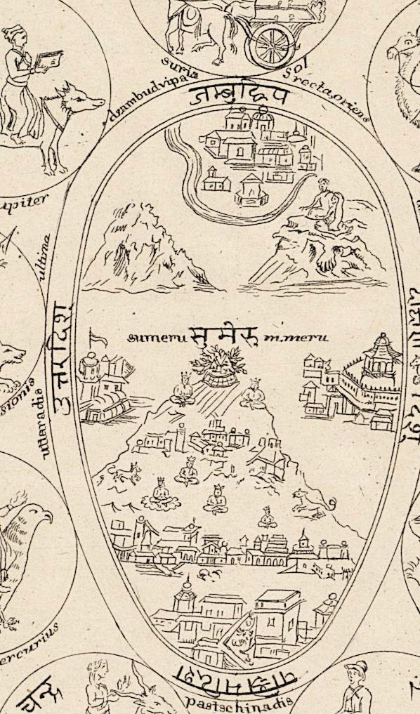
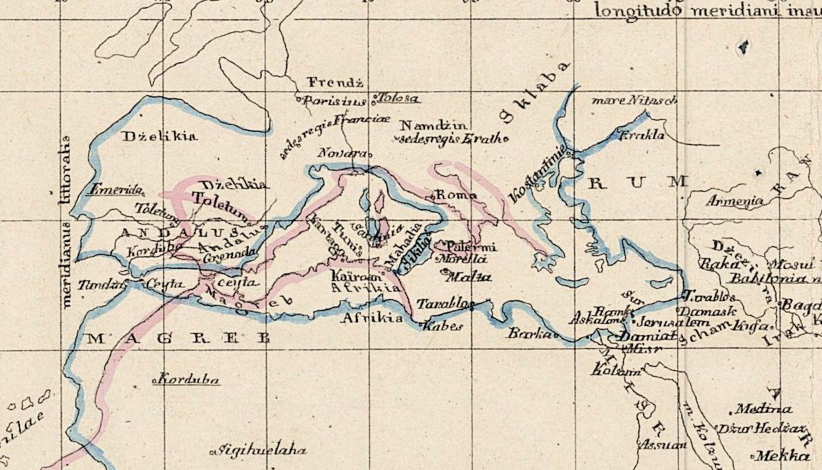
Three more figures surround it. On the left, IMAGO COSMOGRAPHICA HINDORUM puts Mount Meru, sumeru, inside an oval ringed by medallions of the zodiac signs and planets; Joseph E. Schwartzberg explains that in Hindu cosmography the earth and universe are centered on Mount Meru. At the lower right, ARZAKHEL draws the Mediterranean on a grid of degrees under the name of al-Zarqālī, who, according to the Dictionary of Scientific Biography, joined the Toledo observations begun about 1060 as an instrument maker. At the upper right, turned on its side, is the world of Ibn Sa‘id, whose geography, The History of Cartography notes, contains no maps but gives latitude and longitude values.
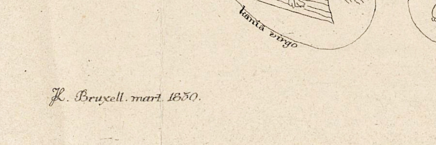
The plate comes from the atlas of Joachim Lelewel (1786–1861), the Polish historian who, in Britannica’s account, moved to Brussels after the insurrection of 1830–31 and published his writings in French there. The Kórnik Library’s copy describes fifty plates engraved by the author, with 145 figures and maps of 88 Arab and Latin geographers. This plate is signed JL. Bruxell. mart. 1850.; the Geneva record dates it 1852, within the Géographie du moyen âge.
What to look for on the sheet
- Inside the round map: Zanguebar, Habaschah, Misr, Magreb, Andalus, the Caspienne with mare khozar, and imperium Sin at the eastern edge.
- In the Hindu figure, the sun as a haloed rider over a chariot, suria sol, and the lunar nodes rāhu and ketu.
- On ARZAKHEL, two scales of longitude along the top, longitudo meridiani littoralis and longitudo meridiani insularum, ten degrees apart, and two coastlines, one blue and one pink.
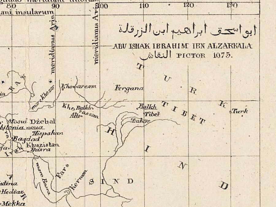
- The title ABU ISHAK IBRAHIM IBN ALZARKALA, with the Arabic النقاش rendered PICTOR, and the date 1075.
- ABULHASSAN NUREDDIN IBN SAID magrebinus granatensis 1274., with the climates, climata, in Roman numerals.
Tibbetts explains two of these details: al-Khwarizmi’s grid starts ten degrees east of Ptolemy’s Fortunate Isles, and the meridian of Ujjain, meridianus Arin on the sheet, remained entirely theoretical. The oldest dated al-Istakhri manuscript he cites is in Gotha, dated 569/1173.
Everything on this sheet: full record
Every inscription on the sheet
We read the sheet on our full-resolution scan. Inscriptions are given letter by letter, with the capitals of the sheet; a slash marks a line break, and a translation follows in [square brackets] where it helps. Inside the maps we list a selection of the clearer names. What we could not read is not written out.
- Above the maps, on a pasted label: No 38 Xme siècle. [No. 38, tenth century], the number 38 in red outline. To the left of the label, in red ink, 1.57 I. At the upper right, in ink, 1,41 I du Dépôt. and below it pl. = IV d. l’atlas [plate IV of the atlas], its end partly unclear.
- Round map, title around the rim: ABU ISHAK PERSA ISTAKHRI 950. IMAGO HABITABILIS. ABU KASSEM MOHAMMED IBN HAUKAL BAGDADINUS 977. [image of the inhabited world]; the first B of HABITABILIS is faint. Below the circle, in Arabic, on the left ابو اسحق الفارسي الاصطخري and on the right محمد ابو القاسم ابن حوقل.
- Round map, inside: in the green band meridies [south] at the top, septentrio [north] at the bottom, oriens on the left and occidens on the right; deserta meridiei, Zanguebar, Habaschah, Bodżah, desertum, Océan Indien with ins. Aual, nil, Sudan, Magreb, Misr, Kibros, regio Frendż, Andalus, Rum, Rus, Caspienne and mare khozar, atel, Khorassan, Dżebal, Dilem, Adherbidżan, Sind, Kerman, Fars, Khuzistan, peninsula Hind, Tibet, imperium Sin, Arab.
- Left: IMAGO COSMOGRAPHICA HINDORUM. In the central oval sumeru, सुमेरु, m. meru; above it जम्बुद्विप and dzambudvipa; below it pastschinadis / postica / occidens [west]; on the left side uttaradis. Medallions, each with its name also in Devanagari: mescha aries, vischa taurus, mithuna gemini, karkata cancer, sinha leo, kania virgo, tulā libra, vristschika scorpio, dhanu arcitenens [archer], kumbha amphora, mîna pisces; suria sol [sun], tschandra luna [moon], bhima Mars, budha Mercurius, vrihaspati Jupiter, sukra Venus, sani Saturnus, rāhu nodus ascensionis and ketu nodus descensionis [the ascending and descending nodes of the moon].
- Lower right: ARZAKHEL. Along the top longitudo meridiani littoralis and longitudo meridiani insularum, two rows of degrees; vertical lines meridianus insularum, meridianus littoralis and twice meridianus Arin; at the left edge verus occidens toletanus in aequatore positus and occidens verus in aequatore [the true west of Toledo, placed on the equator]; at the bottom 28°30′ Toletum and 72°30′ Arin toletana. Title: ابو اسحق ابراهيم ابن الزرقلة / ABU ISHAK IBRAHIM IBN ALZARKALA / النقاش PICTOR 1075. Names include Toletum, ANDALUS, MAGREB, SUDAN, Parisius, Tolosa, Roma, RUM, Sklaba, Jerusalem, Bagdad, Mekka, Medina, SIND, HIND, TURK, TIBET and insulae.
- Upper right, turned on its side: an Arabic line, then ABULHASSAN NUREDDIN IBN SAID magrebinus granatensis 1274. [of the Maghreb, of Granada]; climata at the corner and the climates in Roman numerals; degrees from 0 to 180; mare ambiens [the surrounding sea], SIN, HIND, TURK, HABESCH, SUDAN, SOFALA, fontes nili [sources of the Nile].
- Lower left: JL. Bruxell. mart. 1850. [JL, Brussels, March 1850]; the first letters form a monogram.
What does not agree on the sheet itself: the label says tenth century, but the four figures carry four dates — 950 and 977 on the round map, 1075 on ARZAKHEL and 1274 on Ibn Said’s map — and the signature 1850; the record dates the sheet 1852. The round map mixes Latin with French names, Océan Indien and Caspienne. On ARZAKHEL the Mediterranean has two coastlines, blue and pink, and Toletum stands at more than one place. The Arabic word under ALZARKALA, النقاش, is rendered PICTOR; the Dictionary of Scientific Biography gives al-Zarqālī’s name as ending in al-Naqqāsh.
Editions and other known copies
- Bibliothèque de Genève, BGE Musée cartogr. 1/38 — this copy. Record (e-rara 25915291, DOI 10.3931/e-rara-90377): “Géographie du Moyen Age / [Mappemonde d’Istakri]”; creator al-Iṣṭakhrī; “1 carte ; diamètre 11 cm”; “Lelewel, Géographie du moyen âge. - Bruxelles : Ve et J. Pilliet, 1852-1857”; dates 1852 and 1857; Public Domain Mark. The label N° 38 on the sheet matches the shelfmark.
- Kórnik Library (Biblioteka Kórnicka PAN), shelfmark A II 025 — the atlas: Brussels, V-ve et J. Pilliet, 1850; “Atlas composé de cinquante planches gravées par l’auteur”, with 145 figures and maps of 88 Arab and Latin geographers; some maps hand-colored; 36.5 × 24 cm.
- Royal Museums Greenwich, library — “Geographie du moyen age : atlas”, J Pilliet, 1850, 50 plates of maps; no shelfmark given (oversize shelving).
- The text volumes: Britannica gives the Géographie du moyen âge as 5 vols., 1852–57; The History of Cartography cites 4 vols. and an epilogue, Brussels: J. Pilliet, 1852–57, reprinted Amsterdam: Meridian, 1966. None of these records names the number of this plate; the ink note on our sheet reads plate IV.
Catalog entries and sources
Catalog entry for this copy: Bibliothèque de Genève, BGE Musée cartogr. 1/38; e-rara 25915291, DOI 10.3931/e-rara-90377 (e-rara image file 25915292). Other copies: Kórnik Library, A II 025; Royal Museums Greenwich library record rmgl-19876.
Sources for the story and this record: The History of Cartography, vol. 2, book 1, chapters “The Balkhī School of Geographers” (Gerald R. Tibbetts) and “Cartography of al-Sharīf al-Idrīsī” (S. Maqbul Ahmad); “The Beginnings of a Cartographic Tradition” (Gerald R. Tibbetts) and “Cosmographical Mapping” (Joseph E. Schwartzberg); Dictionary of Scientific Biography, “al-Zarqālī” (J. Vernet); Britannica, “Joachim Lelewel” and “al-Zarqālī”.
This copy
The scan shows the whole sheet, 4433 × 2865 pixels. The ocean band and gulfs of the round map are colored green, and the coastlines and rivers of the ARZAKHEL map blue and pink; the rest is black line. The paper is toned, with vertical creases, small spots and uneven edges. The label with No. 38 and the notes in red and black ink lie above the trimmed frame: they are in the full-sheet file but not in the trimmed one. The signature at the lower left lies inside the frame and was kept. The paper tone was evened and specks were removed; the printed lines were not touched.
Your file
| Original | Joachim Lelewel, Brussels, 1852 (record; plate signed March 1850): [Mappemonde d’Istakri], Géographie du moyen âge, Bruxelles: Ve et J. Pilliet, 1852–1857; 1 map, diameter 11 cm; Bibliothèque de Genève, BGE Musée cartogr. 1/38 |
| Scan | full sheet 4433 × 2865 px; the map inside the trimmed border 3930 × 2310 px |
| Print size at 300 dpi | the map prints to 33 cm (13 in), the full sheet with margins to 37 cm (15 in) |
| You download | six ZIP archives: full sheet, trimmed, 3:2, 4:3, 5:4 and ISO A |
| Inside each one | one JPEG at 300 dpi, the restoration passport as a PDF, a READ ME |
How to print
- The sheet is small and wide: print it at 300 dpi at the size above and do not let the shop scale the file up.
- Pick the archive whose proportions match your frame, so nothing is cropped or stretched.
- Ask for matte fine-art paper, sRGB, auto-enhancement off.
- Where to print it: print shops near you and checked prices at online labs.
Source and rights
The file is made from the Bibliothèque de Genève scan on e-rara, shelfmark BGE Musée cartogr. 1/38, DOI 10.3931/e-rara-90377, under the Public Domain Mark. The library asks that reproductions name the author, the place and the persistent identifier: al-Iṣṭakhrī, Bibliothèque de Genève, BGE Musée cartogr. 1/38, 10.3931/e-rara-90377. The record states neither the technique nor the coloring. The paper tone was evened and specks were removed; the printed lines were not touched. There is no TIFF master in the package. Catalogue record: e-rara (Bibliothèque de Genève) →
Questions
Is this a medieval map?
No. It is a plate of 1852, by the Geneva record, on which Lelewel drew versions of maps by medieval geographers; the plate itself is signed March 1850. The dates 950, 977, 1075 and 1274 are written on the sheet.
Why is south at the top?
The round map is drawn that way: meridies, south, is written at the top and septentrio, north, at the bottom. The History of Cartography notes the usual orientation of the Balkhi school maps in its figure captions; on its maps of Kirman, for example, the top is south.
How large can I print it?
The map to 33 cm (13 in) on the long side at 300 dpi, the full sheet with margins to 37 cm (15 in), from the scan’s own resolution, not an upscale. It suits a small frame.
What does the label N° 38 mean?
The label reads No 38 Xme siècle., and its number matches the shelfmark BGE Musée cartogr. 1/38. It lies above the trimmed frame, so it is only in the full-sheet file.
Is the color original?
The record does not state the coloring. On the scan the round map is green and the ARZAKHEL coastlines are blue and pink; the Kórnik Library describes some maps in its copy of the atlas as hand-colored.
Features
- Arabic
- French
- Latin
- Sanskrit
Attachments
Reviews
No reviews found
More maps from the 1800s
-
 Antique World Map 1850 — Burr, Mercator's Projection
-
Antique World Map c. 1850 — Bartholomew, British Empire in One View
-
Antique World Map 1848 — Johnston, Zoological Geography
-
Antique World Map 1848 — Johnston, Botanical Geography
-
Antique World Map 1858 — Minard, Emigrants of the Globe
-
Antique World Map c. 1845 — Johnston, Botanical Geography