Antique World Map c. 1780 — Bowles, New and Accurate Map of the World

Description
An old world map of c. 1780: Bowles’s New and Accurate Map of the World
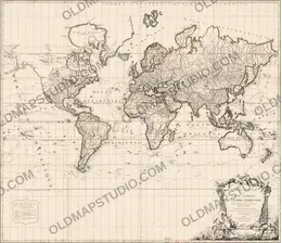
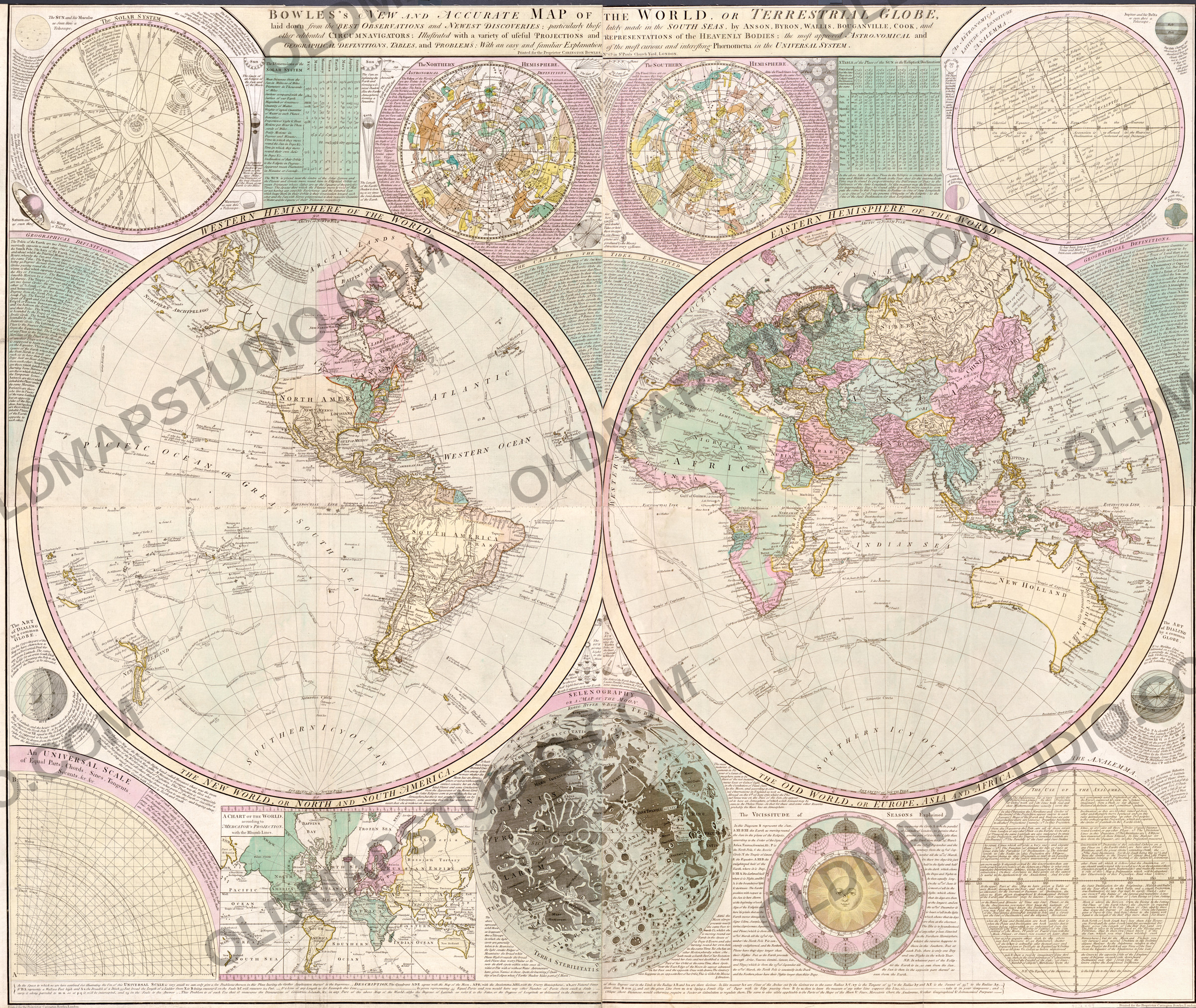
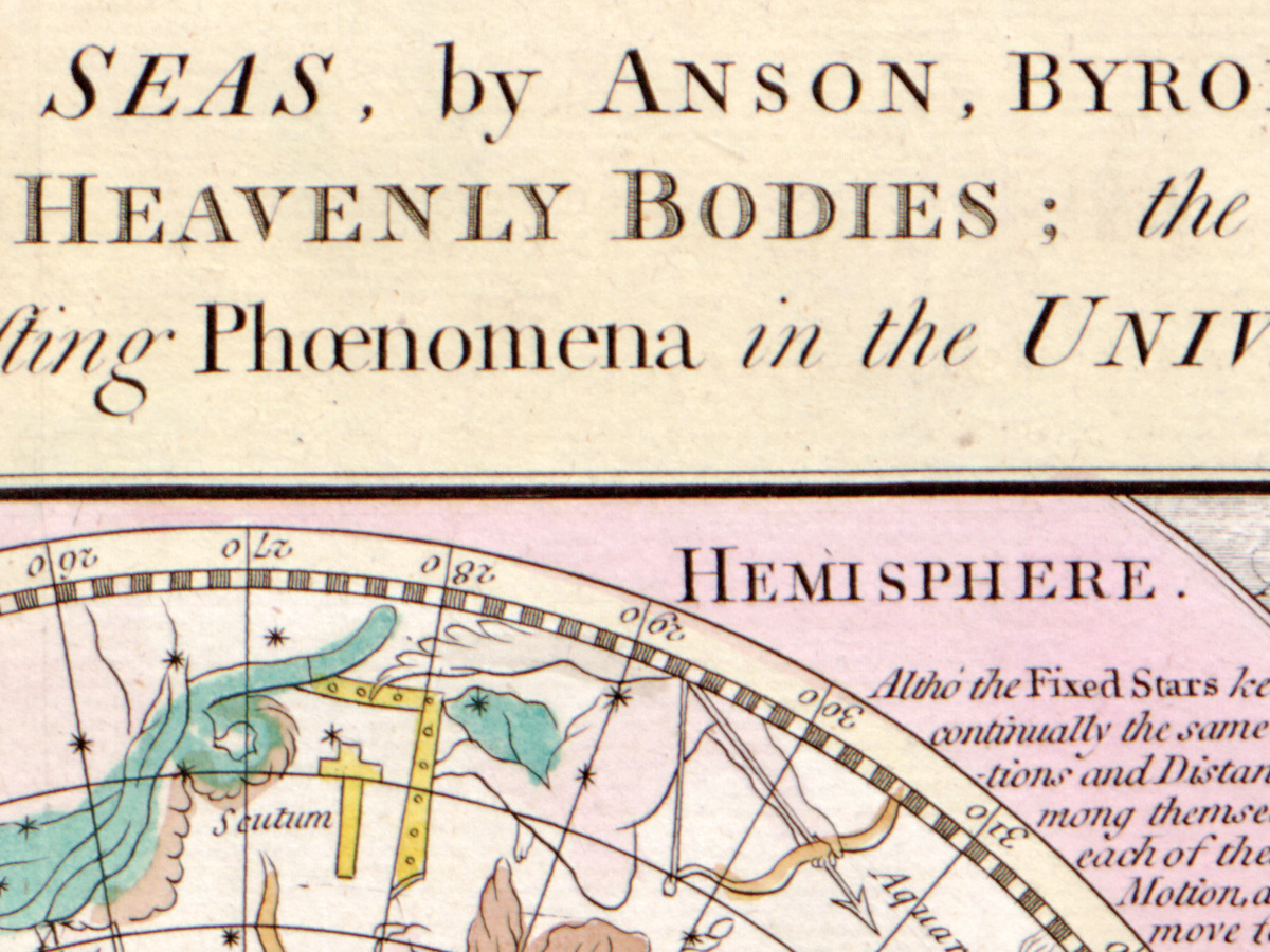
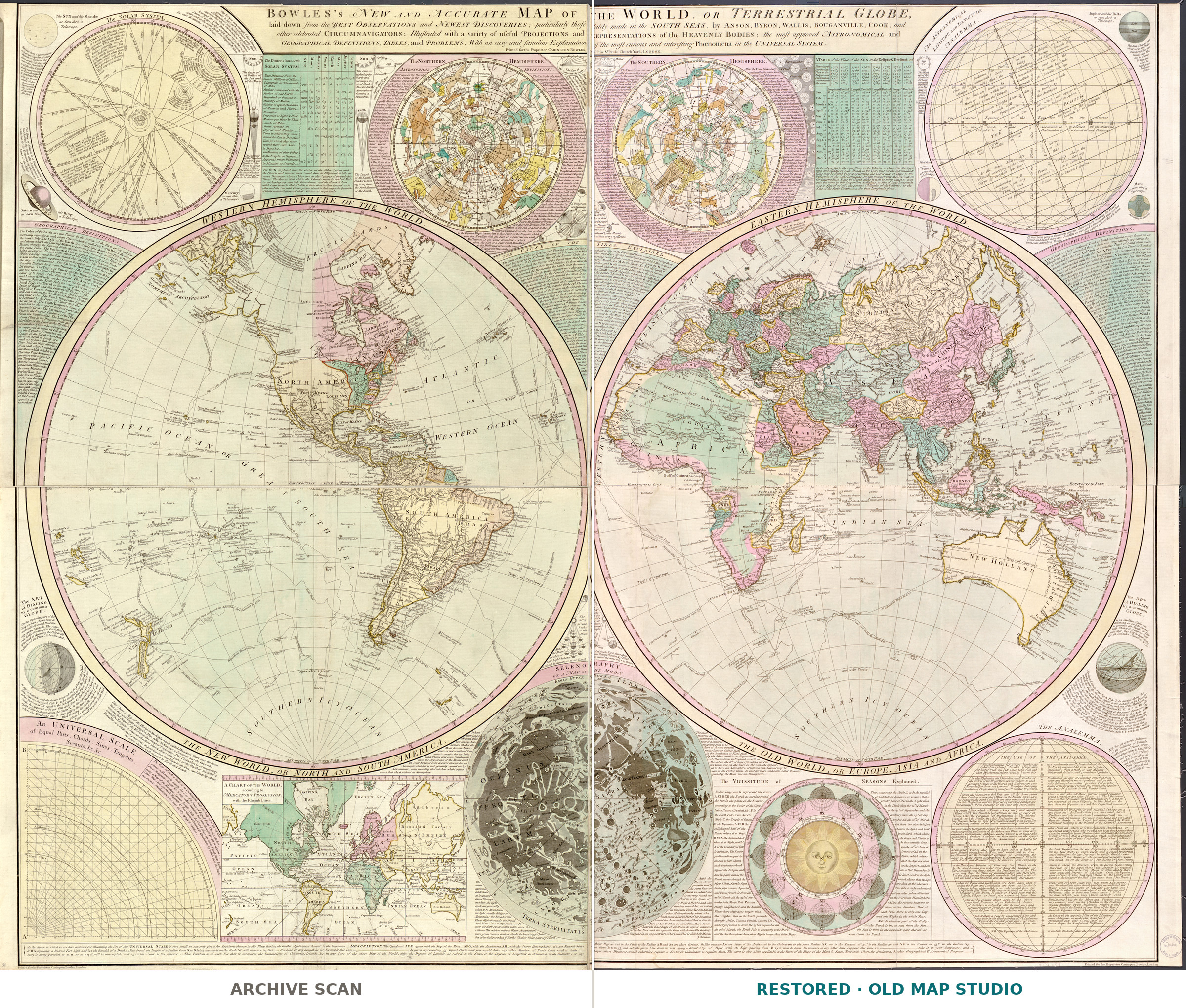
Across the top of the sheet runs a title that reads like a table of contents: BOWLES’s NEW AND ACCURATE MAP OF THE WORLD, OR TERRESTRIAL GLOBE, laid down from the newest discoveries in the South Seas by Anson, Byron, Wallis, Bougainville, Cook “and other celebrated circumnavigators”, with projections, definitions, tables and problems. The Library of Congress copy is hand colored: two hemispheres, each 59 cm across, on a sheet of 106 × 130 cm, printed for Carington Bowles at no. 69 in St. Paul’s Church Yard, London, and dated in the record “[1780?]”.
Carington Bowles (1724–1793), son of the Cornhill printseller John Bowles, was apprenticed to his father in 1741 and took over his uncle Thomas’s business in St Paul’s Churchyard, the Science Museum Group records; it dates his address at no. 69 from 1764, while the Royal Academy notes a 1766 portrait published by him at St Paul’s Churchyard, earlier than the long-assumed 1767. He bought plates of John Rocque and was a great rival of the publisher Sayer. After him, his son Henry Carington Bowles and Samuel Carver traded there as Bowles & Carver.
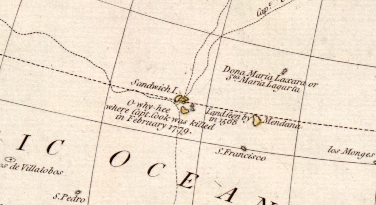
The sheet follows the newest voyages closely. Dotted tracks cross the Pacific with names and years — Anson’s Track in 1742, Bougainvilles Track 1768, Resolution’s Track in 1774 — and Cook’s third voyage is traced leg by leg: Capt. Cook going to Otaheite in 1777, Capt. Cook going to America in 1778, George’s Sound where Capt. Cook repair’d in 1778. Beside the Sandwich I. stands the note O-why-hee where Capt. Cook was killed in February 1779, which fits the library’s date of about 1780. On the northwest coast, Highest Latitude of the Spanish Discoveries in 1775 sits beside Fousang of the Chinese.
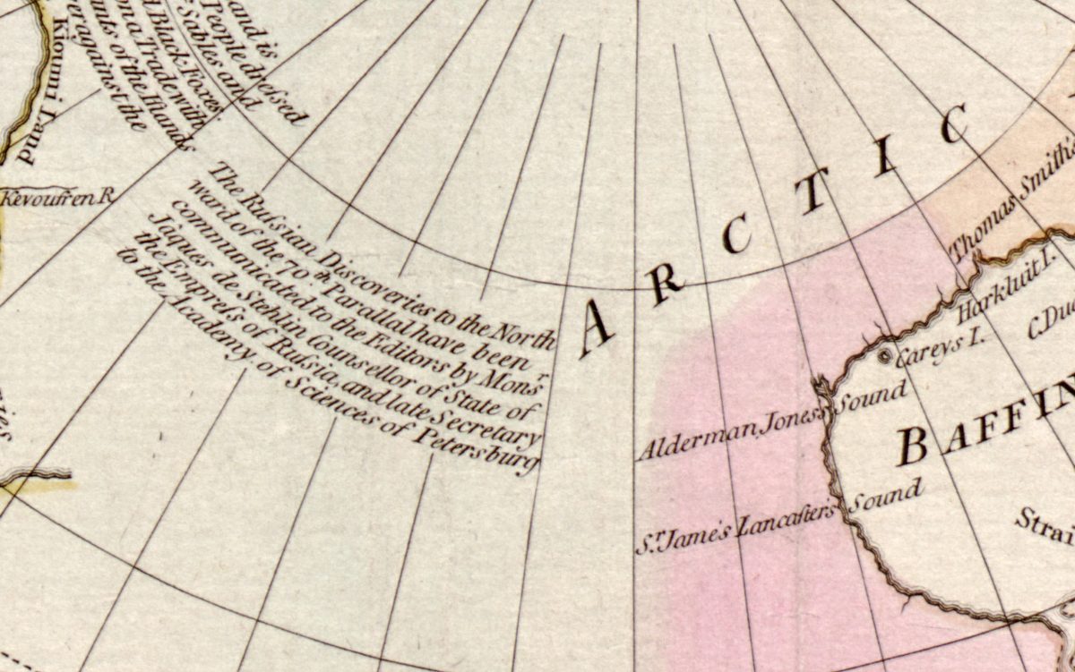
The map also names an informant. Above the Chukchi peninsula, north of the 70th parallel, a note says that the Russian discoveries north of the 70th parallel “have been communicated to the Editors by Monsr Jaques de Stehlin Counsellor of State of the Empress of Russia, and late Secretary to the Academy of Sciences of Petersburg”. Jacob von Stählin (1709–85) compiled an account of the “new northern archipelago” found by Russian voyagers, published in English in London in 1774; much of its map was conjectural, and in 1778 Cook wrote that he “was at a loss to reconcile Mr Staehlins map with my own observations”, the Royal Collection Trust records. Here the islands labeled NORTHERN ARCHIPELAGO lie southwest of the SEA OF ANADIR.
What to look for on the sheet
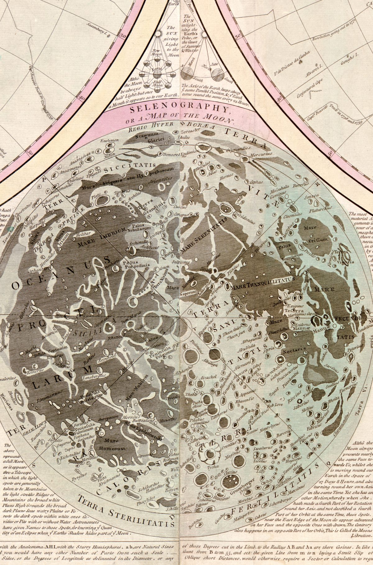
- At the foot, between the hemispheres: SELENOGRAPHY, a map of the Moon with names such as MARE IMBRIUM and TERRA STERILITATIS.
- Upper left: The SOLAR SYSTEM, crossed by comet orbits marked with their years.
- Lower right: The VICISSITUDE of SEASONS Explained — twelve Earths around a sun with a human face.
- Near New Zealand: Cook’s Straits, a point marked Antipodes of London and Field Ice 1773.
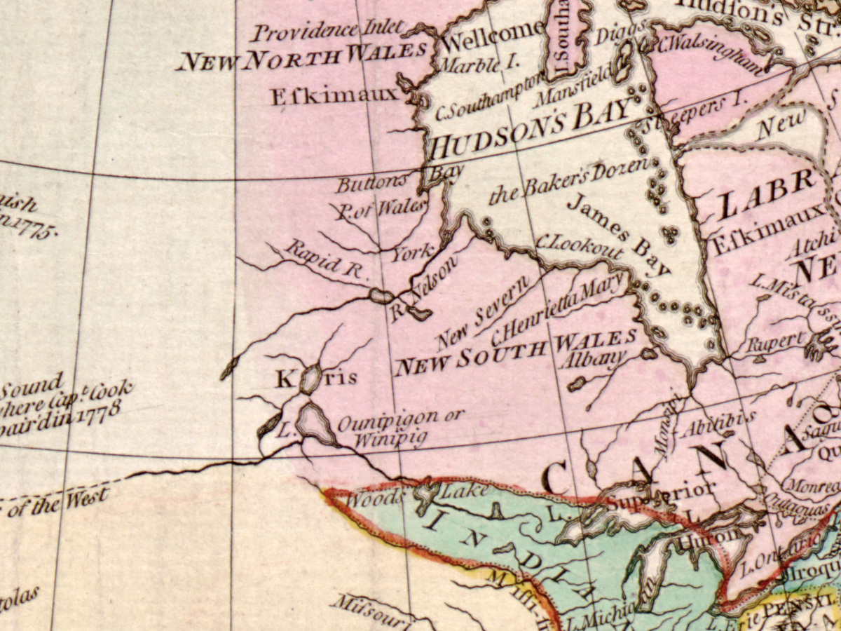
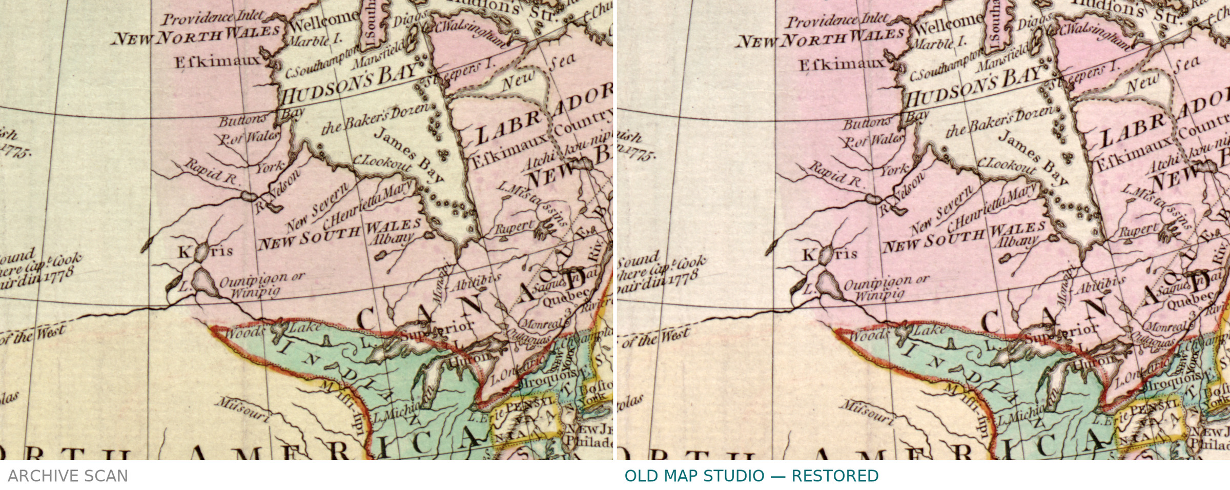
- Two places called NEW SOUTH WALES: one by Hudson’s Bay, the other on the east coast of NEW HOLLAND, “Discovered in 1770”.
A Bowles & Carver issue appeared after his death: the Biblioteca Virtual de Defensa records Bowles’s New Four Sheet Map of the World or Terrestrial Globe, printed for Bowles and Carver at the same address and dated [1794–1832], whose notes list the routes of Anson, Byron, Cook and Bougainville, star charts, an analemma, a Mercator chart, a selenography and the seasons. The Library of Congress copy was cut into four sections and mounted on cloth.
Everything on this sheet: full record
Every inscription on the sheet
The text on the sheet is English, with Latin names on the Moon and the star charts. It is given here letter for letter, with the sheet’s capitals and spellings; long s is shown as s, and raised letters (as in Capᵗ, Mʳ, Nº) are printed on the line. The panels outside the hemispheres are listed by their headings and opening words; inside the hemispheres, the notes, tracks and larger names. The long explanatory texts are not transcribed in full, and lines not read with certainty are left out.
- Title across the top: BOWLES’s NEW AND ACCURATE MAP OF THE WORLD, OR TERRESTRIAL GLOBE, laid down from the BEST OBSERVATIONS and NEWEST DISCOVERIES; particularly those lately made in the SOUTH SEAS, by ANSON, BYRON, WALLIS, BOUGANVILLE, COOK, and other celebrated CIRCUMNAVIGATORS: Illustrated with a variety of useful PROJECTIONS and REPRESENTATIONS of the HEAVENLY BODIES; the most approved ASTRONOMICAL and GEOGRAPHICAL DEFINITIONS, TABLES, and PROBLEMS; With an easy and familiar Explanation of the most curious and interesting Phœnomena in the UNIVERSAL SYSTEM. Below it: Printed for the Proprietor CARINGTON BOWLES, Nº69 in St Pauls Church Yard, LONDON.
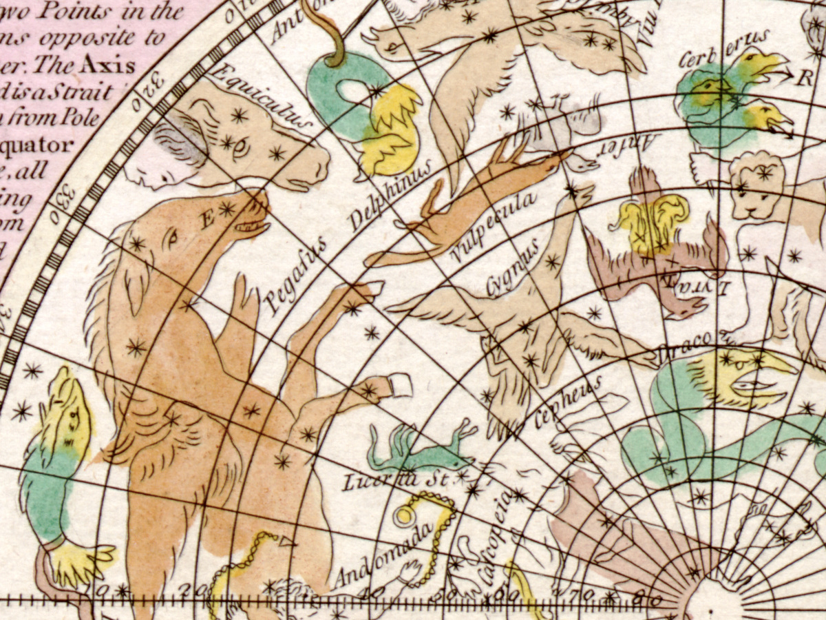
- Upper left: The SOLAR SYSTEM, with orbits of the planets and of comets marked by years (among them 1337, 1472, 1618, 1680, 1682, 1723, 1759); COMETS or Blazing Stars; the note The Comet of 1680, according to Sr Isaac Newton in its nearest Approach to the Sun was 2000 times hotter than red hot Iron; The SUN and his Maculæ as Seen thro’ a Telescope; Saturn and his Ring as seen thro’ a Telescope; The Ring of SATURN.
- Top, between the circles: The Dimensions of the SOLAR SYSTEM (a table); The NORTHERN HEMISPHERE of the stars with ASTRONOMICAL DEFINITIONS; The Law of the Cometary System.; The SOUTHERN HEMISPHERE; A Representation of Part of the Universe; A TABLE of the Place of the SUN in the Ecliptic & Declination, with a side note that every fourth year the Sun’s place returns nearly the same, and columns of years from 1761 to 1808.
- Upper right: An ASTRONOMICAL LATITUDE AND LONGITUDE ANALEMMA; Jupiter and his Belts as seen thro’ a Telescope; Venus as seen thro’ a Telescope; Mars as seen thro’ a Telescope; Mercury as seen thro’ a Telescope.
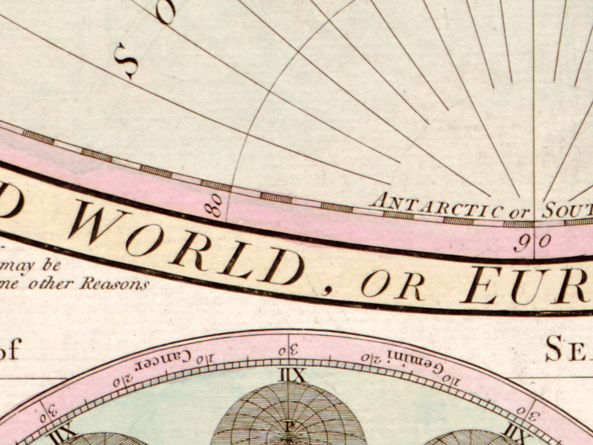
- Hemisphere bands: WESTERN HEMISPHERE OF THE WORLD and THE NEW WORLD, OR NORTH AND SOUTH AMERICA; EASTERN HEMISPHERE OF THE WORLD and THE OLD WORLD, OR EUROPE, ASIA AND AFRICA.
- Side panels: GEOGRAPHICAL DEFINITIONS (left and right, beginning The Poles of the Earth are two Points in the Surface of the Earth or Sea); The ART of DIALING by a common GLOBE (left and right); THE CAUSE OF THE TIDES, beginning The Cause of the Tides or Ebbing and Flowing of the Sea was first Discovered by Sr Isaac Newton, with A Diagram explaining the single and double Tides.
- Lower left and centre: An UNIVERSAL SCALE of Equal Parts, Chords, Sines, Tangents, Secants, &c. &c.; A CHART OF THE WORLD, according to MERCATOR’s PROJECTION, with the Rhumb Lines., with a note that this chart is called Mercator’s Chart although it was the invention of Edward Wright an English Man; SELENOGRAPHY, a map of the Moon, with MARE IMBRIUM, MARE SERENITATIS, Mare Nubium, Mare Humorum, Mare Crisium, TERRA STERILITATIS and named craters such as Plato, Archimedes, Tycha and GRIMALDUS.
- Lower right: The VICISSITUDE of SEASONS Explained., opening In this Diagram S represent the Sun; THE ANALEMMA with THE USE OF THE ANALEMMA; a note beginning N.B. For an accurate Reduction of the Difference of Latitude and Longitude of Places, with figures for Greenwich Observatory, St Pauls London and Paris Observatory.
- Along the bottom, a two-line text beginning As the Space to which we are here confined for illustrating the Use of this UNIVERSAL SCALE is very small, with a DESCRIPTION of the diagram letters; in both lower corners: Printed for the Proprietor Carington Bowles, London.
- Western hemisphere, north: SEA OF ANADIR; NORTHERN ARCHIPELAGO; Fox Islands; the note The Russian Discoveries to the North ward of the 70th Parallal have been communicated to the Editors by Monsr Jaques de Stehlin Counsellor of State of the Empress of Russia, and late Secretary to the Academy of Sciences of Petersburg; ARCTIC LANDS; Arctic Circle; Alderman Jones’s Sound; St James Lancaster’s Sound; BAFFINS BAY; HUDSONS BAY; NEW NORTH WALES; NEW SOUTH WALES.
- Western hemisphere, northwest coast: Highest Latitude of the Spanish Discoveries in 1775.; Tchirikows Land; Land of Volcanos; Fousang of the Chinese; George’s Sound where Capt. Cook repair’d in 1778; River of the West; New Albion; NORTH AMERICA; NEW MEXICO; LOUISIANA; CALIFORNIA as a peninsula.
- Western hemisphere, Pacific: PACIFIC OCEAN OR GREAT SOUTH SEA; Capt. Cook going to America in 1778; Going North in 1779; Sandwich I.; O-why-hee where Capt. Cook was killed in February 1779.; Land seen by Mendana in 1568; Anson’s Track in 1742; Chippertons I. by conjecture; EQUINOCTIAL LINE; Marquesas of Mendoca; Bougainvilles Track 1768; Resolution’s Track in 1774.; Capt. Cook going to Otaheite in 1777.; NEW CALEDONIA; NEW ZEALAND; Cook’s Straits; Track of the Resolution Capt. Cook and the Adventure Capt. Furneaux in 1773; Antipodes of London; Field Ice 1773; SOUTHERN ICY OCEAN.
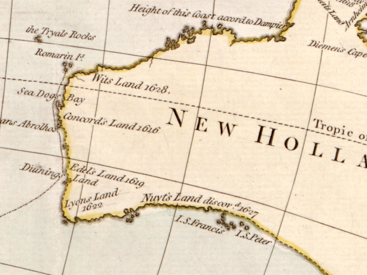
- Eastern hemisphere, around New Holland: NEW HOLLAND; NEW SOUTH WALES Discovered in 1770.; Endeavours Straits 1770; Carpentaria discovd 1628.; Wits Land 1628.; Concords Land 1616; Edels Land 1619; Lyons Land 1622; Nuyts Land discovd 1627; PAPUA or NEW GUINEA; LOUISIADE; Cape Deliverance by Mr de Bougainville 1768.; Tropic of Capricorn.
The sheet does not always agree with itself. The title spells BOUGANVILLE, the track on the map Bougainvilles Track 1768. The note on the Russian discoveries writes Parallal and gives the name as Jaques de Stehlin. The name NEW SOUTH WALES is used twice, by Hudson’s Bay and on the east coast of New Holland. The table of the Sun’s place runs to 1808, years after the date of the map; it is a reckoning table, not a date of printing.
Editions and other known copies
- Library of Congress, Geography and Map Division, G3200 1780 .B6: London, printed for the proprietor Carington Bowles, no. 69 in St. Paul’s Church Yard, [1780?]; 1 map, hand colored; 2 hemispheres each 59 cm in diameter, on sheet 106 × 130 cm. The record notes “Shows various expedition routes.”, “Relief shown pictorially.”, lists the ancillary maps (solar system, northern and southern hemispheres, analemma, universal scale, Mercator chart, selenography, seasons), and adds “Sectioned into 4 pieces, mounted on cloth.” and “LC copy imperfect: Margin trimmed, minor losses along top.”
- Biblioteca Virtual de Defensa (Spain), record 392186: Bowles’s New Four Sheet Map of the World or Terrestrial Globe, printed for the proprietor Bowles and Carver, Nº 69 in St. Pauls Church Yard, [1794–1832]; 1 map on 4 sheets, each 57 × 65 cm or less, engraved and colored. Its notes name the routes of Anson, Byron, Cook and Bougainville, star charts of both hemispheres, an analemma, a Mercator chart, a selenography and the seasons. The copy is in the Biblioteca del Museo Naval, Madrid (MN-1-A-3).
- Biblioteca Virtual del Patrimonio Bibliográfico (Spain), signature [1-A-3]: the same “new four sheet map of the world or terrestrial globe” title, the same signature as the Museo Naval copy in the Defensa record, and evidently the same item.
- None of these records names states of the plate. No other copy of the Carington Bowles issue was found in an openable record in this search.
Catalog entries and sources
Library of Congress LCCN 2006627255; call number G3200 1780 .B6; digital id g3200.ct001476. Biblioteca Virtual de Defensa, record 392186 (Museo Naval, Madrid, MN-1-A-3). Biblioteca Virtual del Patrimonio Bibliográfico, signature [1-A-3].
Sources for the story and this record: the Library of Congress catalog record; the Science Museum Group collection entry for Carington Bowles; the Royal Academy collection entry for Carington Bowles; the British Museum collection entry for Bowles & Carver; the Royal Collection Trust entry for Jacob von Staehlin, An Account of the New Northern Archipelago (London, 1774); the Biblioteca Virtual de Defensa and Biblioteca Virtual del Patrimonio Bibliográfico records.
This copy
The scan shows the Library of Congress copy colored by hand: country borders and land areas in pink, green and yellow, the constellation figures washed in color, the Moon in grey and brown. As the record says, the sheet was sectioned and mounted on cloth: a vertical join runs down the middle between the hemispheres and through the Moon, a horizontal join crosses both hemispheres near the equator, and the cloth shows at the left edge. The margins are trimmed close to the frame. In the lower right margin there is a round stamp reading Library of Congress with Maps & Charts and a handwritten number, and a pencilled note 41¼ x 49 below the frame at lower right.
Your file
| Original | Carington Bowles, London, [1780?]; hand colored; 2 hemispheres each 59 cm in diameter, sheet 106 × 130 cm; Library of Congress, Geography and Map Division, G3200 1780 .B6 |
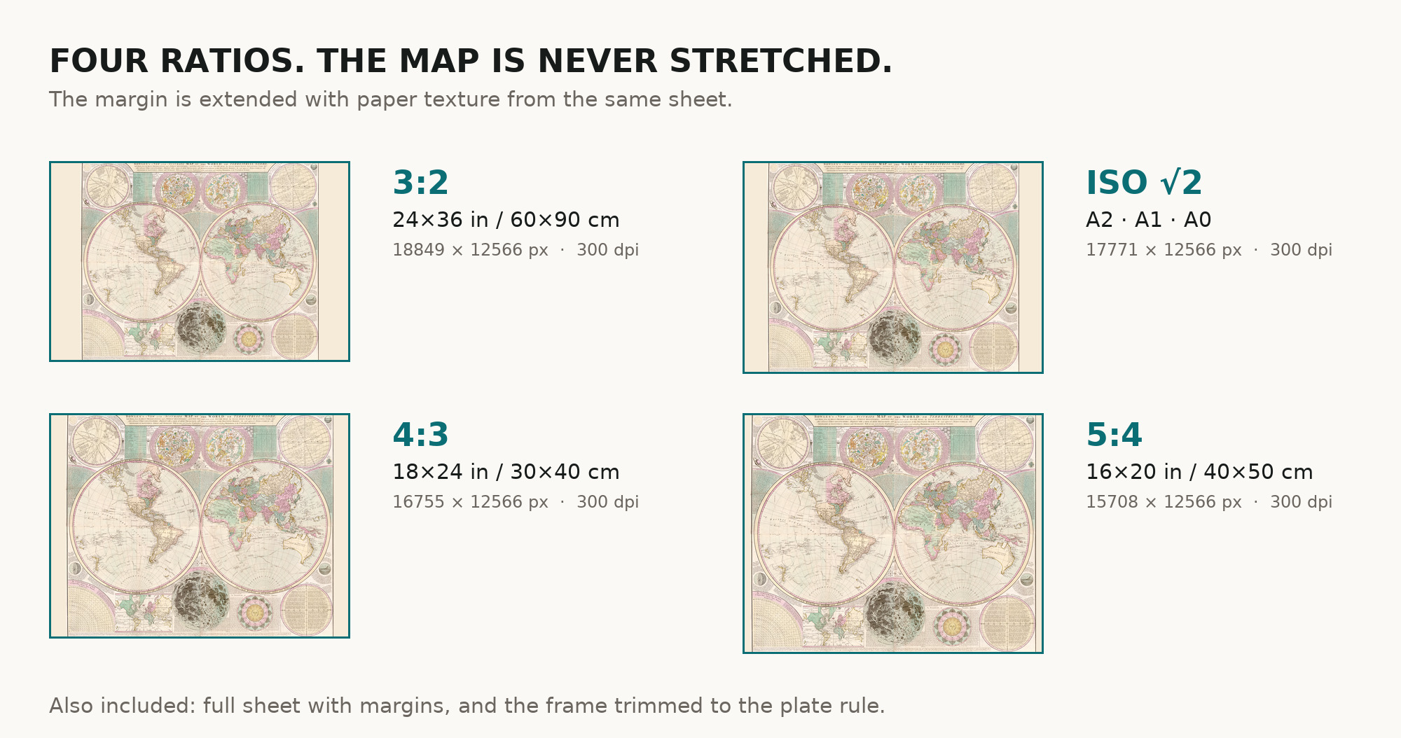
| Scan | full sheet 15412 × 12615 px; the map inside the trimmed border 14900 × 12566 px |
| Print size at 300 dpi | the map prints to 126 cm (50 in), the full sheet with margins to 130 cm (51 in) |
| You download | six ZIP archives: full sheet, trimmed, 3:2, 4:3, 5:4 and ISO A |
| Inside each one | one JPEG at 300 dpi, the restoration passport as a PDF, a READ ME |
How to print
- Print at 300 dpi at the size above and do not let the shop scale the file up.
- Pick the archive whose proportions match your frame, so nothing is cropped or stretched.
- Ask for matte fine-art paper, sRGB, auto-enhancement off. The coloring was kept in restoration, not repainted.
- Where to print it: print shops near you and checked prices at online labs.
Source and rights
Library of Congress, Geography and Map Division, call number G3200 1780 .B6. The Library states that its digitized map collections are free to use and reuse unless a Rights Advisory statement is present; there is none for this item. The record notes that this copy was sectioned into four pieces and mounted on cloth, and is imperfect: the margin is trimmed, with minor losses along the top. It does not name the printing technique. There is no TIFF master in the package. Catalogue record: Library of Congress →
Questions
How large can I print it?
The map to 126 cm (50 in) on the long side at 300 dpi, the full sheet with margins to 130 cm (51 in), from the scan’s own resolution, not an upscale.
Why “c. 1780”?
The record dates the map “[1780?]”: the year is the library’s estimate, not printed on the sheet.
Features
- English
Attachments
Reviews
No reviews found
More maps from the 1700s
-
 Antique World Map 1778 — Brion de la Tour, Mappemonde
-
Old World Map 1786 — Delamarche, Mappe Monde with Cook’s Voyages
-
Antique World Map 1794 — Dunn, A New Map of the World
-
Ottoman World Map 1795 — Hajji Ahmed, Heart-Shaped Map of 1559
-
Antique World Map 1764 — Bellin, Carte réduite du globe
-
Antique World Map c. 1450 — Borgia Map, Facsimile Borgia 1797