Old World Map 1786 — Delamarche, Mappe Monde with Cook’s Voyages
Description
An old world map with Captain Cook’s three voyages, Delamarche, Paris 1786
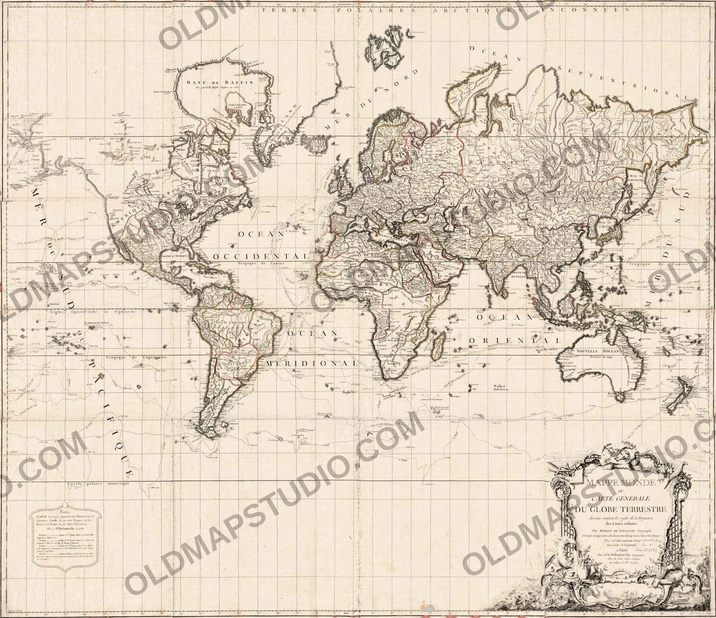
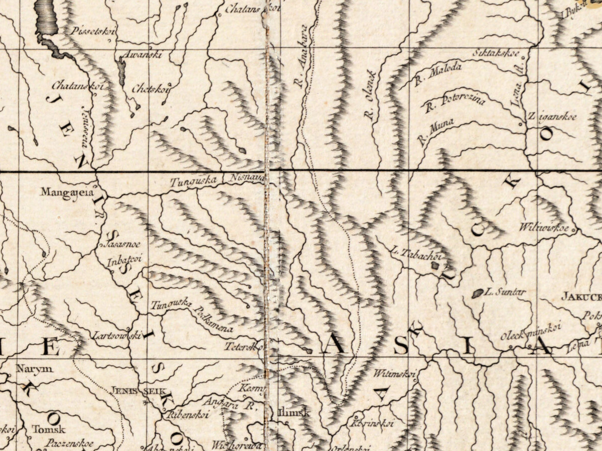
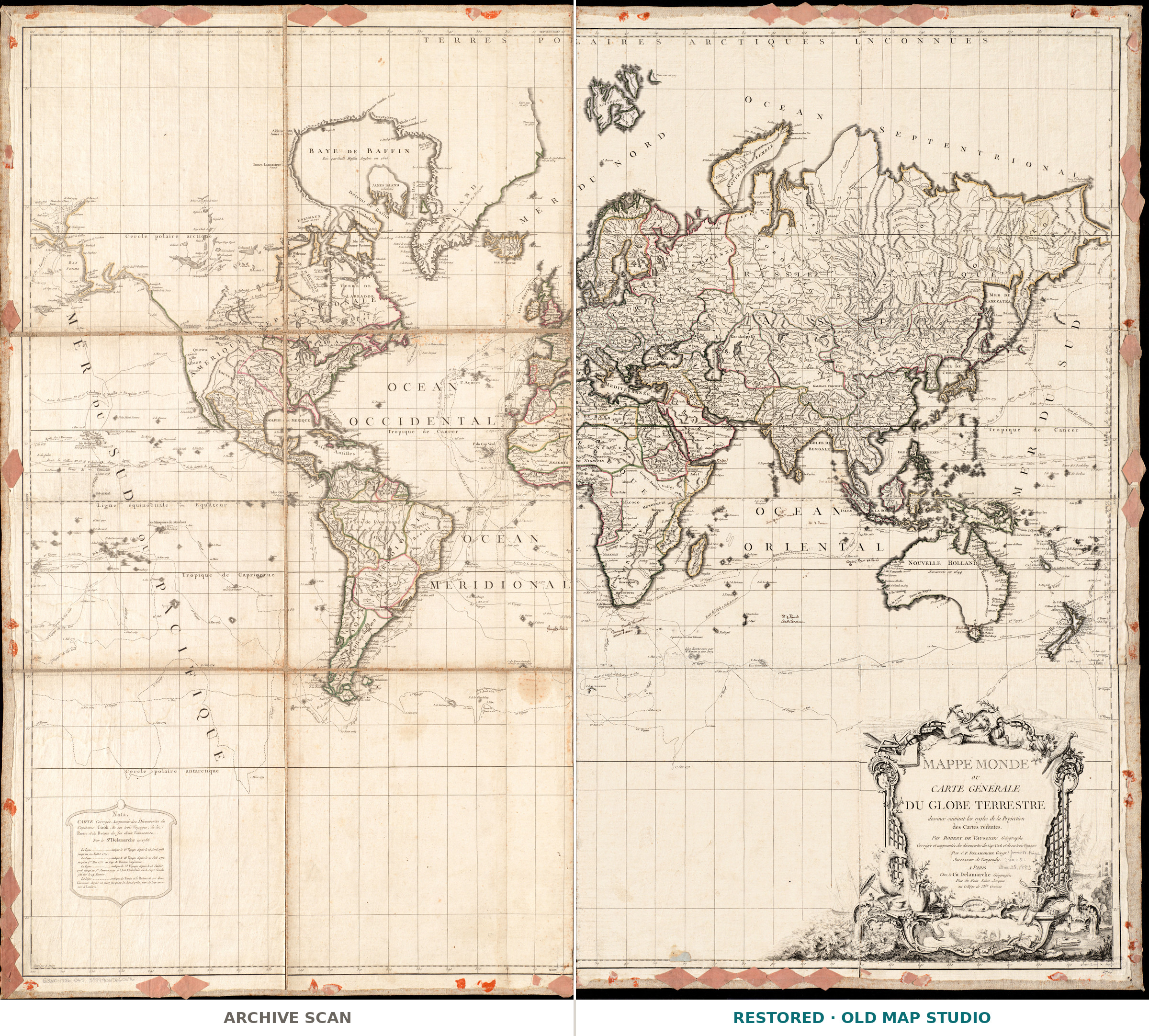
Mappe Monde ou carte générale du globe terrestre is a world map on Mercator’s projection, the “projection des cartes réduites” of its title. Robert de Vaugondy drew it in Paris; this copy is the version Charles François Delamarche corrected to show Captain James Cook’s three voyages. The Boston Public Library’s Leventhal Map & Education Center keeps it as a hand-colored map of 97 × 112 cm, with longitudes counted from Ferro, and dates it [1786], marked as inferred.
The Bibliothèque nationale de France holds the earlier map, published “chès l’auteur” in 1760 and measuring 101 × 119 cm, and catalogs it under Didier Robert de Vaugondy (1723–1786). In its records of the corrected map, the BnF names E. Dussy as the engraver, notes that Pierre Nicolas Arrivet signed the title cartouche, and cites Mary Pedley’s 1985 article “Une mappemonde inconnue de Didier Robert de Vaugondy”.
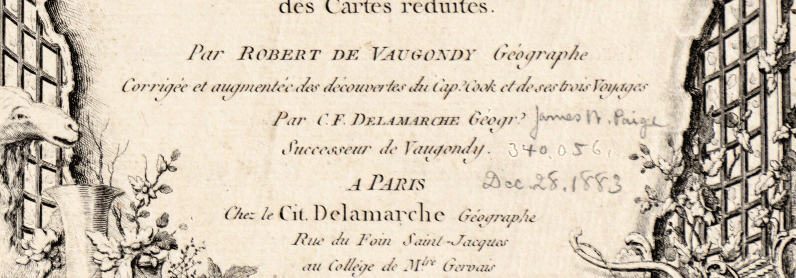
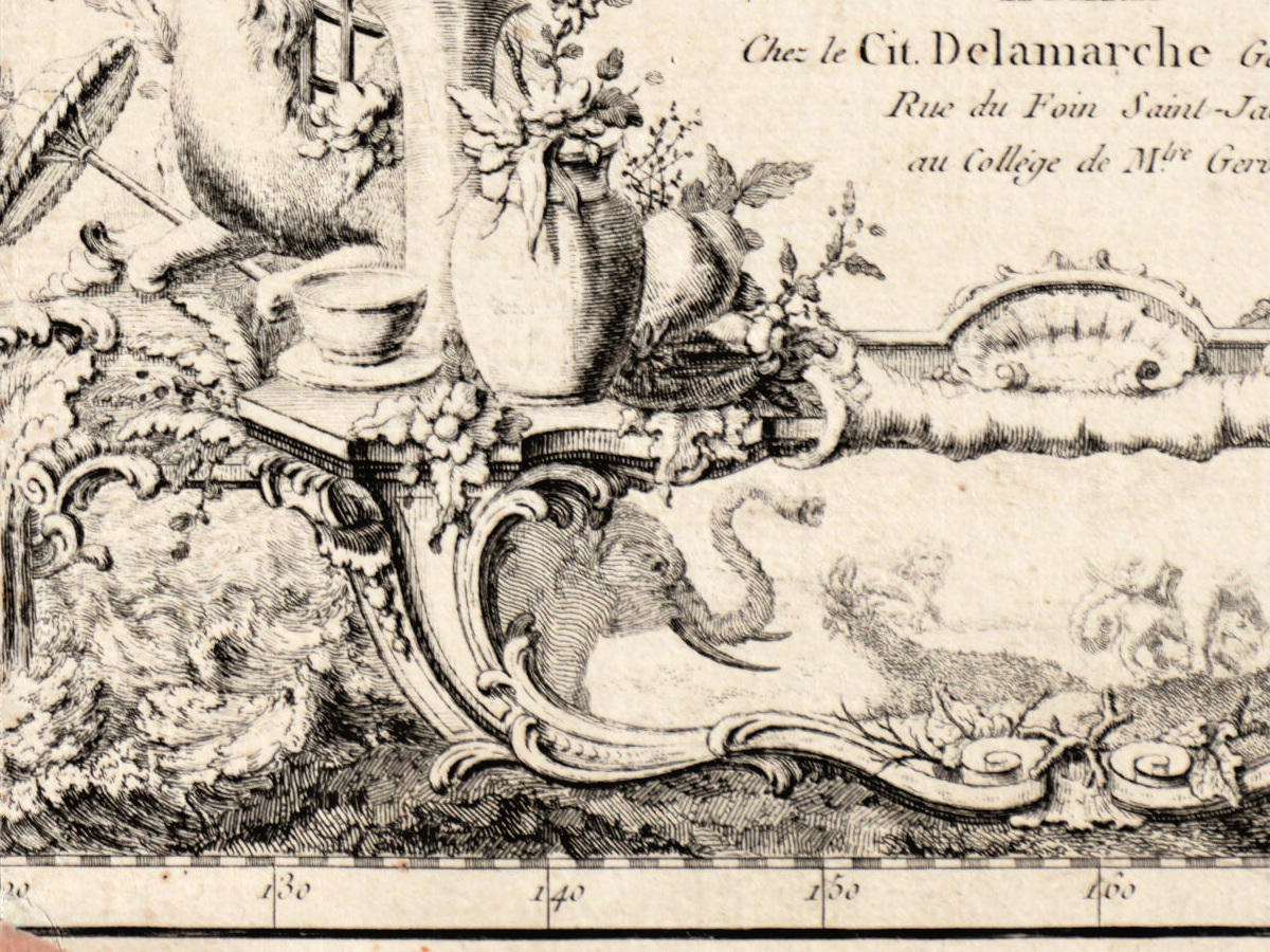
The BnF records that Delamarche was born in Paris in 1740 and died in 1817. In 1786 he bought Didier Robert de Vaugondy’s stock of maps from Jean-Baptiste Fortin and traded as Vaugondy’s successor, mostly correcting or re-engraving the old plates. The title of this sheet calls him Successeur de Vaugondy, at the Collége de M.tre Gervais in the Rue du Foin Saint-Jacques, his address from 1778 to 1804.
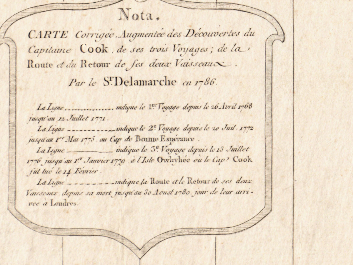
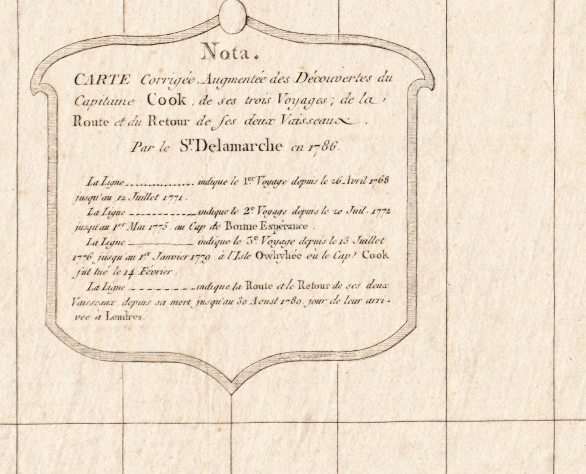
What Delamarche added is set out in a cartouche at the lower left headed Nota. It calls this a map “corrected and enlarged with the discoveries of Captain Cook, of his three voyages, and of the route and return of his two ships”, made Par le S.r Delamarche en 1786. Four kinds of line follow the first voyage (26 April 1768 to 12 July 1771), the second (20 July 1772 to 1 May 1775, at the Cape of Good Hope), the third (13 July 1776 to 1 January 1779, at the island of Owhyhée, “where Captain Cook was killed on 14 February”), and the ships’ way home, which ended in London on 30 August 1780. Britannica dates the voyages 1768–71 in the Endeavour and 1772–75 and 1776–79 in the Resolution, and Cook’s death at Kealakekua Bay, Hawaii, to 14 February 1779.
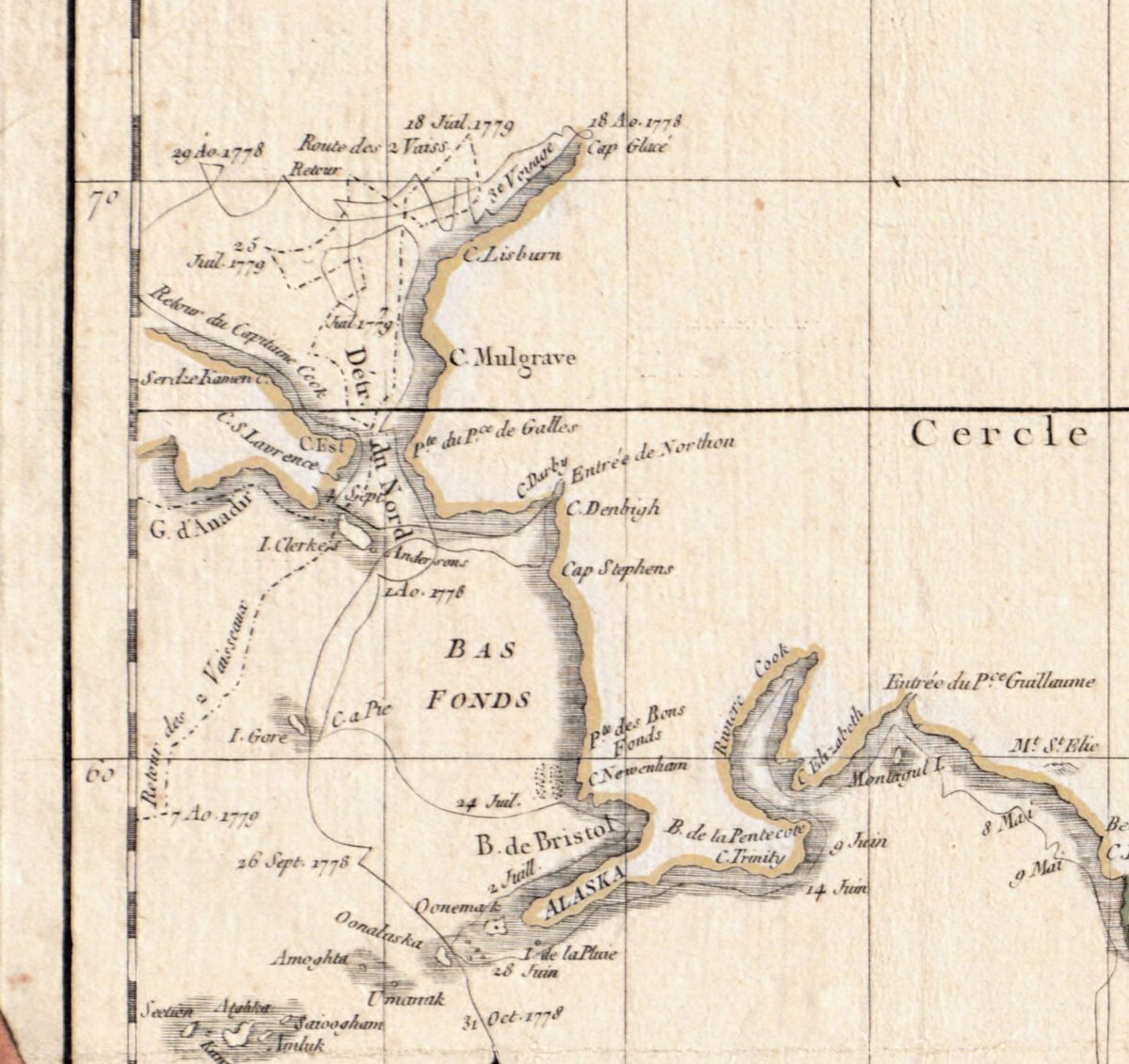
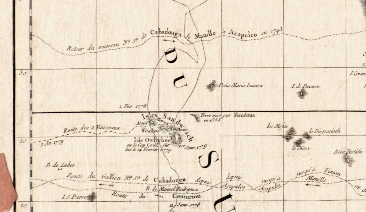
The third voyage went, in Britannica’s words, “in search of a Northwest Passage around Canada and Alaska”. On the sheet its line runs up past Alaska and through the Détr. du Nord to Cap Glacé, dated 18 Ao. 1778, then back south to the Isles Sandwich. Beside the largest island the plate reads Isle Owhyhée ou le Cap. Cook fut tué le 14 Fevrier 1779; a second line takes the two ships north again, to 18 Juil. 1779.
What to look for on the sheet
- Lower left, the Nota. cartouche with a sample of each of the four lines.
- In the North Pacific, the Isles Sandwich; below them run older routes of the Manila galleon and the Centurion.
- Top left, Cap Glacé and C. Lisburn, where the tracks of 1778 and 1779 turn back.
- New Zealand drawn as two islands with the name Cook on the strait between them, and to the southeast Antipodes de Paris.
- Australia labeled NOUVELLE HOLLANDE decouverte en 1644, while its east coast carries the newer name NOUVELLE GALLES MÉRIDIONALE en 1770.
- In the lower border, the signatures Gravé par E. Dussy at the left and Arrivet inv. & Sculp. at the right.
The BnF holds copies of the corrected map with the imprints “Chez Delamarche, 1786” and “chez le Cit. Delamarche … 1786”, and a later edition of the same title dated 1804. After Delamarche’s death, according to the BnF and the Museo Galileo, his son Félix continued the business.
Everything on this sheet: full record
Every inscription on the sheet
All lettering is engraved, except the handwritten notes listed under “This copy”. Inscriptions are given letter for letter, with the capitals, accents and punctuation of the sheet as far as the scan shows them; raised letters after a point are written on the line (S.r, M.tre). The many small coastal and island names, the degree numbers and single dates along the tracks are not listed one by one; names that could not be read with certainty are left out.
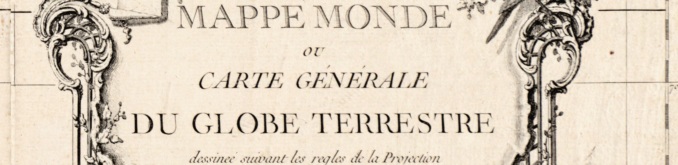
- Title cartouche, lower right: MAPPE MONDE / OU / CARTE GÉNÉRALE / DU GLOBE TERRESTRE / dessineé suivant les regles de la Projection des Cartes réduites. [drawn according to the rules of the projection of reduced charts] / Par ROBERT DE VAUGONDY Géographe / Corrigée et augmentée des découvertes du Cap.t Cook et de ses trois Voyages [corrected and enlarged with the discoveries of Captain Cook and of his three voyages] / Par C.F. DELAMARCHE Géogr. / Successeur de Vaugondy. / A PARIS / Chez le Cit. Delamarche Géographe / Rue du Foin Saint-Jacques / au Collége de M.tre Gervais.
- Cartouche at the lower left: Nota. / CARTE Corrigée, Augmentée des Découvertes du Capitaine Cook, de ses trois Voyages; de la Route et du Retour de ses deux Vaisseaux. [map corrected and enlarged with the discoveries of Captain Cook, of his three voyages, and of the route and return of his two ships] / Par le S.r Delamarche en 1786. Then four lines, each beginning La Ligne with a sample of the line: indique le 1.er Voyage depuis le 26 Avril 1768 jusqu’au 12 Juillet 1771.; indique le 2.e Voyage depuis le 20 Juil. 1772 jusqu’au 1.er Mai 1775. au Cap de Bonne Espérance.; indique le 3.e Voyage depuis le 13 Juillet 1776 jusqu’au 1.er Janvier 1779. à l’Isle Owhyhée où le Cap.t Cook fut tué le 14 Février.; indique la Route et le Retour de ses deux Vaisseaux, depuis sa mort jusqu’au 30 Aoust 1780, jour de leur arrivée à Londres.
- In the lower border: at the left, just above the degree band, Gravé par E. Dussy; at the right, in the degree band under the title cartouche, Arrivet inv. & Sculp.
- Frame: longitudes every 10 degrees along the top and bottom, latitudes along the sides; SEPTENTRION at the top, OCCIDENT at the left, ORIENT at the right; along the right edge Echelle de Lieues marines de 20 au degré [scale of sea leagues, 20 to the degree].
- Seas, circles and lines: TERRES POLAIRES ARCTIQUES INCONNUES [unknown Arctic polar lands]; OCEAN SEPTENTRIONAL; MER DU NORD; OCEAN OCCIDENTAL; OCEAN MERIDIONAL; OCEAN ORIENTAL; MER DU SUD OU PACIFIQUE at the left and MER DU SUD at the right; Cercle polaire arctique, Tropique de Cancer, Ligne équinoctiale ou Equateur, Tropique de Capricorne, Cercle polaire antarctique.
- North Pacific: Isles Sandwich with Atoui and Woahoo; Isle Owhyhée ou le Cap. Cook fut tué le 14 Fevrier 1779 (here without an accent, unlike the Nota.); Route des 2 Vaisseaux; Retour du vaisseau N.a S.a de Cabadonga de Manille à Acapulco en 1743; Route du Gallion N.a S.a de Cabadonga depuis Acapulco jusqu’a Manille; Route du Centurion; Isle de Noel; 3.e Voyage.
- Between Asia and America: Détr. du Nord; Cap Glacé with 18 Ao. 1778; C. Lisburn; C. Mulgrave; G. d’Anadir; I. Clerke's; BAS FONDS; B. de Bristol; ALASKA; Entrée du P.ce Guillaume; Route des 2 Vaiss. with 18 Juil. 1779; Retour du Capitaine Cook.
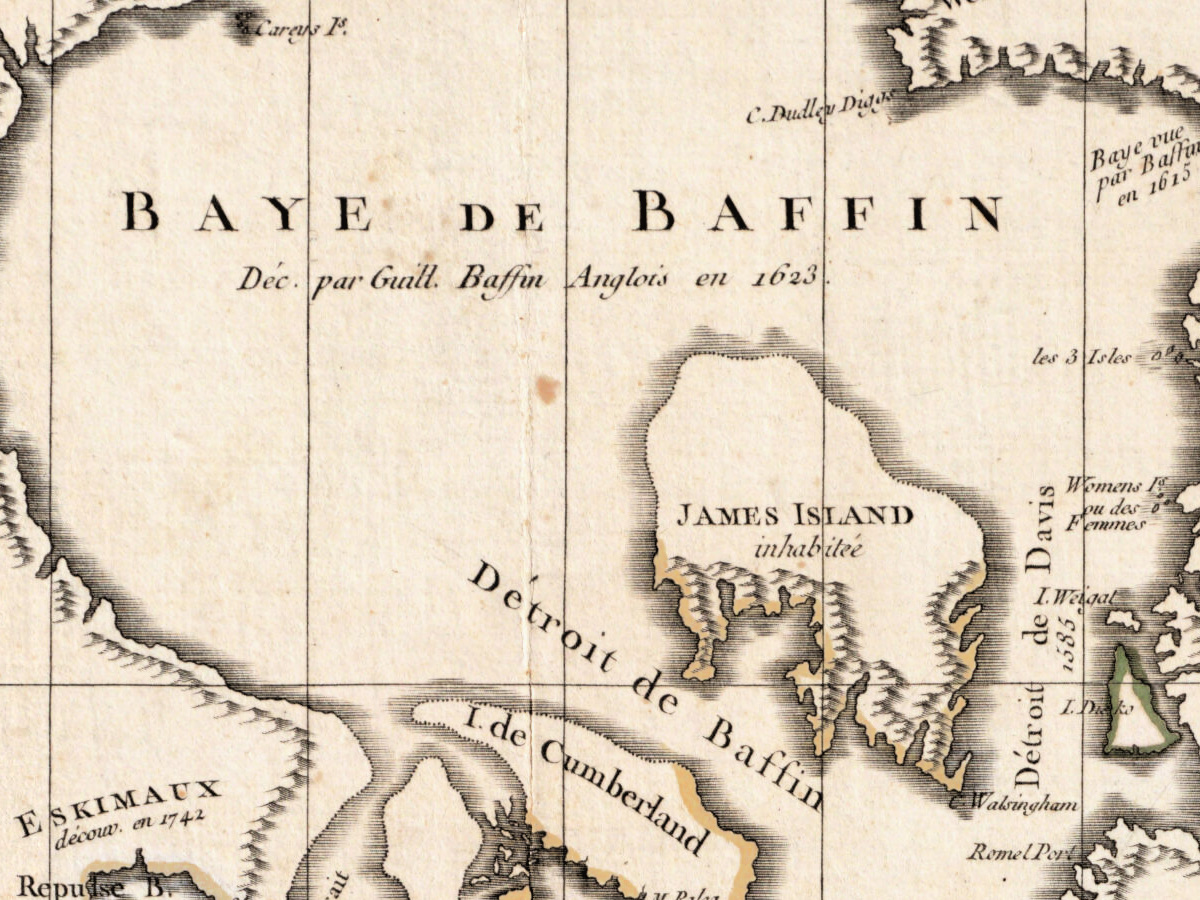
- Baffin Bay: BAYE DE BAFFIN Déc. par Guill. Baffin Anglois en 1623. [discovered by William Baffin, Englishman, in 1623]; Baye vue par Baffin en 1615; JAMES ISLAND inhabitée; Thomas Smiths Sound; Whale Sound; Westenholm Sound; Horn Sound.
- Australia and the South Pacific: NOUVELLE HOLLANDE decouverte en 1644; NOUVELLE GALLES MÉRIDIONALE en 1770; Botany B.; T. de Diemen dec. en 1642; T. de Concorde en 1616; T. de Leuwin en 1622; Terre de Nuyts en 1627; NOUVELLES HEBRIDES; N.lle CALÉDONIE with dec. en 1774; on New Zealand Tavai-Poenammoo and Cook on the strait; Antipodes de Paris; 1.er Voyage, 2.e Voyage, 3.e Voyage.
- South Atlantic: I. de la Georgie; Terre de Sandwich; C. de la Circoncision; Route de l’Aigle et de la Marie en 1739; 2.e Voyage.
The sheet itself holds a few disagreements. The imprint in the title calls the publisher le Cit. Delamarche, while the Nota. cartouche signs the corrections Par le S.r Delamarche en 1786. Baffin Bay carries two years: Déc. par Guill. Baffin Anglois en 1623 under the name, and Baye vue par Baffin en 1615 on the eastern shore. Australia is labeled decouverte en 1644 as a whole, while stretches of its west and south coasts carry earlier years, from 1616 to 1628.
Editions and other known copies
- Boston Public Library, Norman B. Leventhal Map & Education Center, G3200 1786 .D45 (this copy): “Paris : chez le Cit. Delamarche”, “[1786]”, with the note “This date is inferred.”; “1 map : hand col. ; 97 x 112 cm.”; scale “[ca. 1:36,000,000]”; “Prime meridian: Ferro.”; “Relief shown pictorially.”; “Carte corrigée, augmentée ... en 1786.”; “Shows routes of Capt. Cook's 3 circumnavigations.”
- Bibliothèque nationale de France, GE A-1229: the earlier map, “Mappemonde ou Carte générale du globe terrestre … par le S. Robert de Vaugondy”, “A Paris : chès l'auteur, 1760”, “101 x 119 cm”, under Didier Robert de Vaugondy (1723–1786). The BnF records of the corrected map (GE C-8520, GE F CARTE-10768, GE C-8521) note the title cartouche “signé par Arrivet” and cite Mary Pedley, “Une mappemonde inconnue de Didier Robert de Vaugondy” (Bulletin de la Bibliothèque nationale, 1985).
- Bibliothèque nationale de France, GE C-8520: the corrected map, “A Paris : Chez Delamarche, 1786”, 101 x 119 cm, folded 25 x 15 cm.
- Bibliothèque nationale de France, GE F CARTE-10768: “A Paris : chez le Cit. Delamarche, géographe, rue du Foin Saint-Jacques au Collège de Mtre Gervais, 1786”, 101 x 119 cm, folded; the same imprint as this copy. Its note lists “Autres éd. de 1775, Ge C 8520 ; de 1804, Ge C 8521”, although the record for GE C-8520 itself gives 1786.
- Bibliothèque nationale de France, GE C-8521: a later edition, “A Paris : Chez Delamarche, 1804”, 101 x 119 cm.
- The Boston record also gives the Library of Congress number 77695610; the Library of Congress record could not be opened for this dossier. None of the records opened here names states of the plate.
Catalog entries and sources
Boston Public Library G3200 1786 .D45, barcode 39999065660696, identifier 06_01_005937; LCCN 77695610. Bibliothèque nationale de France GE A-1229 (FRBNF40613202), GE C-8520 (FRBNF40613479), GE F CARTE-10768 (FRBNF40613210), GE C-8521 (FRBNF40613480); the smaller Mercator world map engraved by E. Dussy, Paris 1761, GE D-12337 (FRBNF40699833).
Sources for the story and this record: the Boston Public Library catalog record (Digital Commonwealth); Bibliothèque nationale de France catalog records for the map and its editions and the authority record for Charles François Delamarche; Museo Galileo, biography of Charles François Delamarche; Encyclopaedia Britannica, “James Cook”; and the sheet itself.
This copy
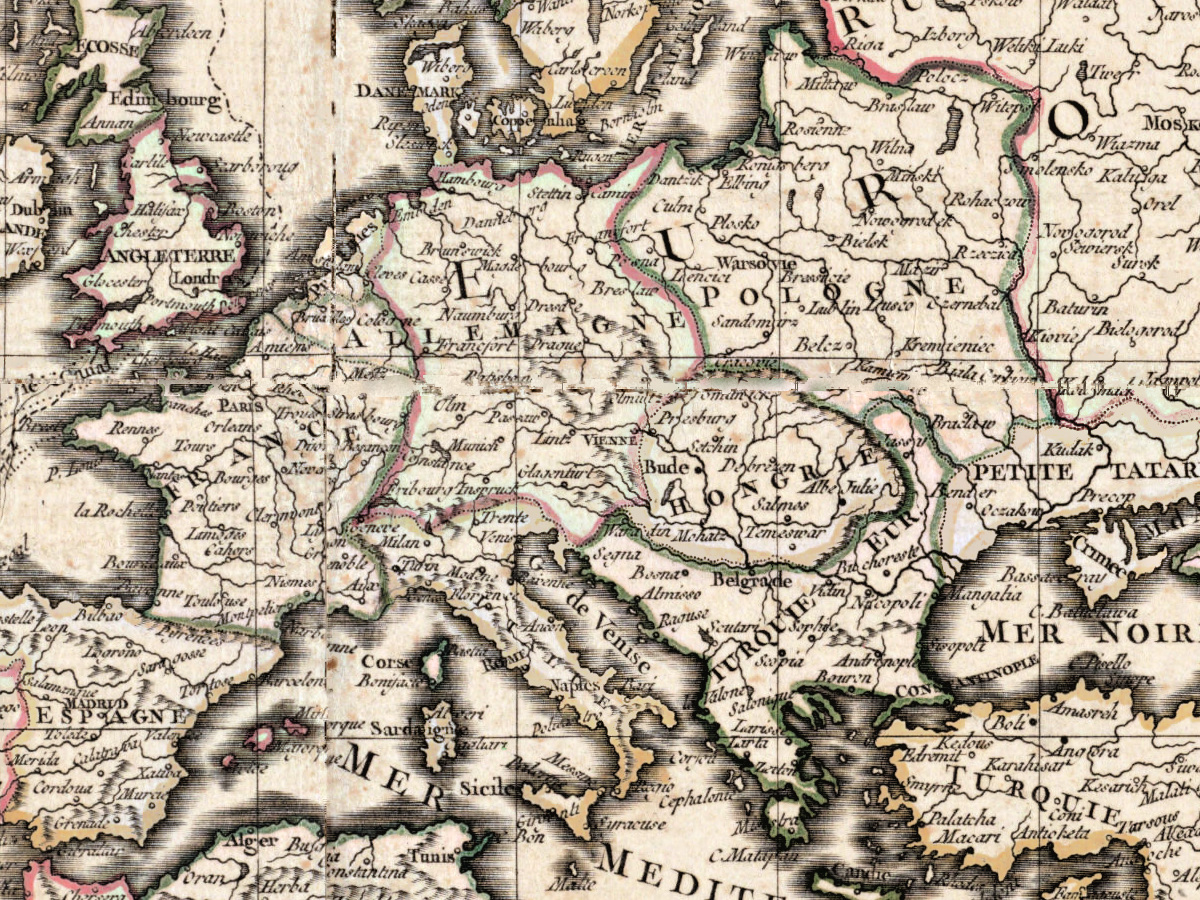
The map is printed on several sheets joined together; the joins show as straight lines across the paper. The whole is backed with cloth, which shows as a fabric border along all four edges, and pink paper tabs in diamond shapes sit along the margins, some with orange-red stains around them. Coastlines and borders are colored by hand in pink, yellow and green; the seas and the cartouches are uncolored. In the title cartouche, beside Delamarche’s name, three handwritten notes in pencil read James W. Paige, 340,056 and Dec. 28, 1883. Below the lower frame at the left, also in pencil: G3200 .1786 .D45 and 39999065660696, matching the Boston call number and barcode. At the lower right corner are a faint oval stamp, not legible on the scan, and the number 44 in pencil. In the Indian Ocean west of Australia a few names are added by hand in brown ink, among them Cloates I and Tryal ++ Rocks; others in the southern Indian Ocean are only partly legible.
Your file
| Original | Charles François Delamarche after Robert de Vaugondy, Paris, [1786] (date inferred by the library); Boston Public Library, Leventhal Map & Education Center, G3200 1786 .D45; hand-colored map 97 × 112 cm |
| Scan | full sheet 10133 × 8810 px; the map inside the trimmed border 9646 × 8333 px |
| Print size at 300 dpi | the map prints to 81 cm (32 in), the full sheet with margins to 85 cm (33 in) |
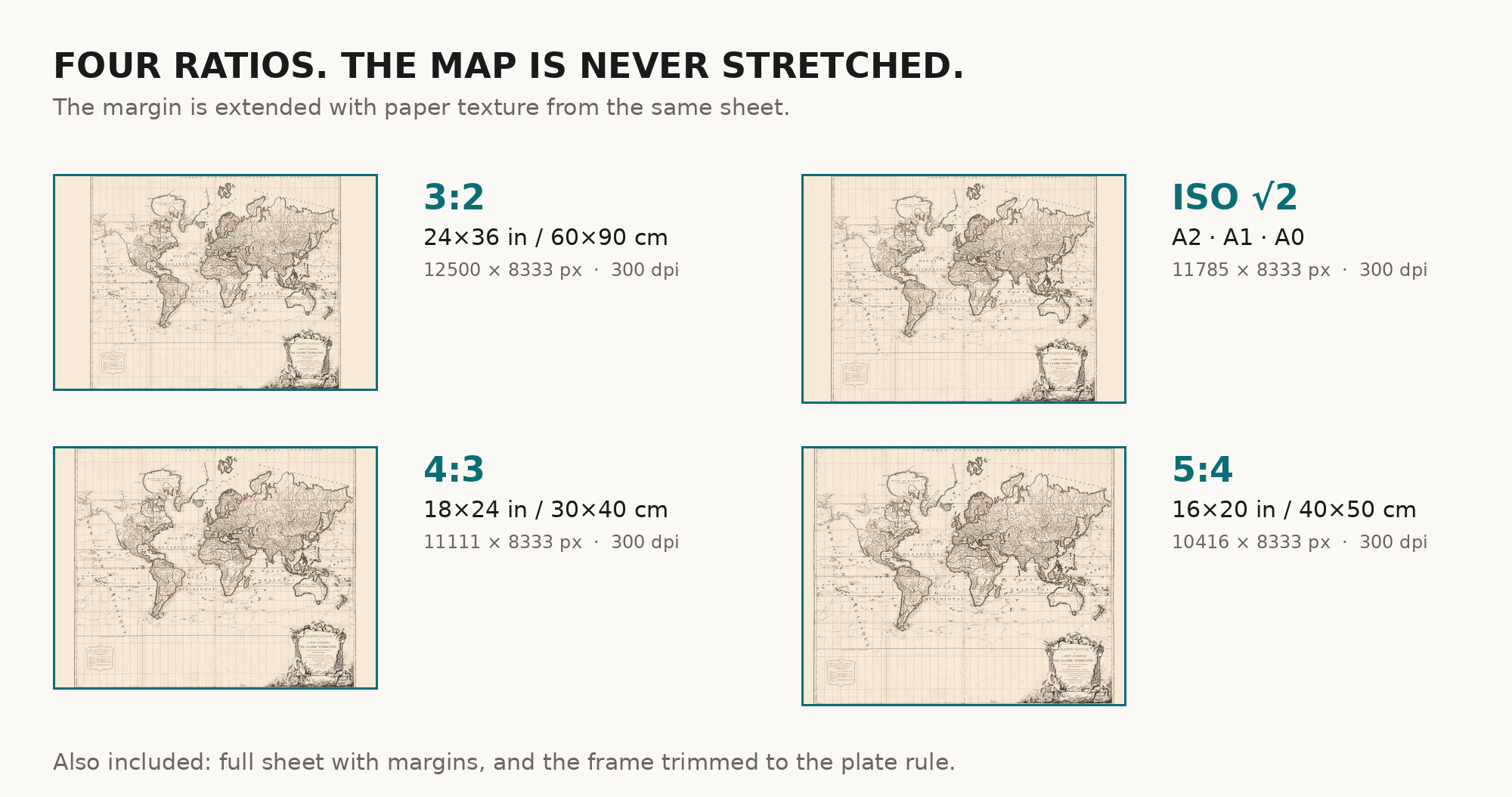
| You download | six ZIP archives: full sheet, trimmed, 3:2, 4:3, 5:4 and ISO A |
| Inside each one | one JPEG at 300 dpi, the restoration passport as a PDF, a READ ME |
How to print
- Print at 300 dpi at the size above and do not let the shop scale the file up.
- Pick the archive whose proportions match your frame, so nothing is cropped or stretched.
- Ask for matte fine-art paper, sRGB, auto-enhancement off. The hand coloring was kept in restoration, not repainted.
- Where to print it: print shops near you and checked prices at online labs.
Source and rights
The file is made from the digitized image published by the Boston Public Library, Norman B. Leventhal Map & Education Center, call number G3200 1786 .D45, with the statement “No known copyright restrictions. No known restrictions on use.” The record gives Paris, [1786], and marks the date as inferred; it describes the map as hand colored. It names E. Dussy as engraver but does not name the printing technique. There is no TIFF master in the package. Catalogue record: Leventhal Map & Education Center →
Questions
What exactly do I get after payment?
Six ZIP archives, each with one JPEG at 300 dpi, the restoration passport as a PDF and a READ ME. There is no TIFF master in the package.
How large can I print it?
The map to 81 cm (32 in) on the long side at 300 dpi, the full sheet with margins to 85 cm (33 in), from the scan’s own resolution, not an upscale. The original itself is 97 × 112 cm.
Why is the year 1786?
The Boston Public Library gives the date as [1786] and marks it as inferred; its record also notes “Carte corrigée, augmentée … en 1786”.
Who made the map?
Robert de Vaugondy drew the original map; Charles François Delamarche corrected it and added Cook’s discoveries; E. Dussy engraved it. All three are named in the library record’s statement of responsibility.
Features
- French
Attachments
Reviews
No reviews found
More maps from the 1700s
-
 Antique World Map c. 1780 — Bowles, New and Accurate Map of the World
-
Antique World Map 1794 — Dunn, A New Map of the World
-
Antique World Map 1778 — Brion de la Tour, Mappemonde
-
Ottoman World Map 1795 — Hajji Ahmed, Heart-Shaped Map of 1559
-
Antique World Map c. 1450 — Borgia Map, Facsimile Borgia 1797
-
Antique World Map 1799 — Chart of the World