Antique World Map c. 1450 — Borgia Map, Facsimile Borgia 1797

Description
An antique world map of c. 1450, in Cardinal Borgia’s facsimile of 1797
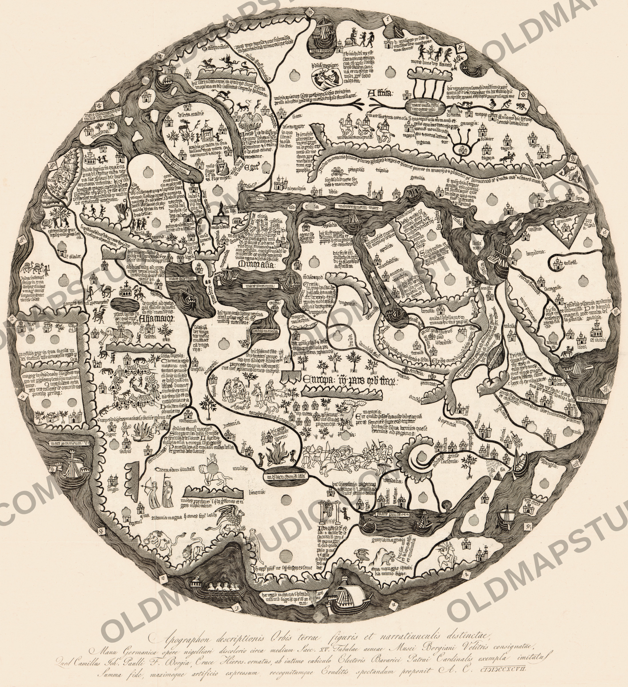
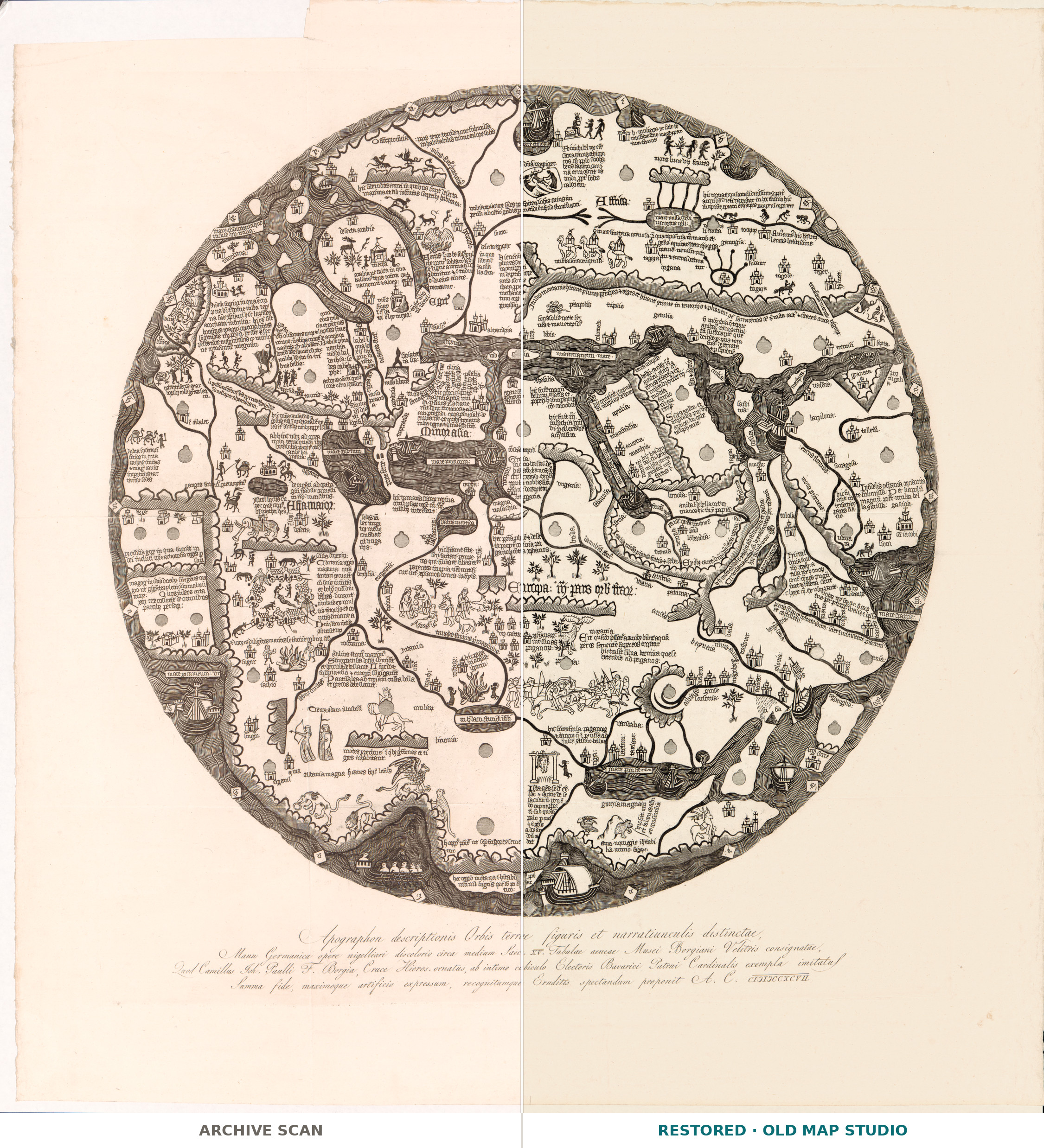
This sheet is a printed copy of a world map that was never meant for paper. The original is, in the words of the Library of Congress, “a niello world map, constructed of two circular copper plates riveted together”, now in the Vatican, and the Library dates it between 1410 and 1460, with some consensus around 1450. The engraved title under the circle calls it the work of a German hand, Manu Germanica, and the Library’s map blog adds that the maker is unknown. The map is round and, as the record notes, “Oriented with the south to the top.” The blog notes that Jerusalem is not shown and that the map may have been made solely for decorative purposes.
Cardinal Stefano Borgia (1731–1804), born in Velletri and from 1770 secretary of Propaganda Fide in Rome, acquired the plates in the mid-1790s and placed them in his museum at Velletri; the map later passed to the Vatican Library. The Library of Congress record says the purchase was made in Portugal, while the historian of cartography Matthew Edney notes that an early account by Seroux d’Agincourt contradicts this.
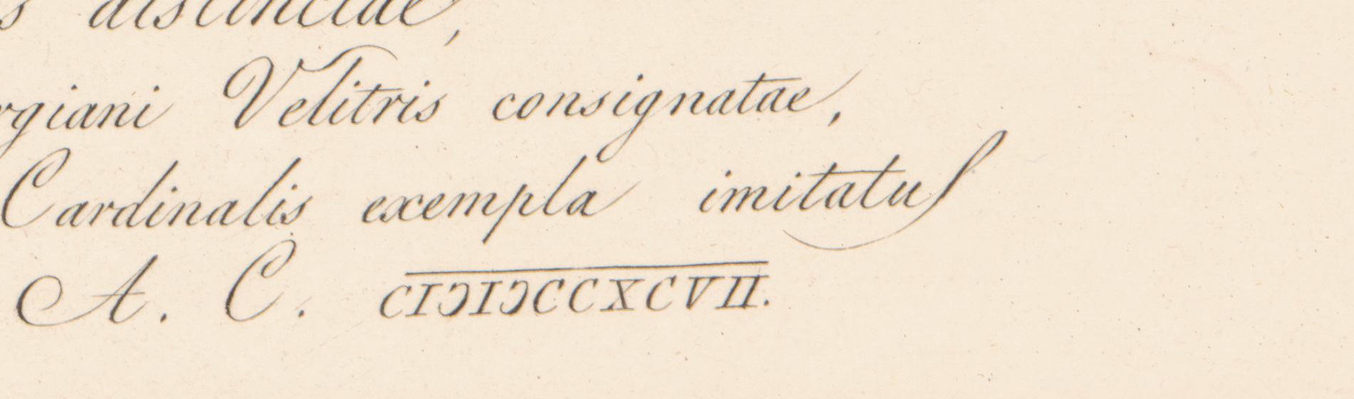
In 1797 the map was issued on paper. The Latin title engraved below the circle, Apographon descriptionis Orbis terrae figuris et narratiunculis distinctae, “a copy of a description of the world, set out with figures and short narratives”, names the cardinal’s nephew Camillo Borgia as the one who presents the copy to scholars, and ends with the year in Roman numerals, CIƆIƆCCXCVII. The Library of Congress record repeats the tradition that a cast was taken from the original for this engraved facsimile, and notes that fewer than ten copies are known. Edney argues instead that the print came from an engraved copper plate, prepared from a tracing of the original and printed on a rolling press.
In 1891 the map historian A. E. Nordenskiöld published an impression he had obtained from Venice, where it was offered for sale as an old German wood-engraving, and treated it as a fifteenth-century print. In his Periplus of 1897 he accepted, according to Edney, that it was identical to Borgia’s facsimile. That impression is now in the John Rylands Library in Manchester.
What to look for on the sheet
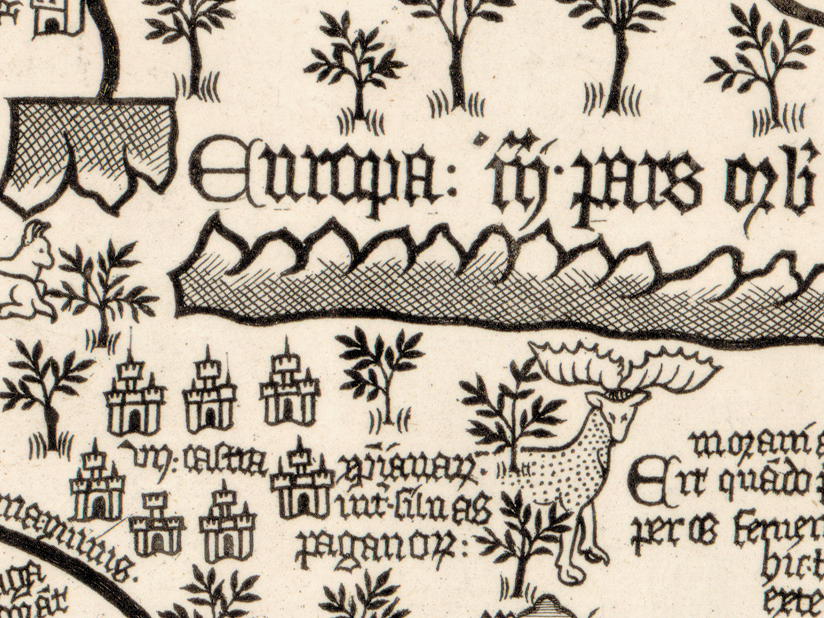
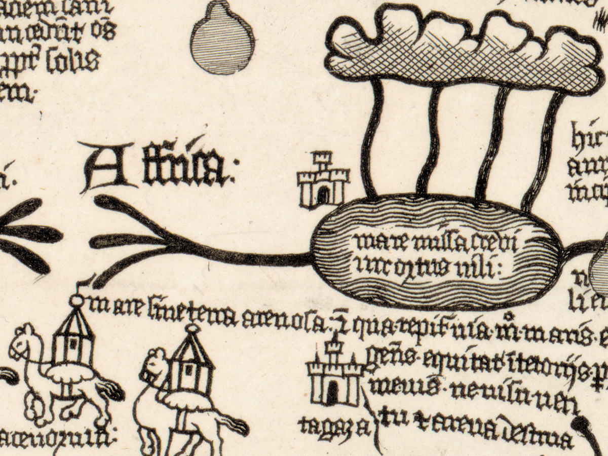
- South is up, so Affrica: stands in the upper part of the circle and Europa: just below the center.
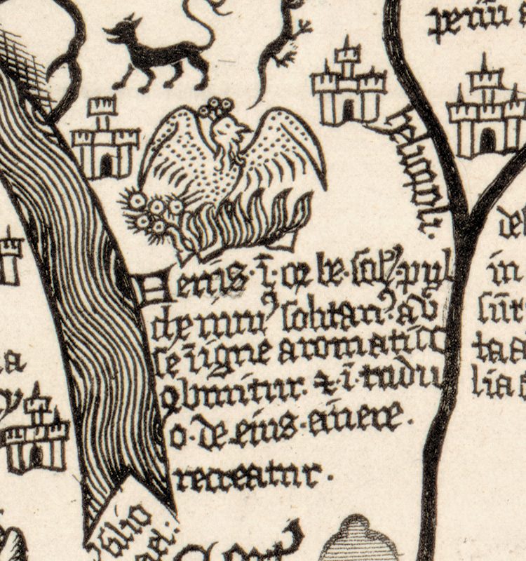
- The phoenix in its fire, in the upper left quarter beside Arabia; in Nordenskiöld’s translation, quoted on the blog, it “burns itself in an aromatic fire, and in three days is recreated from its ashes.”
- In Arabia, mecha (Mecca): two kneeling figures before a tent-like shrine crowned with a ball and pennant, under the heading deserta arabie.
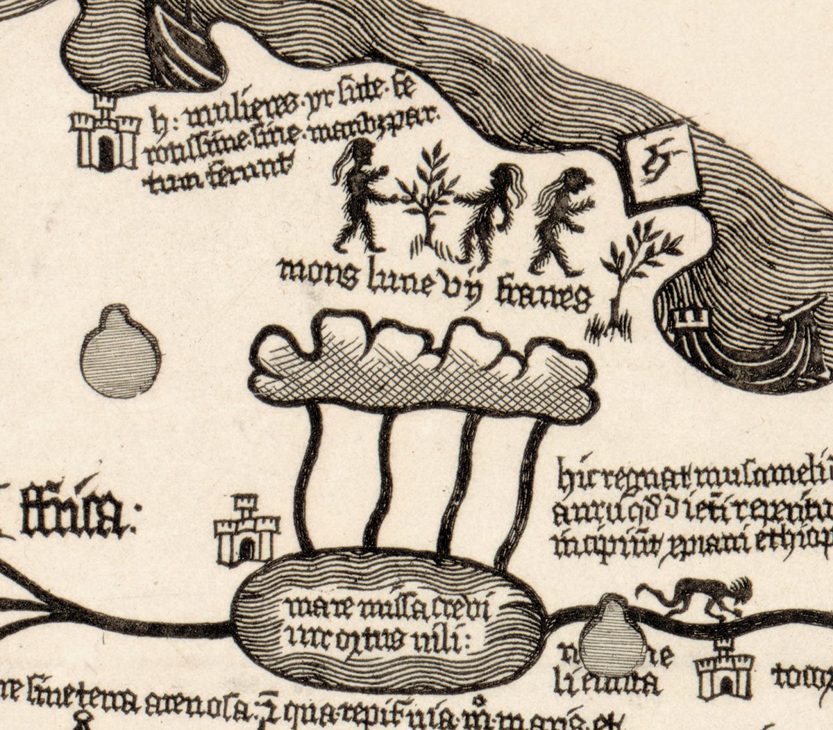
- At the top, right of center, the mons lune, the Mountains of the Moon, with four streams running down into a lake whose legend names the Nile, nili:.
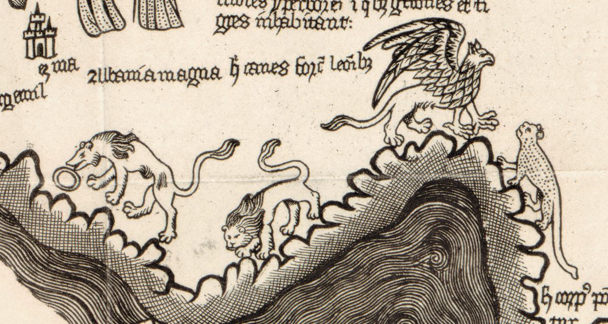
- Near the lower left, Albania magna, with beasts and a griffin on the mountains. Nordenskiöld’s translations, quoted on the blog, read “Here are dogs stronger than lions” and “Hyperborean mountains, in which Griffins and tigers dwell.”
- Small shaded circles across the map and diamond-shaped tablets on the rim. The blog describes thirty-seven circular holes in the original, whose placement “is a mystery”, and a rim “decorated with numbered diamond shapes”.
Edney also records a reduced copy engraved for Seroux d’Agincourt’s Histoire de l’art par les monumens (1810–23), later copied in the ninth edition of the Encyclopaedia Britannica. Impressions of Borgia’s full-size print are held today by, among others, the Library of Congress, the University of Michigan’s Clark Library, the Thorvaldsens Museum in Copenhagen and the John Rylands Library.
Everything on this sheet: full record
Every inscription on the sheet
The 1797 title below the circle is given letter for letter as it appears on this scan, with the capitals and punctuation of the sheet. The legends inside the circle are copied from the fifteenth-century original in a Gothic book hand with many abbreviation marks; only the region names and words that can be read without expanding abbreviations are listed, and the longer legends are described by place. Latin is translated in [square brackets]; translations of whole legends are Nordenskiöld’s, as quoted by the Library of Congress blog, and are marked as such.
- Below the circle, the title of 1797 in four lines of engraved script: Apographon descriptionis Orbis terrae figuris et narratiunculis distinctae, / Manu Germanica opere nigelliari discolorio circa medium Saec. XV. Tabulae aeneae Musei Borgiani Velitris consignatae, / Quod Camillus Joh. Paulli F. Borgia, Cruce Hieros. ornatus, ab intimo cubiculo Electoris Bavarici Patrui Cardinalis exempla imitatus / Summa fide, maximoque artificio expressum recognitumque Eruditis spectandum proponit A. C. CIƆIƆCCXCVII. [roughly: A copy of a description of the world, set out with figures and short narratives, made by a German hand in two-colored niello work about the middle of the fifteenth century and recorded on the copper tablet of the Borgia Museum at Velletri; which Camillo Borgia, son of Giovanni Paolo, decorated with the Cross of Jerusalem, chamberlain of the Elector of Bavaria, following the example of his paternal uncle the Cardinal, presents for scholars to view, rendered and checked with the greatest fidelity and skill, in the year 1797]
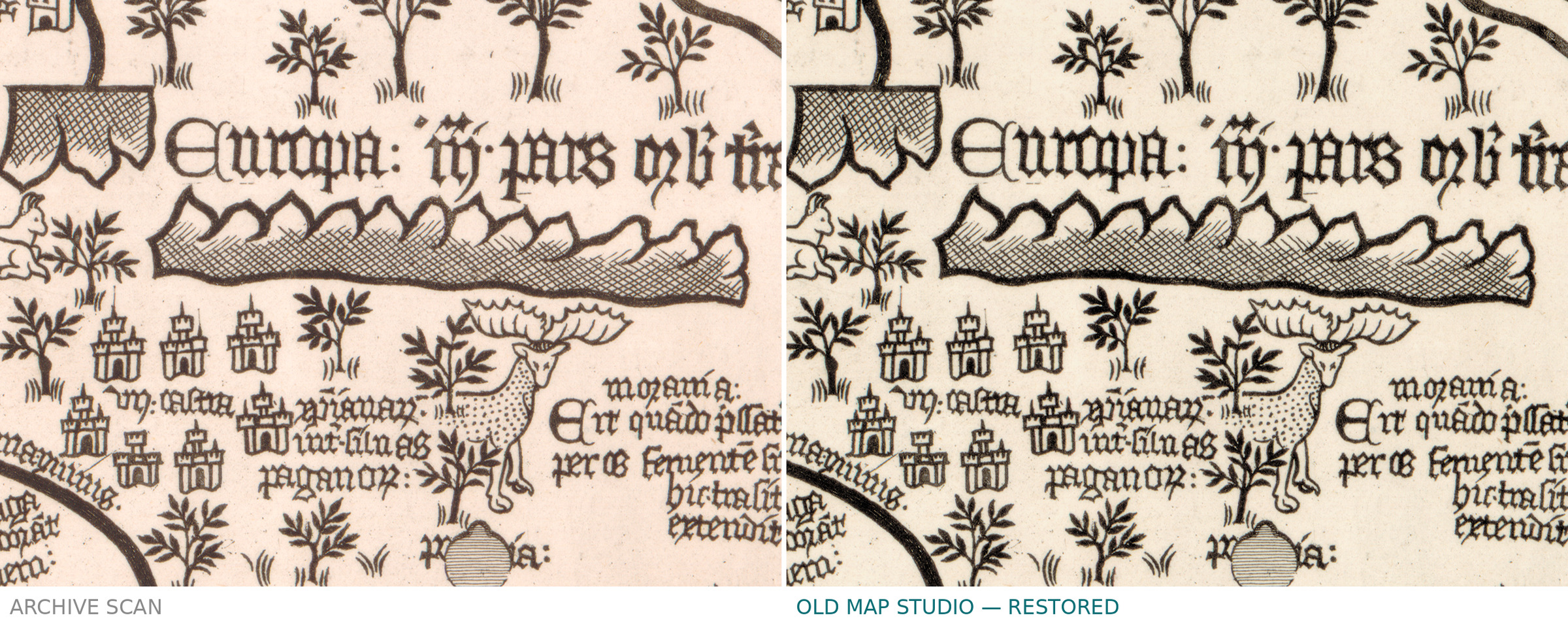
- Large names of the parts of the world: Affrica: in the upper part of the circle and Europa: just below the center, followed by a heavily abbreviated phrase.
- Upper left quarter, Arabia and Egypt: deserta arabie [the desert of Arabia], mecha [Mecca], mare persicum [the Persian Gulf], alexandria and deserta egypti [the desert of Egypt]; beside the phoenix a legend of six lines, which Nordenskiöld translated as “Phoenix, the sole most beautiful and solitary bird in the world, burns itself in an aromatic fire, and in three days is recreated from its ashes.”
- Africa, at the top right of center: three walking figures above the legend mons lune [the Mountains of the Moon], and below them a mountain from which four streams run into a lake with a two-line legend ending nili: [of the Nile].
- Right half, the western Mediterranean: apulia: on the Italian peninsula and sardi / nia: [Sardinia] written over two lines on the island.
- Lower half, around the Danube: viana [Vienna] and austria.
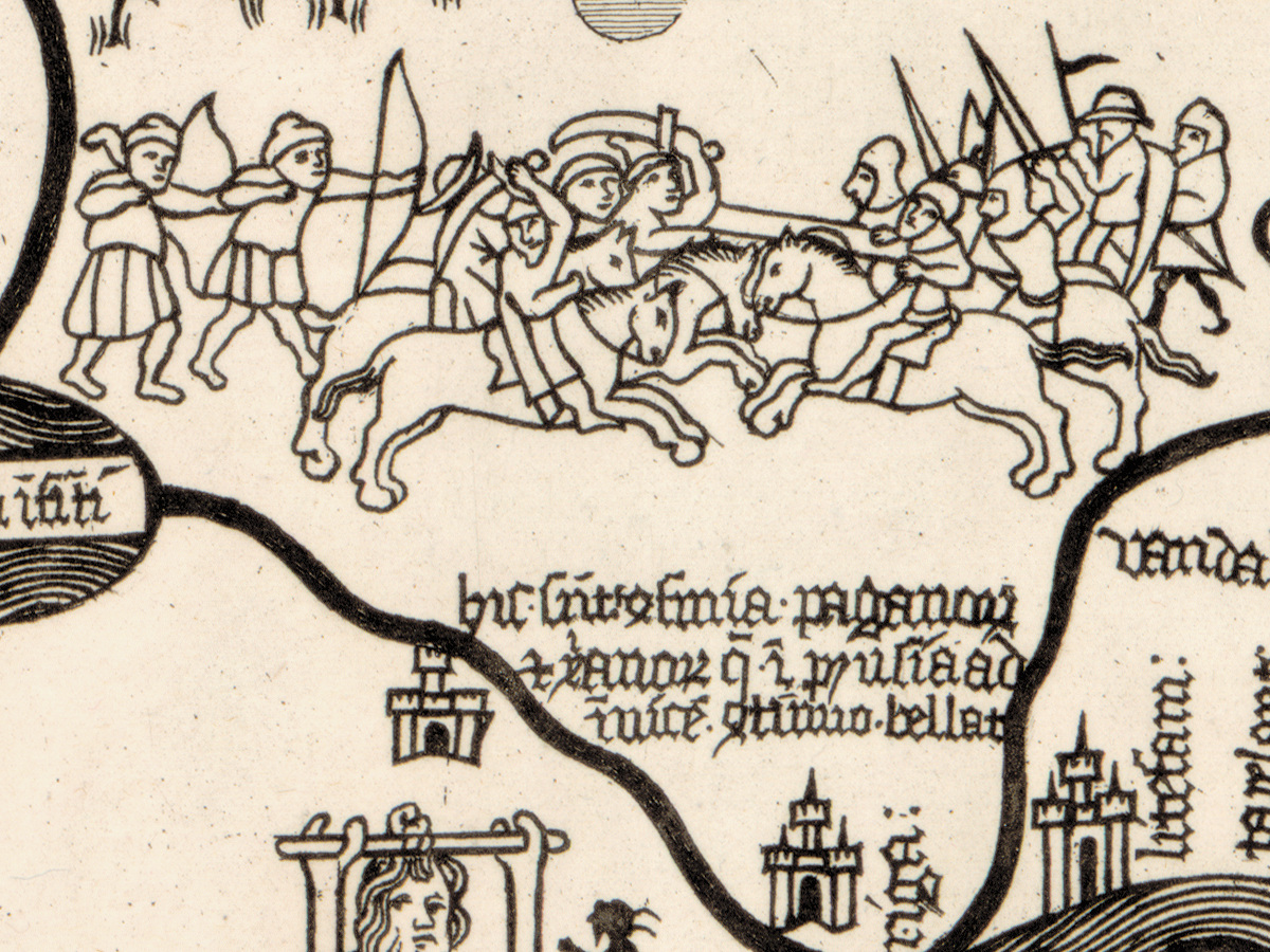
- Lower left, the north-east: two standing women, one drawing a bow and one with a pennoned spear and shield, under a legend beginning Terra quondam illustrium [land once of illustrious (women)]; further right, beyond a mountain range, livonia: (Nordenskiöld: “Livonia. The land formerly of illustrious women”); Albania magna beside beasts and a griffin (Nordenskiöld: “Here are dogs stronger than lions”); above them, beneath a hatched mountain range, a legend that Nordenskiöld rendered as “Hyperborean mountains, in which Griffins and tigers dwell.”
- Lower center: a bearded head hung between two posts, with a small dark figure beside it, above a legend of about ten short lines; in Nordenskiöld’s translation it says “This race considers itself sacred”.
- Lower right, the north: gothia magna [great Gothia], and below a bear on a mountain a two-line legend containing norvegie [of Norway] and ending nimio · frigore: [by excessive cold].
- On the rim: small diamond-shaped tablets, each with a single mark, spaced around the circle; the Library of Congress blog describes the original’s rim as “decorated with numbered diamond shapes.”
Two things on the sheet deserve a note. First, the title spells the word narratiunculis [short narratives]; the Library of Congress catalog title misprints it as “narratinunculis”. Second, the year is written with the old apostrophic numerals CIƆIƆ for 1500, so CIƆIƆCCXCVII reads 1797. Many legends inside the circle are only partly legible on this scan and are not transcribed here.
Editions and other known copies
- Library of Congress, Geography and Map Division, G3200 1450 .A6 1797: Apographon descriptionis Orbis terrae…, [Rome] : [Stefano Borgia], [1797]; “1 map ; 63 cm in diameter, on sheet 76 x 69 cm”; “Fewer than 10 copies of the facsimile are currently known to exist.” Matthew Edney gives the diameter of the same copy as 64 cm.
- University of Michigan, Clark Library: “[Velletri?] : Camillo Borgia, 1797”, “1 map; 27 x 26 in.”; the record names Camillo Giovanni Paolo Borgia (1777–1817) as creator and notes “A later printing from same plate” in the Göttingen society’s Commentationes, v. 16, 1808.
- Thorvaldsens Museum, Copenhagen, E1618: plate 710 × 650 mm on paper 760 × 670 mm; the museum’s own record dates the print “No later than 1700”, which cannot be right for a print of 1797.
- John Rylands Library, Manchester: the impression that Nordenskiöld published in 1891 (State Library of New South Wales record of his Account; Edney).
- Nordenskiöld, An account of a copy from the 15th century of a map of the world engraved on metal, which is preserved in cardinal Stephan Borgia’s museum at Velletri, Stockholm: A. L. Norman (dated 1891 in library records, 1893 by Edney), an English version of his 1891 article in Ymer (National Library of Finland record; Edney); in his Periplus (1897) he accepted that his impression was identical with Borgia’s facsimile (Edney).
- A reduced copper engraving, 40.5 × 30.5 cm, in Seroux d’Agincourt, Histoire de l’art par les monumens (1810–23) (Edney).
- None of these records names states of the plate.
Catalog entries and sources
Library of Congress: LCCN 2024592846, call number G3200 1450 .A6 1797. Thorvaldsens Museum: E1618. The original metal map is cited by the Library of Congress as “Biblioteca Apostolico Vaticana, #237” and by the Museo Galileo as “Musei Vaticani … inv. 70163”.
Sources for the story and this record: Library of Congress catalog record and its Worlds Revealed map blog (2024); Matthew Edney, Mapping as Process blog (February and June 2025); Dizionario Biografico degli Italiani (Treccani), entry on Stefano Borgia; Catholic Encyclopedia, entry on Stefano Borgia; University of Michigan record via the Big Ten Academic Alliance geoportal; Thorvaldsens Museum catalog; State Library of New South Wales and National Library of Finland catalog records.
This copy
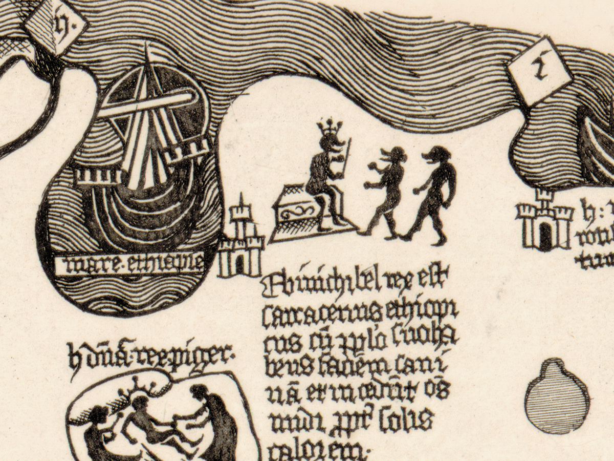
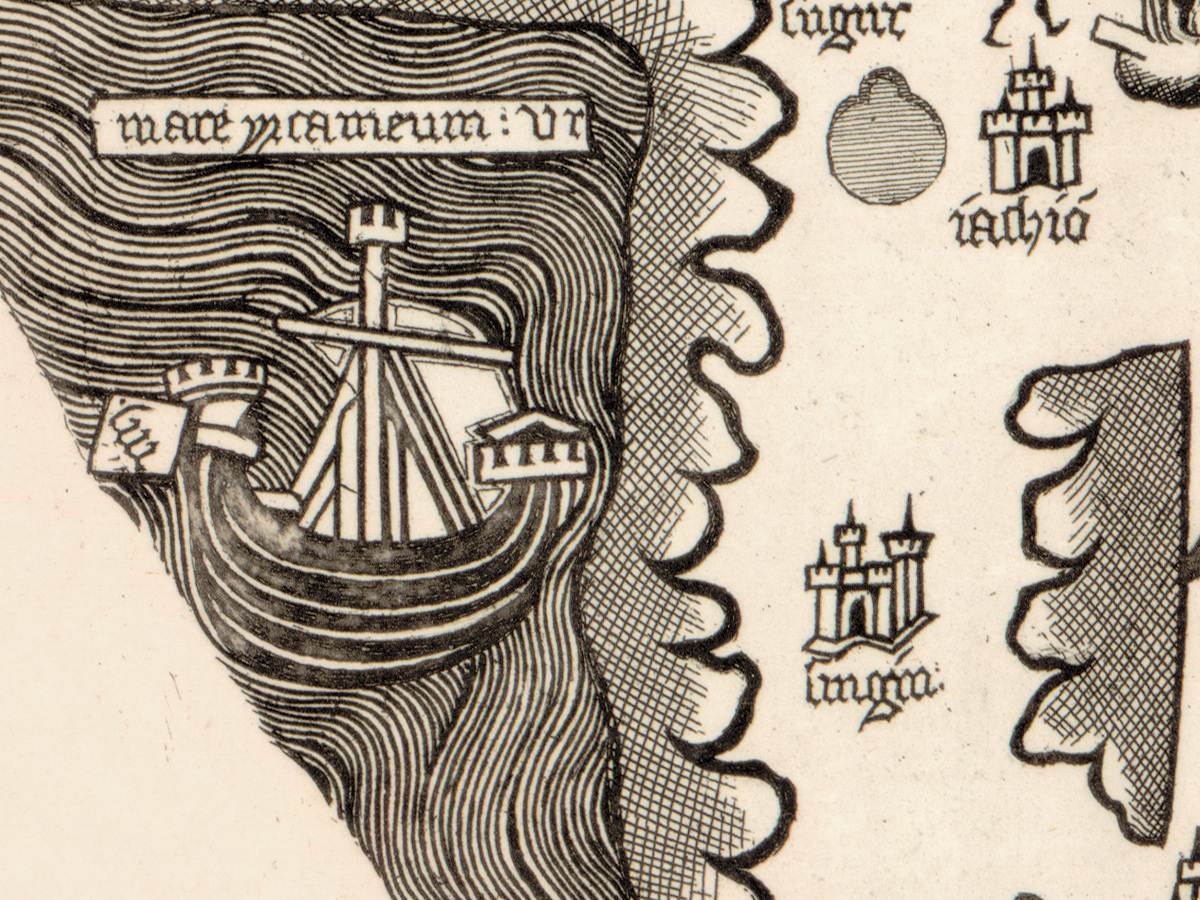
The Library of Congress impression is printed in black ink on cream paper and is not colored. Wide margins surround the circle and the title; at the upper left the edge of the sheet is rough, like a deckle edge. Faint fold lines cross the sheet, one horizontally through the lower half of the circle. On the lower rim, left of the large ship, the printed hatching is interrupted by small pale, scuffed patches. No stamps or pencil notes were noticed on the scan.
Your file
| Original | Apographon descriptionis Orbis terrae…, [Rome]: [Stefano Borgia], [1797]; engraved facsimile of the Borgia world map (original c. 1450, Vatican Library); map 63 cm in diameter on a sheet of 76 × 69 cm |
| Scan | full sheet 9378 × 10000 px; the map inside the trimmed border 7620 × 8330 px |
| Print size at 300 dpi | the map prints to 70 cm (28 in), the full sheet with margins to 84 cm (33 in) |
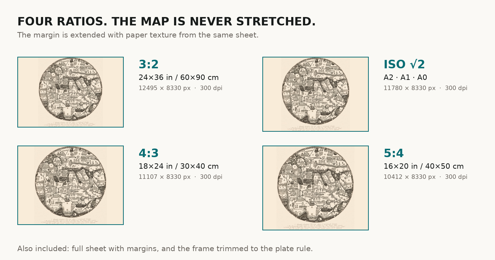
| You download | six ZIP archives: full sheet, trimmed, 3:2, 4:3, 5:4 and ISO A |
| Inside each one | one JPEG at 300 dpi, the restoration passport as a PDF, a READ ME |
How to print
- The sheet is vertical and the map is round. At 300 dpi the map prints to 70 cm. Pick the archive whose proportions match your frame; ask for matte fine-art paper in sRGB with auto-enhancement off.
- Where to print it: print shops near you and checked prices at online labs.
Source and rights
The scan comes from the Library of Congress, Geography and Map Division, call number G3200 1450 .A6 1797. The Library states that its digitized maps are free to use and reuse; the facsimile of 1797 is in the public domain. The record does not state whether the sheet is colored. There is no TIFF master in the package. Catalogue record: Library of Congress →
Features
- Latin
Attachments
Reviews
No reviews found
More maps from the 1700s
-
 Antique World Map 1799 — Chart of the World
-
Ottoman World Map 1795 — Hajji Ahmed, Heart-Shaped Map of 1559
-
Antique World Map 1794 — Dunn, A New Map of the World
-
Old World Map 1786 — Delamarche, Mappe Monde with Cook’s Voyages
-
Antique World Map c. 1780 — Bowles, New and Accurate Map of the World
-
Antique World Map 1778 — Brion de la Tour, Mappemonde