Ottoman World Map 1795 — Hajji Ahmed, Heart-Shaped Map of 1559
Description
An old world map in Ottoman Turkish: Hajji Ahmed’s heart-shaped map, printed in Venice in 1795
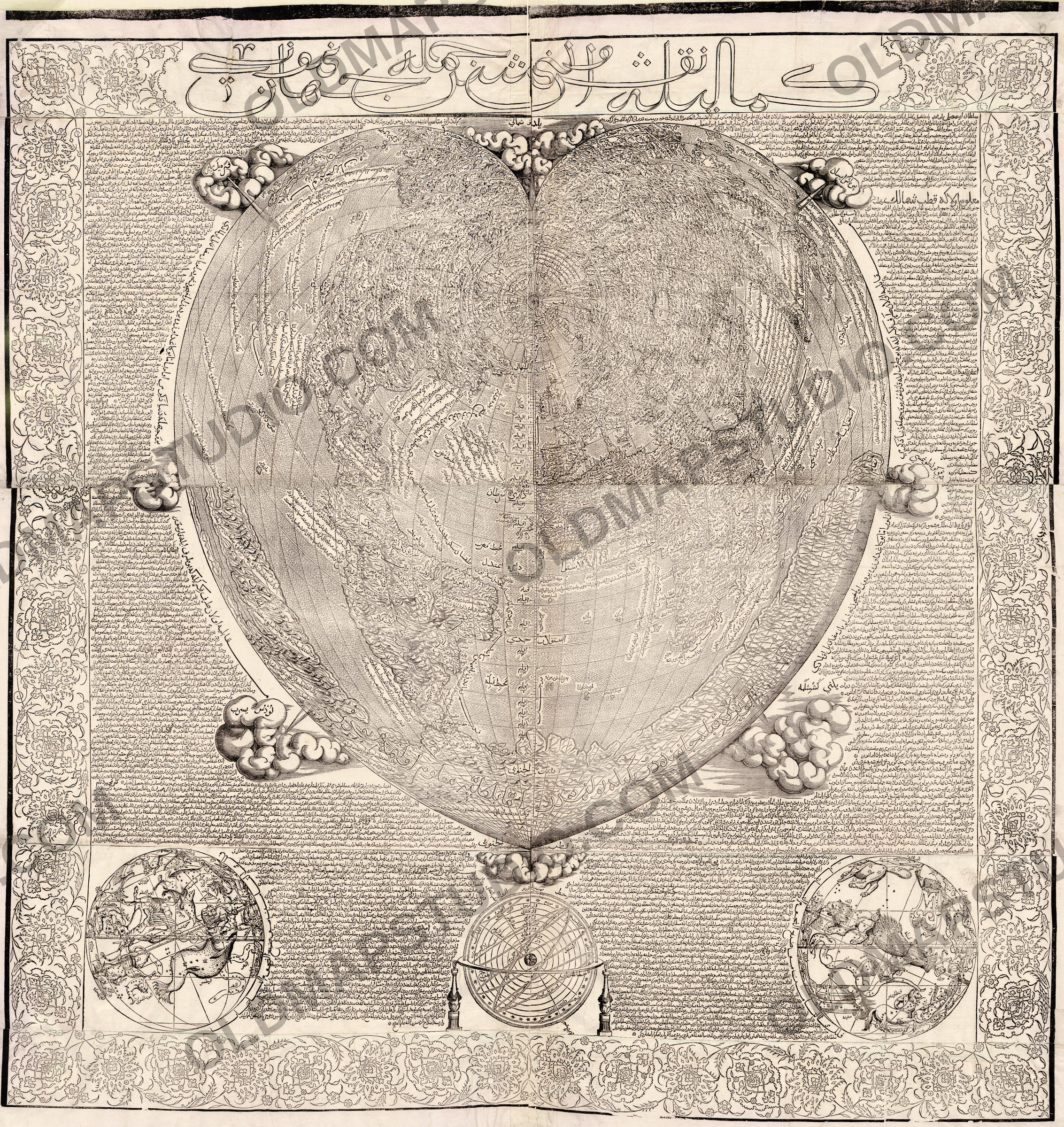
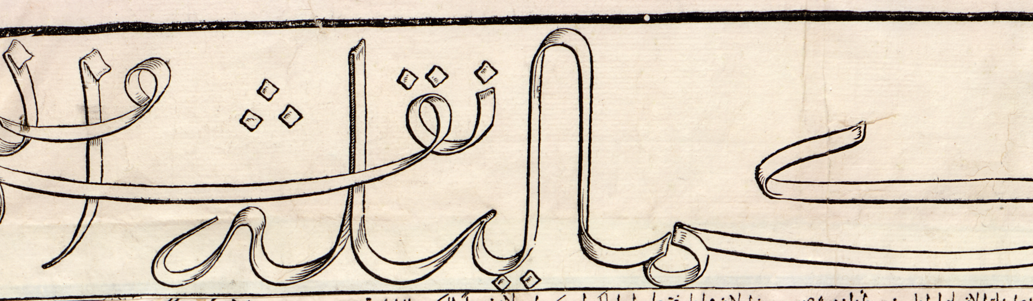
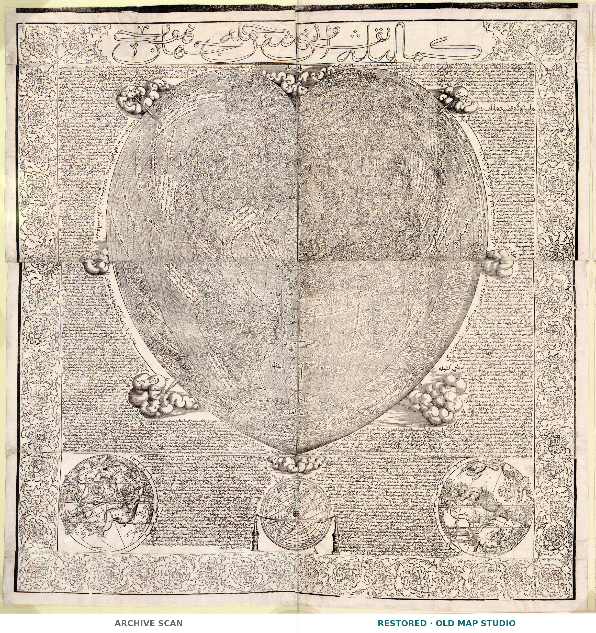
Kemâliyle nakş olunmuş cümle cihan numûnesi — in the Library of Congress’s translation, “the representation of the whole world depicted in its entirety” — is a world map in the shape of a heart, with a long commentary in Ottoman Turkish. Its text says the map was translated into Turkish in 967 of the Islamic calendar, that is October 1559 to September 1560. The sheet itself is younger: the Library’s catalog record describes it as “One of 24 impressions printed in 1795 from six woodcut blocks when found in the archives of the Council of Ten in Venice.”

The map is attributed to a cartographer from Tunis named Hajji Ahmad. At first glance, the Library writes, the text reads as a first-person account of his journey across the Mediterranean; on closer inspection, scholars have questioned its authenticity and authorship. The text contains errors, and European sources such as Giovanni Battista Ramusio’s Delle navigationi et viaggi appear to have influenced the geography. The record calls Hâci Ahmed probably a pseudonym, possibly of Michele Membré and Nicolò Cambi, and the Library’s summary names Membré as the official Turkish translator of the Venetian Republic. Whatever its true provenance, it concludes, the map highlights the cross-cultural influences of the early modern Mediterranean, especially among Tunis, Venice and Istanbul.
The drawing follows Oronce Fine’s heart-shaped world map of 1534, according to Shirley’s Mapping of the World as cited in the record. The Library’s map blog adds that Hajji Ahmad’s version has more place-names and a more accurately drawn American coastline, and that the cordiform projection was conceived by Johannes Werner in Nuremberg in 1514.
What to look for on the sheet
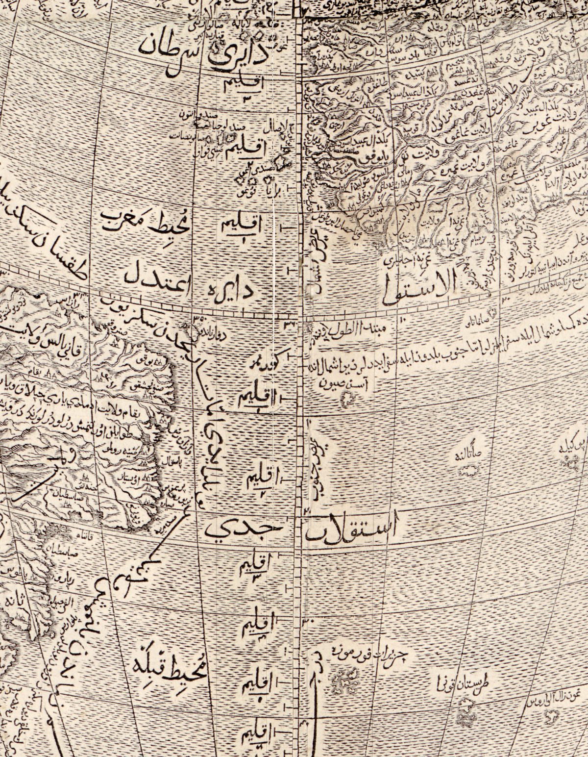
- The four continents and their names inside the heart, with a graduated scale between the poles separating the eastern and western hemispheres.
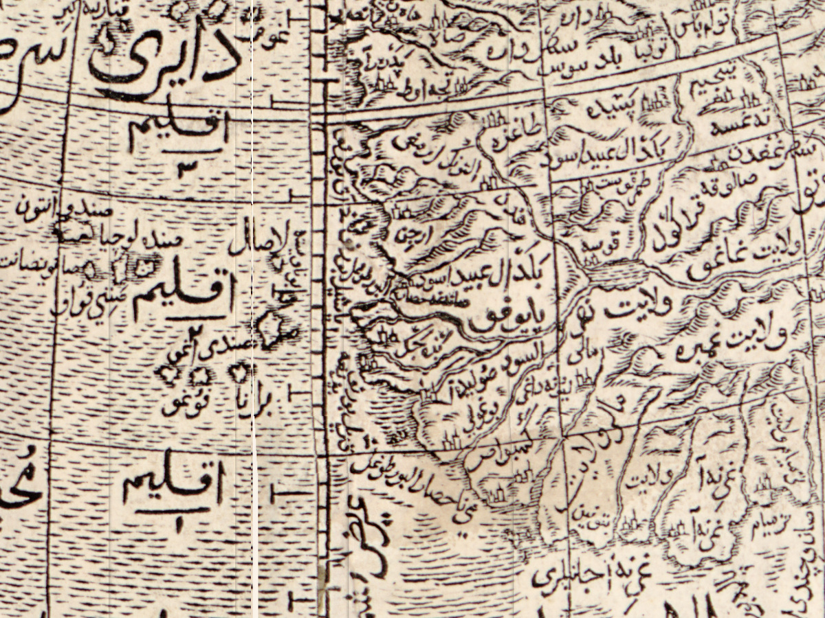
- The iqlim (from the Greek word for “inclination”) shown as horizontal bands, and 20 legends for nautical, astronomical and commercial places, as the Library’s blog describes them.
- The Ottoman Turkish commentary framed by vines and floral arabesques.
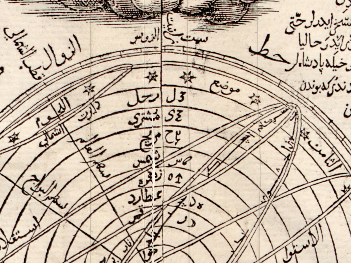
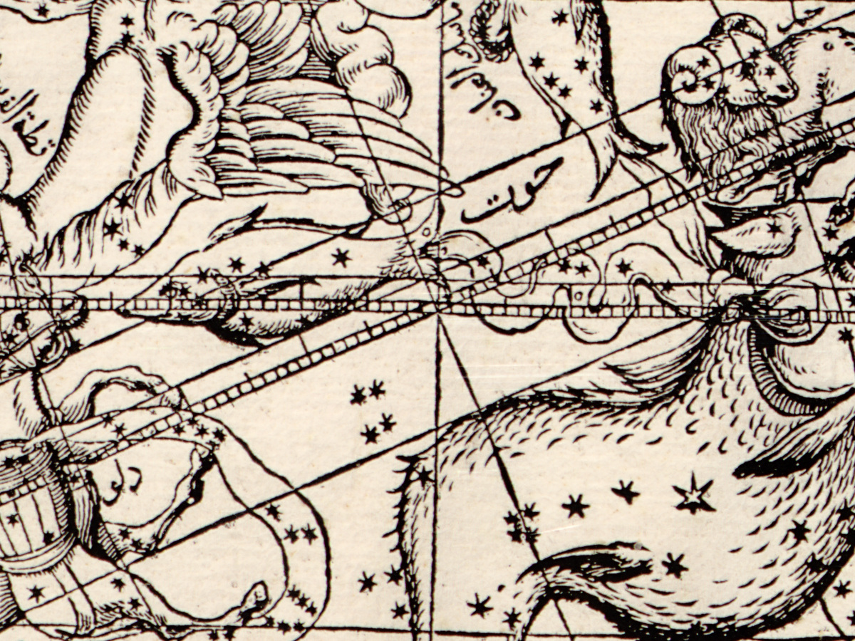
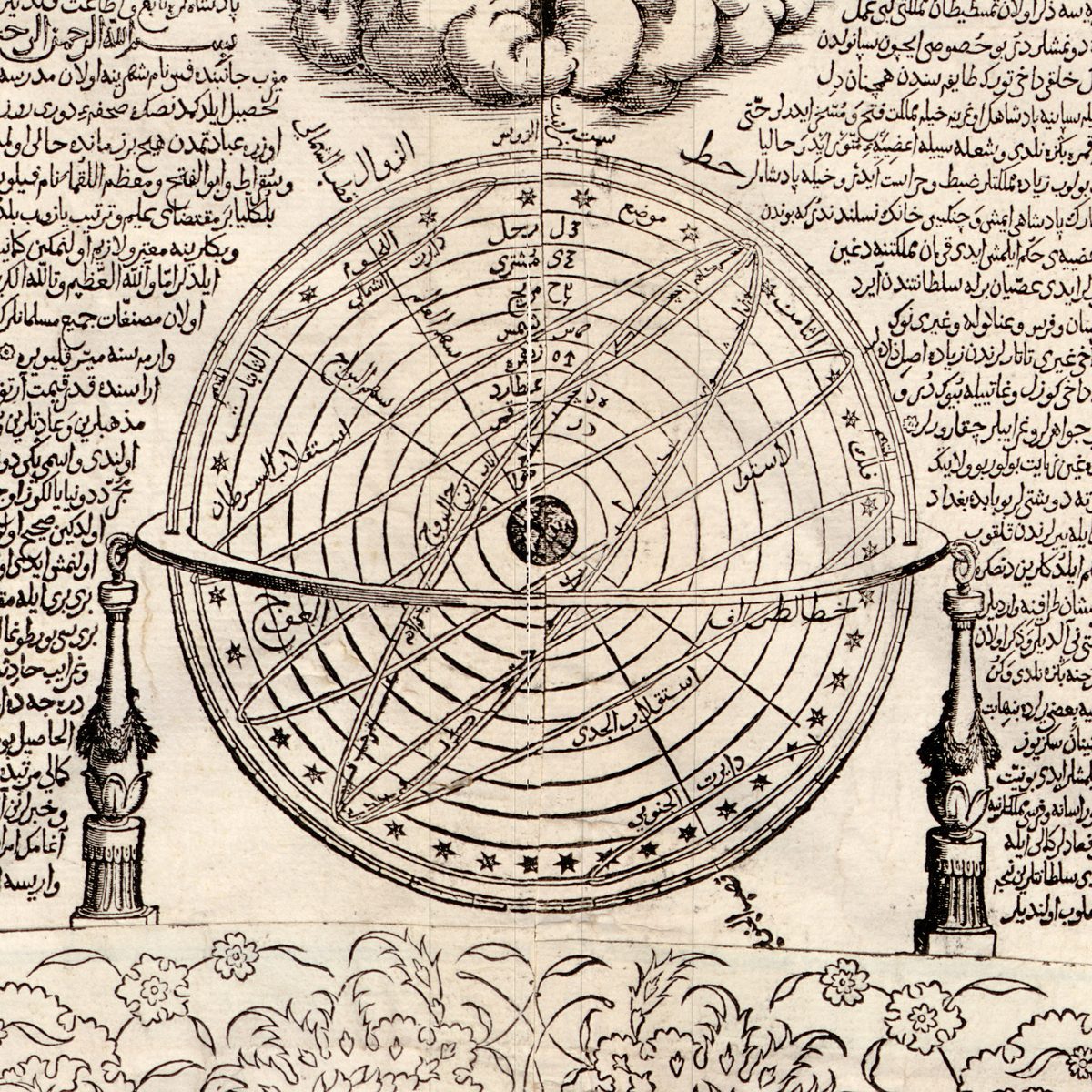
- In the bottom margin, two celestial hemispheres and an armillary sphere, which the catalog record also lists.
- Relief shown pictorially, and the joins of the ten sheets pasted together to make the map.
The blocks were carved from cherry wood in 1559–60, the Library’s blog says, and were confiscated and forgotten before any map was printed. The Factum Foundation, which recorded the blocks in 3D in 2019–2020, counts six blocks of 106 × 110 cm, now in the Biblioteca Marciana in Venice; they were found in 1795 in the criminal archive of the Council of Ten in the Doge’s Palace; twenty-four prints were made, and no others are known. The Library of Congress calls its copy the earliest printed wall map in its collections.
Everything on this sheet: full record
Every inscription on the sheet
All lettering on the sheet is cut in the wood and printed in black, in Arabic script; the language is Ottoman Turkish, with Arabic terms for the circles, the planets and the constellations. The long commentary that fills the side columns and the band below the heart runs to many hundreds of lines and is not transcribed here; neither are the several hundred small place names inside the heart. Only short labels that can be read with confidence on the scan are quoted below, in the script of the sheet, with a transliteration or translation in square brackets. Where a label is described rather than quoted, part of it could not be read with certainty.
- Band across the top: the title in large outlined letters, كماليله نقش اولنمش جمله جهان نمونه سى [Kemâliyle nakş olunmuş cümle cihan numûnesi, as the catalog record transliterates it].
- Side columns, the band under the heart and the margins round the three pictures at the foot: continuous Ottoman Turkish prose, paragraphs often marked by a small rosette. Beside the armillary sphere a passage opens with بسم الله الرحمن الرحيم [in the name of God, the Merciful, the Compassionate]. In the right-hand column, next to the north-eastern cloud, a heading in larger letters begins with قطب [pole].
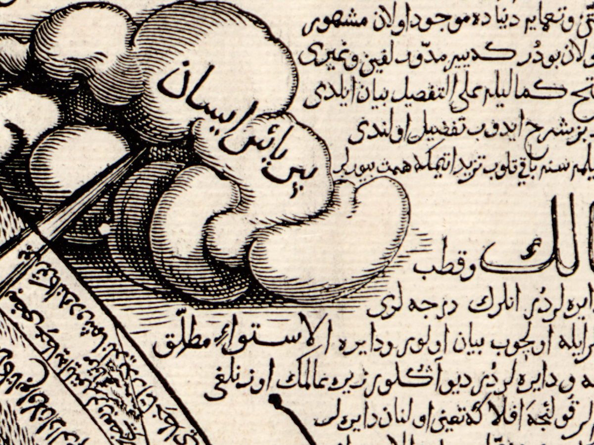
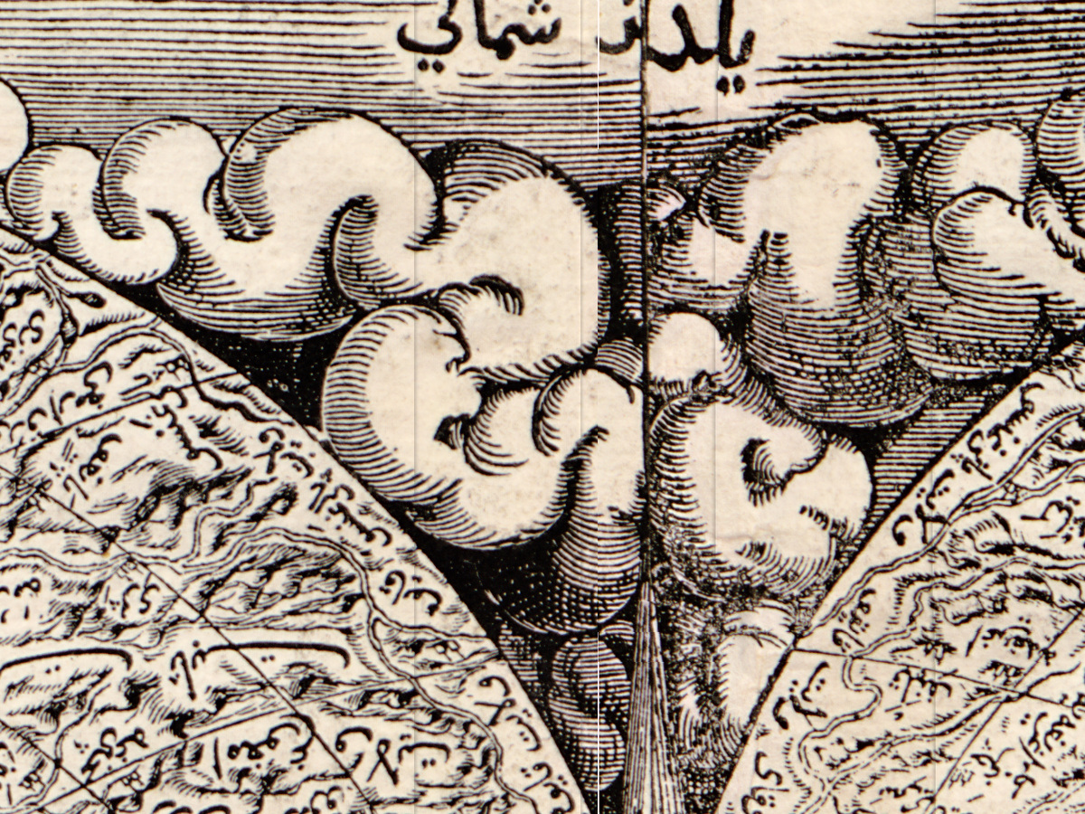
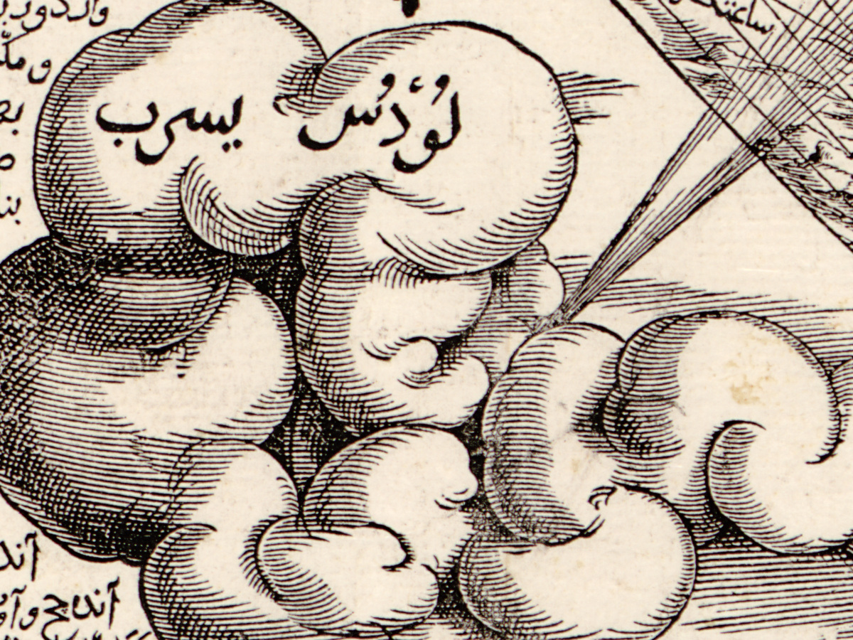
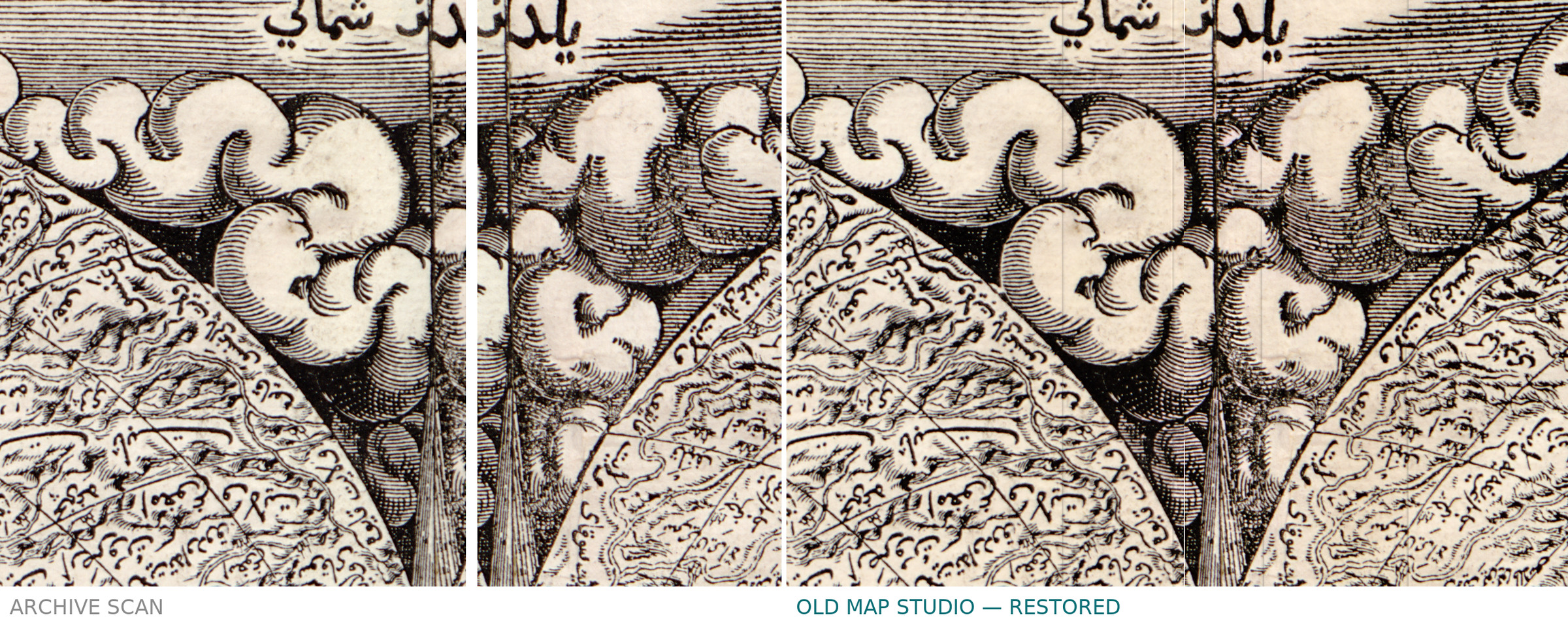
- Clouds round the heart, each sending a narrow ray toward the map: at the top, between the two lobes, يلدز شمالي [Yıldız, the north wind]; upper left, a two-word label beginning with قره يل [Karayel, the north-west wind]; on the left, the Turkish name of the west wind, Gün batısı, with غرب [west]; lower left, a two-word label beginning with لودس [Lodos, the south-west wind]; on the right, beside the cloud, the Turkish name of the east wind, Gün doğusu; lower right, above the cloud, Keşişleme, the south-east wind. The upper right cloud carries a two-word label not read here, and the cloud under the point of the heart carries none.
- Down the central meridian: a graduated scale, and in each band the word اقليم [iqlim] with its number.
- The circles inside the heart: دايرى سرطان [circle of Cancer, the Tropic of Cancer]; the Equator as دايره اعتدل [circle of the equinox, spelled without the long alif] west of the meridian and الاستوا [the equator] east of it; the Tropic of Capricorn with جدي [Capricorn] west of the meridian and a second word east of it; near the bottom, the southern circle with دايرت east of the meridian and الجنوبى [southern] west of it.
- At the point of the heart: قطب [pole] to the right of the meridian and الجنوبى [southern] to the left, the South Pole.
- Oceans in large letters: محيط مغرب [the Western Ocean] north of the Equator and محيط قبله [the ocean of the qibla] south of the Tropic of Capricorn, both in the western half. Across the southern lands runs a long curved inscription in very large letters, not transcribed here.
- Left celestial hemisphere, among other names: حوت [Pisces], دلو [Aquarius], جدي [Capricorn], قيطس [Cetus, the Whale], النهر [the River], الحوت الجنوبى [the Southern Fish], الفرس الاعظم [the Great Horse, Pegasus], التلت [the Triangle] and طريق التبانه [the Milky Way].
- Right celestial hemisphere, among other names: الدب الاكبر [the Great Bear], اسد [Leo], سنبله [Virgo, literally the ear of grain], ميزان [Libra], باطت [Crater, the Cup], غراب [Corvus, the Crow], قنطورس [Centaurus] and سفينه [Argo, the Ship]; the Hydra is labeled in a single word.
- Armillary sphere: on circles stacked above the Earth, قمر [Moon], عطارد [Mercury], زهره [Venus], شمس [Sun], مريخ [Mars], مشتري [Jupiter] and زحل [Saturn], each with a short abbreviation beside it; the tilted rings are labeled for the Tropics, the Equator (الاستوا) and the southern circle.
Two things on the sheet itself are worth noting. The same circle can carry two different names on either side of the central meridian: the Equator is دايره اعتدل in the western half and الاستوا in the eastern. And the two celestial pictures are not a northern and a southern sky: each shows half of the heavens, with the equator as a straight line across the middle and the band of the zodiac crossing it at a slant, so that the Fishes, the Water-bearer and Capricorn stand in the left picture and the Lion, the Virgin and the Balance in the right.
Editions and other known copies
All the printed copies come from one printing. The Library of Congress gives the imprint as [Venice : Pinelli, 1795] and calls its sheet one of 24 impressions printed in 1795 from six woodcut blocks found in the archives of the Council of Ten. Benjamin Arbel (Imago Mundi, 2002) writes that the blocks were found most probably in 1794, and counts eleven copies known in public libraries; the Qatar National Library record also says “One of 11 known surviving copies”. According to Ménage (1958) and Arbel, the Council of Ten decided on 6 February 1568 that the world maps confiscated from the house of a Venetian, Marc’Antonio Giustinian, should be returned to him on condition that they not be published without permission, and on 13 May 1568 the Senate granted him the exclusive right to print the map. None of these records describes differences between the 1795 impressions.
- Library of Congress, Geography and Map Division, G3200 1559 .K4: [Venice : Pinelli, 1795]; 1 map, 92 × 91 cm, printed on 10 sheets pasted together; “Includes ill., including 2 celestial hemispheres and an illustration of an armillary sphere.” This is the copy reproduced here.
- Newberry Library, Chicago, Novacco 8F 11: dated 1795, Pinelli; 1,097 × 1,060 mm to the outer limit of the printed border; catalogued as “A complete and perfect map describing the whole world”, translated from the Turkish title.
- Qatar National Library, Heritage Library, HC.MAP.00480: “[1559] 1795”, Venice, Pinelli; 165.2 × 222.8 cm on a sheet of 175.2 × 230 cm; the record adds that the cartographer was possibly Giacomo Gastaldi.
- Museum of Ethnography, Budapest, inventory no. 2784: captioned October 1559 – August 1560, while the museum’s text counts it among the 24 prints made in 1795; 108 × 114 cm; inventoried in 1961 with no accompanying information.
- Biblioteca Nazionale Marciana, Venice: the six woodblocks, each 106 × 110 cm according to the Factum Foundation, which recorded them in 2019–2020; the Library of Congress’s preservation pages say the Marciana also holds two printed copies.
- Arbel’s list of copies also names the British Library, the Bibliothèque nationale de France, the Austrian National Library, the William L. Clements Library, the Dallas Pratt Collection at the American Museum in Britain, the John Carter Brown Library, an Italian library and a private collection in New York; their own catalog records were not consulted for this page.
The sizes differ because the records measure different things: the Library of Congress gives 92 × 91 cm without saying what was measured, the Newberry the printed border, and the Factum Foundation the blocks.
Catalog entries and sources
- Library of Congress: call number G3200 1559 .K4; LCCN 2004626121; digital ID g3200.ct001491; contributors Hâcı Ahmed, active 16th century, and Oronce Fine, 1494–1555.
- Shirley, The Mapping of the World, no. 103, as cited by the History of Cartography; the Library of Congress cites Shirley’s Mapping of the World, 1993, without a number.
- Sources for the story and this record: the Library of Congress catalog record and its summary; Carissa Pastuch, “The Cosmographic Heart”, Worlds Revealed blog, Library of Congress, 2024; the Library of Congress preservation blog on the paper of this copy, 2023; the Factum Foundation’s page on the cordiform map of Hajji Ahmed; V. L. Ménage, “The Map of Hajji Ahmed and its Makers”, Bulletin of the School of Oriental and African Studies, 1958; Benjamin Arbel, “Maps of the World for Ottoman Princes?”, Imago Mundi 54, 2002; Ahmet T. Karamustafa in The History of Cartography, volume 2, book 1, 1992; George Kish, The Suppressed Turkish Map of 1560, 1957; catalog records of the Newberry Library, the Qatar National Library and the Museum of Ethnography, Budapest.
This copy
The scan shows the Library of Congress sheet printed in black only, with no color. The joins of the pasted sheets show as fine straight lines, the clearest running down the center of the map and across the heart near the level of the Tropic of Cancer. The paper is evenly toned, and the printed frame of flowering scrolls survives on all four sides. According to the Library of Congress preservation blog, the paper of this copy came from the Toscolano district of the Venetian Republic and carries the watermarks “GF” and three moons.
Your file
| Original | Hâcı Ahmed (attributed), heart-shaped world map after Oronce Fine; printed in Venice in 1795 by Pinelli from woodblocks of 1559–60; 10 sheets pasted together, 92 × 91 cm; Library of Congress, Geography and Map Division, G3200 1559 .K4 |
| Scan | full sheet 13490 × 13888 px; the map inside the trimmed border 12840 × 13600 px |
| Print size at 300 dpi | the map prints to 115 cm (45 in), the full sheet with margins to 117 cm (46 in) |
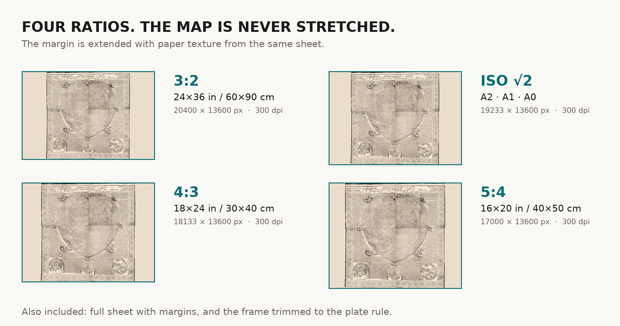
| You download | six ZIP archives: full sheet, trimmed, 3:2, 4:3, 5:4 and ISO A |
| Inside each one | one JPEG at 300 dpi, the restoration passport as a PDF, a READ ME |
How to print
- Print at 300 dpi at the size above and do not let the shop scale the file up.
- Pick the archive whose proportions match your frame, so nothing is cropped or stretched.
- Ask for matte fine-art paper, sRGB, auto-enhancement off.
- Where to print it: print shops near you and checked prices at online labs.
Source and rights
The file is made from the digital image published by the Library of Congress, Geography and Map Division, call number G3200 1559 .K4. The record states: “The Library of Congress is unaware of any copyright or other restrictions in the World Digital Library Collection.” It names the technique (woodcut blocks) but says nothing about coloring. There is no TIFF master in the package. Catalogue record: Library of Congress →
Questions
What exactly do I get after payment?
Six ZIP archives, each with one JPEG at 300 dpi, the restoration passport as a PDF and a READ ME. There is no TIFF master in the package.
How large can I print it?
The map to 115 cm (45 in) on the long side at 300 dpi, the full sheet with margins to 117 cm (46 in), from the scan’s own resolution, not an upscale.
Is it from 1559 or from 1795?
Both dates belong to it. The blocks were cut in 1559–60 and the text dates its translation to those years; the sheet was printed from them in 1795. The listing gives 1795, the year of the print we scanned.
Who was Hajji Ahmed?
The Library of Congress says the map is attributed to a cartographer from Tunis of that name, but that scholars doubt it: the record calls the name probably a pseudonym, possibly of Michele Membré and Nicolò Cambi.
Features
- Ottoman Turkish
Attachments
Reviews
No reviews found
More maps from the 1700s
-
 Antique World Map 1794 — Dunn, A New Map of the World
-
Antique World Map c. 1450 — Borgia Map, Facsimile Borgia 1797
-
Antique World Map 1799 — Chart of the World
-
Old World Map 1786 — Delamarche, Mappe Monde with Cook’s Voyages
-
Antique World Map c. 1780 — Bowles, New and Accurate Map of the World
-
Antique World Map 1778 — Brion de la Tour, Mappemonde