Antique World Map c. 1845 — Johnston, Botanical Geography
Description
An antique world map of plant geography, Edinburgh, c. 1845
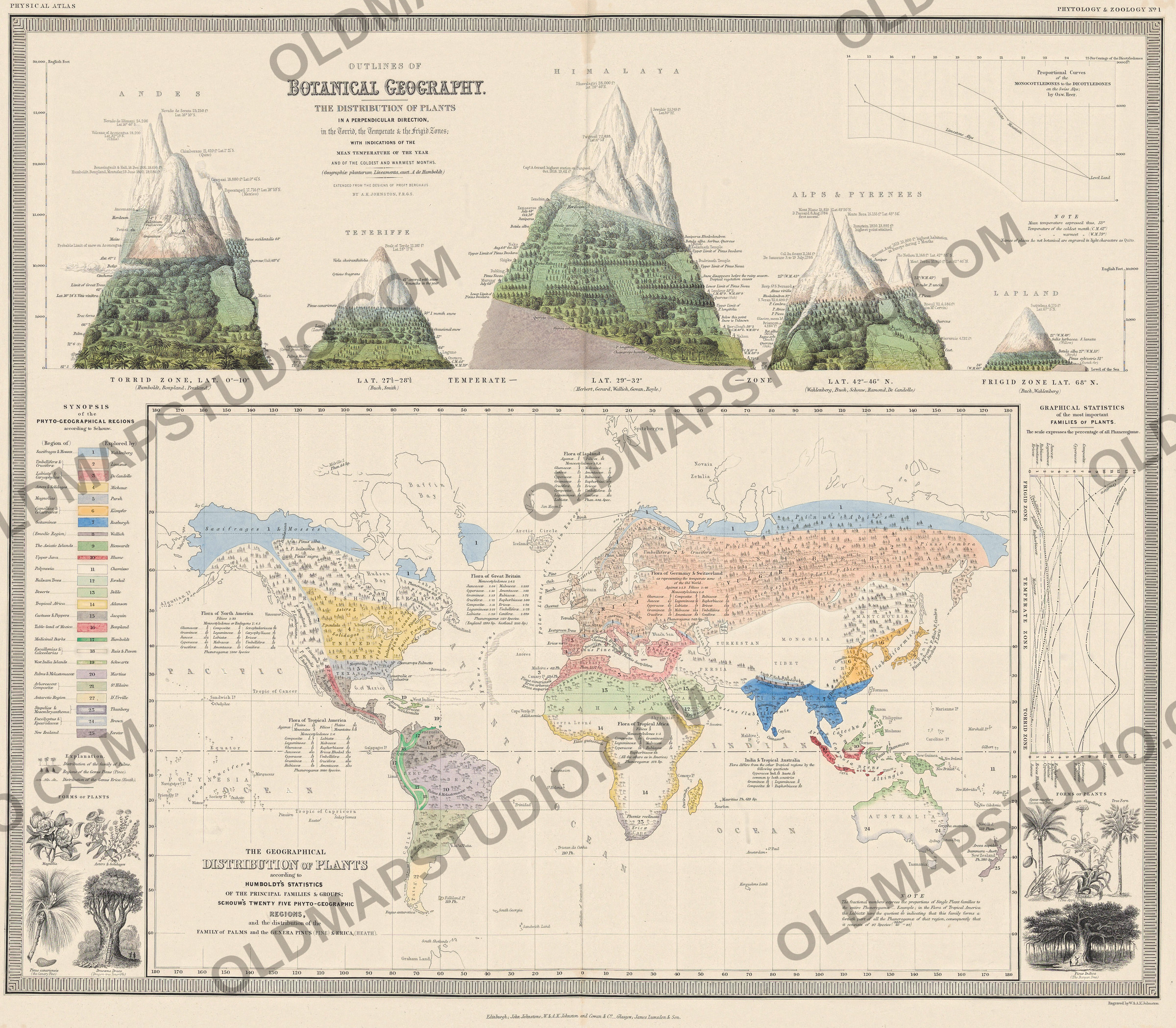
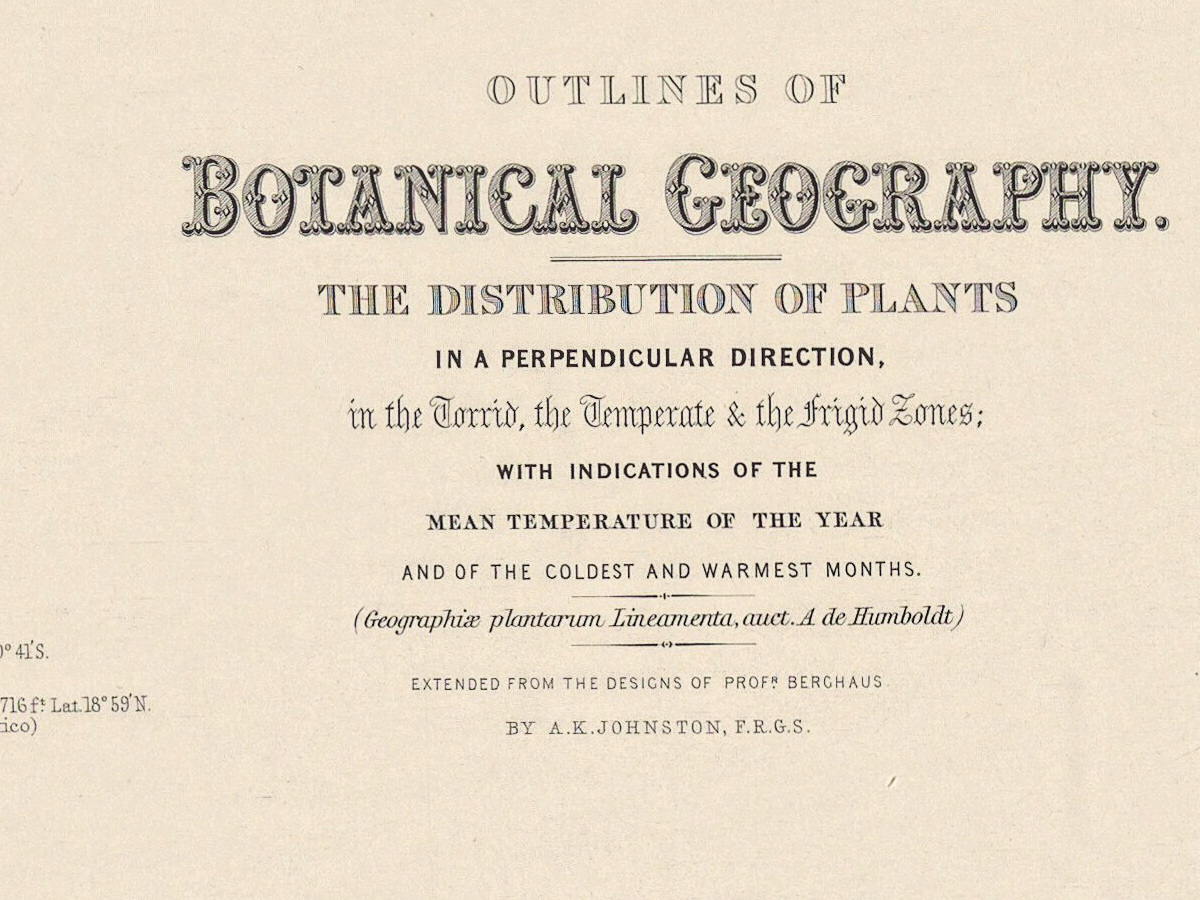
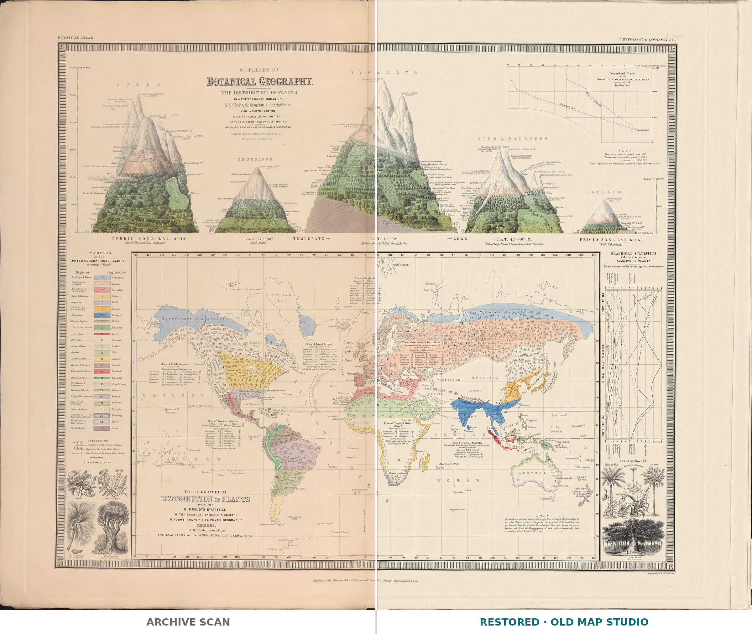
Two pictures share this sheet. Across the top, five mountain profiles – Andes, Teneriffe, Himalaya, Alps and Pyrenees, Lapland – are clothed from foot to snowline in the plants of each height. Below is a world map colored by plant regions. The title names the sources: Geographiæ plantarum Lineamenta, auct. A de Humboldt [outlines of plant geography, after A. de Humboldt], EXTENDED FROM THE DESIGNS OF PROF.R BERGHAUS BY A.K.JOHNSTON, F.R.G.S.
Alexander Keith Johnston (1804–1871) went into partnership as an engraver with his brother William in Edinburgh in 1826; the sheet is signed Engraved by W. & A.K. Johnston. In the preface to The Physical Atlas, dated April 1848, Johnston thanked Alexander von Humboldt, “at whose suggestion the Work was undertaken”, and noted that of its thirty maps fifteen were designed by Heinrich Berghaus, author of the Physikalischer Atlas. The Dictionary of National Biography calls it “the first physical atlas ever published in England”.
The atlas first came out in parts – three maps to a part, at one guinea, every other month, by the prospectus of 1845 – before William Blackwood & Sons issued it as a volume in 1848. This impression carries the imprint Edinburgh; John Johnstone, W. & A.K. Johnston and Cowan & C.o _ Glasgow; James Lumsden & Son.; the National Library of Scotland records its copy, a sheet of 71 × 60 cm, under Blackwood, 1848. Wellcome Collection catalogs the image with an 1845 issue by J. Johnstone, “Specimen number. Pt. I only.”, although the 1845 prospectus does not list botanical geography in the first two parts.
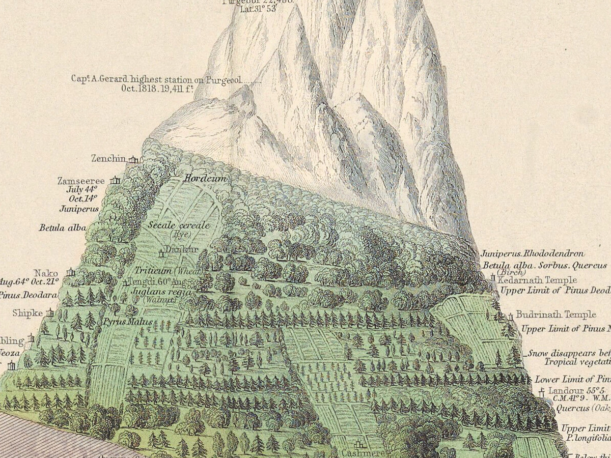
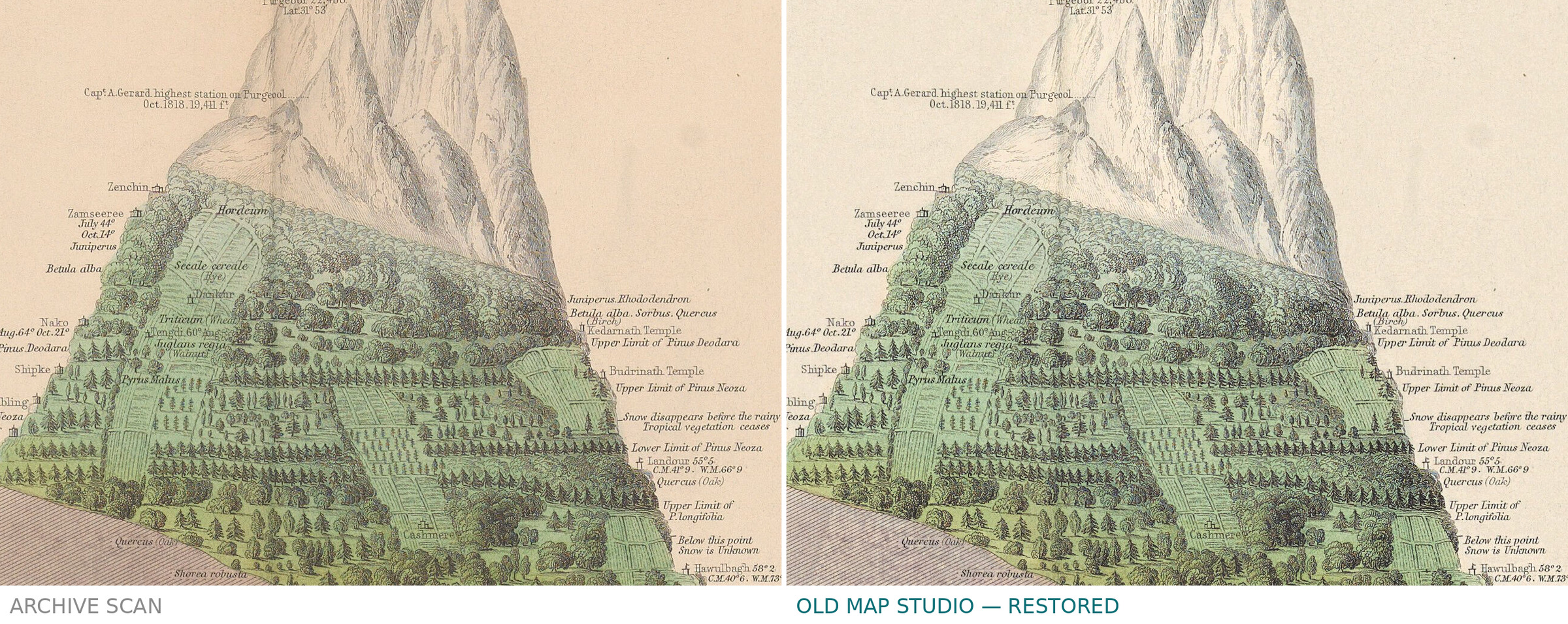
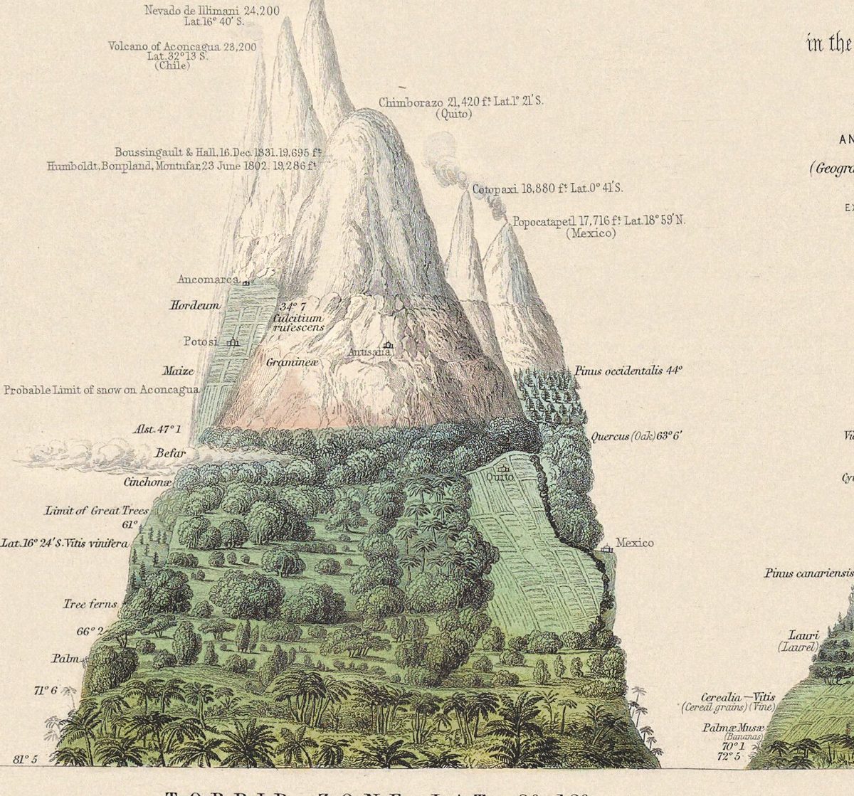
Beside each mountain, plants are set at the heights where they stop – Limit of Great Trees, Upper Limit of Pinus Deodara, with mean temperatures for the year and its extremes. Climbers are named too: on Chimborazo, Humboldt, Bonpland, Montufar, 23 June 1802. 19,286 f.t, and above them Boussingault & Hall, 16. Dec. 1831. 19,695 f.t; on Mont Blanc, D. Paccard 8. Aug. 1786 first ascent.
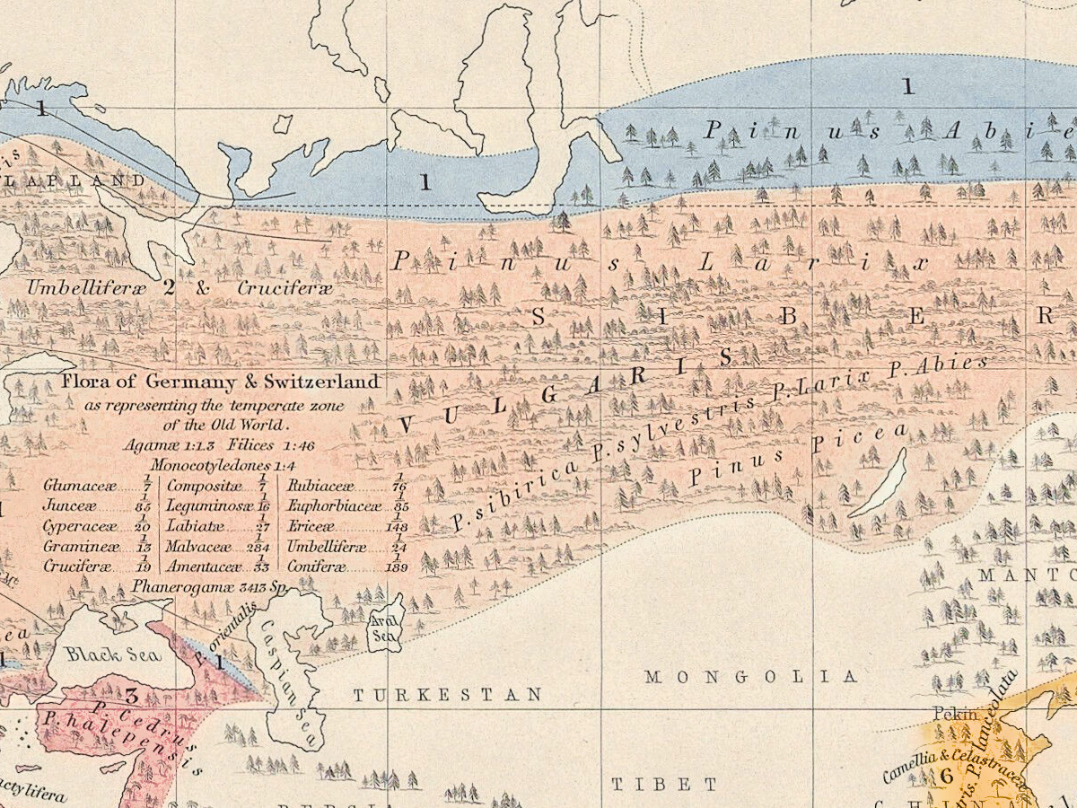
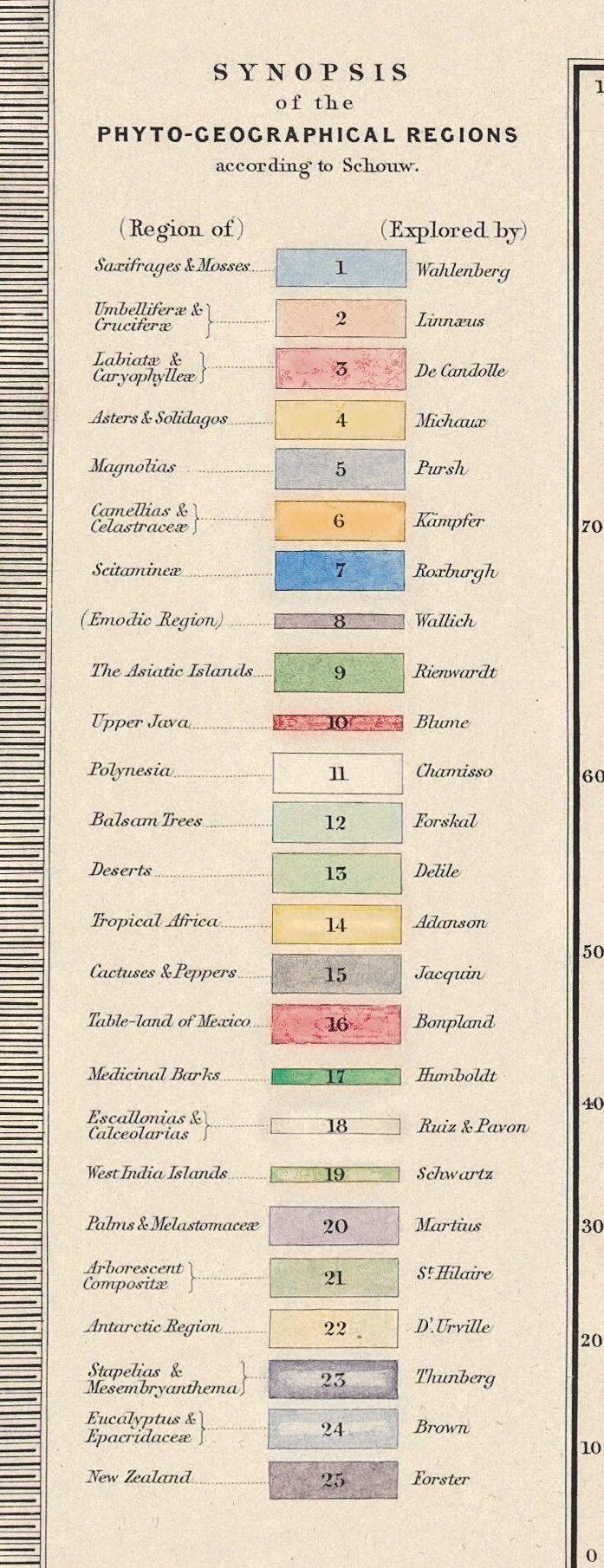
The world map divides the land into SCHOUW’S TWENTY FIVE PHYTO-GEOGRAPHIC REGIONS. The Danish botanist Joakim Frederik Schouw published, in 1823, what Den Store Danske calls the first maps proposing a division of the earth into floral realms. Each region is named for its plants and paired with the explorer of its flora: Saxifrages & Mosses with Wahlenberg, Medicinal Barks with Humboldt.
What to look for on the sheet
- Upper left: peaks drawn higher than Chimborazo – Nevado de Sorata 25,250 f.t and Nevado de Illimani 24,200.
- Upper right: Proportional Curves of the MONOCOTYLEDONES to the DICOTYLEDONES on the Swiss Alps; by Osw. Heer., with separate lines for Limestone Alps and Granite Mountain.
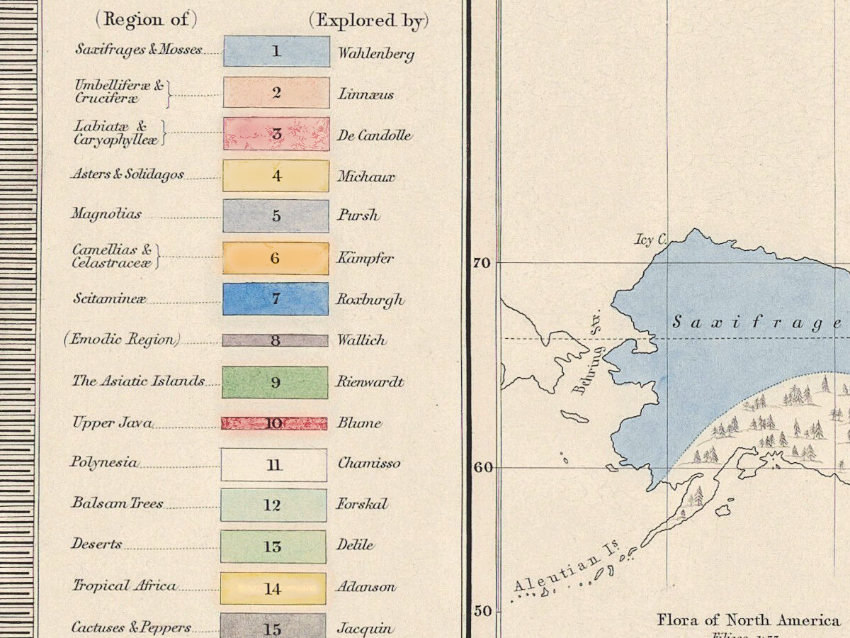
- Left margin: the SYNOPSIS of the PHYTO-GEOGRAPHICAL REGIONS according to Schouw, 25 color keys with the name of an explorer beside each.
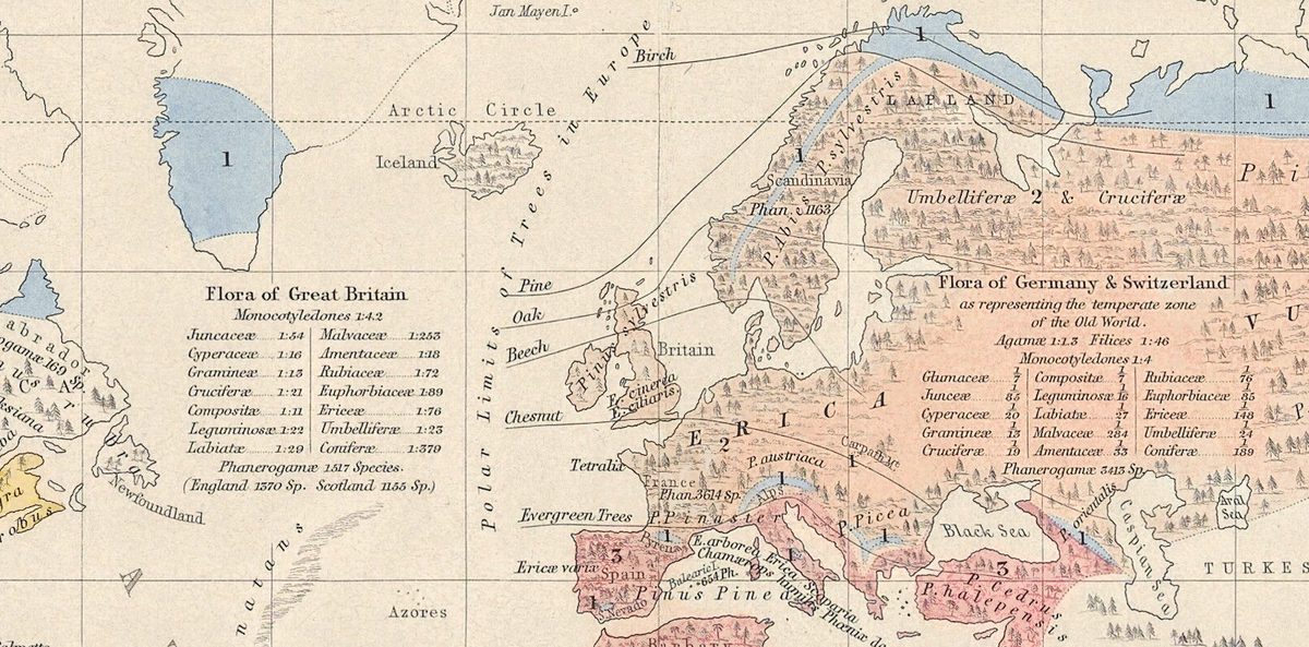
- West of Europe: Polar Limits of Trees in Europe, lines running from birch to evergreen trees.
- Lower right of the map: a NOTE on the fractions in the flora tables – a fortieth of 3,880 species in tropical America makes 97 Labiatæ.
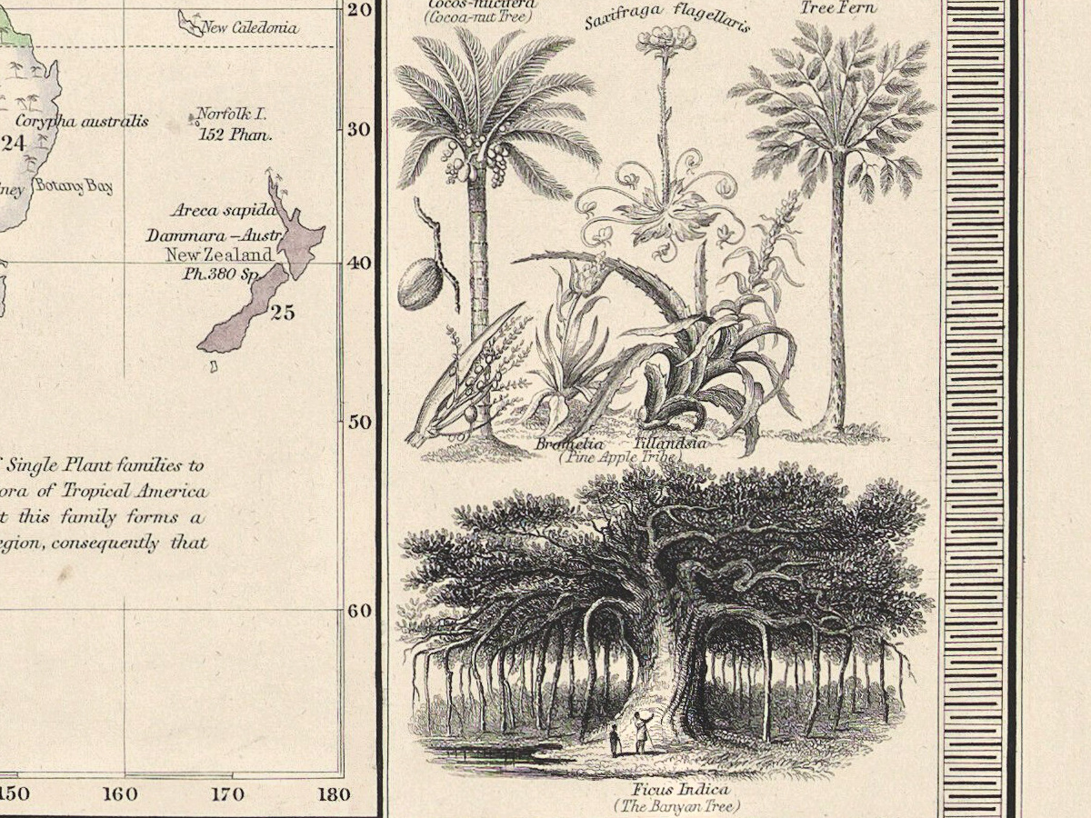
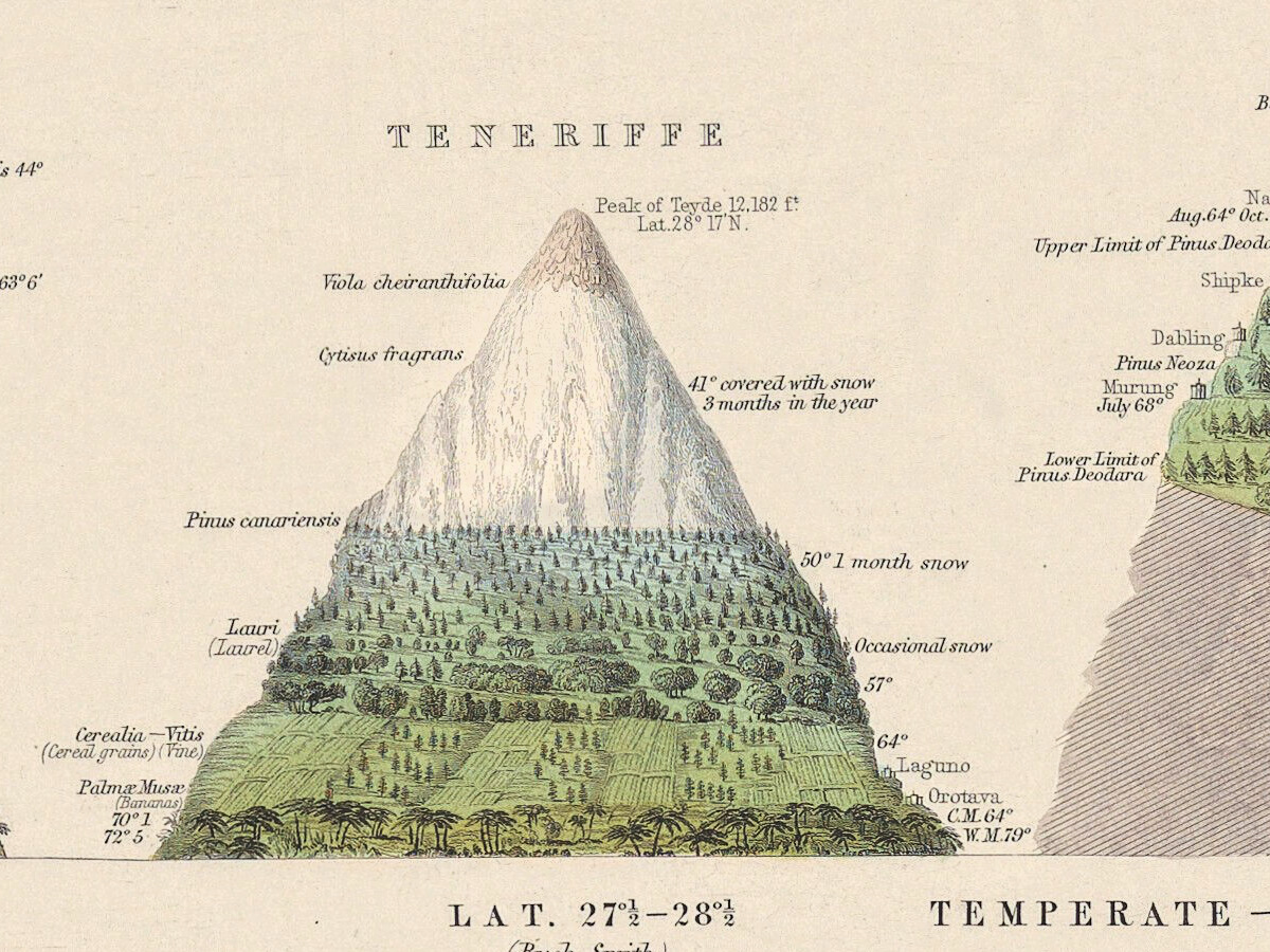
- In the side panels, FORMS OF PLANTS: the dragon tree of Teneriffe, a ladder against its trunk, and the banyan.
Berghaus’s own sheet, Umrisse der Pflanzengeographie, dated 1838 (Gotha, Justus Perthes), is in the David Rumsey Map Collection, with drawings of vegetation in the Andes, Himalayas and Alps above its map. For the edition of 1856 Johnston and the botanist Arthur Henfrey redrew the subject as plate 25, with Schouw’s regions. Wellcome Collection keeps the atlas under EPB/F/960 and publishes this image, L0077829, with the Public Domain Mark; your file is made from that scan.
Everything on this sheet: full record
Every inscription on the sheet
All lettering is engraved. Inscriptions are given letter for letter, with the capitals and punctuation of the sheet; raised letters are written on the line after a point (F.t, C.o, N.o), and fractions as 3880/40. Outside the world map everything legible is listed; on the mountains and the map, the headings, notes and larger names. Latin is translated in square brackets.
- Above the border: upper left PHYSICAL ATLAS; upper right PHYTOLOGY & ZOOLOGY N.o 1.
- Title, upper left of center: OUTLINES OF BOTANICAL GEOGRAPHY. · THE DISTRIBUTION OF PLANTS IN A PERPENDICULAR DIRECTION, · in the Torrid, the Temperate & the Frigid Zones; · WITH INDICATIONS OF THE MEAN TEMPERATURE OF THE YEAR AND OF THE COLDEST AND WARMEST MONTHS. · (Geographiæ plantarum Lineamenta, auct. A de Humboldt) [outlines of plant geography, by A. de Humboldt] · EXTENDED FROM THE DESIGNS OF PROF.R BERGHAUS · BY A.K.JOHNSTON, F.R.G.S.
- Mountain headings, left to right: ANDES, TENERIFFE, HIMALAYA, ALPS & PYRENEES, LAPLAND; at the left a vertical scale headed English Feet, at the right another, English Feet 10,000, 5,000, 0, with Level of the Sea.
- Andes: Nevado de Sorata 25,250 f.t Lat. 16° 10′ S.; Nevado de Illimani 24,200 Lat. 16° 40′ S.; Volcano of Aconcagua 23,200 Lat. 32° 13′ S. (Chile); Chimborazo 21,420 f.t Lat. 1° 21′ S. (Quito); Boussingault & Hall, 16. Dec. 1831. 19,695 f.t; Humboldt, Bonpland, Montufar, 23 June 1802. 19,286 f.t; Cotopaxi 18,880 f.t Lat. 0° 41′ S.; Popocatapetl 17,716 f.t Lat. 18° 59′ N. (Mexico); Probable Limit of snow on Aconcagua; Limit of Great Trees 61°; Cinchonæ, Tree ferns, Palm, Maize, Hordeum; the towns Quito, Mexico, Potosi.
- Teneriffe: Peak of Teyde 12,182 f.t Lat. 28° 17′ N.; Viola cheiranthifolia, Cytisus fragrans, Pinus canariensis, Lauri (Laurel); 41° covered with snow 3 months in the year; 50° 1 month snow; Occasional snow; Laguno, Orotava C.M. 64° W.M. 79°.
- Himalaya: Dhawalagiri 28,000 f.t Lat. 28° 40′ N.; Jewahir 25,749 f.t Lat. 30° 22′.; Purgeool 22,488. Lat. 31° 53′; Cap.t A. Gerard highest station on Purgeool Oct. 1818. 19,411 f.t; Upper Limit of Pinus Deodara, Upper Limit of Pinus Neoza, Snow disappears before the rainy season. Tropical vegetation ceases, Below this point Snow is Unknown; Kedarnath Temple, Budrinath Temple, Cashmere, Saharunpore, Jungle.
- Alps and Pyrenees: Mont Blanc 15,810 Lat. 45° 50′ N. with D. Paccard 8. Aug. 1786 first ascent.; Monte Rosa 15,155 f.t Lat. 45° 56′.; Zumstein 1820. 13,992 f.t highest point attained.; Col du Geant 11,146 f.t De Saussure 3, to 19 July, 1788; Vincent, Aug. 1819. 10,800 f.t highest habitation in Europe during 2 Months; Pic Nethou 11,168 f.t Lat. 42° 38′ N.; Mont Perdu 10,950 f.t Lat. 42° 40′ N.; Hosp. G.t S. Bernard, Briançon 4,284 f.t, Breuil Vil. 6,586 f.t (on M.t Cervin), Gavarnie 4,732 f.t.
- Lapland: Sutitelma 6,175 f.t Lat. 67° 5′ N.; Salix herbacea S. lanata (Willow), Betula alba 27° (W.M. 55°) (Birch), Pinus sylvestris 31° (Scotch fir).
- Under the mountains: TORRID ZONE, LAT. 0°–10° (Humboldt, Bonpland, Pentland.) · LAT. 27°½–28°½ (Buch, Smith) · TEMPERATE — LAT. 29°–32° — ZONE (Herbert, Gerard, Wallich, Govan, Royle.) · LAT. 42°–46° N. (Wahlenberg, Buch, Schouw, Ramond, De Candolle.) · FRIGID ZONE LAT. 68° N. (Buch, Wahlenberg).
- Upper right: Proportional Curves of the MONOCOTYLEDONES to the DICOTYLEDONES on the Swiss Alps; by Osw. Heer., a grid from 14 to 25 Per Centage of the Dicotyledones and from 0 to 9000 F.t, with the curves Limestone Alps and Granite Mountain meeting at Level Land. Below it: NOTE Mean temperature expressed thus, 53° Temperature of the coldest month (C.M. 61°) „ „ warmest „ (W.M. 79°) Names of places &c not botanical are engraved in light characters as Quito.
- Left panel: SYNOPSIS of the PHYTO-GEOGRAPHICAL REGIONS according to Schouw., columns (Region of) and (Explored by), 25 numbered color keys: 1 Saxifrages & Mosses – Wahlenberg; 2 Umbelliferæ & Cruciferæ – Linnæus; 3 Labiatæ & Caryophylleæ – De Candolle; 4 Asters & Solidagos – Michaux; 5 Magnolias – Pursh; 6 Camellias & Celastraceæ – Kämpfer; 7 Scitamineæ – Roxburgh; 8 (Emodic Region) – Wallich; 9 The Asiatic Islands – Rienwardt; 10 Upper Java – Blume; 11 Polynesia – Chamisso; 12 Balsam Trees – Forskal; 13 Deserts – Delile; 14 Tropical Africa – Adanson; 15 Cactuses & Peppers – Jacquin; 16 Table-land of Mexico – Bonpland; 17 Medicinal Barks – Humboldt; 18 Escallonias & Calceolarias – Ruiz & Pavon; 19 West India Islands – Schwartz; 20 Palms & Melastomaceæ – Martius; 21 Arborescent Compositæ – S.t Hilaire; 22 Antarctic Region – D’Urville; 23 Stapelias & Mesembryanthema – Thunberg; 24 Eucalyptus & Epacridaceæ – Brown; 25 New Zealand – Forster.
- Below it: Explanation. Distribution of the family of Palms. · Regions of the Genus Pinus (Pines). · Distribution of the Genus Erica (Heath).; then FORMS OF PLANTS: Magnolia, Asters & Solidagos, Pinus canariensis (the Canary Pine), Dracæna Draco (Dragon-tree Teneriffe).
- Right panel: GRAPHICAL STATISTICS of the most important FAMILIES OF PLANTS. The scale expresses the percentage of all Phanerogamæ., a scale from 0 to 14 against FRIGID ZONE, TEMPERATE ZONE, TORRID ZONE; below, FORMS OF PLANTS: Cocos-nucifera (Cocoa-nut Tree), Saxifraga flagellaris, Tree Fern, Bromelia, Tillandsia (Pine Apple Tribe), Ficus Indica (The Banyan Tree).
- Map title, lower left: THE GEOGRAPHICAL DISTRIBUTION OF PLANTS according to HUMBOLDT’S STATISTICS OF THE PRINCIPAL FAMILIES & GROUPS; SCHOUW’S TWENTY FIVE PHYTO-GEOGRAPHIC REGIONS, and the distribution of the FAMILY of PALMS and the GENERA PINUS (PINE) & ERICA (HEATH).
- Map, lower right: NOTE The fractional numbers express the proportions of Single Plant families to the entire Phanerogamæ — Example; in the Flora of Tropical America the Labiatæ have the quotient 1/40 indicating that this family forms a fortieth part of all the Phanerogamæ of that region, consequently that it consists of 97 Species (3880/40 = 97).
- Flora tables on the map: Flora of North America (Phanerogamæ 2890 Species), Flora of Lapland (Phan. 496. Spec.), Flora of Great Britain (Phanerogamæ 1517 Species. (England 1370 Sp. Scotland 1155 Sp.)), Flora of Germany & Switzerland as representing the temperate zone of the Old World. (Phanerogamæ 3413 Sp.), Flora of Tropical America (Phanerogamæ 3880 Species.), Flora of Tropical Africa (Phanerogamæ 573 Sp., (All the others as in America)), India & Tropical Australia.
- Map, large names and lines: PACIFIC OCEAN, ATLANTIC OCEAN, INDIAN OCEAN, POLYNESIA; Arctic Circle, Tropic of Cancer, Equator, Tropic of Capricorn; Polar Limits of Trees in Europe with Birch, Pine, Oak, Beech, Chesnut, Evergreen Trees; region names such as Saxifrages 1 & Mosses, Umbelliferæ 2 & Cruciferæ, Pinus Abies, Phœnix dactylifera, Palms & Melastomaceæ, Arborescent Compositæ; island counts such as Melville I. Phan. 64 Sp., Mauritius Ph. 619 Sp., Norfolk I. 152 Phan.
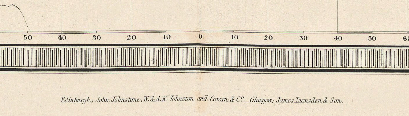
- Below the border: center Edinburgh; John Johnstone, W. & A.K. Johnston and Cowan & C.o _ Glasgow; James Lumsden & Son.; right Engraved by W. & A.K. Johnston.
Discrepancies on the sheet itself: Nevado de Sorata and Illimani are drawn and numbered higher than Chimborazo; Mont Blanc, Illimani, Aconcagua and Purgeool have no f.t after their heights; Chesnut, Popocatapetl, Rienwardt, Sutitelma, Sierra Leoné, Guatimala and MANTCHOURIA are the sheet’s spellings.
Editions and other known copies
- Wellcome Collection, EPB/F/960 (the source of this file, image L0077829): The physical atlas, cataloged under Heinrich Berghaus with A. K. Johnston; Edinburgh: J. Johnstone, 1845; 6, 2, 4 pages, colour maps, folio; “Specimen number. Pt. I only.”; Public Domain Mark. The record does not name the botanical map.
- Wellcome Collection, EPB/F/961: The physical atlas, Divisions I–IV, London: W. Blackwood & Sons, 1849; 4 parts, 30 double colour maps, folio.
- National Library of Scotland, EMW.X.249: Outlines of Botanical Geography, Edinburgh: William Blackwood & Sons, 1848, from The Physical Atlas, “based on Professor H. Berghaus’s Physikalischer Atlas”; 1 map, colored, 65 × 55 cm on a sheet of 71 × 60 cm.
- David Rumsey Map Collection, 12509.080 (seen through its Internet Archive copy): The Geographical Distribution of Plants. Outline of Botanical Geography …, Edinburgh, William Blackwood, title page dated 1850; 51 × 60 cm; the record says the 1850 issue is the first edition of 1848 with only the date changed, with engraved, hand-colored plates.
- David Rumsey Map Collection, 0372.026: Geographical distribution of indigenous vegetation, by A. K. Johnston and Arthur Henfrey, plate 25 of the edition of 1856, imprint 1 May 1854; 52 × 60 cm; scale 1:91,000,000; Phillips 229; the record notes that in this edition most of the maps are lithographed in color, but some are still engraved.
- David Rumsey Map Collection, 2515.048: Heinrich Berghaus, Umrisse der Pflanzengeographie, 5te Abtheilung: Pflanzengeographie, No. 1, Gotha, Justus Perthes, dated 1838, engraved by Johann Carl Ausfeld; 34 × 44 cm; from the 1849 edition of the Physikalischer Atlas.
- Osher Map Library, record 149582: the world map with the same long title (Humboldt’s statistics, Schouw’s twenty-five regions, palms, pines and heaths), from The Physical Atlas of Natural Phenomena; no date or size on the record.
- State Library of New South Wales: a detail of an 1848 copy captioned plate ‘Phytology & Zoology No. 1’.
- National Library of Ireland, LBR 5514 and JLB 5514: The physical atlas, Blackwood, 1848, 30 maps, 57 cm.
None of these records names states of the plate. Ours carries the John Johnstone imprint, while the NLS and Rumsey copies of 1848 and 1850 are recorded under Blackwood; which part of the 1845–1848 issue first carried this sheet is not stated in any record opened.
Catalog entries and sources
Wellcome Collection EPB/F/960, image L0077829; National Library of Scotland EMW.X.249; David Rumsey Map Collection 12509.080, 0372.026, 2515.048; Osher Map Library 149582; National Library of Ireland LBR 5514.
Sources for the story and this record: the records named above; the preface to The Physical Atlas (1848, digitized by e-rara); the 1845 prospectus (Internet Archive; Osher Map Library); Dictionary of National Biography, “Johnston, Alexander Keith (1804–1871)” and “Johnston, William (1802–1888)”; Den Store Danske, “florariger”.
This copy
- The plant regions of the world map are colored in flat washes – pale blue, salmon, yellow, gray, green, deep blue, red and violet – matching the keys of the synopsis; the mountain slopes are tinted green, the snowfields white with pink and blue at their base; apart from the color keys of the synopsis, the side panels are uncolored.
- The central fold runs down the middle of the sheet, through the Himalaya and the imprint, with a small nick at the top edge.
- The paper is evenly toned; light brown stains in the top margin, one above the end of PHYTOLOGY & ZOOLOGY N.o 1, another at the central fold.
- Margins are wide on all sides, widest at the right; no stamp or handwritten mark is visible on the face of the sheet at the resolution examined.
Your file
| Original | Edinburgh, c. 1845, Wellcome Collection EPB/F/960, image L0077829; folio atlas, the record gives no sheet size |
| Scan | full sheet 6971 × 5658 px; the map inside the trimmed border 5854 × 5120 px |
| Print size at 300 dpi | the map prints to 49 cm (19 in), the full sheet with margins to 59 cm (23 in) |
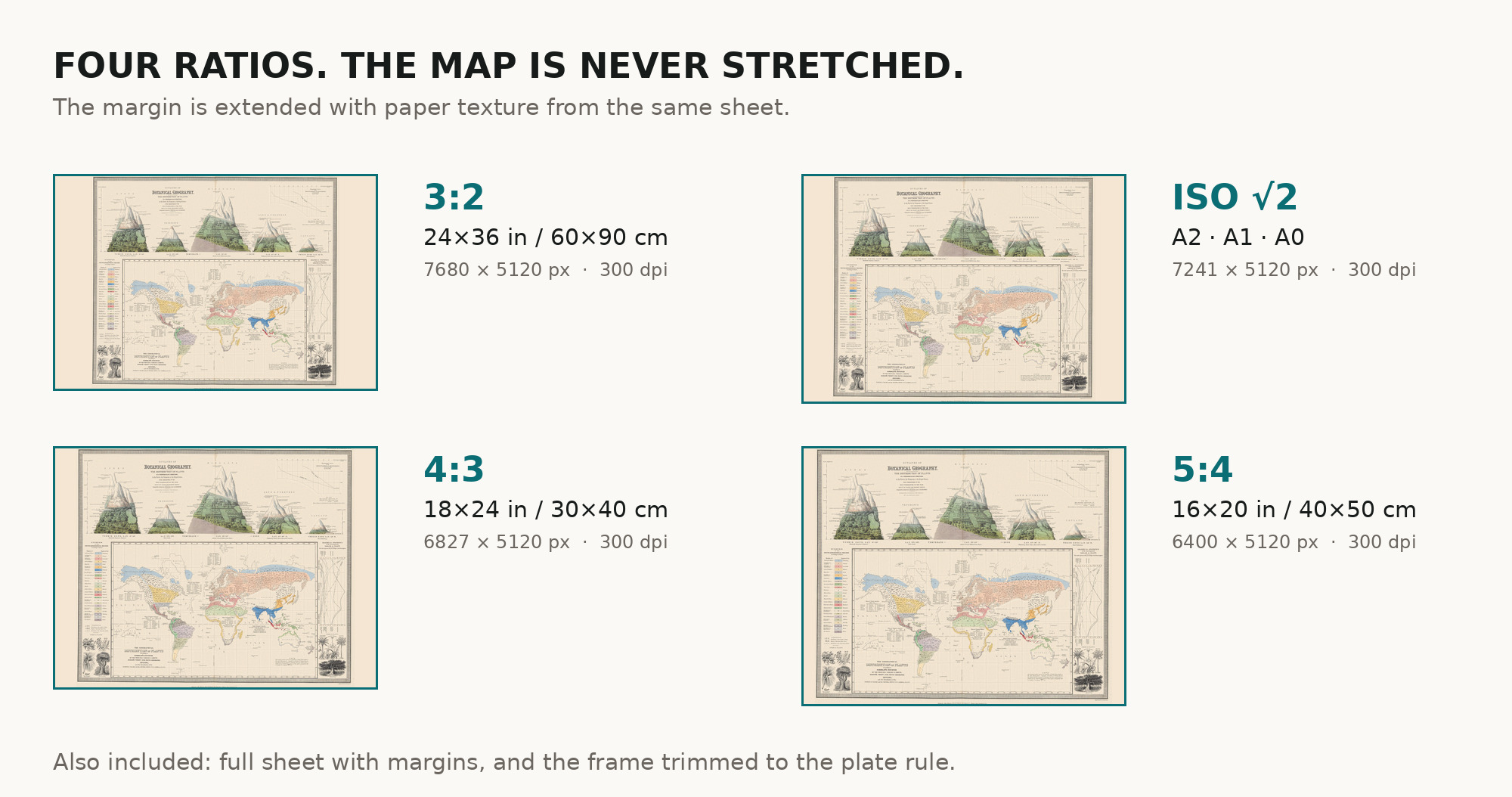
| You download | six ZIP archives: full sheet, trimmed, 3:2, 4:3, 5:4 and ISO A |
| Inside each one | one JPEG at 300 dpi, the restoration passport as a PDF, a READ ME |
How to print
- At 300 dpi the map prints to 49 cm. Pick the archive whose proportions match your frame; ask for matte fine-art paper in sRGB with auto-enhancement off.
- Where to print it: print shops near you and checked prices at online labs.
Source and rights
The file is made from Wellcome Collection’s scan, marked with the Public Domain Mark. The record describes the atlas as having “colour maps” but names neither the printing technique nor the method of coloring. There is no TIFF master in the package. Catalogue record: Wellcome Collection →
Features
- English
Attachments
Reviews
No reviews found
See also
-
 Antique World Map c. 1190 — Sawley Map, Miller Facsimile 1895, Plate 13
-
Antique World Map — Beatus Map Paris II, Miller Facsimile 1895, Plate 2
-
Antique Map of Asia c. 1150 — Jerome Map, Miller Facsimile 1895, Plate 11
-
Antique World Map — Turin Beatus Map, Miller Facsimile 1895, Plate 8
-
Antique World Map 1710 — Hōtan, Nansenbushū Bankoku Shōka
-
Antique Holy Land Map c. 1150 — Jerome, Miller Facsimile 1895, Pl. 12