Antique World Map 1710 — Hōtan, Nansenbushū Bankoku Shōka

Description
An antique Buddhist world map, Kyoto, 1710
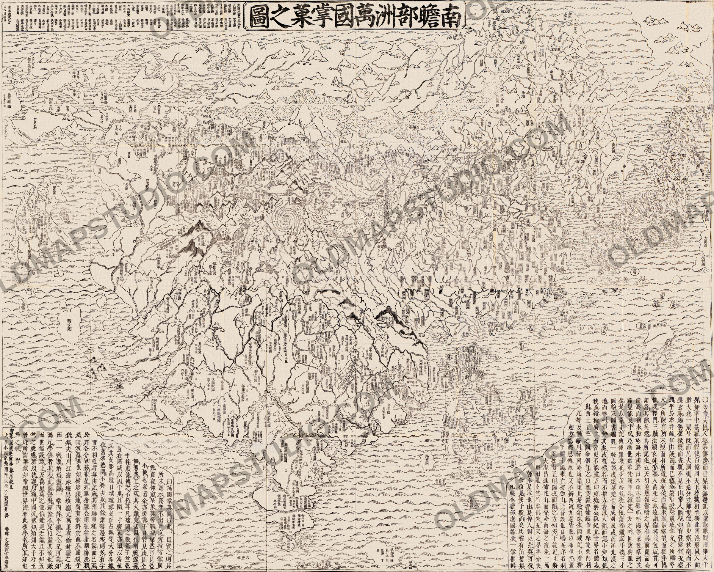
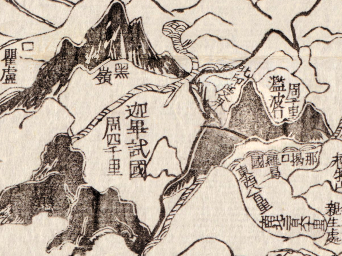
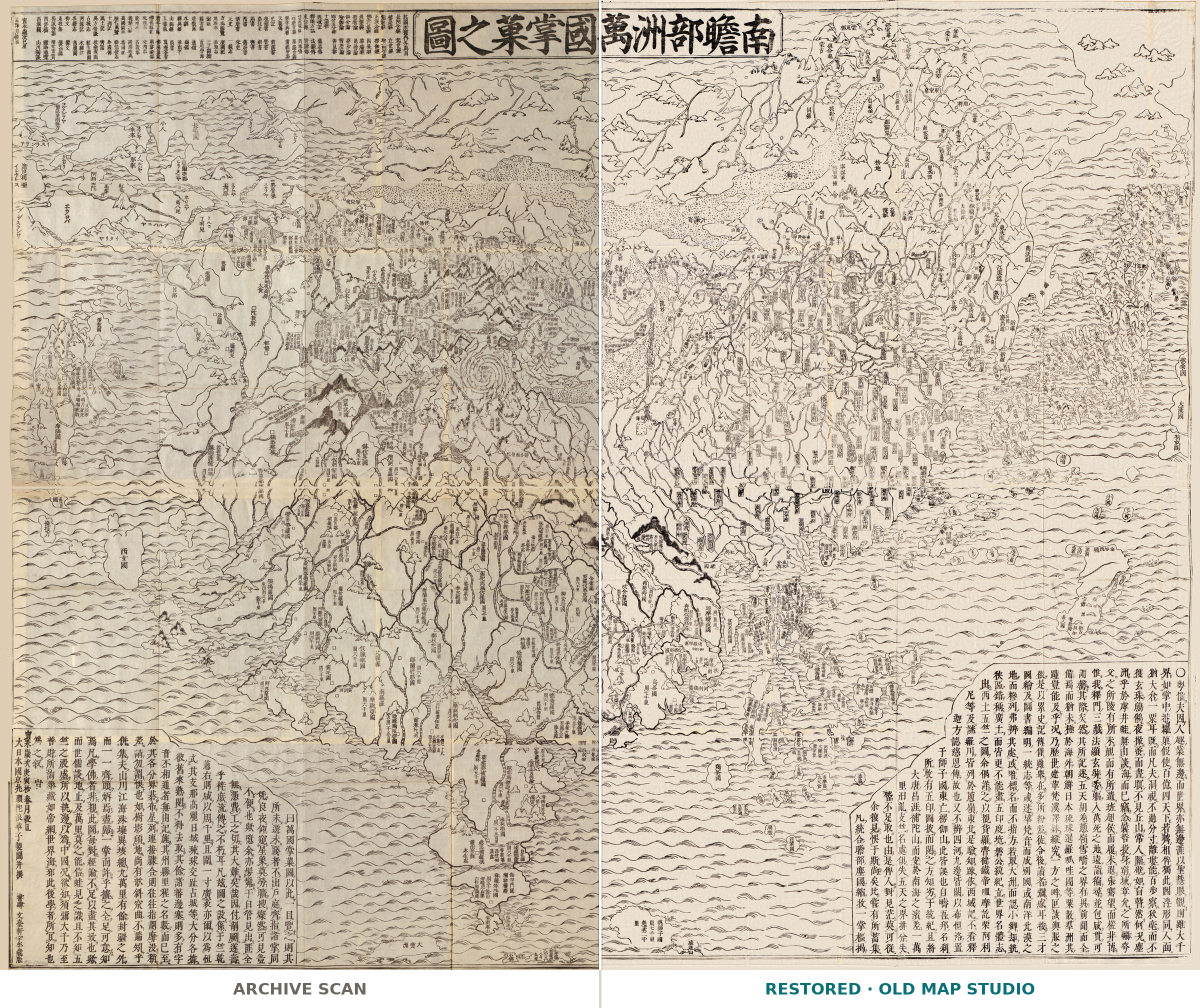
This woodblock map shows the world as Buddhist cosmology describes it: Jambudvīpa, the continent where people live, with Lake Anavatapta at its center. The Library of Congress catalogs it as Nansenbushū bankoku shōka no zu, by Sōshun, published in Kyoto by Bundaiken Uhei in the seventh year of Hōei, 1710. Its record says the map shows the world “based on knowledge from numerous famous Chinese and Japanese classics and Buddhism.” The title runs across the top, 南瞻部洲萬國掌菓之圖, which D. Max Moerman translates as “Handy Map of the Myriad Countries of Jambudvīpa”.
Sōshun is better known as Hōtan (1659–1738), a monk of the Kegon school who restored the Kyoto temple of Kegonji. On the sheet he signs himself 頭陀浪華子, Zuda Naniwashi; Kyoto University Library notes that Naniwashi is said to be Hōtan’s pen name. In a 2021 study in the Hualin International Journal of Buddhist Studies, Moerman calls this “the largest and most detailed Buddhist map of the world ever printed”.
A box to the left of the title lists the books behind the map, more than a hundred of them by Moerman’s count. His chief guide was Xuanzang’s record of his journey to India, although, as Moerman points out, the pilgrim’s route itself is not drawn here. For China Hōtan drew on a Chinese map of the Ming empire first published in 1663, and for Europe on one of the simplified versions of Matteo Ricci’s Jesuit world maps printed in Japan.
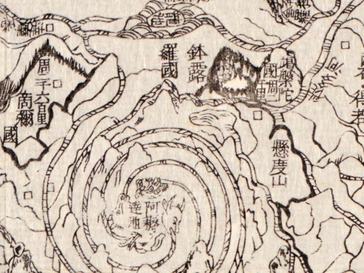
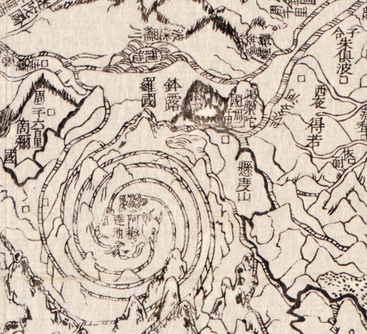
At the center, Lake Anavatapta, 阿耨達池, is drawn as a spiral of mountain rings around a coiled, dragon-like figure. Moerman describes its four outlets as the mouths of a silver ox, a golden elephant, a lapis lazuli horse and a crystal lion, from which the four great rivers flow, the Ganges among them.
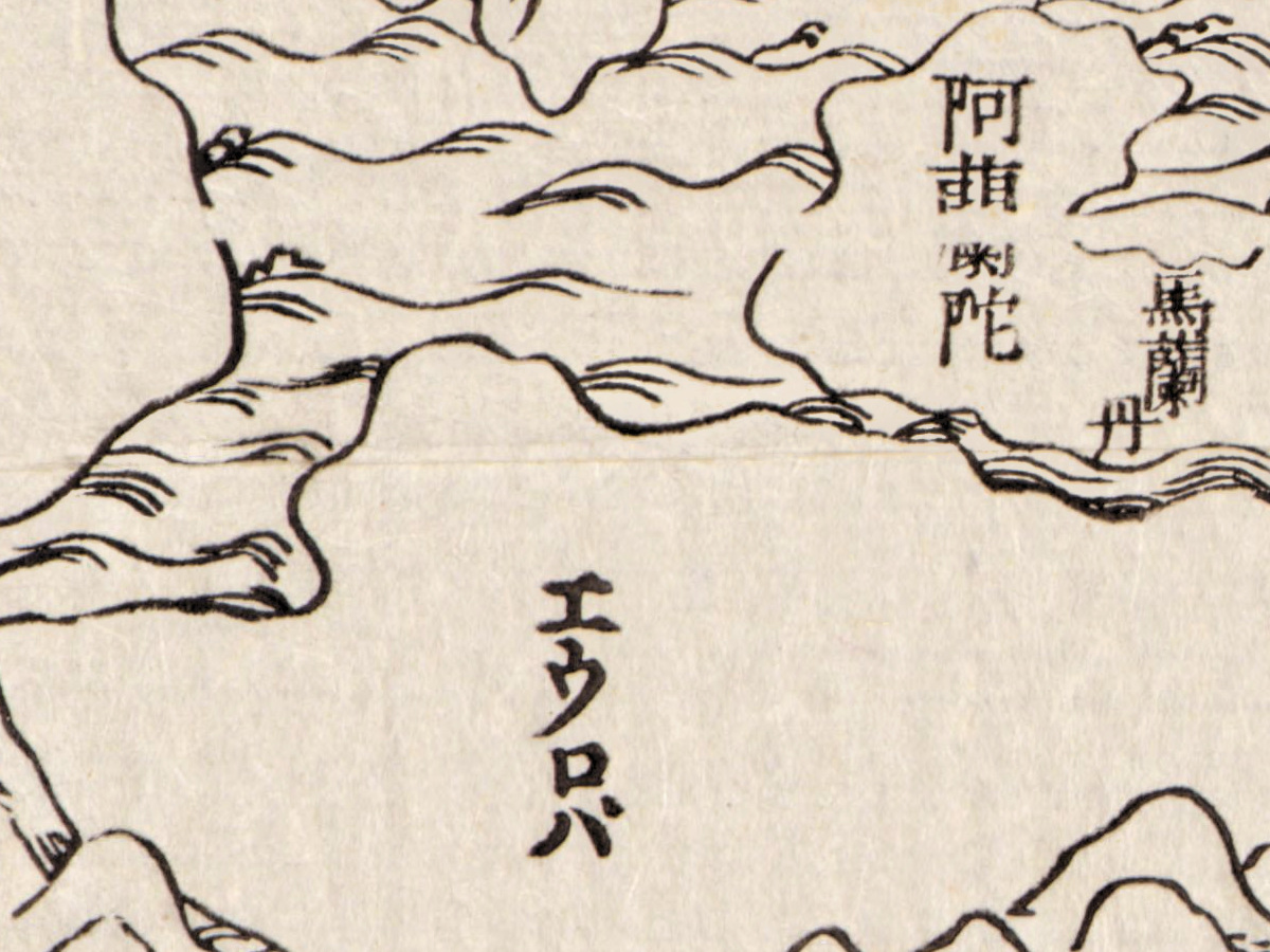
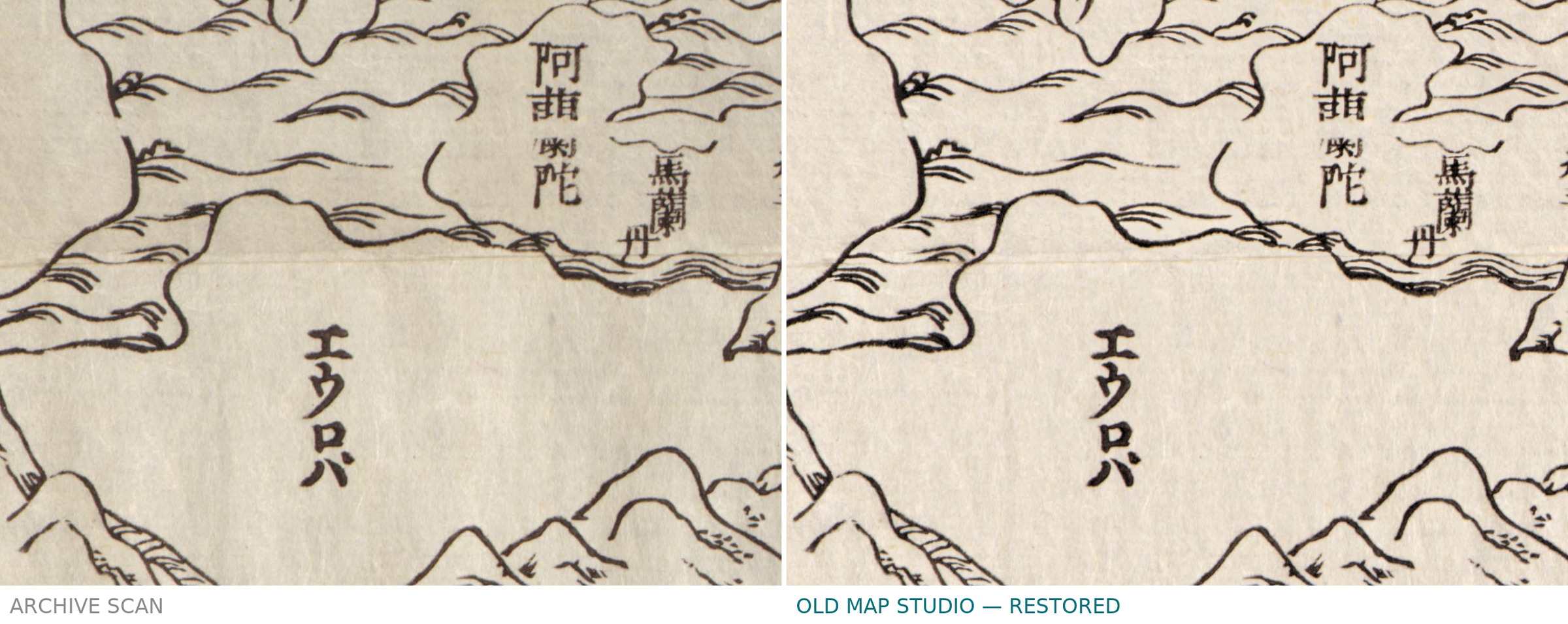
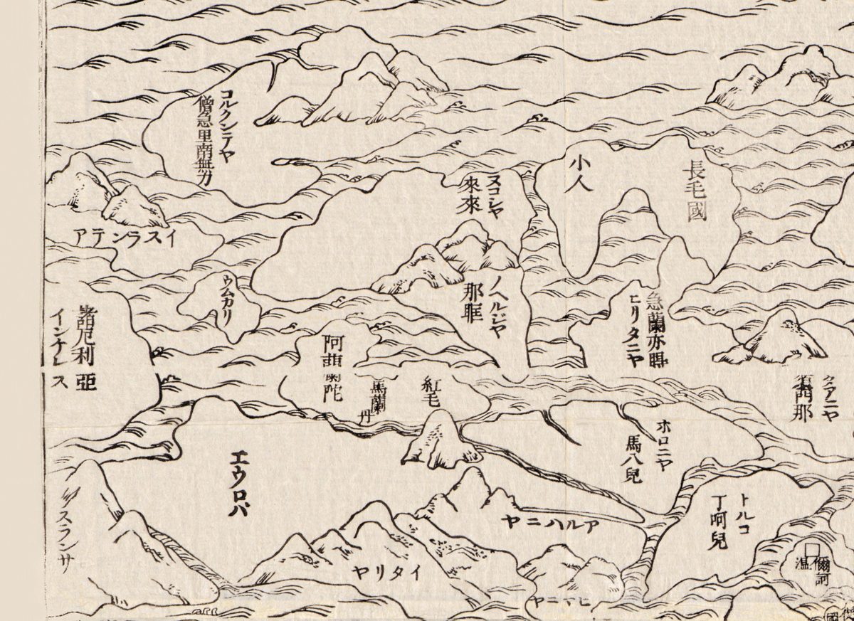
The edges of the Buddhist continent hold something new. According to Moerman, this was the first Buddhist map of the world to include Europe and the Americas within its western and eastern borderlands. In the north-west corner Europe becomes a cluster of islands named in katakana, the largest lettered エウロハ, Europa.
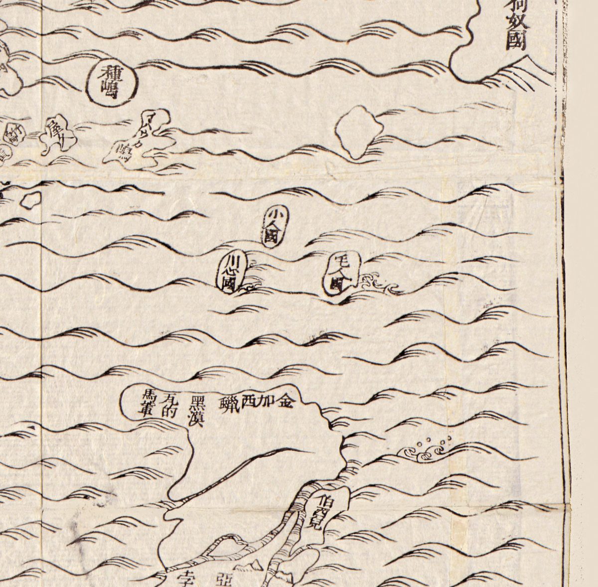
Japan lies near the eastern edge, its provinces named around the capital, 京兆. At the eastern border, lands cut off by the frame are lettered 扶桑國, 大漢國 and 狗奴國, and further south a coast carries the names 金加西蠟 and 伯西兒, Castilla del Oro and Brazil.
What to look for on the sheet
- The box beside the title, headed 此圖所據内外典目, the Buddhist and other books this map is based on; among the titles are 紅毛國圖 and 扶桑國圖.
- The large island 西女國, the Land of Western Women, in the western ocean.
- Below the tip of India, the island 執師子國, Siṃhala, with its circuit given as 周七千里, seven thousand li.
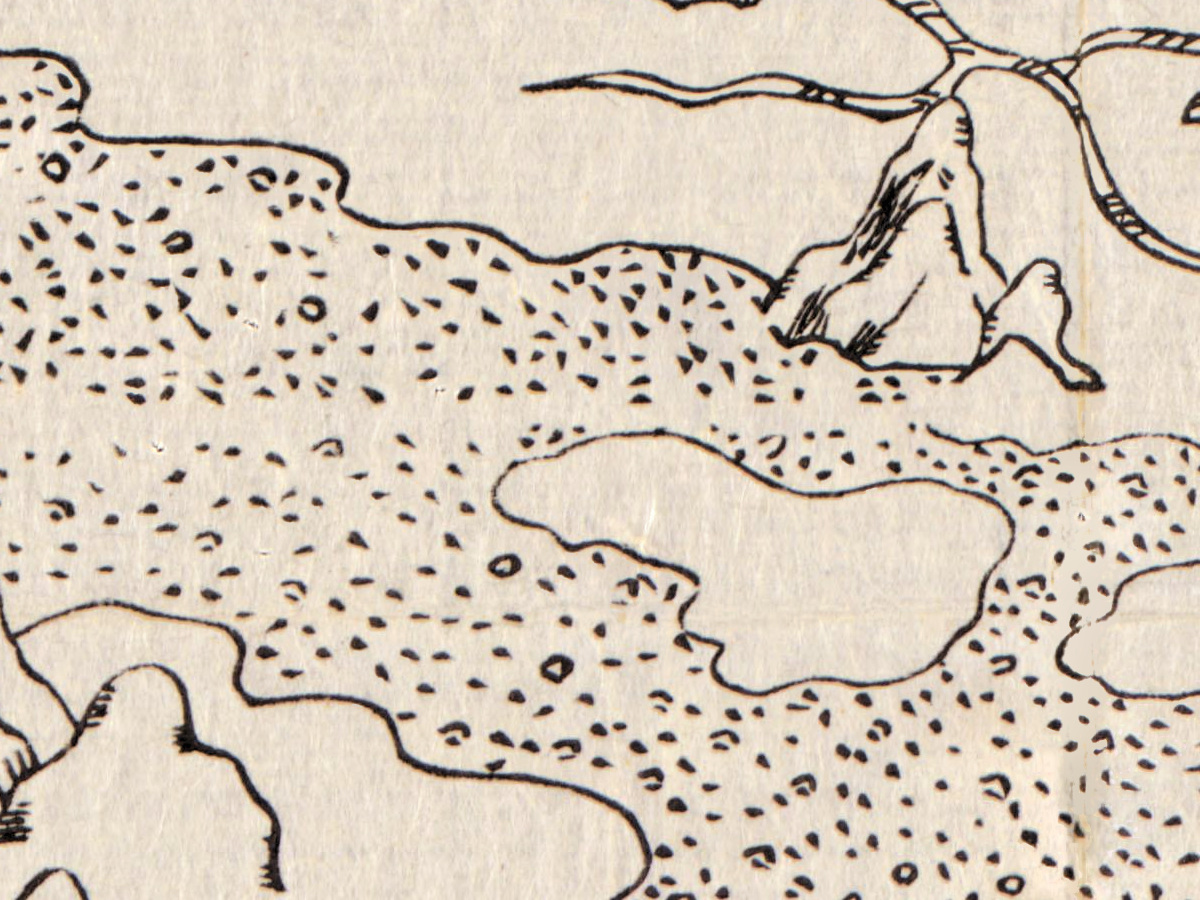
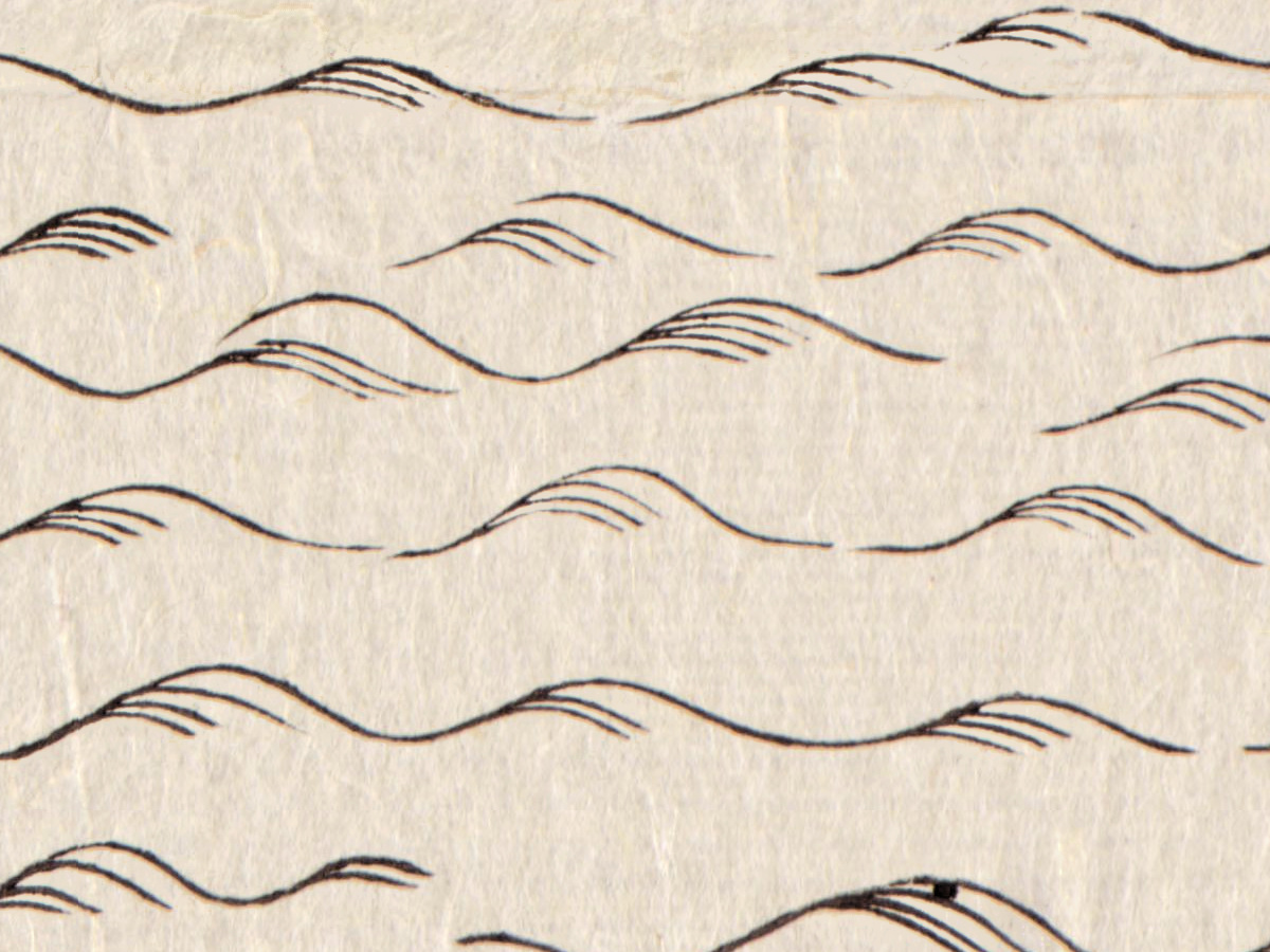
- Seas drawn as waves, deserts as dots; the Library of Congress record notes that depths are shown pictorially.
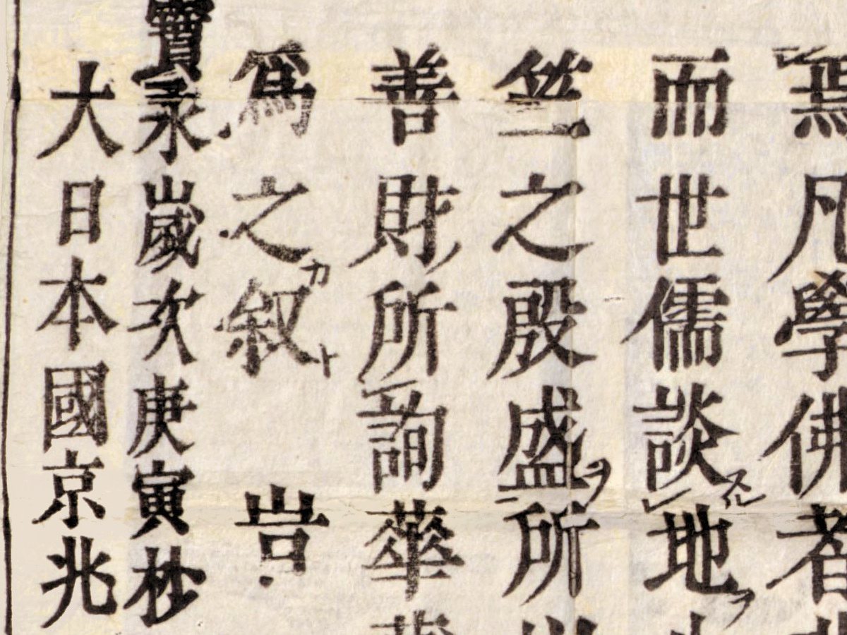
- Hōtan’s preface in the lower corners, ending at the left with the date 寶永歳次庚寅杪春月穀旦, an auspicious day in late spring of 1710, and the signature 大日本國京兆頭陀浪華子製圖并撰.
Moerman notes that the map remained in print for over a century and spawned numerous simplified and reduced editions; a Kyoto University record describes a version of 1744 reduced to about a quarter, with the names in kana. The Library of Congress copy is a woodblock print, 115 × 143 cm, folded into a cover of 24 × 18 cm, kept under G3200 1710 .H61; its record notes that the map and its author, Hōtan, are listed in Imago Mundi’s review of early cartography (vol. 10, 1954), quoting the phrase “prototype of Buddhist world maps”. Your file is made from its scan.
Everything on this sheet: full record
Every inscription on the sheet
The sheet is lettered in Chinese characters, many with small Japanese reading marks beside them, and in katakana for the European names. Inscriptions are given below as printed. The map holds several hundred names; the list gives the texts outside the map in full where we could read them, and inside the map the main names by region. Katakana written horizontally runs from right to left and is given here in reading order. What we could not read with certainty is left out.
- Top center, in a framed panel: 南瞻部洲萬國掌菓之圖 [Handy Map of the Myriad Countries of Jambudvīpa, in Moerman’s translation].
- Top left, a framed list headed 此圖所據内外典目 [catalog of Buddhist and other books on which this map is based], with titles in columns, among them 水經, 山海經, 佛祖統紀, 佛祖通載, 萬國圖志, 紅毛國圖, 扶桑國圖, 高麗圖, 琉球志, 廣州志, 交州志 and 西湖圖; its last two columns carry the date 寶永歳次己丑, followed by a smaller line ending 月穀旦, in the Hōei year that corresponds to 1709.
- Center: 阿耨達池 [Lake Anavatapta] inside the spiral; nearby 懸度山 and 鉢露羅國.
- North-west, Europe as islands: エウロハ, ヒリタニヤ, ノヘルジヤ, ホロニヤ, トルコ, イタリヤ (lettered horizontally), and in characters 紅毛, 長毛國 and 小人.
- Western ocean: the island 西女國 [Land of Western Women].
- South: below the tip of India 秣剌耶山 and 布呾洛迦山; the island 執師子國 with 周七千里 [circuit seven thousand li]; on a small island at the bottom edge 石佛 [stone Buddha].
- East: China with prefectures in rectangular labels ending in 府, 山海關 and 泰山; Korea with 朝鮮, 高句麗, 百濟 and 新羅; Japan with its provinces, the capital 京兆 and the island 種嶋; beyond, at the eastern border, 扶桑國, 大漢國 and 狗奴國; in the ocean the small islands 小人國 and 毛人國; further south a coast with 金加西蠟 and 伯西兒.
- Lower right and lower left: Hōtan’s preface in columns of text, with reading marks; it names the pilgrims 法顯 and 玄奘 and the record 西域記.
- Lower left, at the end of the preface: 寶永歳次庚寅杪春月穀旦 [Hōei, year kanoe-tora, an auspicious day of the last month of spring, that is 1710] and 大日本國京兆頭陀浪華子製圖并撰 [made and written by the mendicant Naniwashi of the capital, Great Japan].
- Bottom left, below the colophon: the publisher’s imprint 書肆 文臺軒… 藏版 [blocks owned by the bookseller Bundaiken], the Bundaiken Uhei of the catalog records; the personal name is hard to read on this scan.
The sheet carries two dates: the list of sources is dated in the Hōei year corresponding to 1709, the colophon of the preface in the following year, 1710. The Iwase Bunko record likewise gives 1709 for the composition and 1710 for the publication, and the Edo-Tokyo Museum dates its copy 1709.
Editions and other known copies
- Library of Congress, G3200 1710 .H61: Nansenbushū bankoku shōka no zu, Sōshun, [Kyoto], Bundaiken Uhei, Hōei 7 [1710]; “1 map ; 115 x 143 cm., folded in cover 24 x 18 cm.”; “Wood block print.”; “Depths shown pictorially.” Your file is made from this copy.
- David Rumsey Map Collection, list no. 5763.001: 115 × 143 cm, hand colored, folded cover 24 × 19 cm, with annotations in red ink.
- University of California, Berkeley, East Asian Library, Japanese map collection A1: 115 × 145 cm, folded 36 × 20 cm.
- Kyoto University Library, Muroga collection, 室賀/YG/21/2-45: woodblock, 117 × 145 cm; the same collection holds the reduced popular version of 1744 by Hanabō Heizō, 52 × 71 cm.
- Iwase Bunko, Nishio: 116.5 × 142.8 cm, cover 23.5 × 18.4 cm.
- Ryukoku University Library, 022-742-1: woodblock printed in black ink (木版墨摺).
- Tohoku University Library, Kano collection, 3/9403/1: colored, folded.
- Edo-Tokyo Museum, 91009656: dated 1709, 117.0 × 141.3 cm.
- Princeton University Library, 6358908, and University of Michigan Library (115 × 145 cm); MacLean Collection, 29629, 114 × 144 cm.
Sizes differ slightly from record to record, between about 114 and 117 cm by 141 to 145 cm; Moerman gives 121 × 144 cm for the Rumsey copy. None of these records names states of the woodblock.
Catalog entries and sources
- Library of Congress, LCCN 96685908, call number G3200 1710 .H61, digital id g3200.ct002184, acquisitions control no. 94-37; subjects “World maps--Early works to 1800”, “India--Maps”, “China--Maps”; note: “Map and author, Hōtan, listed in Imago Mundi’s Review of early cartography, v. 10, 1954.”
Sources for the story and this record: the Library of Congress record; D. Max Moerman, study in the Hualin International Journal of Buddhist Studies 4.1 (2021); Kyoto University Library, records of the 1710 map and of the 1744 reduction; Kotobank, Nihon jinmei daijiten, entry for Hōtan; NDL Search records of the Iwase Bunko and Ryukoku copies; Tohoku University, Edo-Tokyo Museum, David Rumsey Map Collection, UC Berkeley, Princeton, University of Michigan and Leventhal Map & Education Center records.
This copy
The scan shows the map printed in black ink, with no hand coloring; we saw no handwritten notes. The large sheet is built up from joined pieces of paper, and the joins and the folds of the folded map show as faint straight lines across the image. Along the lower part of the left edge a strip of blue-gray paper shows beyond the printed border.
Your file
| Original | Kyoto, 1710, Library of Congress G3200 1710 .H61; woodblock print, 115 × 143 cm |
| Scan | full sheet 17400 × 14066 px; the map inside the trimmed border 17195 × 13788 px |
| Print size at 300 dpi | the map prints to 145 cm (57 in), the full sheet with margins to 147 cm (58 in) |
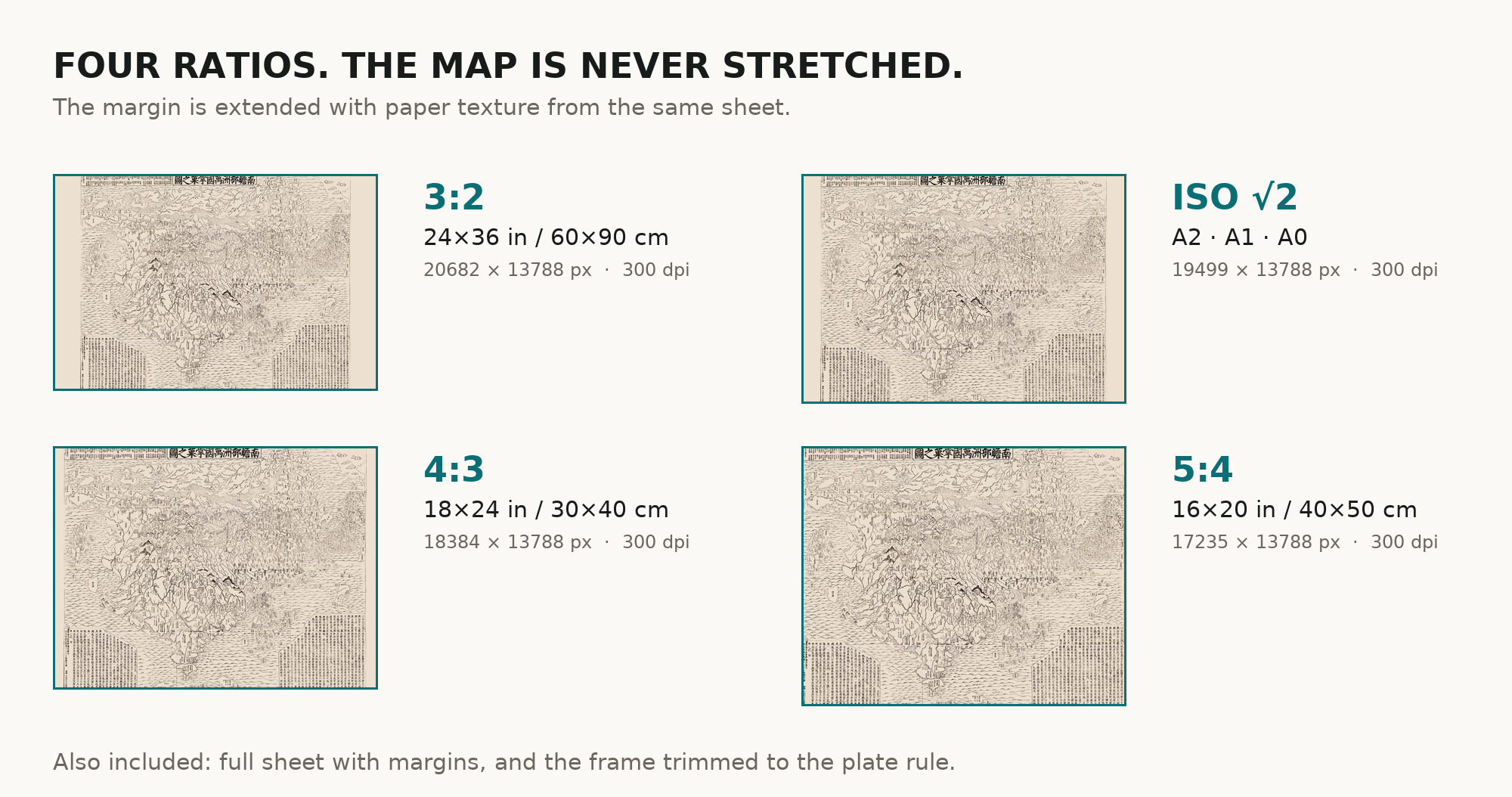
| You download | six ZIP archives: full sheet, trimmed, 3:2, 4:3, 5:4 and ISO A |
| Inside each one | one JPEG at 300 dpi, the restoration passport as a PDF, a READ ME |
How to print
- At 300 dpi the map prints to 145 cm. Pick the archive whose proportions match your frame; ask for matte fine-art paper in sRGB with auto-enhancement off.
- Where to print it: print shops near you and checked prices at online labs.
Source and rights
The Library of Congress states that the content of its Geography and Map Division digitized collections is free to use and reuse unless a rights advisory says otherwise; there is none on this record. The record names the technique as a woodblock print and does not mention color. There is no TIFF master in the package. Catalogue record: Library of Congress →
Features
- Chinese
- Japanese
Attachments
Reviews
No reviews found
See also
-
 Antique World Map 1602 — Mercator & Hondius, Orbis Terrae
-
Antique Map of Asia c. 1150 — Jerome Map, Miller Facsimile 1895, Plate 11
-
Antique World Map 1807 — Hansteen, Abweichungskarten
-
Antique World Map c. 1190 — Sawley Map, Miller Facsimile 1895, Plate 13
-
Antique World Map c. 1816 — Elizabeth Knight, Map of the World
-
Antique World Map c. 1845 — Johnston, Botanical Geography