Antique Map of Asia c. 1150 — Jerome Map, Miller Facsimile 1895, Plate 11


Description
An antique map of Asia from Miller’s Mappaemundi, 1895
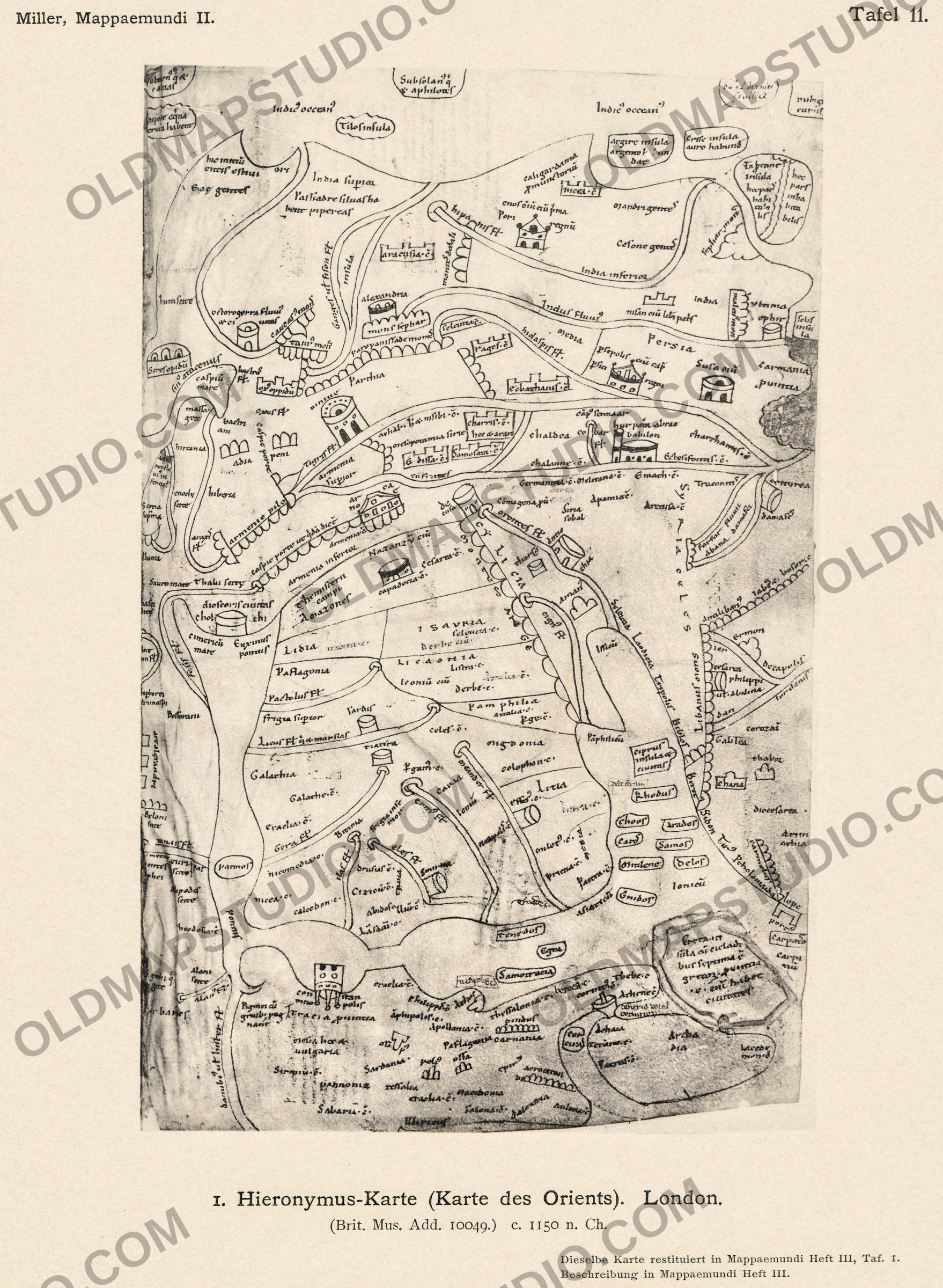
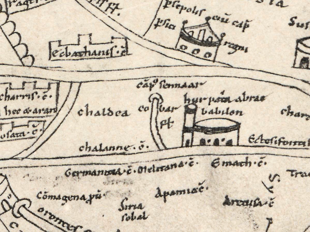
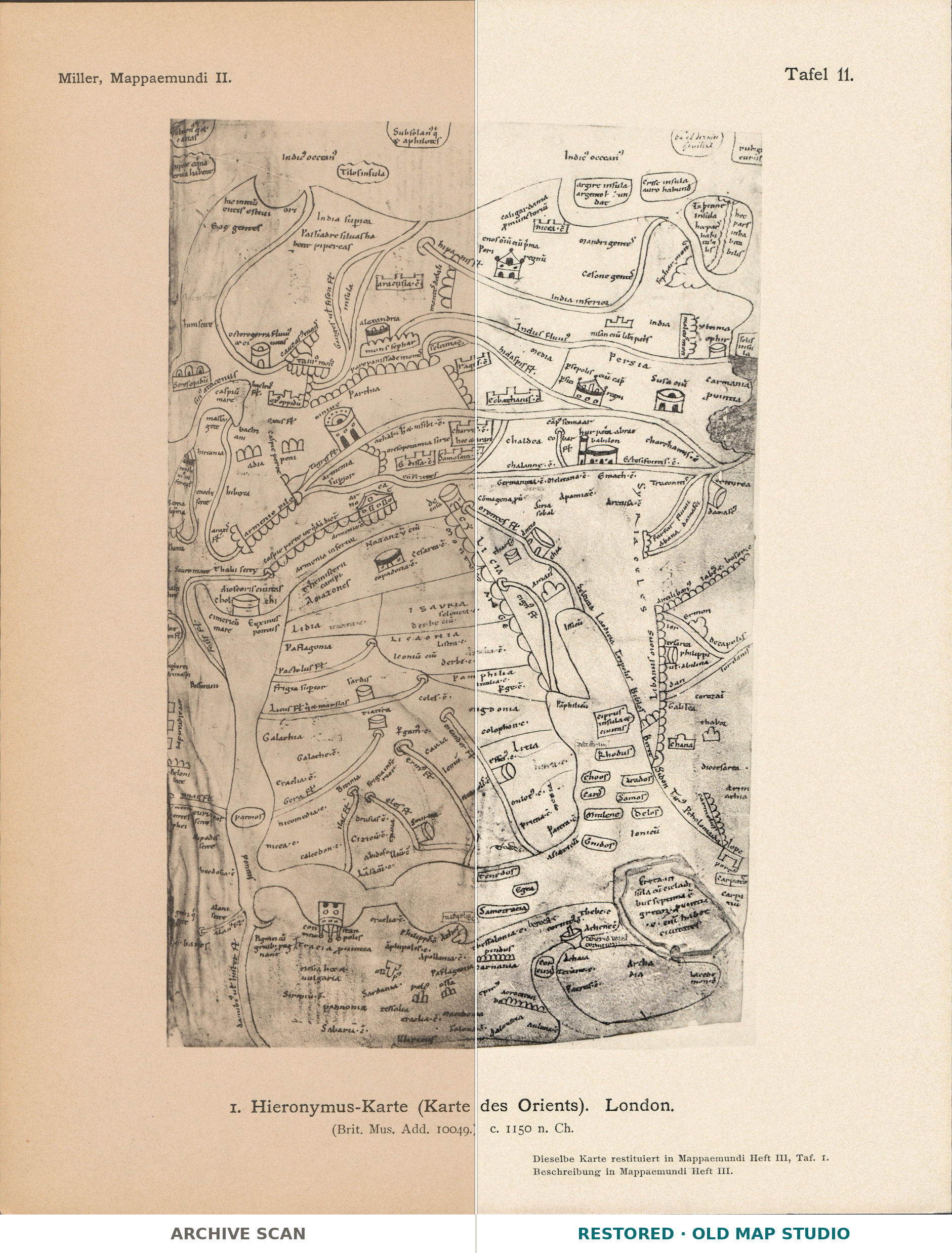
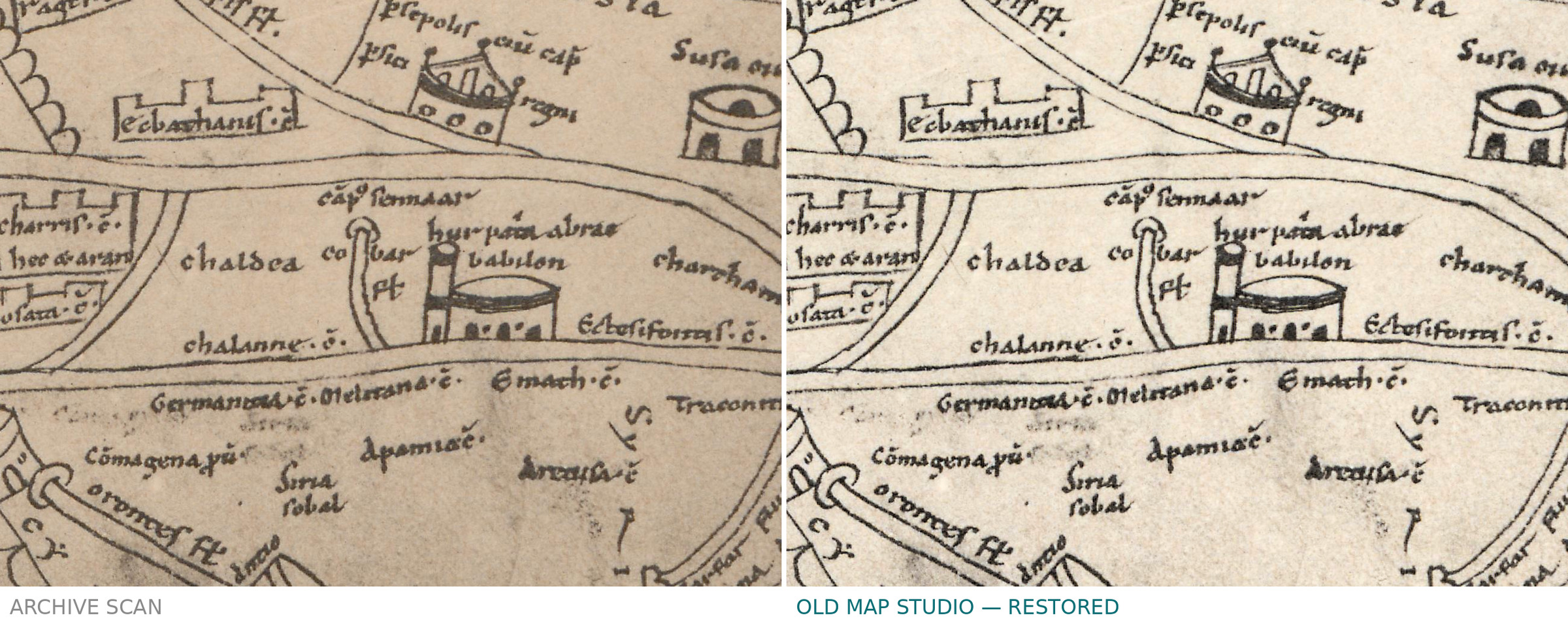
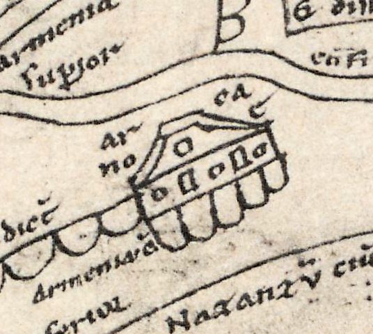
Noah’s ark sits between the mountain chains of Armenia. Beside Babylon a note reads hur patria abrae, Ur, the homeland of Abraham, and next to Constantinople another says that the Pygmies fight the cranes. This sheet is a collotype of a twelfth-century map of Asia, drawn on the last leaf of a manuscript of Saint Jerome’s works in the British Library, Add MS 10049. Konrad Miller printed it as Tafel 11 of the atlas part, Heft II, of Mappaemundi: Die ältesten Weltkarten (Stuttgart, 1895).
The manuscript holds Jerome’s Hebrew Questions on Genesis, his book of Hebrew names and his Latin version of Eusebius’s book of Hebrew places; the British Library catalogues the map as a “tabula geographica” drawn from Jerome’s writings. LauraLee Brott, in a 2024 dissertation on the manuscript, dates the maps to around 1150 and places them at the Benedictine abbey of Saint Martin in Tournai. The map of Asia fills folio 64 recto with 278 inscriptions. East is at the top: the Peloponnese lies at the foot of the leaf, the Indian Ocean along its upper edge.
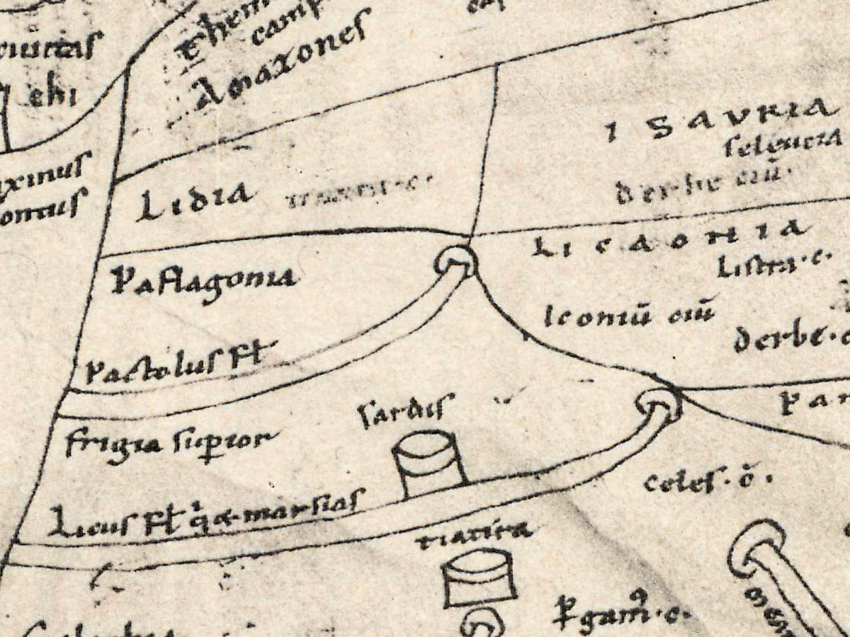
In the words of The History of Cartography, the map “exaggerates Asia Minor—its main point of interest—to the point that it is almost as large as the representation of the rest of Asia”. LauraLee Brott also reports that multispectral imaging found a draft map of Palestine beneath the map of Asia; Theodore Cachey, reviewing Paul Harvey’s book, puts it as “not three maps but four”.
Konrad Miller (1844–1933) was a Catholic priest who taught natural sciences at the Realgymnasium in Stuttgart; from 1895 he published the Mappaemundi, the world maps of the Christian Middle Ages (Neue Deutsche Biographie). The work came out in six parts between 1895 and 1898. A note under this plate refers to Heft III for the description and for a redrawn version of the same map. In Heft VI (1898) Miller wrote that the two maps of Jerome survive in a single copy of about 1150 and that Jerome’s authorship can only be shown indirectly. Harvey, in Medieval Maps of the Holy Land (2012), found no evidence that Jerome drew a map of any kind.
What to look for on the sheet
- Noah’s ark in Armenia: a boat with windows, its name written in pieces around it, ar, ca, no, e.
- Babylon as a tower beside a round building, with hur patria abrae above it and cobar fl, a river, to its left.
- Pigmei cum gruibus pugnant, “the Pygmies fight the cranes”, just north of Constantinople, whose name is split around its gate: con, stan, tino, polis.
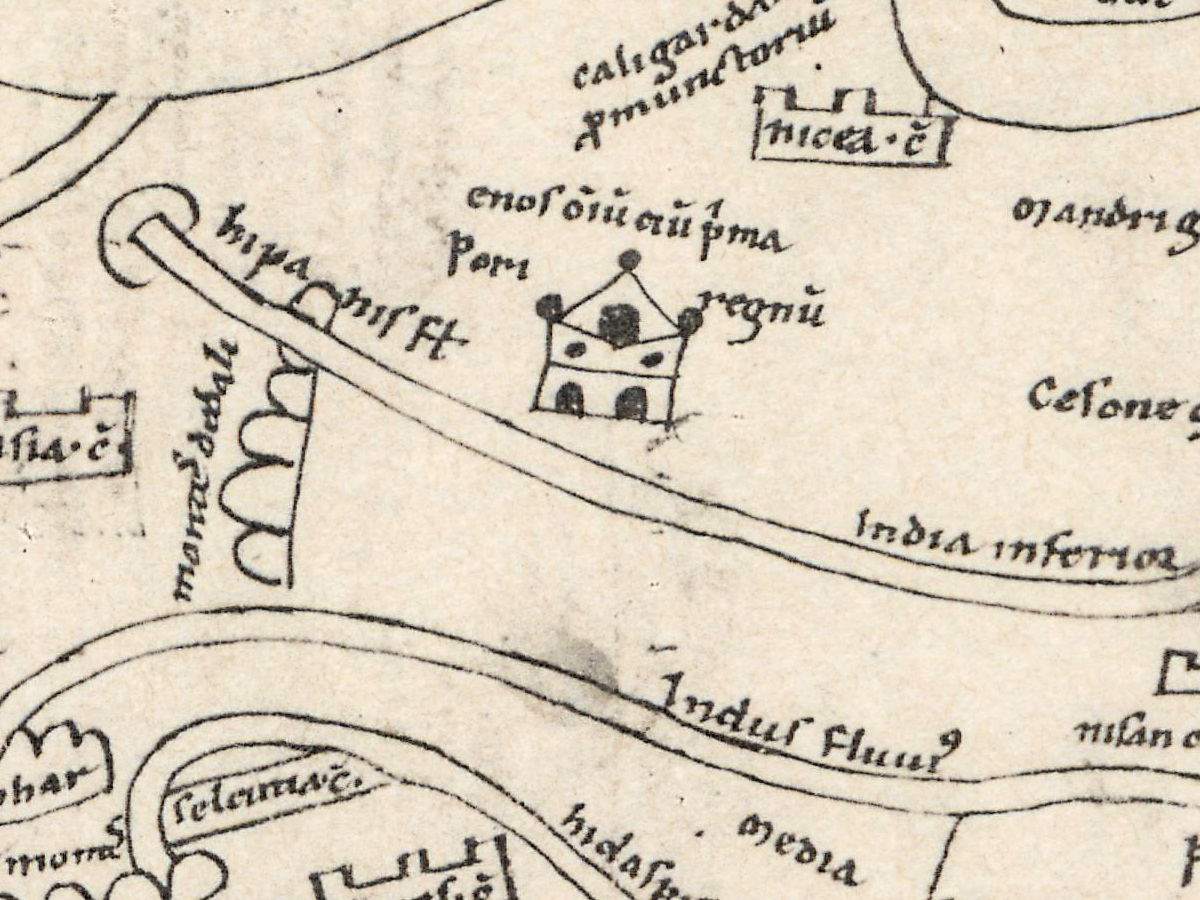
- Upper India, whose people siluas habent pipereas, “have pepper forests”, and the Ganges, labelled Ganges ut fison, with the name of Pison, the first river of Eden in Genesis.
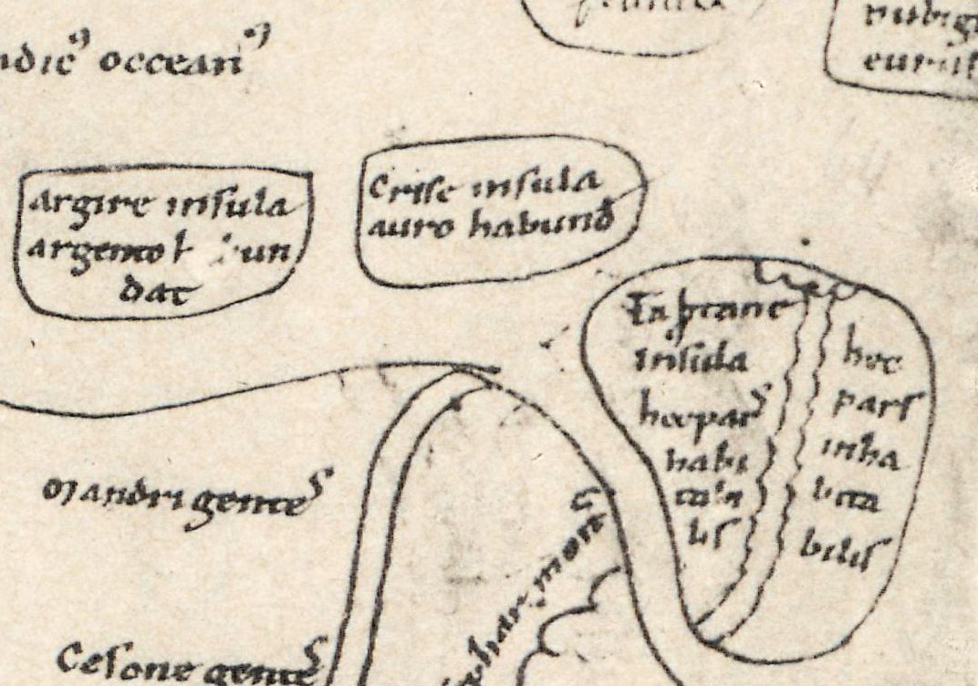
- The islands in the Indian Ocean: Argire insula, Crise insula auro habund, rich in gold, and Taprane insula, divided by a line, with hec pars inhabitabilis, “this part uninhabitable”, on its right half.
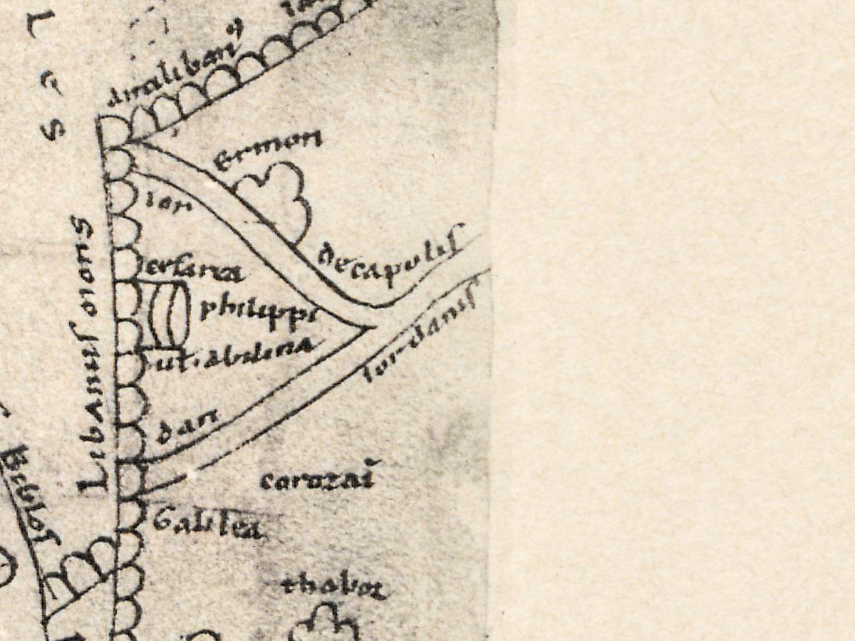
- farfar and abana damasci, the two rivers of Damascus that Naaman praises in the Second Book of Kings.
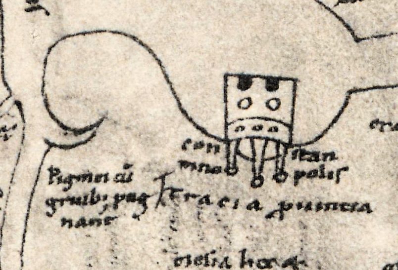
Pliny’s Natural History tells the Pygmy story after Homer: a people warred upon by cranes. The History of Cartography (1987) names the Jerome map of Asia among regional maps so wide in extent that they have been mistaken for fragments of world maps, and says that Beazley’s history of geographical exploration, along with Miller’s volumes, still provides a wealth of detail not available elsewhere. The second Jerome map, of Palestine, on the back of the same leaf, is Tafel 12 of the same atlas.
Everything on this sheet: full record
Every inscription on the sheet
The printed lines of the plate are given in full. The manuscript map carries 278 inscriptions according to Brott; we list those we can read with confidence on this scan, by area, with east at the top. Most abbreviation marks are written out (cum for c with a stroke, patria, damascus); a few common ones are kept as on the sheet: fl for fluvius, c for ciuitas, supior for superior, habund for habundat. Long s is given as s, and words we cannot read are left out.
- Top margin, printed: Miller, Mappaemundi II. on the left, Tafel 11. on the right.
- Bottom margin, printed: 1. Hieronymus-Karte (Karte des Orients). London. [1. Jerome map (map of the Orient). London.] and (Brit. Mus. Add. 10049.) c. 1150 n. Ch.; at the lower right Dieselbe Karte restituiert in Mappaemundi Heft III, Taf. 1. [The same map restored in Mappaemundi Heft III, plate 1.] and Beschreibung in Mappaemundi Heft III. [Description in Mappaemundi Heft III.]
- Upper edge, the ocean: Indicus oceanus twice; Subsolanus qui et apheliotes in a framed box [the east wind, also called apheliotes]; Tilos insula; Argire insula argento habundat [Argyre island abounds in silver]; Crise insula auro habund [Chryse island, abounding in gold]; Taprane insula, its right half hec pars inhabitabilis [this part uninhabitable]. In the box at the upper left corner, equina crura habent [they have horses’ legs]. A framed note at the upper right is a later addition in French, reading … et dernier feuillet [… and last leaf].
- India and Persia (upper third): India supior; siluas habent pipereas [they have pepper forests]; Ganges ut fison fl; insula; aracusia c; alexandria; mons sephar; caucasus mons; taurus mons; paropanisade montes; India inferior; India; ophir; Persia; persepolis; Susa; carmania; media; hidaspis fl; ecbatanis c; Parthia.
- Mesopotamia (middle right): chaldea; babilon; hur patria abrae [Ur, homeland of Abraham]; cap sennaar; cobar fl; chalanne c; charris c hec et aran [Carrhae, which is also Haran]; Edissa c; Samosata c; ninive; tigris fl.
- Armenia and the Caspian (middle left): the letters ar, ca, no, e around the ark; armenie pile [Armenian gates]; caspie porte ut quidam dicunt [Caspian gates, as some call them]; armenia supior; armenia inferior; caspium mare; massagete; hircania; bactriani; hiberia; albania; capadocia c; Cesarea c.
- The Black Sea (left of centre): Euxinus pontus; cimericum mare; chol and chi on either side of a tower, with dioscoris ciuitas above; Amazones; campi; Sauromate; Bosforani.
- Asia Minor (lower centre): Lidia; Paflagonia; Pactolus fl; frigia supior; Licus fl qui et marsias [the Lycus, also called Marsyas]; sardis; Galathia; Bitinia; nicomedia; nicea c; calcedon c; troia; Abidos; ISAURIA; LICAONIA; iconium; derbe c; Listra c; Pamphilia; colophon c; parmos in an oval beside the strait.
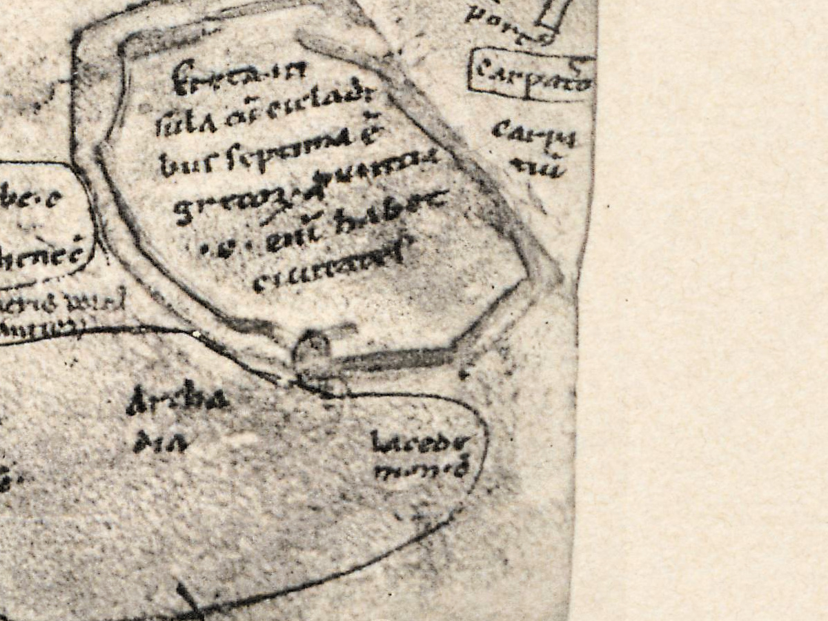
- Islands of the Aegean (lower right): ciprus insula et ciuitas; Rhodus; choos; Samos; delos; Gnidos; tenedos; Samotracia; Creta, in a large frame with a longer note we do not transcribe.
- Syria and Palestine (right edge): damascus at the city; farfar fluuii and abana damasci along the river; Seleucia; Laodicia; Tripolis; Biblos; Libanus mons; Sidon; decapolis; iordanis; Galilea; chana; thabor; diocesarea; ermon.
- Europe (bottom): con, stan, tino, polis around the gate of Constantinople; Pigmei cum gruibus pugnant [the Pygmies fight the cranes]; Tracia; uulgaria; pannonia; Sirmium c; Sabaria c; Paflagonia; tessalia; ossa; thessalonia c; thebe c; Athene c; achaia; archadia; lacedemonia; epirus; dalmatia; danubius ut hister fl along the left.
- Left edge (north), partly cut by the dark strip of the photograph: alani scite; alani fl; theodosia c; arimaspi.
Discrepancies on the sheet itself. The Caspian gates are labelled twice: caspie porte written upright beside a gate building near peni, and caspie porte ut quidam dicunt along the mountain chain that runs to the ark; the Armenian gates, armenie pile, stand on a parallel chain close by. Two rivers carry a second name joined by ut: Ganges ut fison and danubius ut hister. Paflagonia is written twice, once in Asia Minor and once in the European strip at the bottom. An island named parmos (perhaps Patmos) stands in an oval in the strait beside Nicomedia, away from the other Aegean islands. The ark’s name is not written as one word but in four pieces around the drawing.
Editions and other known copies
- ETH Library Zurich, Rar K 257: 2, digitized on e-rara (record 11583321, plate image 11583336; DOI 10.3931/e-rara-38523), the copy scanned for this file. The record, as quoted on the product page, reads “Die ältesten Weltkarten / 2 Atlas von 16 Lichtdruck-Tafeln : von Konrad Miller”, Jos. Roth’sche Verlagshandlung, 1895, 16 plates, with contents “Psalter-Karte, Beatus, Cotton Map, Hieronymus, Heinrich von Mainz, Higden”.
- Service hydrographique de la Marine, Paris (French Ministry of Defence digital libraries): Mappaemundi: die ältesten Weltkarten by Konrad Miller (1844-1933), Stuttgart, Jos. Roth’sche Verlagshandlung, 1895-1898, six volumes with maps, 30 cm, including the Atlas von 16 Lichtdruck-Tafeln; the record gives no shelfmark.
- Technisches Museum Wien, library: Mappae Mundi - Die ältesten Weltkarten, “Herausgegeben und erläutert von Konrad Miller”, Stuttgart, Roth’sche Verlagshandlung, Hefte I–VI including “II. Atlas von 16 Lichtdrucktafeln”; the record gives no year.
- Biblioteka Uniwersytecka w Toruniu, Kartografia 042: Heft 4 only, Die Herefordkarte, Stuttgart, Jos. Roth’sche Verlagshandlung, dated 1896, 30 cm, with one folded map. The date differs from the 1895 of the ETH atlas record; the parts appeared one after another.
- University of California copy, scanned by Google and on the Internet Archive (OCLC 214277877): Heft VI, Rekonstruierte Karten, title page dated 1898. Its text refers back to Heft III for the two Jerome maps.
- None of these records names states of the plate.
Catalog entries and sources
ETH Library Zurich, Rar K 257: 2; e-rara 11583321 (atlas) and 11583336 (this plate); DOI 10.3931/e-rara-38523. The manuscript: British Library, Add MS 10049, folio 64 recto. Sources for the story and this record: the e-rara record as quoted on the product page; the British Library manuscripts catalogue; L. Brott, The Holy Land within the Manuscript: Performative Cartography in British Library Additional Manuscript 10049, dissertation, University of Wisconsin–Madison, 2024; D. Woodward, “Medieval Mappaemundi”, in The History of Cartography, vol. 1 (1987); T. J. Cachey, review of P. D. A. Harvey, Medieval Maps of the Holy Land, in The Medieval Review (2014); Neue Deutsche Biographie, “Miller, Konrad”; K. Miller, Mappaemundi, Heft VI (1898); the records of the French Ministry of Defence libraries, Technisches Museum Wien and the Toruń University Library; Pliny, Natural History, book 7; the Bible, Genesis 2 and 2 Kings 5.
This copy
The plate is printed in black on cream paper; the photograph of the manuscript leaf sits in the upper part, with the printed heading above it and the caption and notes below. The leaf’s edges show in the photograph: a dark vertical strip runs down the left side and cuts off the first letters of several names, and the lower edge of the leaf is uneven. A thin pale line crosses the upper left corner of the photograph, and a dark patch stands at the right edge beside carmania. The printed margins are clean, with no stamps or pencil notes visible on the scan.
Your file
| Original | Konrad Miller, Mappaemundi, Heft 2 (atlas), Stuttgart: J. Roth, 1895, Tafel 11; after British Library Add MS 10049, fol. 64r |
| Scan | full sheet 5361 × 6842 px; the map inside the trimmed border 4630 × 6320 px |
| Print size at 300 dpi | the map prints to 53 cm (21 in), the full sheet with margins to 57 cm (22 in) |
| You download | six ZIP archives: full sheet, trimmed, 3:2, 4:3, 5:4 and ISO A |
| Inside each one | one JPEG at 300 dpi, the restoration passport as a PDF, a READ ME |
How to print
- The sheet is upright. At 300 dpi the plate prints to 53 cm. Pick the archive whose proportions match your frame; ask for matte fine-art paper in sRGB with auto-enhancement off.
- Where to print it: print shops near you and checked prices at online labs.
Source and rights
The scan comes from e-rara.ch, the Swiss platform for digitized rare books (plate image 11583336). Its record of the atlas, DOI 10.3931/e-rara-38523, reads “Die ältesten Weltkarten / 2 Atlas von 16 Lichtdruck-Tafeln : von Konrad Miller”, Jos. Roth’sche Verlagshandlung, 1895, 16 plates, and lists its contents as “Psalter-Karte, Beatus, Cotton Map, Hieronymus, Heinrich von Mainz, Higden”. Konrad Miller died in 1933; the plates are in the public domain. The scanned copy is held by ETH Library Zurich, shelfmark Rar K 257: 2 (e-rara record 11583321), and carries the Public Domain Mark. The plate is captioned “1. Hieronymus-Karte (Karte des Orients). London. (Brit. Mus. Add. 10049.) c. 1150 n. Ch.”. The size of the plates is not given here, and color is not stated. There is no TIFF master in the package. Catalogue record: e-rara →
Features
- Latin
Attachments
Reviews
No reviews found
See also
-
 Antique World Map 1710 — Hōtan, Nansenbushū Bankoku Shōka
-
Antique World Map c. 1190 — Sawley Map, Miller Facsimile 1895, Plate 13
-
Antique World Map 1602 — Mercator & Hondius, Orbis Terrae
-
Antique World Map c. 1845 — Johnston, Botanical Geography
-
Antique World Map 1807 — Hansteen, Abweichungskarten
-
Antique World Map — Beatus Map Paris II, Miller Facsimile 1895, Plate 2