Antique World Map c. 1190 — Sawley Map, Miller Facsimile 1895, Plate 13


Description
An antique world map from Miller’s Mappaemundi, 1895
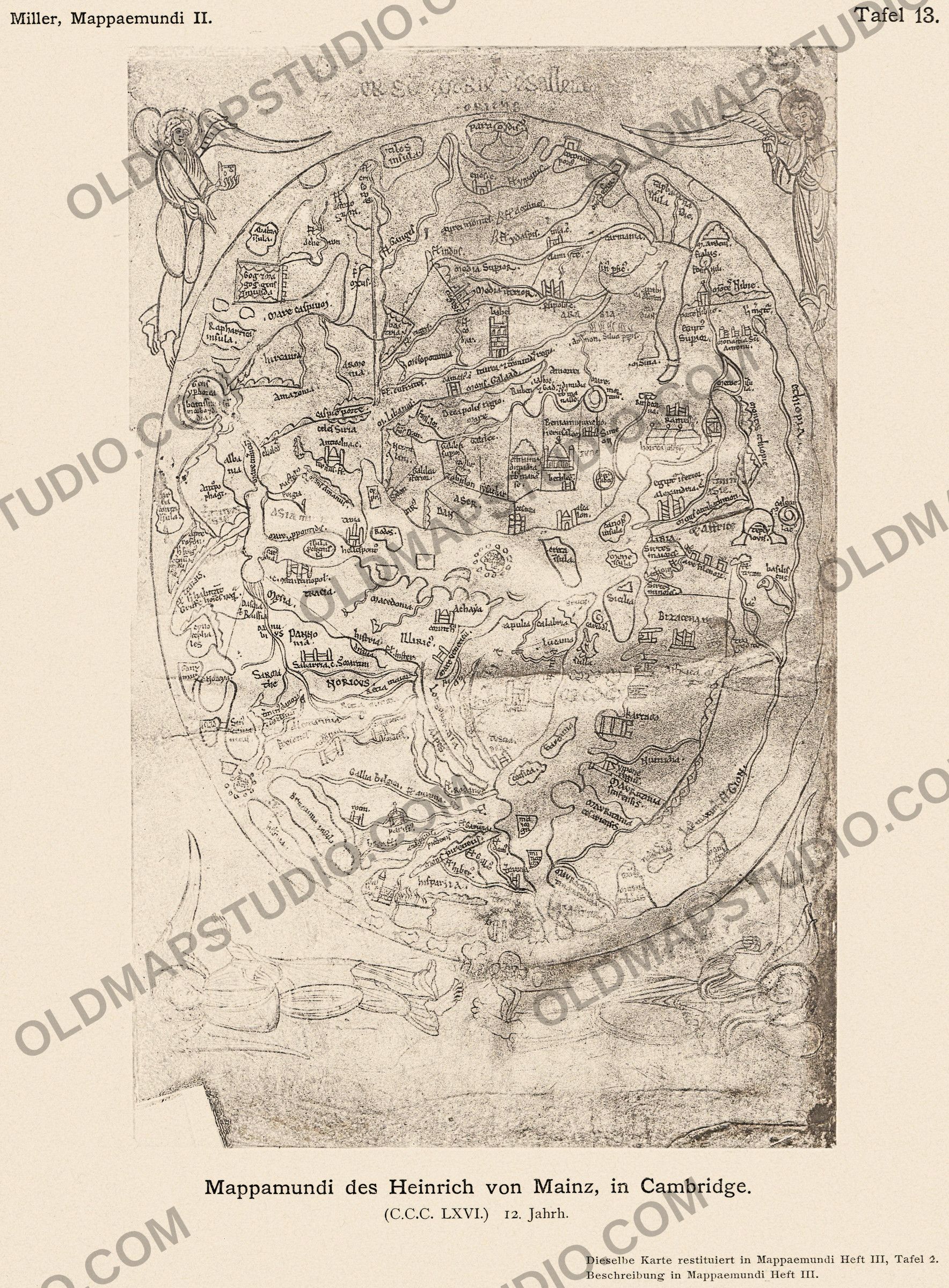
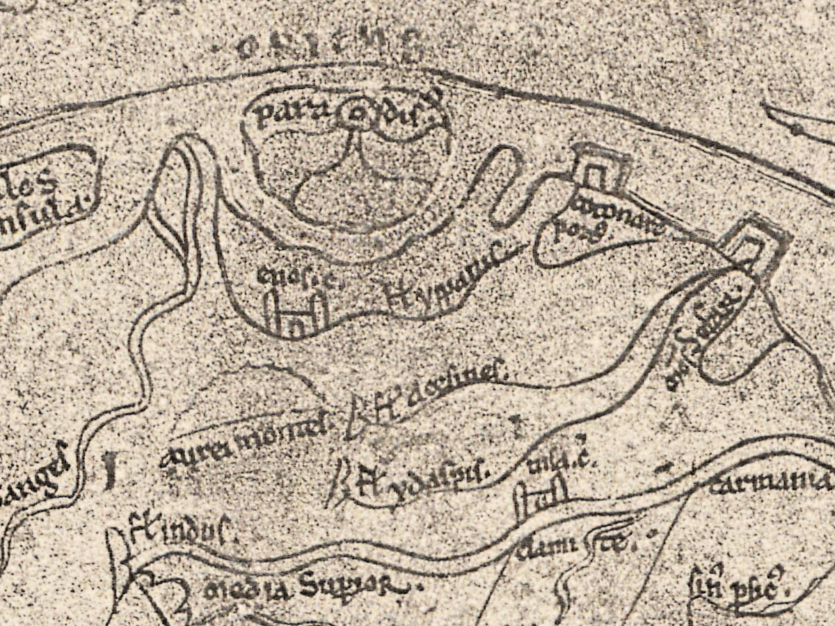
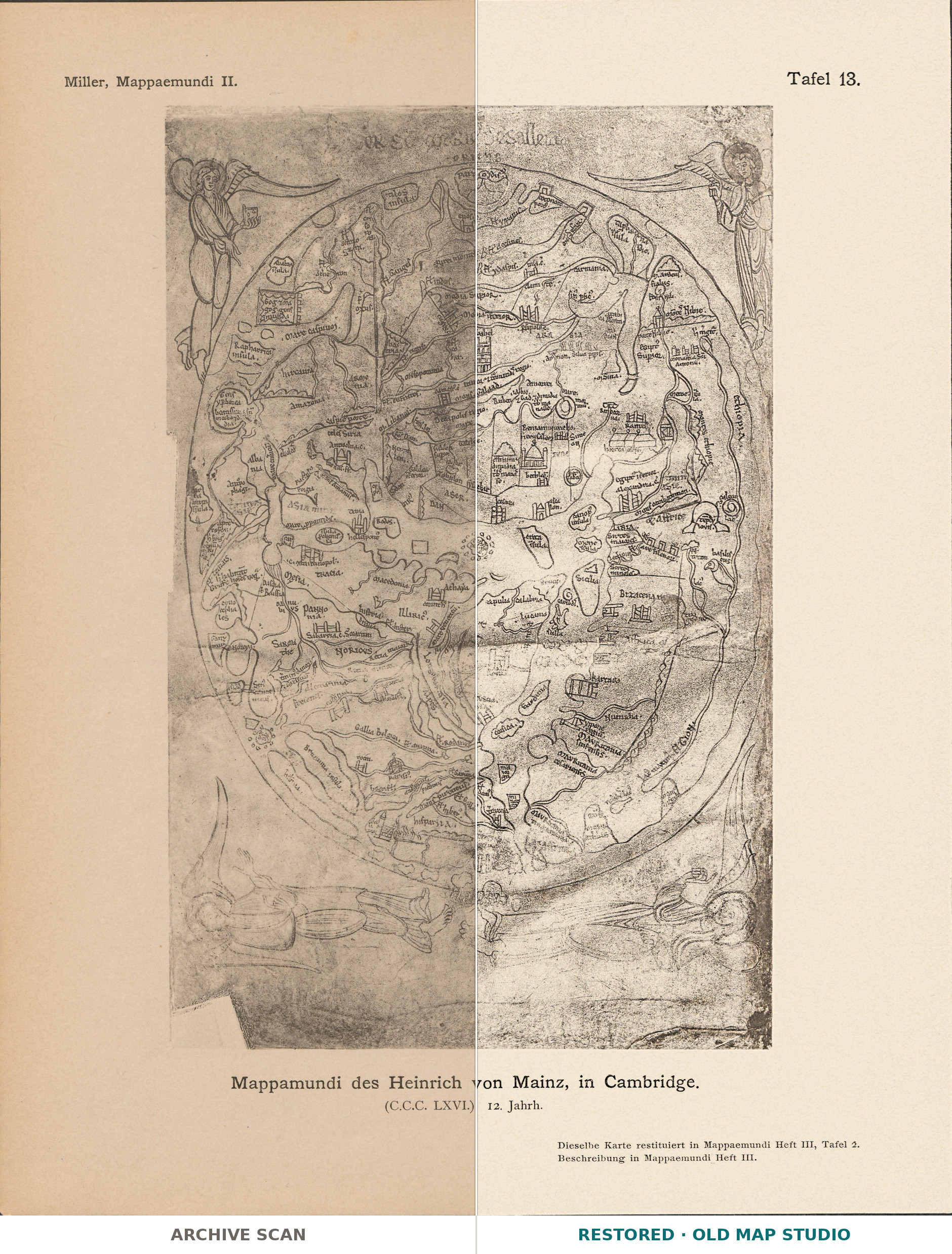
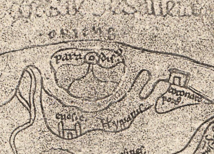
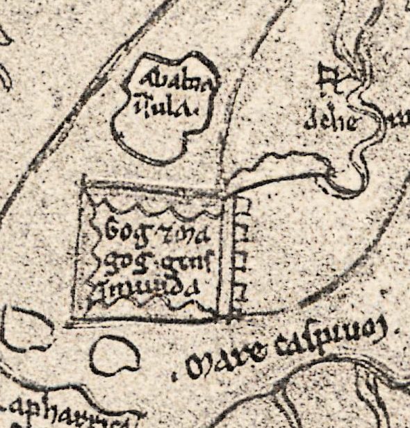
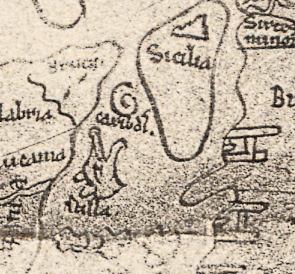
Paradise sits at the top of the world, under the word ORIENS, the east. Below it, in a walled enclosure in the far north-east, a note reads Gog et ma gog gens immunda, “Gog and Magog, an unclean people”, and near Sicily the whirlpool of Charybdis spirals beside Scylla. This sheet is a collotype of the Sawley map, an English world map of the twelfth century in Corpus Christi College, Cambridge, MS 66. Konrad Miller printed it as Tafel 13 of the atlas part, Heft II, of Mappaemundi: Die ältesten Weltkarten (Stuttgart, 1895), under the caption Mappamundi des Heinrich von Mainz, in Cambridge.
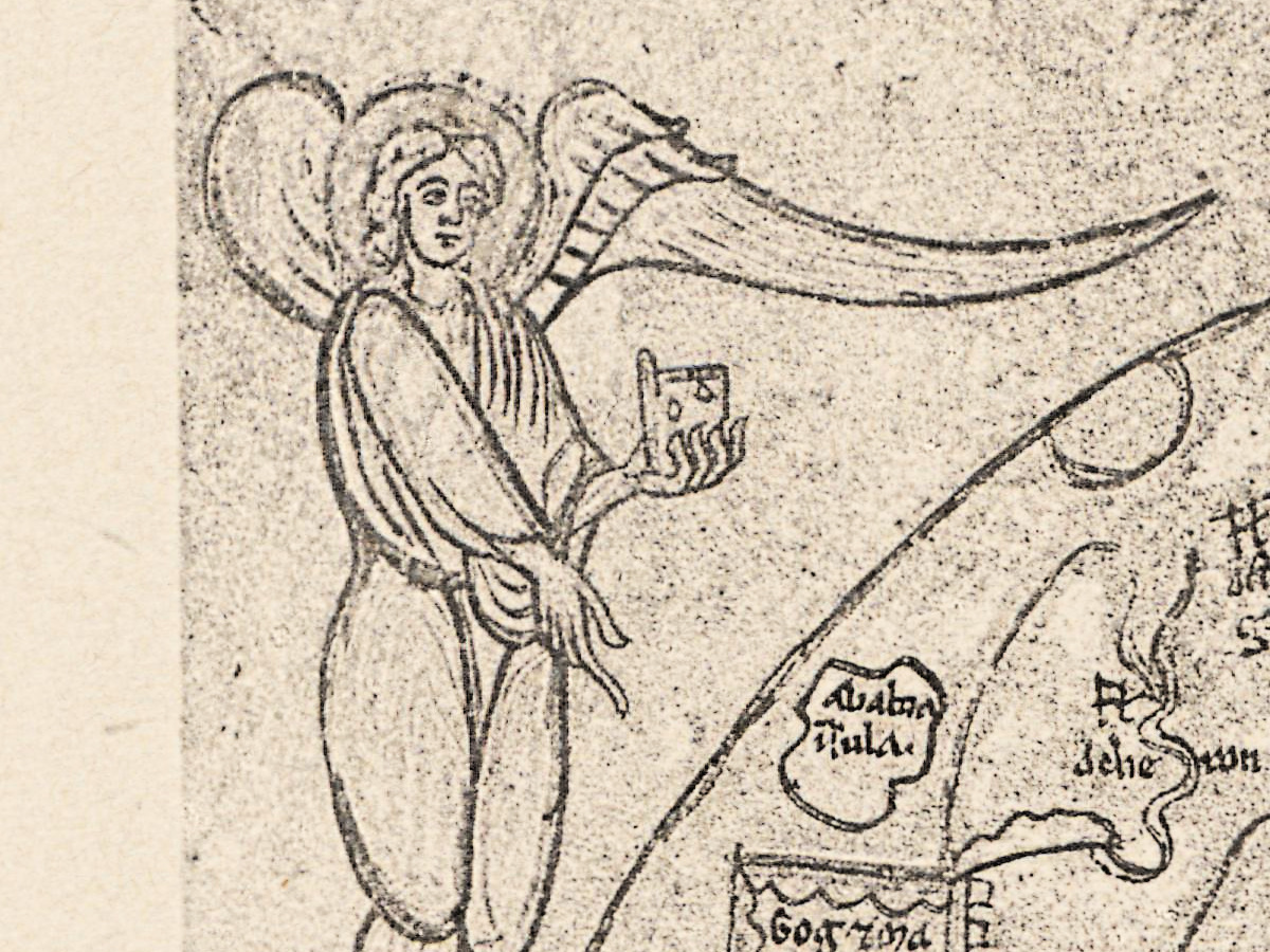
The Metropolitan Museum of Art, which showed the map in its 2009 exhibition Pen and Parchment, gives it as England, probably Durham, about 1190: “Created by a twelfth-century English monk, it was the first image in a book called the Imago Mundi”, the encyclopedia of the world by Honorius Augustodunensis. The book is inscribed Liber Sancte Marie de Salleia, a book of the Cistercian abbey of Sawley in Yorkshire, and the faint upper line of this plate still shows its last words, de salleia. The Parker Library record describes an oval map with four full-length angels with gold nimbi.
Miller knew it by an older name, the world map of Henry of Mainz, and The History of Cartography (1987) still uses that name in a section heading, “Henry of Mainz to Richard of Haldingham (ca. 1100–1300)”. Paul Harvey studied it under its present name in “The Sawley map and other world maps in twelfth-century England” (Imago Mundi, 1997).
The manuscript matters for its text as well. Natalia Petrovskaia calls Corpus Christi 66 one of “only two early witnesses to the first version of Imago Mundi, composed in 1110”, and the one that preserves the complete text. In a 2019 companion to English world maps, Alfred Hiatt discusses evidence that the map is related to a mappa mundi that Bishop Hugh de Puiset left to Durham Cathedral. It belongs to the manuscripts of Archbishop Matthew Parker, which came to Corpus Christi College in 1574.
Konrad Miller (1844–1933) was a Catholic priest who taught natural sciences at the Realgymnasium in Stuttgart; from 1895 he published the Mappaemundi, the world maps of the Christian Middle Ages (Neue Deutsche Biographie). A note under this plate refers to Heft III for the description and for Miller’s redrawn version, Tafel 2 there.
What to look for on the sheet
- paradisus at the top, under ORIENS, an enclosed island at the eastern rim of the world.
- The tower of babel, drawn in storeys, just below Media inferior.
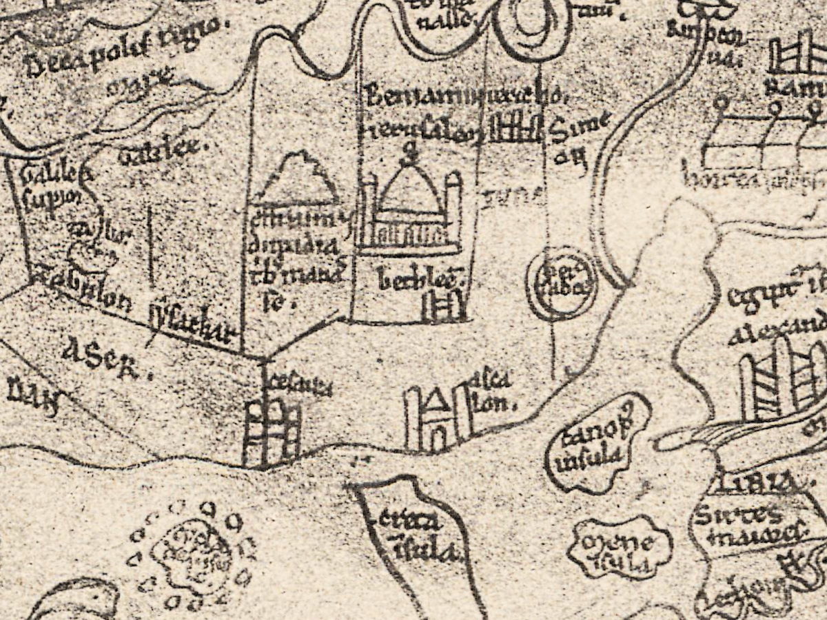
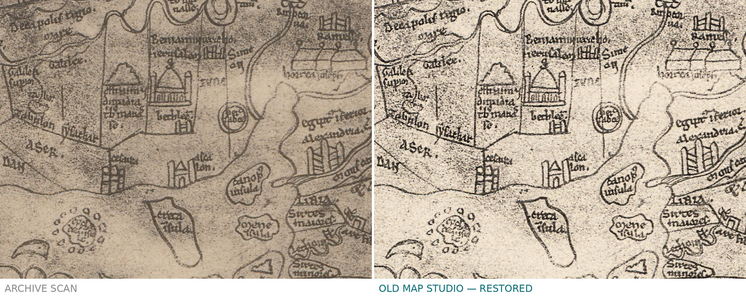
- ierusalem with a domed building, bethleem below it, and the lands of the tribes, Beniamin, Simeon, IVDA; to the north two springs labelled fons ior and fons dan.
- In Egypt, three round-roofed buildings above the faint words horrea ioseph, Joseph’s granaries; nearby the templum iovis, a temple of Jupiter, and a bird’s head beside the word basiliscus.
- scilla and caribdis, the two dangers of the strait, beside Sicilia.
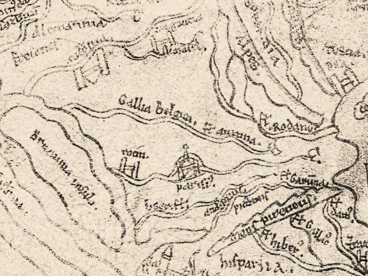
- In the north-west corner the long island Britannia insula, hibernia beside it, and parisius and rotom on the mainland; further north the cyno cephales, the dog-headed people.
The 2019 companion treats it beside the English world maps of the following century, among them the Psalter map of about 1262 and the Hereford map of about 1300. Miller gave the Hereford map a part of its own, Heft IV of the series, and placed the Sawley map among the smaller world maps of Heft III.
Everything on this sheet: full record
Every inscription on the sheet
The printed lines of the plate are given in full. On the manuscript map we list the names we can read with confidence on this scan, by area, with east at the top: north is on the left, south on the right, the west at the bottom. Common abbreviation marks are written out (egiptus, sancti, dimidia tribus); fl for fluvius, m for mons and c for ciuitas are kept as on the sheet. Capital and small letters follow the sheet. Long s is given as s, and words we cannot read are left out.
- Top margin, printed: Miller, Mappaemundi II. on the left, Tafel 13. on the right.
- Bottom margin, printed: Mappamundi des Heinrich von Mainz, in Cambridge. [World map of Henry of Mainz, in Cambridge.] and (C.C.C. LXVI.) 12. Jahrh. [12th century]; at the lower right Dieselbe Karte restituiert in Mappaemundi Heft III, Tafel 2. [The same map restored in Mappaemundi Heft III, plate 2.] and Beschreibung in Mappaemundi Heft III. [Description in Mappaemundi Heft III.]
- Above the map: a faint line of large letters across the top of the leaf, of which the last words, de salleia, can be read; below it ORIENS [east].
- The eastern rim and India: paradisus in an enclosed island; taprobana insula; m. ardens [burning mountain]; inland carmania and aurei montes [golden mountains].
- India, Persia and Mesopotamia (upper half): Ganges; fl. indus; Media superior; Media inferior; babel at the tower; persepolis; ARA and BIA written apart; mesopotamia; fl. eufrates.
- The north (left side): Gog et ma gog gens immunda [Gog and Magog, an unclean people] in a walled enclosure; Mare caspium; Rapharrica insula; hircania; amazonia; armenia; caspie porte [Caspian gates]; albania; antropo phagi [man-eaters]; Gens ypborea [the Hyperborean people], in a round frame with a longer note we do not transcribe; cyno cephales [dog-heads]; SARMA the.
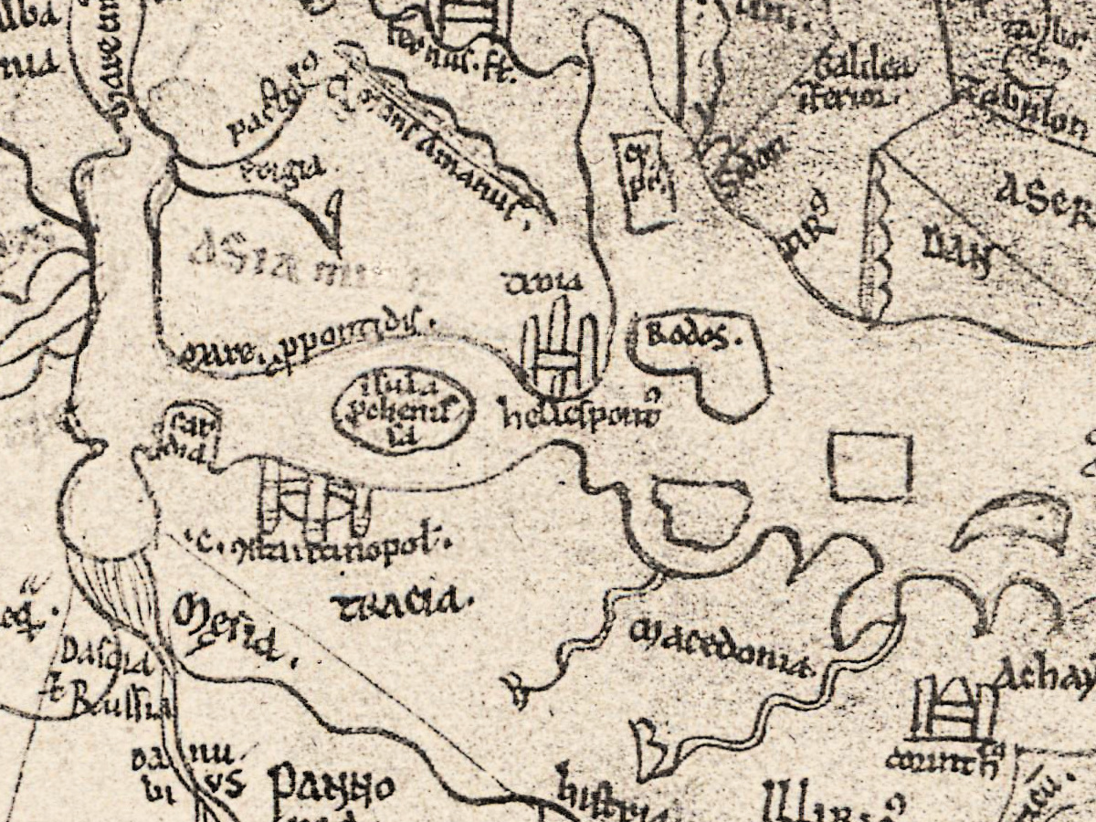
- Asia Minor and Syria (middle): ASIA minor; mare propontidis [Sea of Marmara]; hellespontus; Rodos; celes siria; antiochia c; m. Libanus; Sidon; cesarea; asca lon.
- The Holy Land (middle right): fons ior and fons dan [the springs Jor and Dan]; Decapolis regio; Galilea superior; Galilea inferior; mare galilee; mons Galaad; the tribes Zabulon, ASER, DAN, Ruben, Gad, Effraim, dimidia tribus manasse [half the tribe of Manasseh], Beniamin, Simeon and IVDA; iericho; ierusalem at the domed building; bethleem; m. Sina.
- Egypt and Ethiopia (right side): horrea ioseph [Joseph’s granaries] under three domed buildings, the second word faint; egiptus superior; egiptus inferior; monasteria sancti antonii [the monasteries of Saint Anthony]; alexandria; canopus insula; montes ethiopie; ethiopia along the outer edge; templum iovis [temple of Jupiter]; basiliscus [basilisk] beside a bird’s head.
- North Africa (lower right): LIBIA; Sirtes maiores and Sirtes minores; BIZACENA; kartago; Numidia; Mauritania cesariensis; fl. Gion along the outer river.
- The Mediterranean (centre and lower centre): creta isula; Sicilia; scilla and caribdis beside it; apulia, calabria and lucania; sardinia; corsica.
- Europe (lower left): constantinopol at the city; tracia; Mesia; macedonia; Achaya; histria; fl. hister; PANNO nia; da nu bi us in four pieces; NORICUS; Sabaria c; Longobardia; Alpes; fl. Rodanus; Gallia belgica; parisius and rotom; fl. Garunna; mons pireneus; fl. hiber; hispania; Britannia insula and hibernia, the second written in abbreviated form.
Discrepancies on the sheet itself. Miller’s printed caption names Henry of Mainz, while the faint line at the top of the leaf ends with de salleia, the Sawley inscription of the manuscript. The Danube is written in four pieces, da nu bi us, and ARA and BIA stand apart on either side of a river. The two springs fons ior and fons dan stand side by side north of Galilee. The lower third of the leaf, with western Europe, Africa and the two lower angels, is much paler than the upper part.
Editions and other known copies
- ETH Library Zurich, Rar K 257: 2, digitized on e-rara (record 11583321, plate image 11583338; DOI 10.3931/e-rara-38523), the copy scanned for this file. The record, as quoted on the product page, reads “Die ältesten Weltkarten / 2 Atlas von 16 Lichtdruck-Tafeln : von Konrad Miller”, Jos. Roth’sche Verlagshandlung, 1895, 16 plates, with contents “Psalter-Karte, Beatus, Cotton Map, Hieronymus, Heinrich von Mainz, Higden”.
- Service hydrographique de la Marine, Paris (French Ministry of Defence digital libraries): Mappaemundi: die ältesten Weltkarten, Stuttgart, Jos. Roth’sche Verlagshandlung, 1895-1898, six volumes, 30 cm; the record gives no shelfmark.
- Technisches Museum Wien, library: Mappae Mundi - Die ältesten Weltkarten, Hefte I–VI, among them “II. Atlas von 16 Lichtdrucktafeln” and “III. Die kleineren Weltkarten”; the record gives no year.
- Biblioteka Uniwersytecka w Toruniu, Kartografia 042 (mirrored on the Internet Archive): Heft 4 only, Die Herefordkarte.
- A Google-scanned copy on the Internet Archive: Heft VI, Rekonstruierte Karten (1898). Its list of maps gives this one as “Hn — Heinrich v. Mainz”, with a reference to Heft III, page 23.
- None of these records names states of the plate.
- The manuscript: Cambridge, Corpus Christi College, MS 66, part 1. The Parker Library description, as given on Biblissima, records vellum leaves of 298 × 203 mm in double columns, the inscription Liber Sancte Marie de Salleia, and an oval map with four full-length angels with gold nimbi. The Bury St Edmunds part once bound with it was separated in 1954 and is now MS 66A.
Catalog entries and sources
ETH Library Zurich, Rar K 257: 2; e-rara 11583321 (atlas) and 11583338 (this plate); DOI 10.3931/e-rara-38523. The manuscript: Cambridge, Corpus Christi College, MS 66, part 1. Sources for the story and this record: the e-rara record as quoted on the product page; the Parker Library description on Biblissima and the Stanford record of MS 66A; the Metropolitan Museum of Art, Pen and Parchment (2009); D. Woodward, “Medieval Mappaemundi”, in The History of Cartography, vol. 1 (1987); P. D. A. Harvey, “The Sawley map and other world maps in twelfth-century England”, Imago Mundi 49 (1997); N. Petrovskaia on the early witnesses of the Imago Mundi (2014); D. Terkla and N. Millea (eds), A Critical Companion to English Mappae Mundi of the Twelfth and Thirteenth Centuries (2019), and G. Bailey’s review of it in Cartographic Perspectives; Corpus Christi College on Matthew Parker’s library; Neue Deutsche Biographie, “Miller, Konrad”; K. Miller, Mappaemundi, Heft VI (1898); the records of the French Ministry of Defence libraries, Technisches Museum Wien and the Toruń University Library.
This copy
The plate is printed in black on cream paper; the photograph of the manuscript leaf fills the upper part, with the printed heading above it and the caption and notes below. The edges of the leaf show in the photograph: a dark strip runs down the right side, the lower left corner is turned or missing and shows as a pale wedge with a dark edge, and a crease crosses the leaf horizontally just below the middle, through Italy, the sea beyond it and North Africa. The two lower angels are faint. The printed margins are clean, with no stamps or pencil notes visible on the scan.
Your file
| Original | Konrad Miller, Mappaemundi, Heft 2 (atlas), Stuttgart: J. Roth, 1895, Tafel 13; after Corpus Christi College, Cambridge, MS 66 |
| Scan | full sheet 5364 × 6849 px; the map inside the trimmed border 4580 × 6216 px |
| Print size at 300 dpi | the map prints to 52 cm (20 in), the full sheet with margins to 57 cm (22 in) |
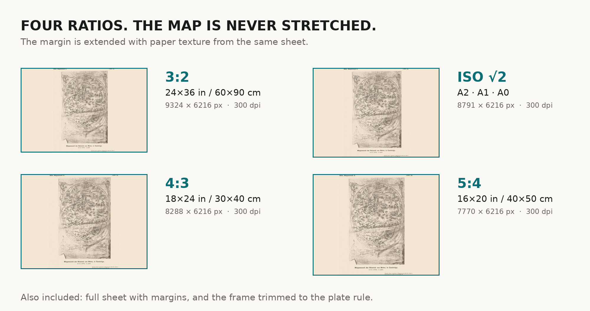
| You download | six ZIP archives: full sheet, trimmed, 3:2, 4:3, 5:4 and ISO A |
| Inside each one | one JPEG at 300 dpi, the restoration passport as a PDF, a READ ME |
How to print
- The sheet is upright. At 300 dpi the plate prints to 52 cm. Pick the archive whose proportions match your frame; ask for matte fine-art paper in sRGB with auto-enhancement off.
- Where to print it: print shops near you and checked prices at online labs.
Source and rights
The scan comes from e-rara.ch, the Swiss platform for digitized rare books (plate image 11583338). Its record of the atlas, DOI 10.3931/e-rara-38523, reads “Die ältesten Weltkarten / 2 Atlas von 16 Lichtdruck-Tafeln : von Konrad Miller”, Jos. Roth’sche Verlagshandlung, 1895, 16 plates, and lists its contents as “Psalter-Karte, Beatus, Cotton Map, Hieronymus, Heinrich von Mainz, Higden”. Konrad Miller died in 1933; the plates are in the public domain. The scanned copy is held by ETH Library Zurich, shelfmark Rar K 257: 2 (e-rara record 11583321), and carries the Public Domain Mark. The plate is captioned “Mappamundi des Heinrich von Mainz, in Cambridge. (C.C.C. LXVI.) 12. Jahrh.”. The size of the plates is not given here, and color is not stated. There is no TIFF master in the package. Catalogue record: e-rara →
Features
- Latin
Attachments
Reviews
No reviews found
See also
-
 Antique Map of Asia c. 1150 — Jerome Map, Miller Facsimile 1895, Plate 11
-
Antique World Map c. 1845 — Johnston, Botanical Geography
-
Antique World Map 1710 — Hōtan, Nansenbushū Bankoku Shōka
-
Antique World Map — Beatus Map Paris II, Miller Facsimile 1895, Plate 2
-
Antique World Map 1602 — Mercator & Hondius, Orbis Terrae
-
Antique World Map — Turin Beatus Map, Miller Facsimile 1895, Plate 8