Antique World Map — Italienische Weltkarte, Bomsdorff Facsimile 1872


Description
An antique world map with Magellan’s route, in a Leipzig facsimile of 1872
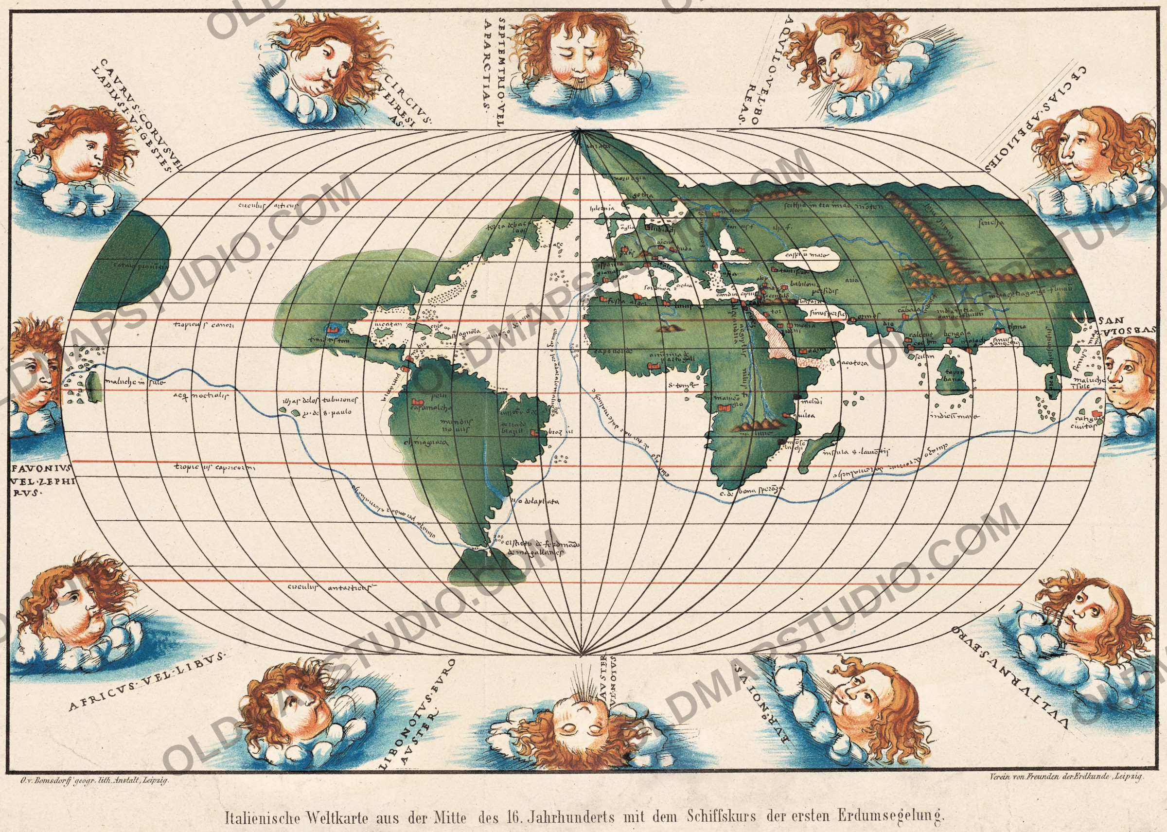
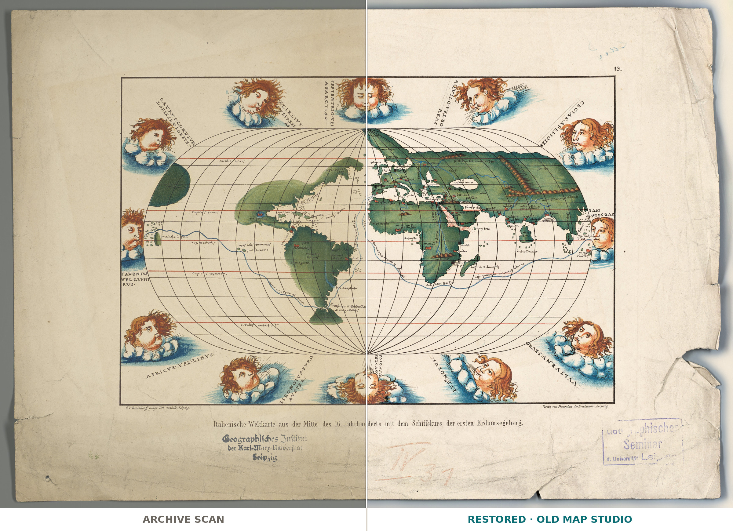
This antique world map is a copy made in Leipzig in 1872, and its German title under the frame says what it shows: Italienische Weltkarte aus der Mitte des 16. Jahrhunderts mit dem Schiffskurs der ersten Erdumsegelung, an Italian world map from the middle of the 16th century with the ship’s course of the first circumnavigation of the Earth. The holder’s record, from the Leibniz-Institut für Länderkunde in Leipzig, names Otto von Bomsdorff as its author and describes a colored map of 30 × 20 cm, without a scale, with relief shown.
Who printed it
Under the frame, on the left: “O. v. Bomsdorff’ geogr. lith. Anstalt, Leipzig”, a geographical lithographic workshop that also printed a sheet of Carl Kanitz’s city plan of 1880. On the right: “Verein von Freunden der Erdkunde, Leipzig”, the city’s society of friends of geography. The record does not say in which publication the map appeared.
The geographer Oscar Peschel, author of a history of the age of discoveries (1858), took up the newly created chair of geography at Leipzig University in 1871. A paper by him with almost the same title, Ueber eine italienische Weltkarte aus der Mitte des 16. Jahrhunderts, is listed, undated, in the catalog of the INAF libraries in Italy. Neither record links it to this sheet.
What the map shows
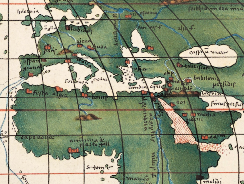
The record does not name the Italian original. But what the sheet shows matches how the Library of Congress and the Morgan Library describe the world map in the manuscript atlases of Battista Agnese, a Genoese chartmaker working in Venice between 1536 and 1564: an oval world, twelve wind heads around it, and the route of Magellan’s voyage. In the Library of Congress atlas the wind heads represent “the classical twelve-point winds from which modern compass directions evolved”; Magellan’s route is drawn “in pure silver that later tarnished”, and a second route, from Cadiz to Peru across the Isthmus of Panama, in gold. The Leipzig copy prints the circumnavigation as a blue line and the Peru route as a fine dark line.
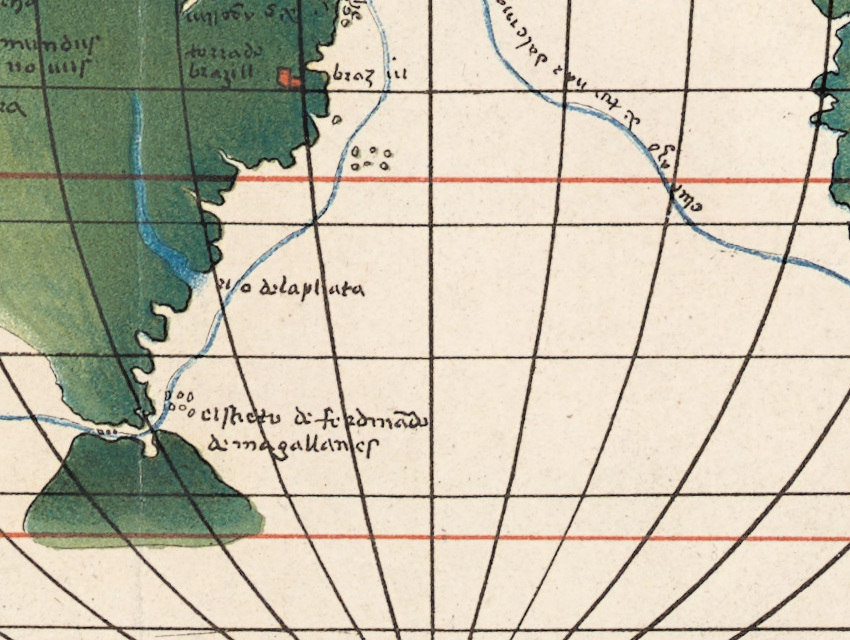
According to Britannica, Magellan’s expedition (1519–1522) sailed around South America, through the strait named after him, and across the Pacific; Magellan was killed in the Philippines in April 1521, and one ship went on westward to Spain, completing the first circumnavigation. On this map the blue line runs from Spain down the Atlantic, through the strait, across the Pacific to the Moluccas, and back around the Cape of Good Hope.
What to look for on the sheet
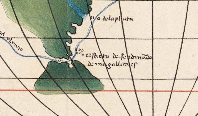
- At the tip of South America, the strait with the label el streto di ferdinãdo de magallanes.
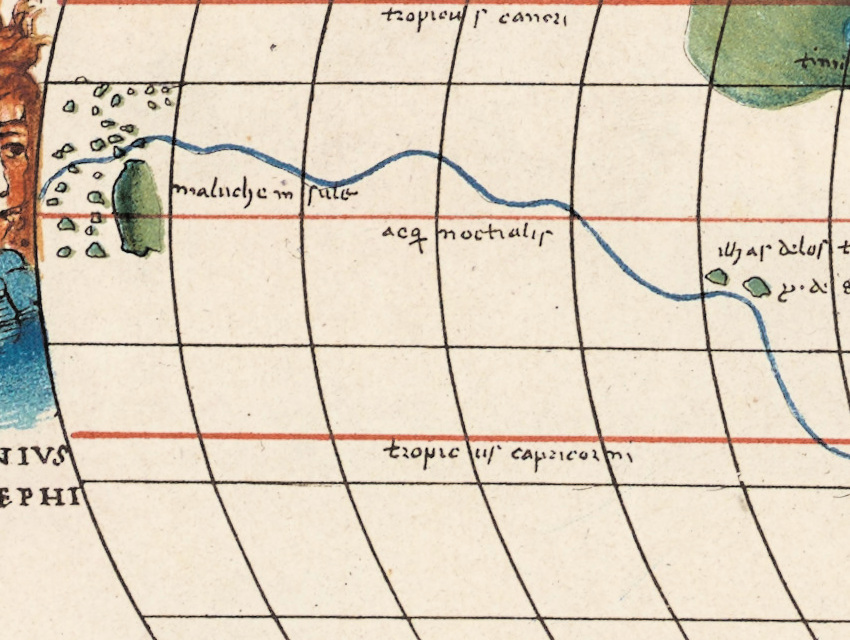
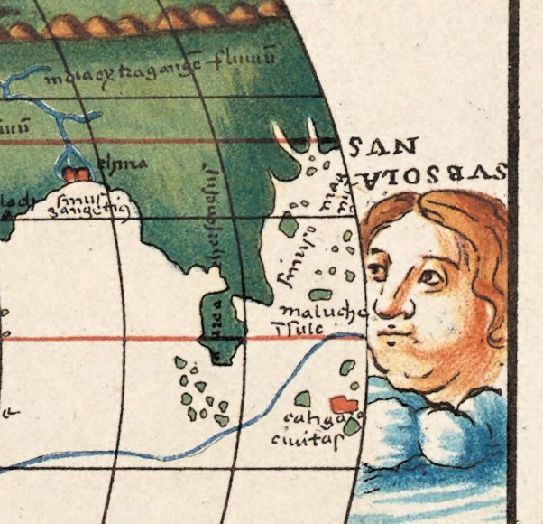
- The Moluccas appear twice, at both edges of the oval: maluche in sule in the west and maluche in the east, because the route runs off one edge and back in at the other.
- The words along the blue line: per andar (to go) to the Moluccas in the Pacific, di tornar (to return) from them in the Indian Ocean and again in the Atlantic.
- Two small islands on the Pacific stretch of the route, ilhas delos tuburones and y. d. s. paulo.
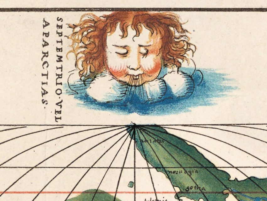
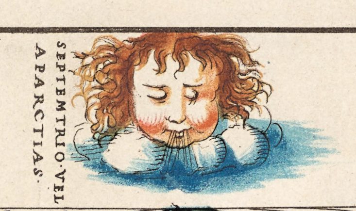
- Twelve wind heads with Latin names, among them SEPTEMTRIO·VEL APARCTIAS·, the north wind at the top.
Agnese’s atlases were made by hand: the Library of Congress counts seventy-one survivors, each with a version of this oval map, and the John Carter Brown Library, which holds one, speaks of “70 or more”. This sheet is a printed copy of that kind of map, made three centuries later.
Everything on this sheet: full record
Every inscription on the sheet
We read the sheet on our full-resolution scan. Inscriptions are given letter by letter, with the capitals, dots and line breaks of the sheet (a slash marks a line break); a translation follows in [square brackets] where the Latin or Italian is not obvious. What we could not read is not written out. Inside the oval we list the circles, the routes and a selection of the clearer names.
- Below the frame, center: Italienische Weltkarte aus der Mitte des 16. Jahrhunderts mit dem Schiffskurs der ersten Erdumsegelung. [Italian world map from the middle of the 16th century with the ship’s course of the first circumnavigation of the Earth]
- Below the frame, left: O. v. Bomsdorff’ geogr. lith. Anstalt, Leipzig. Below the frame, right: Verein von Freunden der Erdkunde, Leipzig.
- Above the frame, upper right: 13.
- Wind heads, clockwise from the top: SEPTEMTRIO·VEL / APARCTIAS· [north wind]; AQVILO·VEL·BO / REAS·; CECIAS·APELIOTES; on the right, upside down, SVBSOLA / NVS [east wind]; VVLTVRNVS·EVRO; EVRONOTVS·, with the first O small and raised; at the bottom AVSTER and NOTVS, the word between them abbreviated [south wind]; LIBONOTVS·EVRO / AVSTER·; AFRICVS·VEL·LIBVS·; on the left FAVONIVS / VEL·ZEPHI / RVS· [west wind]; CAVRVS·CORVS·VEL / LAPIX·SI·VIGESTES·; CIRCIVS·, followed by a second name in two lines ending in AS·, partly unclear.
- Circles: circulus articus, tropicus cancri, aeq noctialis [equator], tropicus capricorni, circulus antarticus; the tropics, the equator and the polar circles are drawn in red.
- Along the blue route: in the Pacific, upside down, per andar … maluche [to go … to the Moluccas]; in the Indian Ocean and again in the Atlantic, di tornar … maluche [to return … from the Moluccas]. The words before and between them are written in a running hand and partly unclear.
- The Americas: iucatan, spagnola, panama, peru, caxamalcha, mundus / nouus [New World], rio delaplata, el streto di ferdinãdo / de magallanes [the strait of Ferdinand Magellan]; in the Pacific, ilhas delos tuburones [islands of the sharks] and y. d. s. paulo [island of St Paul]; along the fine dark line from the Caribbean towards Panama, uiazo di peru [voyage of Peru], its first letters unclear.
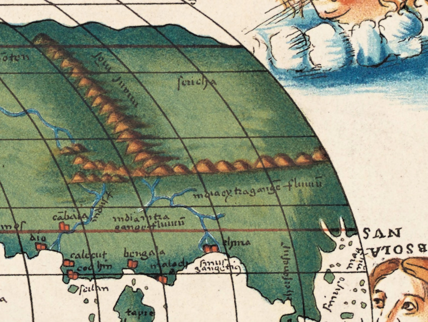
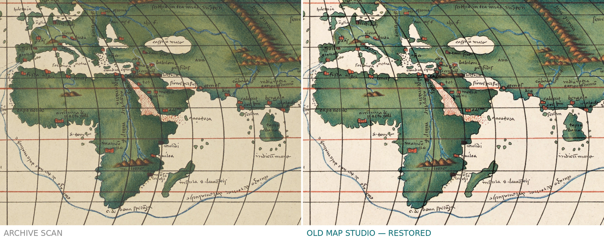
- Africa and Asia: c. d. bona sperãza [Cape of Good Hope], indicũ mare [Indian Ocean], tapro / bana, calecut, bengala; at the left edge maluche in sule [the Moluccas], at the right edge maluche over a second line ending in sule, its first letter unclear, and further down ciuitas after a word we cannot read.
What does not agree on the sheet itself: the north wind is spelled SEPTEMTRIO, not the classical Septentrio, and the Arctic circle circulus articus. CECIAS·APELIOTES joins two classical wind names in one label, as LIBONOTVS·EVRO / AVSTER· does. The Moluccas are named at both ends of the oval, because the route leaves the map at one edge and comes back at the other. The record notes that the map has no scale, and none is printed.
Editions and other known copies
- Leibniz-Institut für Länderkunde, Leipzig — this copy. Record as published with the scan on Wikimedia Commons (read by our team on 9 October 2026; Commons could not be reopened from our research tools in this pass): author Otto von Bomsdorff; Leipzig, 1872; “1 Kt. : kolor. (30 x 20 cm)”; no scale; title below the map field; “13” at the upper right; relief indicated; CC0 1.0. No shelfmark is given.
- We found no other catalogued copy of this sheet in the records we could open. None of the records names an edition, a state or a series to which the sheet belongs.
Catalog entries and sources
Catalog entry for this copy: Wikimedia Commons file “Italienische Weltkarte aus der Mitte des 16. Jahrhunderts mit dem Schiffskurs der ersten Erdumsegelung.jpg”, provided by the Leibniz-Institut für Länderkunde; no shelfmark. Related: INAF library catalog, record 98597, Peschel, “Ueber eine italienische Weltkarte aus der Mitte des 16. Jahrhunderts”, undated, holding OAMI, shelfmark MI.102.840.1.
Sources for the story and this record: Library of Congress, “Agnese Atlas” (General Atlases essay); The Morgan Library & Museum, Battista Agnese atlas page; John Carter Brown Library, Agnese atlas page; Britannica, “Ferdinand Magellan”; Neue Deutsche Biographie and Allgemeine Deutsche Biographie, “Peschel, Oscar”; museum-digital: sachsen, Leipzig City History Museum, Kanitz city plan, sheet 12 O (S/37/2003).
This copy
The scan shows the whole sheet, 5232 × 3626 pixels, with wide margins. The map is colored: green land with brown hills, blue rivers, red town signs, a blue route line and wind heads with brown hair in blue-and-white clouds. The paper is toned. The right edge is torn in several places, with a notch missing near the lower right, and there are creases and small marks in the margins.
Below the title, on the left, a black stamp reads Geographisches Institut der Karl-Marx-Universität Leipzig; on the right a violet stamp reads Seminar and d. Universität, its first word and the place partly illegible. Between them, in red pencil, IV 37. There is a short note in blue pencil above the frame at the upper right and a pencil mark beside the violet stamp, neither of them legible. The violet stamp touched the lower right corner of the map; in our trimmed file that corner was restored with paper from the same sheet.
Your file
| Original | Italienische Weltkarte aus der Mitte des 16. Jahrhunderts mit dem Schiffskurs der ersten Erdumsegelung, Otto von Bomsdorff, Leipzig, 1872; colored, map 30 × 20 cm |
| Scan | full sheet 5232 × 3626 px; the map inside the trimmed border 3580 × 2552 px |
| Print size at 300 dpi | the map prints to 30 cm (12 in), the full sheet with margins to 44 cm (17 in) |
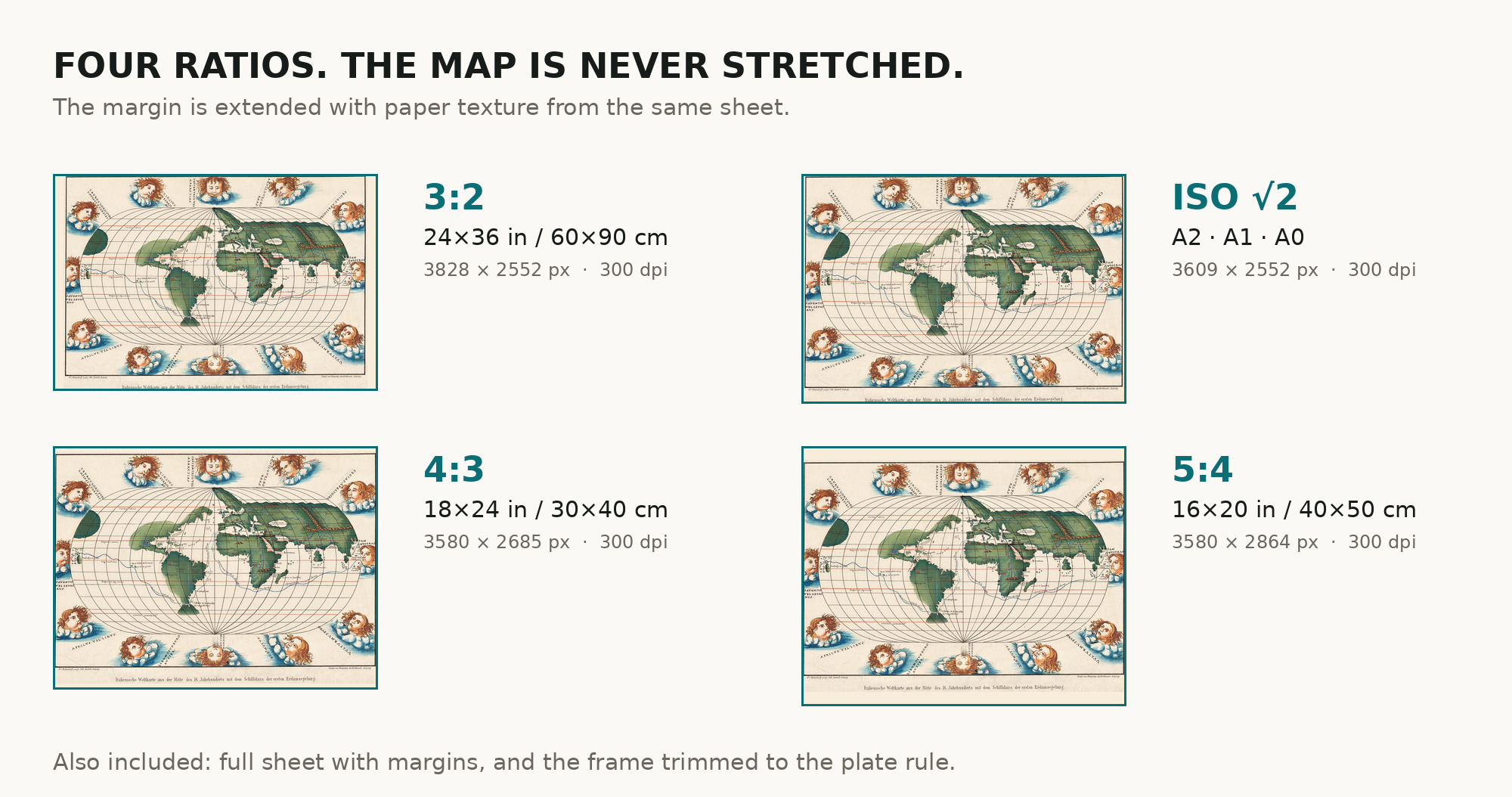
| You download | six ZIP archives: full sheet, trimmed, 3:2, 4:3, 5:4 and ISO A |
| Inside each one | one JPEG at 300 dpi, the restoration passport as a PDF, a READ ME |
How to print
- Print at 300 dpi at the size above and do not let the shop scale the file up.
- Pick the archive whose proportions match your frame, so nothing is cropped or stretched.
- Ask for matte fine-art paper, printed in sRGB with auto-enhancement off.
- Where to print it: print shops near you and checked prices at online labs.
Source and rights
The scan comes from the Leibniz-Institut für Länderkunde in Leipzig and is published on Wikimedia Commons with a CC0 1.0 public domain dedication. The record gives no shelfmark. The imprint names a lithographic workshop, but the record does not name the printing technique, so we do not either. A library stamp that touched the lower right corner of the map was removed from the trimmed file and replaced with paper from the same sheet; on the full-sheet file the library stamps, a red pencil mark and pencil notes in the margins remain. There is no TIFF master in the package. Catalogue record: Wikimedia Commons →
Questions
What exactly do I get after paying?
Six ZIP archives, each with one JPEG at 300 dpi, a restoration passport as a PDF and a READ ME. They differ only in framing.
Is this a 16th-century map?
The map it reproduces is: the title calls it an Italian world map from the middle of the 16th century. The sheet itself was printed in Leipzig in 1872, and that is the sheet you get.
How large can I print it?
The map inside the border is 3580 pixels on its long side. At 300 dpi it prints to 30 cm, the same as the 30 × 20 cm the record gives for the map; the full sheet with margins prints to 44 cm.
Who drew the original map?
The record does not say. Its oval form, twelve wind heads and Magellan’s route match the world maps in Battista Agnese’s atlases as the Library of Congress and the Morgan Library describe them, but no record we opened names the manuscript that was copied.
Features
- German
- Italian
- Latin
Attachments
Reviews
No reviews found
More maps from the 1800s
-
 Antique World Map 1873 — Vivien de Saint-Martin, Planisphère, Mercator
-
Antique World Map 1870 — Barber, Pharmaceutical Map
-
Antique World Map c. 1867 — Drioux, Planisphère
-
Antique World Map 1858 — Minard, Emigrants of the Globe
-
Antique World Map 10th c. — Istakhri and Ibn Hawqal, Lelewel 1852
-
Old Flat Earth Map 1893 — Ferguson, Map of the Square and Stationary Earth