Old Flat Earth Map 1893 — Ferguson, Map of the Square and Stationary Earth

Description
An old flat earth map of 1893: Orlando Ferguson’s square and stationary Earth
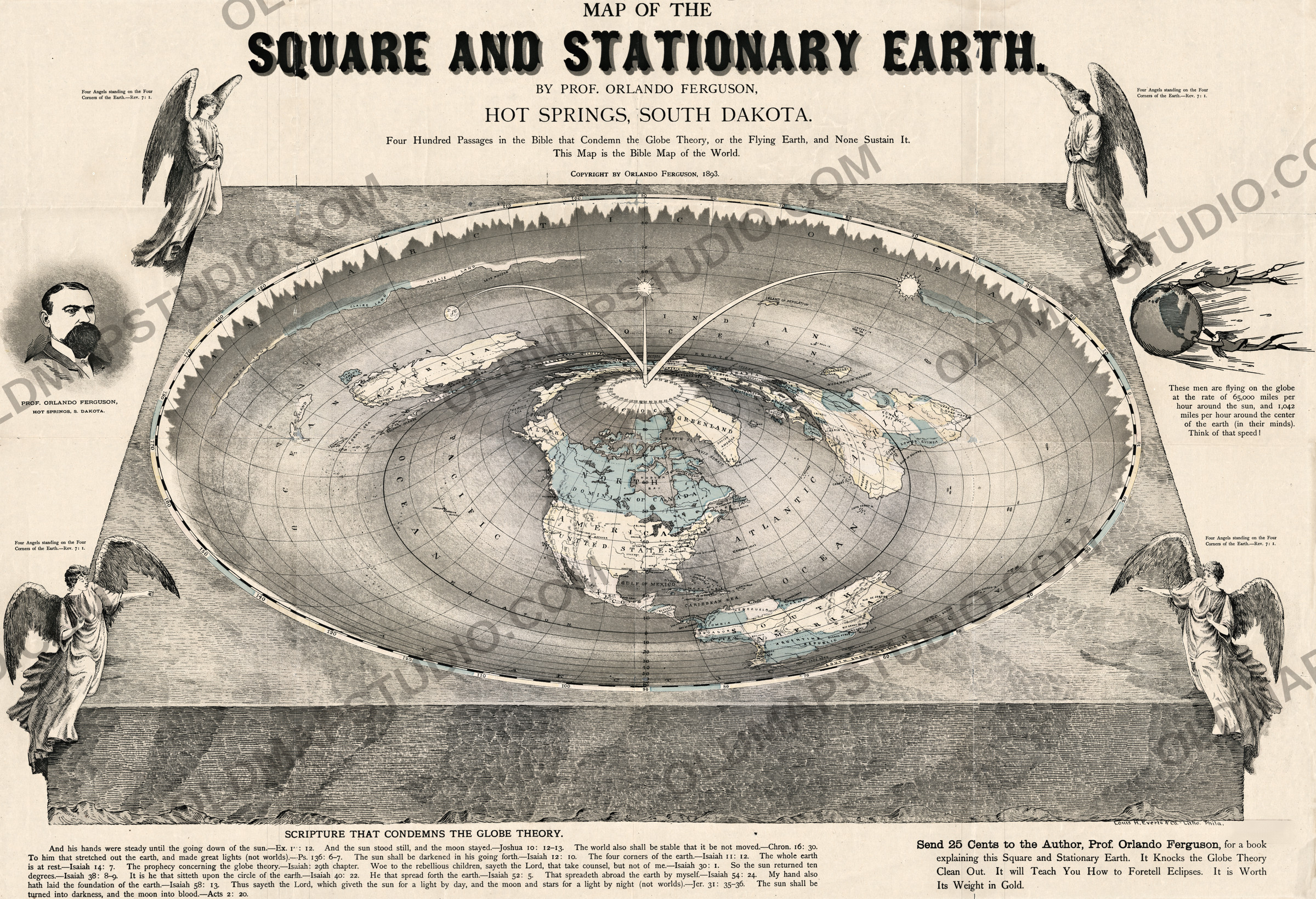
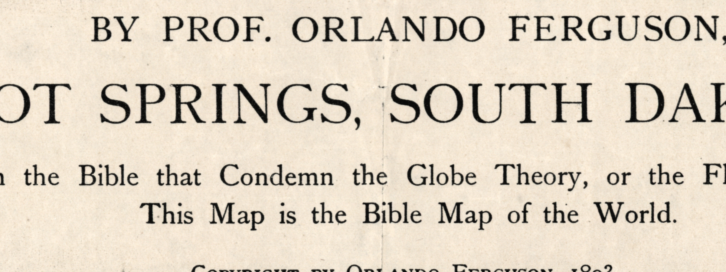
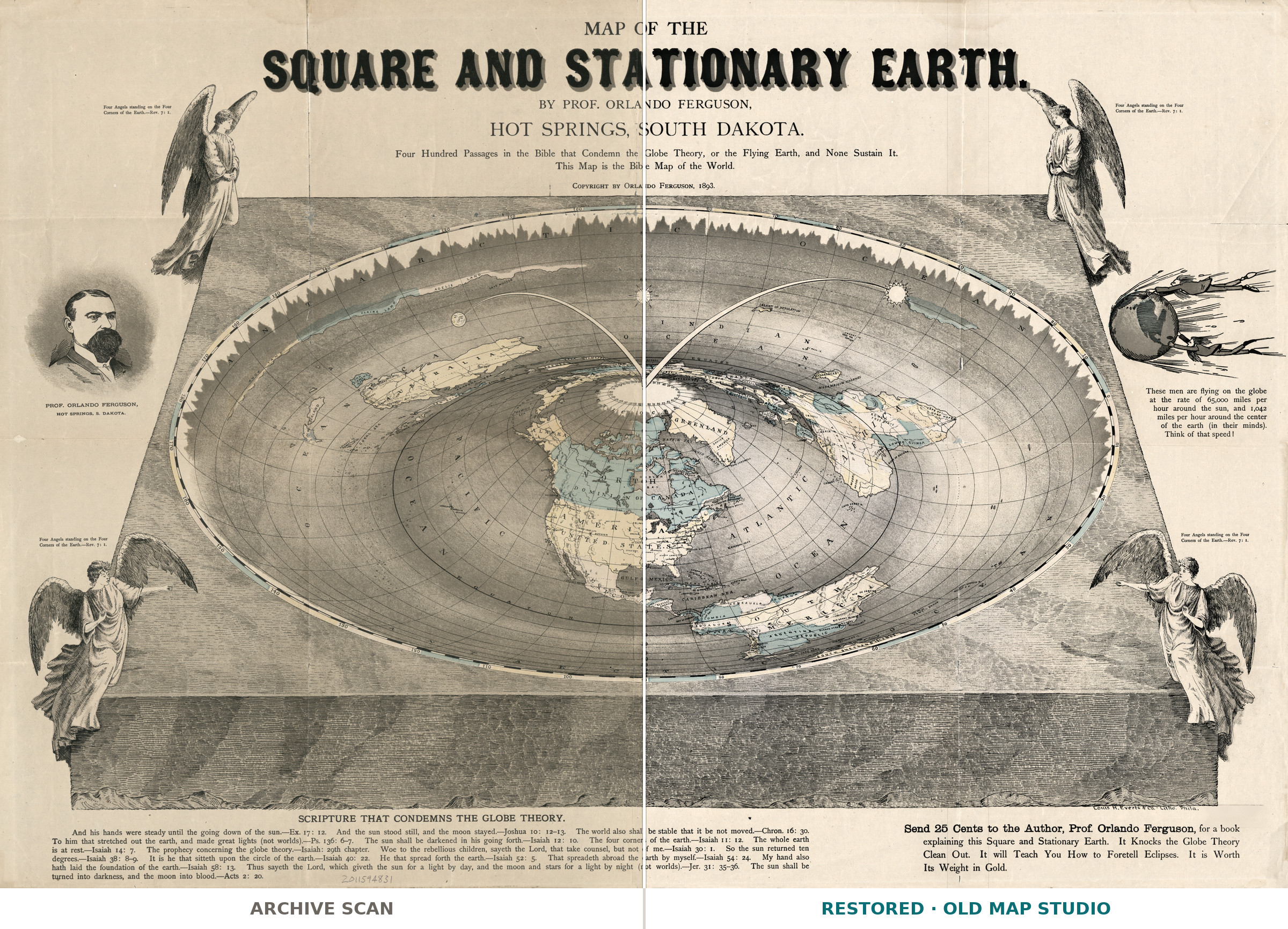
The title is printed in heavy shaded capitals across the top: MAP OF THE SQUARE AND STATIONARY EARTH. A smaller line below states the argument: Four Hundred Passages in the Bible that Condemn the Globe Theory, or the Flying Earth, and None Sustain It. This Map is the Bible Map of the World. Ferguson published it himself in Hot Springs, South Dakota (COPYRIGHT BY ORLANDO FERGUSON, 1893.); a small imprint at the foot names the lithographers, Louis H. Everts & Co. - Litho. Phila. The Library of Congress copy is hand colored, on a sheet of 57 × 82 cm, with relief shown by hachures.
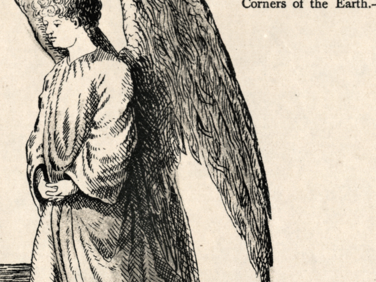
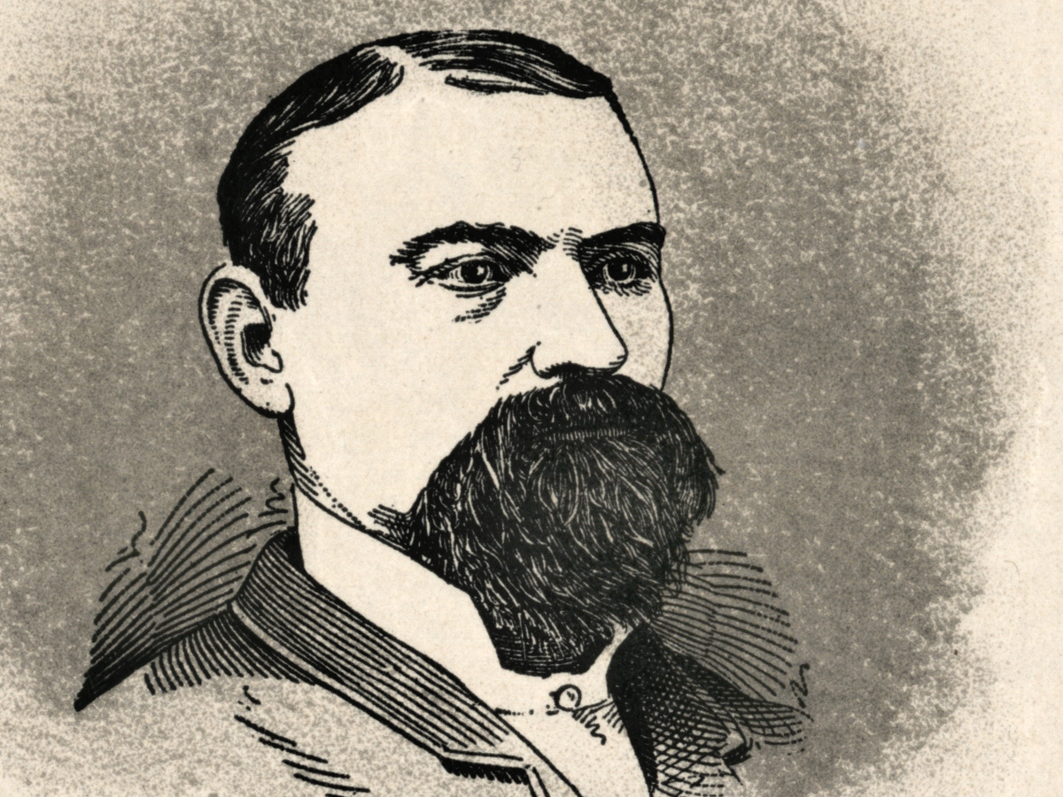
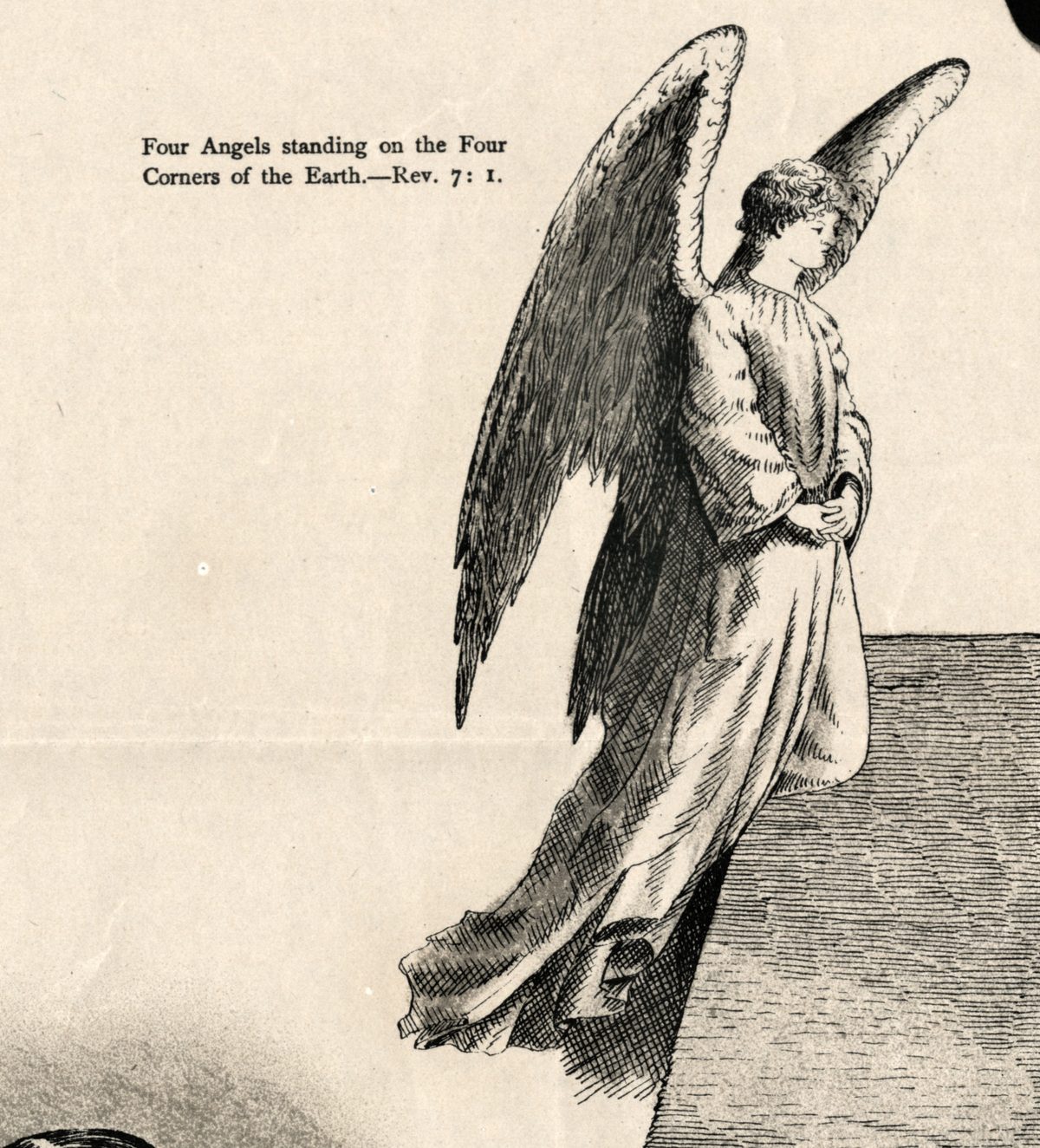
The Library of Congress map blog says Ferguson based his beliefs on a biblical passage describing four angels standing at the corners of the Earth, and the sheet takes it literally: at each corner of the square stands a winged angel, captioned Four Angels standing on the Four Corners of the Earth.—Rev. 7: 1. The Leventhal Map & Education Center notes that he called himself “Doctor” and “Professor”, titles he is unlikely to have earned; on the map he is PROF. ORLANDO FERGUSON, with a portrait at the left.
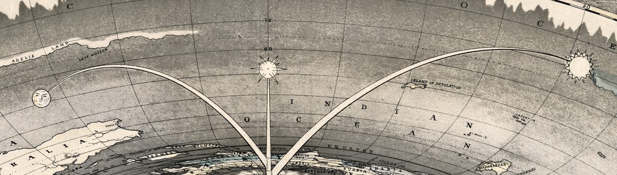
Inside the square lies a round basin, and in it a flat world map with the North Pole at the center. The continents spread outward from a white polar disc, and the Equator is a circle around it. At the outer edge there is no south: Antarctica becomes a jagged wall of ice along the far side of the rim, lettered ANTARCTIC OCEAN. From the pole, arms rise over the Indian Ocean and hold the heavenly bodies like lamps: the Moon with a human face on the left, a rayed Sun on the right, and a third rayed light on a straight arm between them.
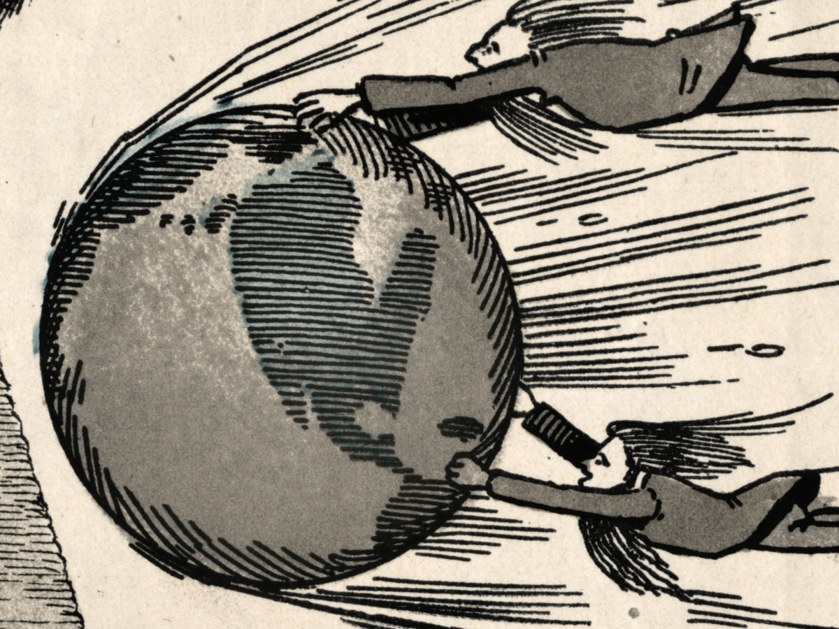
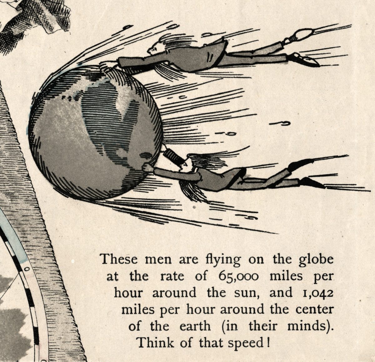
On the right is what Ferguson rejected. Two men cling to a small globe streaking through space: These men are flying on the globe at the rate of 65,000 miles per hour around the sun, and 1,042 miles per hour around the center of the earth (in their minds). Think of that speed! The Library’s blog singles out this detail.
Along the foot runs SCRIPTURE THAT CONDEMNS THE GLOBE THEORY., verses with references, among them The four corners of the earth.—Isaiah 11: 12. To the right is a sales pitch: Send 25 Cents to the Author, Prof. Orlando Ferguson, for a book explaining this Square and Stationary Earth. It Knocks the Globe Theory Clean Out. The American Philosophical Society holds his 1891 pamphlet The latest discoveries in astronomy: The globe theory of the earth refuted; the Leventhal Center adds that he lectured and wrote a pamphlet claiming the Sun was 30 miles across and 3,000 miles from the Earth.
What to look for on the sheet
- In the United States, a dot marked HOT SPRINGS, the author’s own town.
- The Moon’s face on its lamp above Australia.
- KNOX LAND, CLAIRE LAND and ADELIE LAND just inside the ice wall.
- The words (not worlds) added twice to the verses at the foot.
- Under the portrait: PROF. ORLANDO FERGUSON, HOT SPRINGS, S. DAKOTA.
The Library of Congress received this copy in September 2011 as a gift from Don Homuth, who had it from his eighth-grade teacher. News reports that year said the Library compared it with more than 75 maps, and named another copy in the Pioneer Museum in Hot Springs. In the Leventhal Center’s exhibition Bending Lines, Ferguson’s square Earth is shown right after Alexander Gleason’s New Standard Map of the World of 1892.
Everything on this sheet: full record
Every inscription on the sheet
All text on the sheet is English. It is given here letter for letter, with the sheet’s capitals, spellings and punctuation; the verses at the foot are transcribed in full, references as printed. Inside the round map, the large names of oceans and continents and a selection of the smaller names are listed; lines not read with certainty are marked as such.
- Title across the top: MAP OF THE / SQUARE AND STATIONARY EARTH. / BY PROF. ORLANDO FERGUSON, / HOT SPRINGS, SOUTH DAKOTA. / Four Hundred Passages in the Bible that Condemn the Globe Theory, or the Flying Earth, and None Sustain It. / This Map is the Bible Map of the World. / COPYRIGHT BY ORLANDO FERGUSON, 1893.
- Beside each of the four angels at the corners, the same caption: Four Angels standing on the Four Corners of the Earth.—Rev. 7: 1.
- Left, under the oval portrait: PROF. ORLANDO FERGUSON, / HOT SPRINGS, S. DAKOTA.
- Right, under the two men on the globe: These men are flying on the globe at the rate of 65,000 miles per hour around the sun, and 1,042 miles per hour around the center of the earth (in their minds). Think of that speed!
- Center of the map: a white polar disc ringed with longitude numbers 0 to 180 on both sides, the letters of ARCTIC OCEAN around it, and three arms rising from the pole that hold the Moon (with a face), a central rayed light and the Sun.
- The rim: a jagged ice wall along the far side, lettered ANTARCTIC (left) and OCEAN (right); the same words again along the near rim; a longitude scale along the outer edge; just inside the ice KNOX LAND, CLAIRE LAND, ADELIE LAND and CAPE HUDSON.
- Oceans: INDIAN OCEAN, PACIFIC OCEAN, ATLANTIC OCEAN; the circle EQUATOR; islands ISLAND OF DESOLATION, CROZET IS., ST PAUL IS., MADAGASCAR with MOZAMBIQUE CHANNEL.
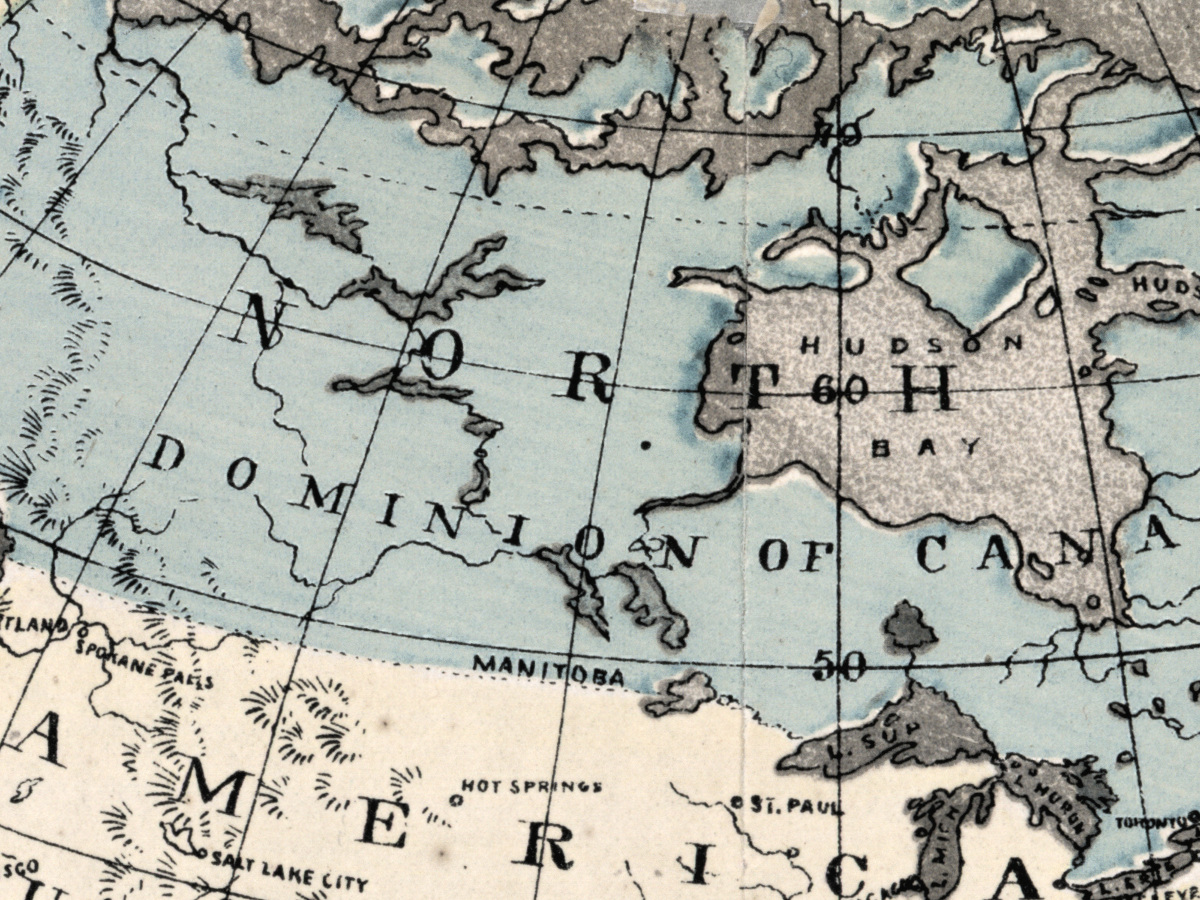
- North America: NORTH AMERICA, DOMINION OF CANADA, UNITED STATES, ALASKA, BERING STRAIT, BERING SEA, HUDSON BAY, BAFFIN BAY, DAVIS STRAIT, KANE BASIN, GREENLAND, DANISH AMERICA, CAPE FAREWELL; towns including HOT SPRINGS, ST. PAUL, DENVER, SALT LAKE CITY, SAN FRANCISCO, CHICAGO, NEW ORLEANS.
- South America and the Caribbean: SOUTH AMERICA, GULF OF MEXICO, CARIBBEAN SEA., WEST INDIES, VENEZUELA, GUIANA, BRAZIL, BOLIVIA, ARGENTINE REPUBLIC, RIO DE JANEIRO, BUENOS AYRES, MONTEVIDEO.
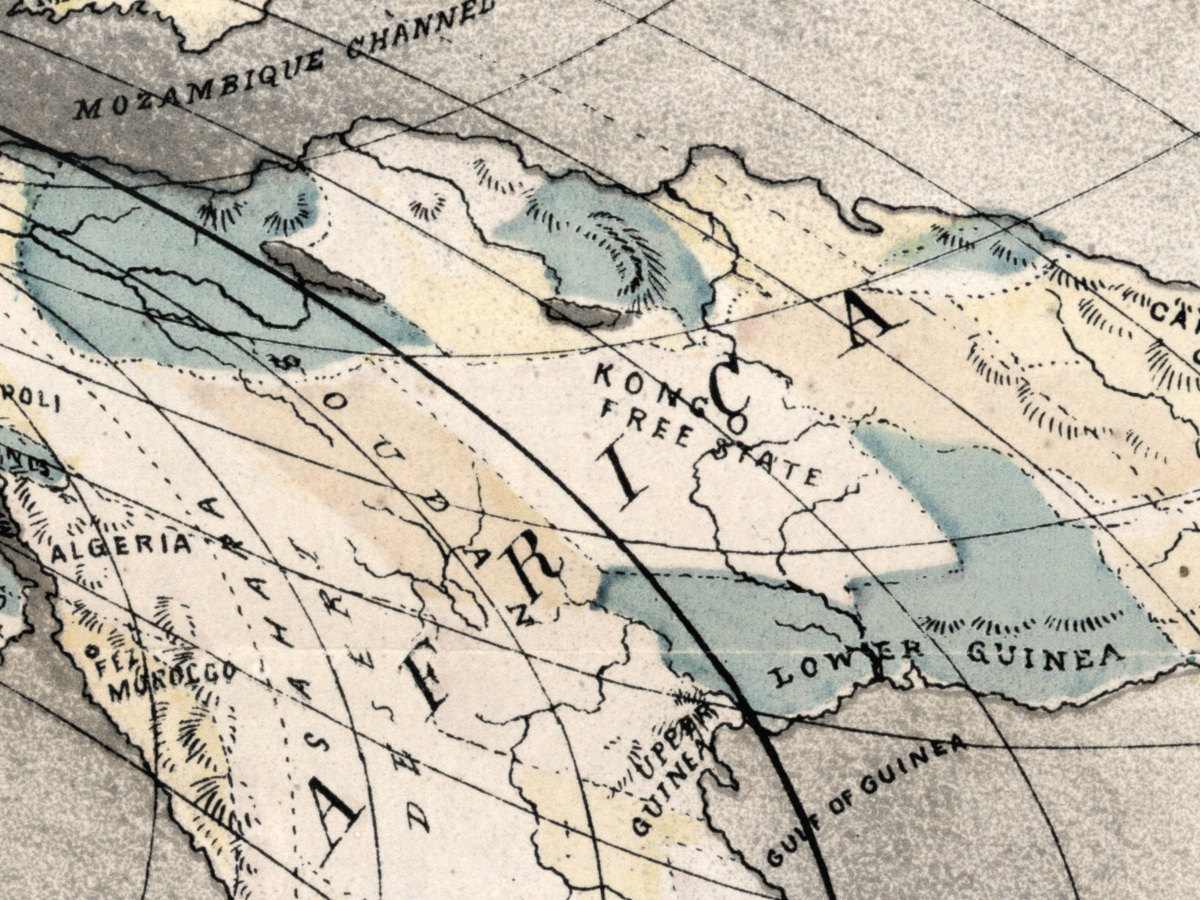
- Europe, Africa and Asia: EUROPE, RUSSIA, ICELAND, ENGLAND, LONDON, PARIS, SPAIN, AFRICA, ALGERIA, KONGO FREE STATE, CAPE OF GOOD HOPE, ARABIA, SIBERIA, BRITISH INDIA, BAY BENGAL, SUMATRA, BORNEO, BARENTZ SEA.
- Australia and the Pacific: AUSTRALIA, VAN DIEMEN’S LAND, …ZEALAND [first word lost in a fold], NEW GUINEA, ARAFURA SEA, SOLOMON ISLANDS, CORAL SEA, LOYALTY IS.
- Foot, left and center, under the heading SCRIPTURE THAT CONDEMNS THE GLOBE THEORY.: And his hands were steady until the going down of the sun.—Ex. [chapter number unclear on the scan] : 12. And the sun stood still, and the moon stayed.—Joshua 10: 12–13. The world also shall be stable that it be not moved.—Chron. 16: 30. To him that stretched out the earth, and made great lights (not worlds).—Ps. 136: 6–7. The sun shall be darkened in his going forth.—Isaiah 12: 10. The four corners of the earth.—Isaiah 11: 12. The whole earth is at rest.—Isaiah 14: 7. The prophecy concerning the globe theory.—Isaiah: 29th chapter. Woe to the rebellious children, sayeth the Lord, that take counsel, but not of me.—Isaiah 30: 1. So the sun returned ten degrees.—Isaiah 38: 8–9. It is he that sitteth upon the circle of the earth.—Isaiah 40: 22. He that spread forth the earth.—Isaiah 52: 5. That spreadeth abroad the earth by myself.—Isaiah 54: 24. My hand also hath laid the foundation of the earth.—Isaiah 58: 13. Thus sayeth the Lord, which giveth the sun for a light by day, and the moon and stars for a light by night (not worlds).—Jer. 31: 35–36. The sun shall be turned into darkness, and the moon into blood.—Acts 2: 20.
- Foot, right: Send 25 Cents to the Author, Prof. Orlando Ferguson, for a book explaining this Square and Stationary Earth. It Knocks the Globe Theory Clean Out. It will Teach You How to Foretell Eclipses. It is Worth Its Weight in Gold.
- Under the right edge of the slab: Louis H. Everts & Co. - Litho. Phila.
On the sheet itself: Ferguson is PROF. in the title, under the portrait and in the advertisement, while the catalog record names him plainly. The verse references are printed as given and have not been checked here against any edition of the Bible. The only date on the sheet is in the copyright line; the Library of Congress gives the date in brackets, [1893], with ©1893.
Editions and other known copies
- Library of Congress, Geography and Map Division, G3201.A67 1893 .F4: Hot Springs, South Dakota : Orlando Ferguson, [1893], ©1893; 1 map, hand colored, on sheet 57 × 82 cm; relief shown by hachures; “Fold-lined.” “Conserved.” L.H. Everts & Co. is listed as a contributor. Gift of Don Homuth, September 2011, with accompanying material that includes transcriptions of Ferguson’s obituaries and a photocopy of “The globe theory of the earth refuted”.
- Pioneer Museum, Hot Springs, South Dakota: a second copy reported in news coverage of the 2011 gift; no catalog record of it was found, and its date, size and coloring are not stated.
- The Leventhal Map & Education Center shows the Library of Congress copy in its online exhibition and gives the same size, 57 × 82 cm. None of these records names states or editions of the map.
Catalog entries and sources
Library of Congress LCCN 2011594831; call number G3201.A67 1893 .F4; digital id g3201a.ct003543. Ferguson’s pamphlet The latest discoveries in astronomy: The globe theory of the earth refuted (1891, 46 p.): American Philosophical Society, 520 Pam., no. 82.
Sources for the story and this record: the Library of Congress catalog record; the Library of Congress map blog post on unconventional theories of the Earth’s shape (2025); the Leventhal Map & Education Center exhibition Bending Lines (sections on Ferguson and on Alexander Gleason’s map of 1892); the American Philosophical Society catalog; news reports on the 2011 gift by Live Science and ABC13.
This copy
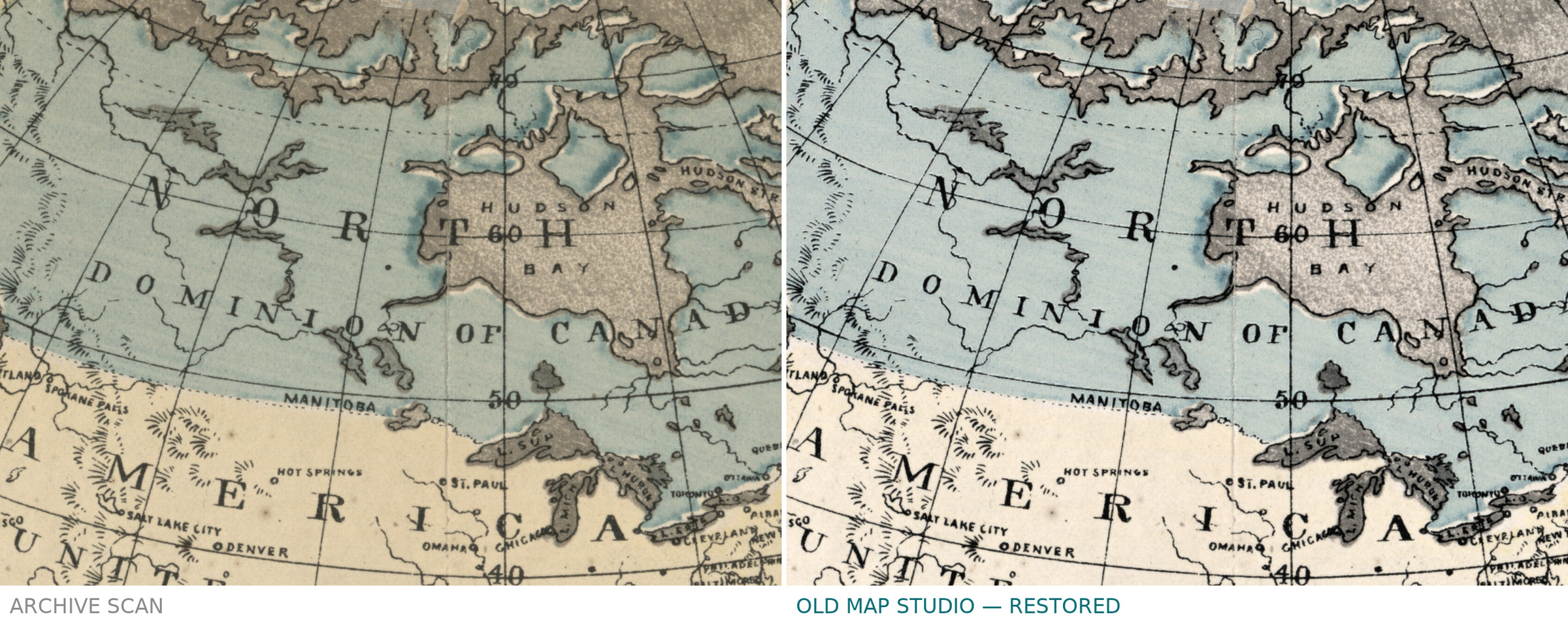
The scan shows the Library of Congress copy printed in black and gray, with hand coloring in pale blue and buff on the land areas of the round map, light blue along the ice rim and touches of blue on the globe held by the two men. Fold lines cross the sheet horizontally and vertically, visible as faint creases in the margins and through the verses at the foot. There are small light spots and a narrow pale sliver in the ocean east of Africa; the margins are complete around the printed area.
Your file
| Original | Orlando Ferguson, Hot Springs, South Dakota, [1893], ©1893; hand colored; sheet 57 × 82 cm; Library of Congress, Geography and Map Division, G3201.A67 1893 .F4 |
| Scan | full sheet 12781 × 8818 px; the map inside the trimmed border 12522 × 8555 px |
| Print size at 300 dpi | the map prints to 106 cm (42 in), the full sheet with margins to 108 cm (43 in) |
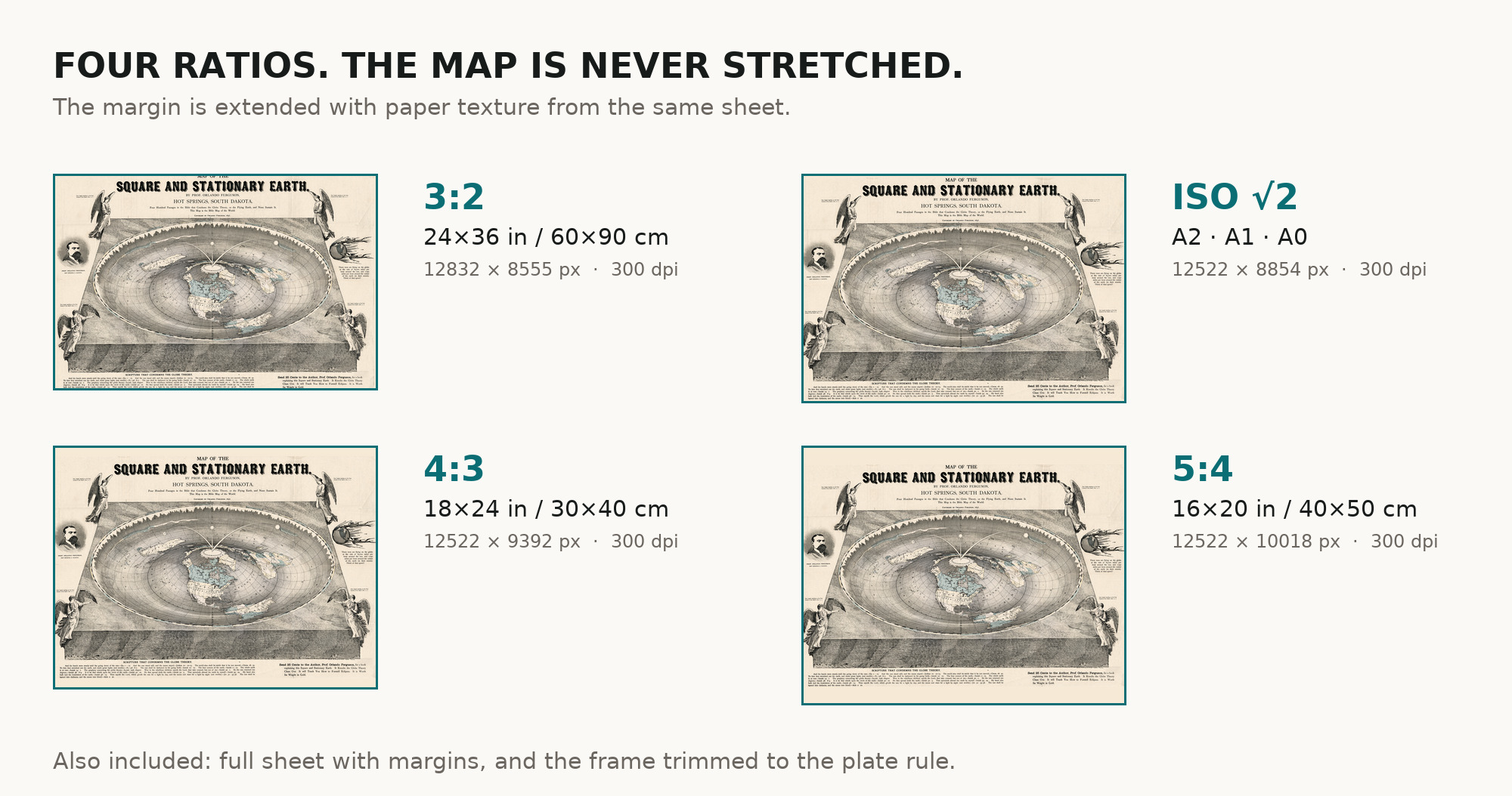
| You download | six ZIP archives: full sheet, trimmed, 3:2, 4:3, 5:4 and ISO A |
| Inside each one | one JPEG at 300 dpi, the restoration passport as a PDF, a READ ME |
How to print
- Print at 300 dpi at the size above and do not let the shop scale the file up.
- Pick the archive whose proportions match your frame, so nothing is cropped or stretched.
- Ask for matte fine-art paper, sRGB, auto-enhancement off. The coloring was kept in restoration, not repainted.
- Where to print it: print shops near you and checked prices at online labs.
Source and rights
Library of Congress, Geography and Map Division, call number G3201.A67 1893 .F4, a gift of Don Homuth in September 2011. The Library states that its digitized map collections are free to use and reuse unless a Rights Advisory statement is present; there is none for this item. The record notes the sheet as fold-lined and conserved, and does not name the printing technique. There is no TIFF master in the package. Catalogue record: Library of Congress →
Questions
How large can I print it?
The map to 106 cm (42 in) on the long side at 300 dpi, the full sheet with margins to 108 cm (43 in), from the scan’s own resolution, not an upscale.
Is this a serious map?
Ferguson meant it seriously, as an argument from the Bible against a round, moving Earth. Today it is kept as a document of that belief, not as geography.
Features
- English
Attachments
Reviews
No reviews found
More maps from the 1800s
-
 Antique Map of Asia c. 1150 — Jerome Map, Miller Facsimile 1895, Plate 11
-
Antique World Map c. 1190 — Sawley Map, Miller Facsimile 1895, Plate 13
-
Antique World Map — Beatus Map Paris II, Miller Facsimile 1895, Plate 2
-
Antique World Map — Turin Beatus Map, Miller Facsimile 1895, Plate 8
-
Antique Holy Land Map c. 1150 — Jerome, Miller Facsimile 1895, Pl. 12
-
Antique World Map — Psalter Map, Miller Facsimile 1895, Plate 1