Antique World Map 1724 — Delisle, Hemisphere Oriental


Description
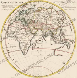
An old world map of the eastern half, drawn for the King: Delisle’s Hemisphere Oriental
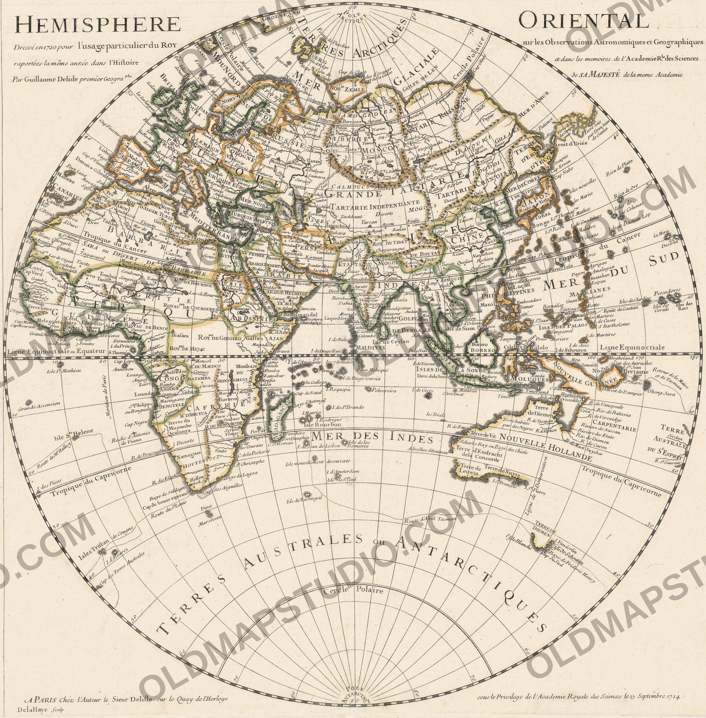
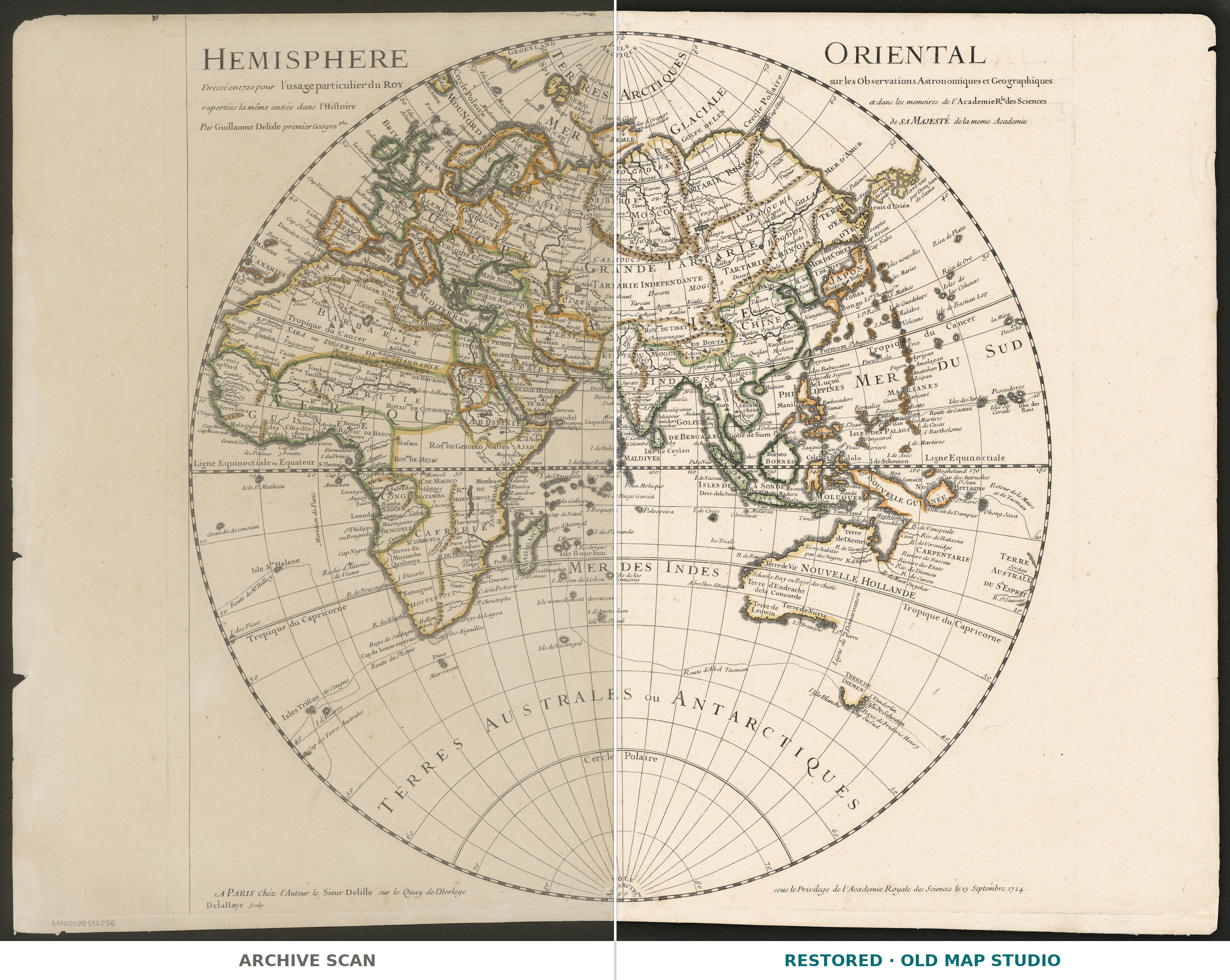
Europe, Africa, Asia and a first, unfinished outline of Australia share one circle on this sheet. The title, engraved in two halves across the top corners, reads HEMISPHERE ORIENTAL Dressé en 1720 pour l'usage particulier du ROY: drawn in 1720 for the King’s own use, on the observations reported that year by the Royal Academy of Sciences.
Guillaume Delisle (1675–1726) was born and died in Paris. Encyclopaedia Britannica credits him with leading the reform of French cartography: a student of Jean-Dominique Cassini, he fixed positions by astronomical observation and greatly reduced the errors in longitude of earlier maps. He entered the Academy in 1702, and in 1718 became chief geographer to the king, according to the PSL dictionary of geographers as a reward for teaching geography to Louis XV, who was ten years old in 1720.
On 27 November 1720 Delisle read to the Academy a memoir on the position of the parts of the earth, printed in 1722 with his world map for the King, as R. H. de Oliveira and J. P. Cintra show. From the Cape of Good Hope to the eastern point of China he found only 105 degrees of longitude, where ordinary maps gave 123. The memoir also records that the Tsar told him the whirlpool supposed to be in the Caspian lay in a smaller sea joined to it; the Paris Observatory dates Peter the Great’s visit to France to 1717.
The plate was engraved by De la Haye and sold, the imprint says, at the author’s house on the Quai de l’Horloge. This impression carries the Academy’s privilege of 15 September 1724. The National Library of Poland holds it under ZZK 28 842: a copper engraving, the map 51 × 50 cm on a sheet of 51 × 67 cm, at about 1:54,000,000, with longitude counted from Ferro in the Canary Islands and relief drawn as small hills.
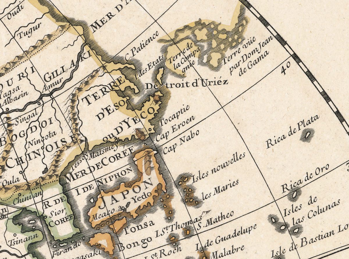
In the far northeast, the memoir complains that ordinary maps had stretched the land of Yeço across the north of the Pacific; here TERRE D'ESO ou D'YECO lies just north of Japan, joined to the mainland. Beyond Detroit d'Uriéz come Terre de la Compagnie and a coast lettered Terre vüe par Dom Jean de Gama.
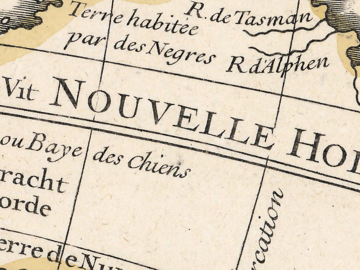
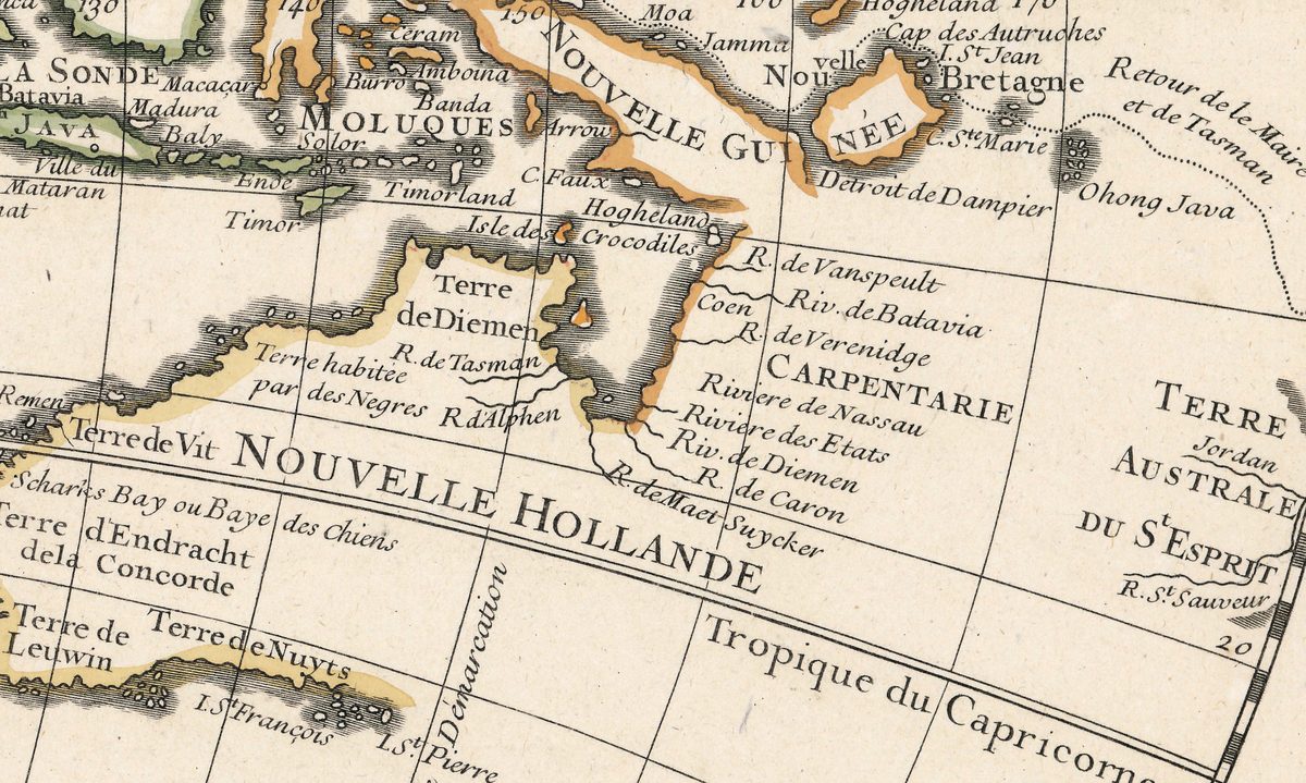
In the southeast, NOUVELLE HOLLANDE is a coastline in pieces: the Gulf of Carpentaria with Dutch river names, the west coast from Terre d'Endracht to Terre de Nuyts, and far to the south a short coast lettered TERRE DE DIEMEN on the dotted track of Abel Tasman. No east coast is drawn.
What to look for on the sheet
- Two Terre de Diemen: one on the north coast of New Holland, west of Carpentaria, and TERRE DE DIEMEN on Tasman’s coast far to the south.
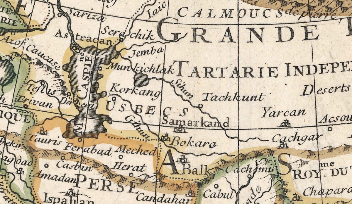
- M. CASPIEne drawn tall from north to south, with a separate, unnamed lake to the east into which the Sihun flows.
- The Niger drawn from L. Maberia past Tombut ou Tanbouctou east to the Lac de Bournou, where it ends.
- South Atlantic: the dotted Route de Mr Halley beside Isle Ste Helene.
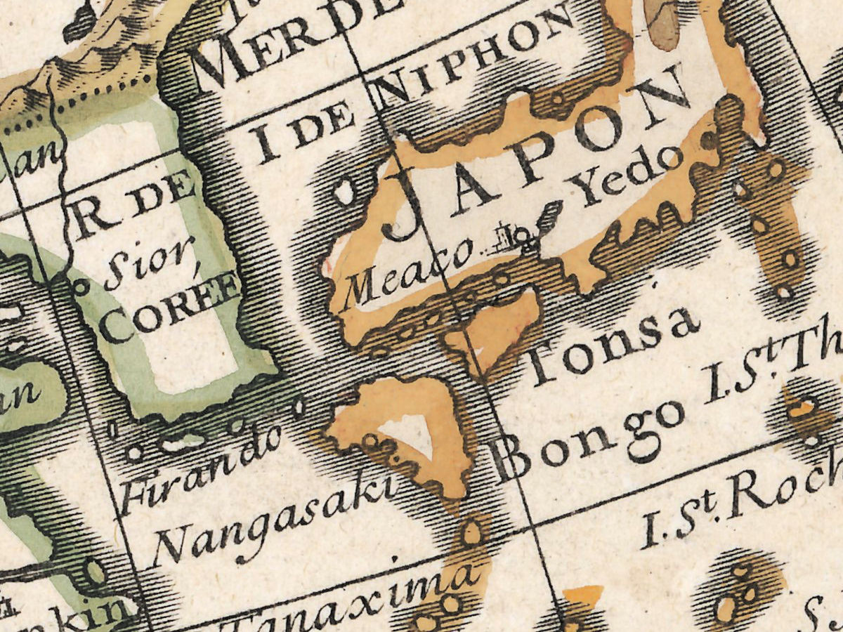
- MER DE COREE between Korea and Japan.
- South of New Holland, lettered along a meridian between Terre de Nuyts and the southern TERRE DE DIEMEN: Ligne de Démarcation.
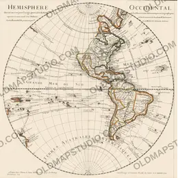
The David Rumsey Map Collection holds a copy bound in a composite atlas it catalogs as Atlas de Geographie and dates to 1731. Philippe Buache reissued the pair in 1745, and in Amsterdam Covens and Mortier published their own edition; a copy of that edition in the University of Tasmania includes the discoveries of 1739. The companion sheet, Hemisphere Occidental, carries the same title formula and the same privilege of 1724.
Everything on this sheet: full record
Every inscription on the sheet
All lettering is engraved: the title in roman capitals and lower case, the imprint and many place names in italic. Inscriptions are given letter for letter, with the accents and capitals of the sheet; the long s is written as s, word spacing, which the engraver often closes up, is normalized, and raised letters are written on the line. Inside the hemisphere only the circles, the large names and the inscriptions that tell a story are listed, not the hundreds of smaller names. Translations are in square brackets.
- Title, read across the two top corners line by line: HEMISPHERE (left) ORIENTAL (right) · Dressé en 1720 pour l'usage particulier du ROY · sur les Observations Astronomiques et Geographiques · raportées la même année dans l'Histoire · et dans les memoires de l'Academie Rle des Sciences · Par Guillaume Delisle premier Geographe · de SA MAJESTÉ de la meme Academie [Eastern hemisphere, drawn in 1720 for the King's own use, on the astronomical and geographical observations reported the same year in the History and in the Memoirs of the Royal Academy of Sciences, by Guillaume Delisle, first geographer of His Majesty, of the same Academy].
- At the foot, left of the circle: A PARIS Chéz l'Auteur le Sieur Delisle sur le Quay de l'Horloge [in Paris, at the author's, Sieur Delisle, on the Quai de l'Horloge] and below it DelaHaye Sculp [De la Haye engraved it].
- At the foot, right of the circle: sous le Privilege de l'Academie Royale des Sciences le 15 Septembre 1724. [under the privilege of the Royal Academy of Sciences, 15 September 1724].
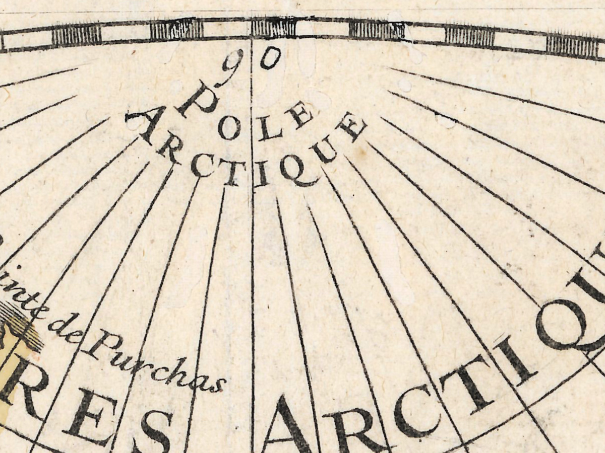
- The circle: POLE ARCTIQUE at the top and POLE ANTARCTIQUE at the foot, with 90 at both poles; Cercle Polaire north and south; Tropique du Cancer and Tropique du Capricorne; the equator lettered Ligne Equinoctiale ou Equateur at the left and Ligne Equinoctiale at the right, numbered every 10 degrees from 10 to 180; latitudes every 10 degrees along the rim.
- Large names: TERRES ARCTIQUES, MER GLACIALE, TERRES AUSTRALES ou ANTARCTIQUES, MER DES INDES, MER DU SUD, MER MEDITERRANEE, MER NOIRE, GRANDE TARTARIE, TARTARIE INDEPENDANTE, CHINE, JAPON, INDES, BARBARIE, NIGRITIE, CAFRERIE, NOUVELLE GUINÉE, NOUVELLE HOLLANDE, TERRE AUSTRALE DU St ESPRIT.
- The Arctic: GROENLAND, Pointe de Purchas, Isle de Jean Mayen, Beeren, Hope, Isle de Edge, Côte de Glace, Cap de Glace, Isles d'Orange, Port de la Glace, GOLFE DE LEN, Maelstrom, Nord Cap, Vardhus.
- Northeast Asia: MER D'AMUR, C. Patience, I des Etats, Terre de la Compagnie, Terre vüe par Dom Jean de Gama [land seen by Dom Jean de Gama], Detroit d'Uriéz, TERRE D'ESO ou D'YECO, Tesso, Matsmey, Tocaptie, Cap Eroen, Cap Nabo, MER DE COREE, I DE NIPHON, Yedo, Meaco, Tonsa, Bongo, Nangasaki, Firando.
- The North Pacific east of Japan: Isles nouvelles, les Maries, Rica de Plata, Rica de Oro, Isles de las Colunas, Isle de Bastian Lop, la Mira, Deserta, Agrigan, Anatahan, Zeipan, Isles des Jardins, Route de Gaetan [Gaetano's route], Pescadores, Isles des Corails, Isles des Rois.
- New Guinea and New Holland: Detroit de Dampier, Cap des Autruches, Ohong Java, Retour de le Maire et de Tasman [return of Le Maire and Tasman], Hogheland, Isle des Crocodiles, Terre de Diemen, R. de Tasman, R. d'Alphen, Terre habitée par des Negres, Terre de Vit, CARPENTARIE, R. de Vanspeult, Riv. de Batavia, Coen, Riviere de Nassau, Riviere des Etats, Riv. de Diemen, R. de Caron, Scharks Bay ou Baye des Chiens, Terre d'Endracht de la Concorde, Terre de Leuwin, Terre de Nuyts, I. St François, I. St Pierre.
- Far to the south: TERRE DE DIEMEN, l'Isle Blanche, I. Vanderlin, Isle de S. Schouten, Baye de Frideric Henry, Cap du Sud, and to the west the dotted Route d'Abel Tasman.
- The Indian Ocean: Ligne de Démarcation along a meridian in the open sea south of New Holland, east of Terre de Nuyts, Abrolhos d'Houtman, les Trials, I. de Cocos, Christmat, Polvereira, Isle nouvellement decouverte [newly discovered island], I. d'Amsterdam, Isle de St Paul, Isle Bourbon, I Maurice, I Rodrigue, MALDIVES, Isle de Ceylan.
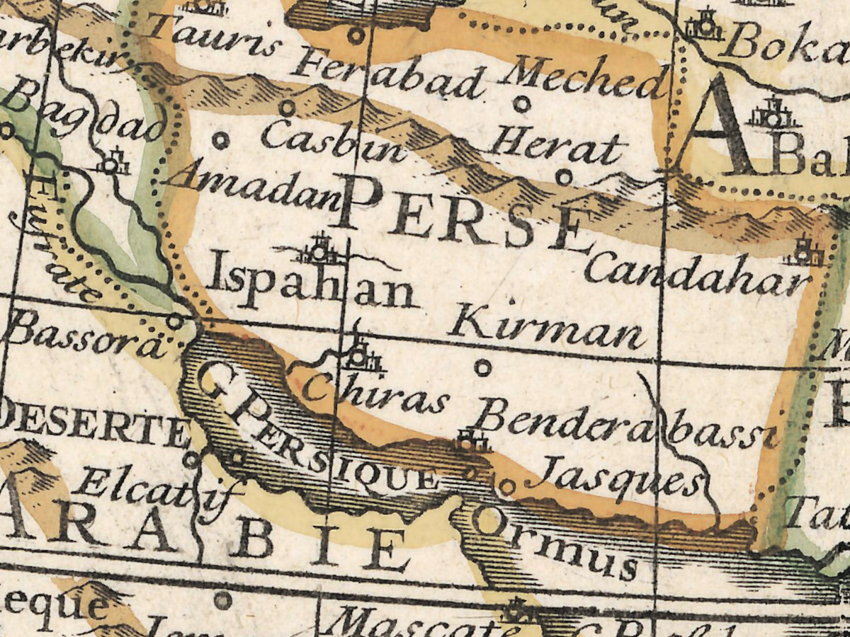
- Asia inland: M. CASPIEne, Astracan, Iaic, Jemba, Sihun, Gihun, Samarkand, CALMOUCS, ETATS DU MOGOL, ROYme DU TIBET, Lassa.
- Africa and the Atlantic: SARA ou DESERT DE BARBARIE, Mer de Mousa, Tombut ou Tanbouctou, Niger, Lac de Bournou, Senegal, NUBIE, HOTTENTOTS, Cap de bonne esperance, Cap des Aiguilles, Route de Mr Halley, Isle Ste Helene, Grande Ascension, Roche d'Antonio de Viana, Route du St Louis, Isles Tristan de Cougne, I. d'Alvarez, and a meridian lettered Meridien de Paris.
Differences on the sheet itself: the title spells même in one line and meme in another; Terre de Diemen names two different coasts; the title gives 1720, the year of drawing, while the privilege at the foot is dated 1724.
Editions and other known copies
- National Library of Poland, ZZK 28 842 (this copy): “A Paris : chez l'Auteur le Sieur Delisle […], 1724”; copper engraving, map 51 × 50 cm, sheet 51 × 67 cm, about 1:54,000,000; prime meridian Ferro; relief as small hills; verso blank. The companion western sheet is ZZK 28 843.
- David Rumsey Map Collection, 4764.003: Paris, Guillaume DeLisle, Quai de l'Horloge, 1724; engraver Jean Baptiste Delahaye; bound in an untitled atlas catalogued as (Atlas de Geographie), dated 1731; 49 × 48 cm, outline color, 1:54,000,000; routes of Halley, Tasman, Le Maire and Gaetan. The record gives the privilege as 15 September 1734, against 1724 on this sheet, a date that cannot stand with an atlas of 1731.
- University of Tasmania, Royal Society of Tasmania collection, RS Mp/9: Paris, chez l'auteur sur le Quay de l'Horloge, privilege of 15 September 1724; 48 × 49 cm, colored; presented by R. W. Giblin in 1927; New Holland with the Gulf of Carpentaria and Western Australia, “with a slight gap in the coastline”.
- University of Tasmania, RS Mp/11: Amsterdam, J. Covens et C. Mortier, undated, believed mid-18th century; 48 × 49 cm; includes the discoveries of 1739 and Cap de la Circoncision.
- State Library of New South Wales, M2 110/1775/1: Amsterdam, Covens & Mortier, [177-?], “corrigé par Covens et Mortier”, signed I. Condet S.; hand-colored, diameter 47 cm on a sheet of 57 × 68 cm.
- Leiden University, via Yale-NUS Historical Maps, 876347: dated 1724, drawn 1720; New Guinea and New Holland shown as one landmass.
- Barry Lawrence Ruderman Antique Maps (dealer), 85886: the pair reissued by Philippe Buache in Paris in 1745, outline color, described as “true to the first state”.
Apart from that dealer’s phrase, none of these records names states of the plate.
Catalog entries and sources
National Library of Poland ZZK 28 842 (companion ZZK 28 843); David Rumsey 4764.003; University of Tasmania RS Mp/9 and RS Mp/11; State Library of New South Wales M2 110/1775/1; Leiden University 876347.
Sources for the story and this record: the Polona record of the National Library of Poland; Encyclopaedia Britannica, “Guillaume Delisle”; the PSL dictionary of geographers; R. H. de Oliveira and J. P. Cintra, “A reforma cartográfica de Delisle” (VIII Simpósio Luso-Brasileiro de Cartografia Histórica, 2019); the library of the Paris Observatory, “A life between two meridians”; the records of the David Rumsey Map Collection, the University of Tasmania, the State Library of New South Wales and Leiden University; Barry Lawrence Ruderman Antique Maps.
This copy
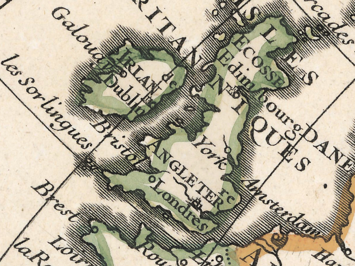
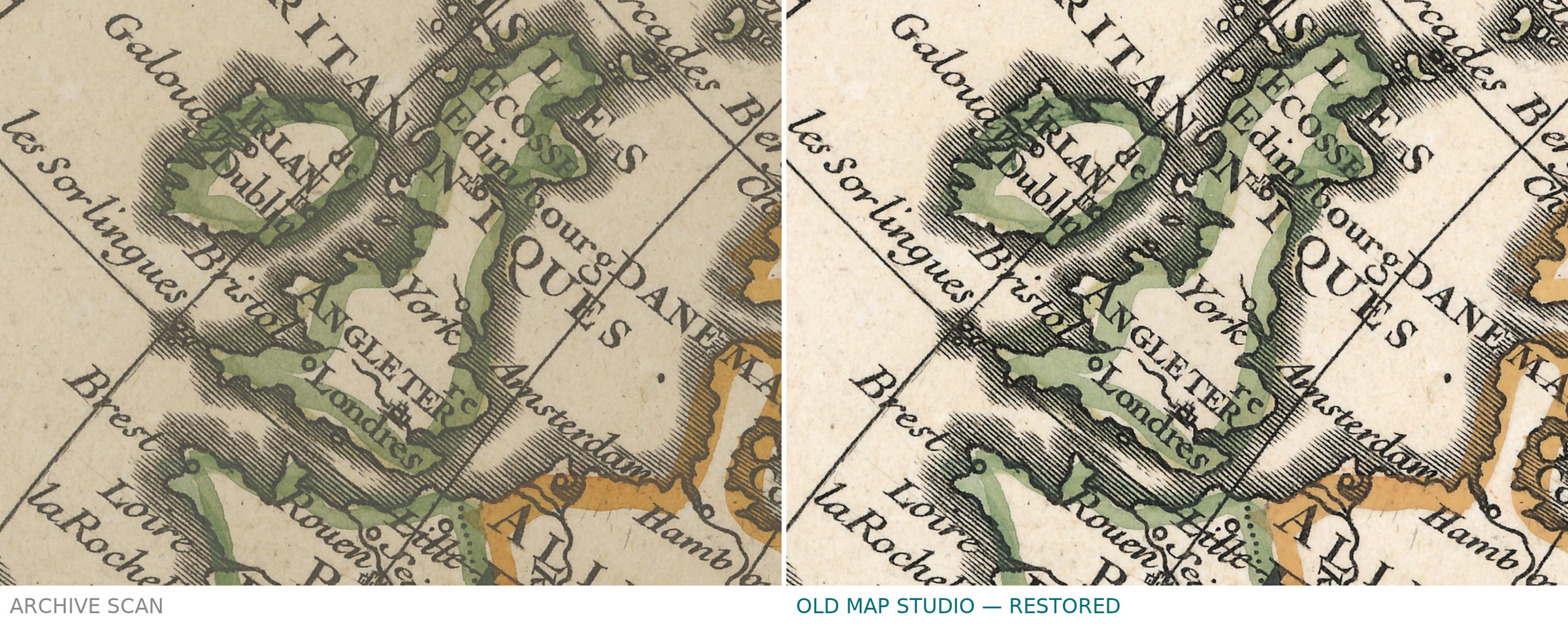
The scan shows the whole sheet with wide margins. The outlines of coasts and borders are colored by hand in green, yellow, orange and brown; many islands carry an orange wash; the seas and the lettering are uncolored. A ruled line runs down the left margin. In the lower left margin a library number is written in pencil, b1000000512056. The lower edge of the paper shows a narrow, slightly uneven strip. East of the southern Terre de Diemen there is a short dark stroke in the open sea, and the paper has scattered small brown specks.
Your file
| Original | Guillaume Delisle, Paris, chez l’Auteur, privilege of 15 September 1724; copper engraving; map 51 × 50 cm, sheet 51 × 67 cm; National Library of Poland, ZZK 28 842 |
| Scan | full sheet 16110 × 12325 px; the map inside the trimmed border 11410 × 11610 px |
| Print size at 300 dpi | the map prints to 98 cm (39 in), the full sheet with margins to 136 cm (54 in) |
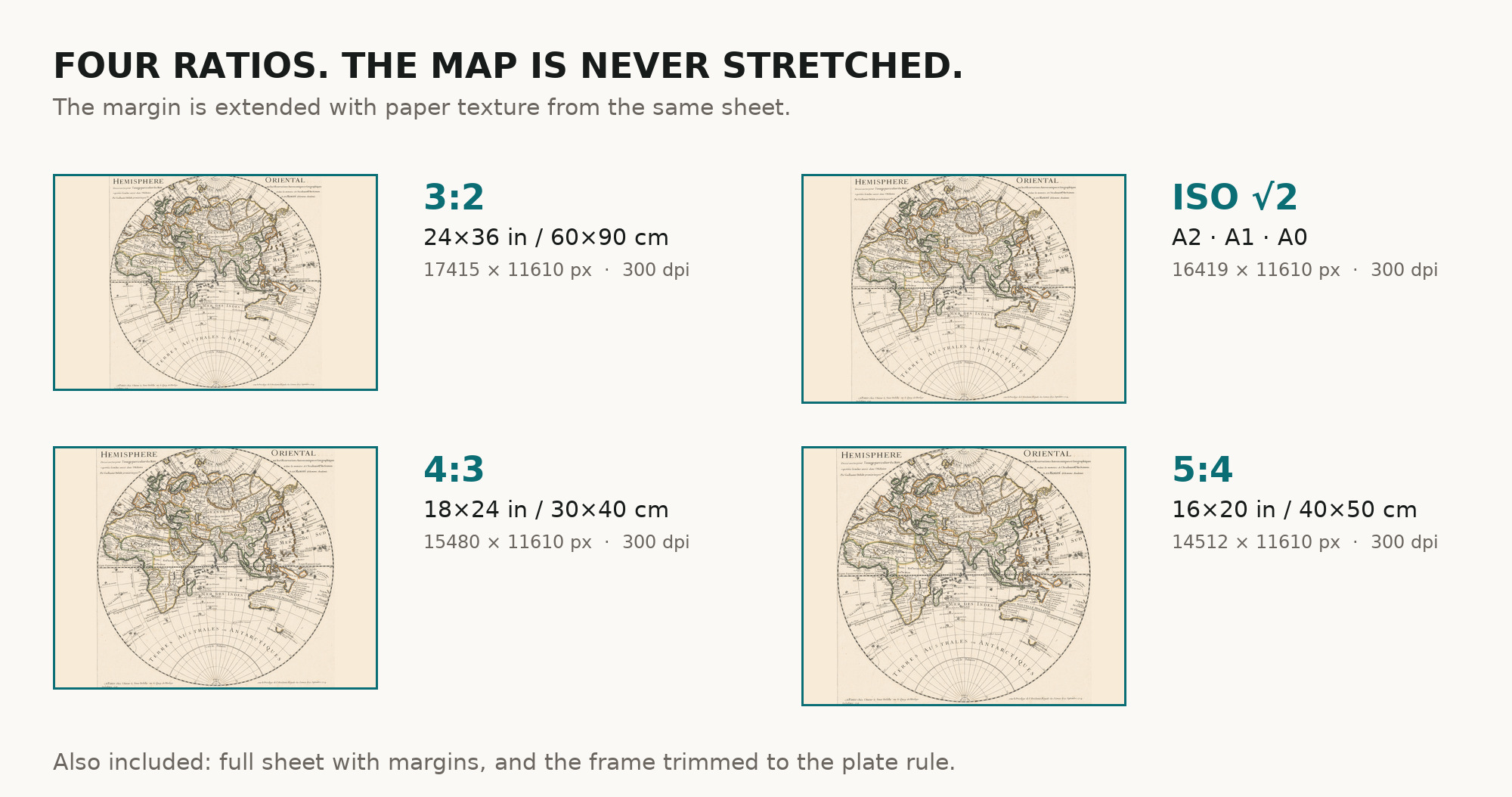
| You download | six ZIP archives: full sheet, trimmed, 3:2, 4:3, 5:4 and ISO A |
| Inside each one | one JPEG at 300 dpi, the restoration passport as a PDF, a READ ME |
How to print
- Print at 300 dpi at the size above and do not let the shop scale the file up.
- Pick the archive whose proportions match your frame, so nothing is cropped or stretched.
- Ask for matte fine-art paper, sRGB, auto-enhancement off.
- Where to print it: print shops near you and checked prices at online labs.
Source and rights
National Library of Poland (Biblioteka Narodowa), call number ZZK 28 842, published on Polona. The library places the sheet in the public domain and allows it to be reproduced, altered and distributed, commercially too. The record names the technique as copper engraving and says nothing about coloring. There is no TIFF master in the package. Catalogue record: Polona →
Questions
What exactly do I get after payment?
Six ZIP archives, each with one JPEG at 300 dpi, the restoration passport as a PDF and a READ ME. There is no TIFF master in the package.
How large can I print it?
The map to 98 cm (39 in) on the long side at 300 dpi, the full sheet with margins to 136 cm (54 in), from the scan’s own resolution, not an upscale. The difference is the wide blank paper around the round map.
Why does the title say 1720 and the year 1724?
The map was drawn in 1720, as the title states; this sheet was issued under a privilege of 15 September 1724. The listing gives the year of the sheet we scanned.
Is there a western half?
Yes. Delisle’s Hemisphere Occidental, the companion sheet from the same library, is also in the shop, so the two can hang side by side.
Features
- French
Attachments
Reviews
No reviews found