Antique Constellation Map 1515 — Dürer, Imagines coeli Meridionales

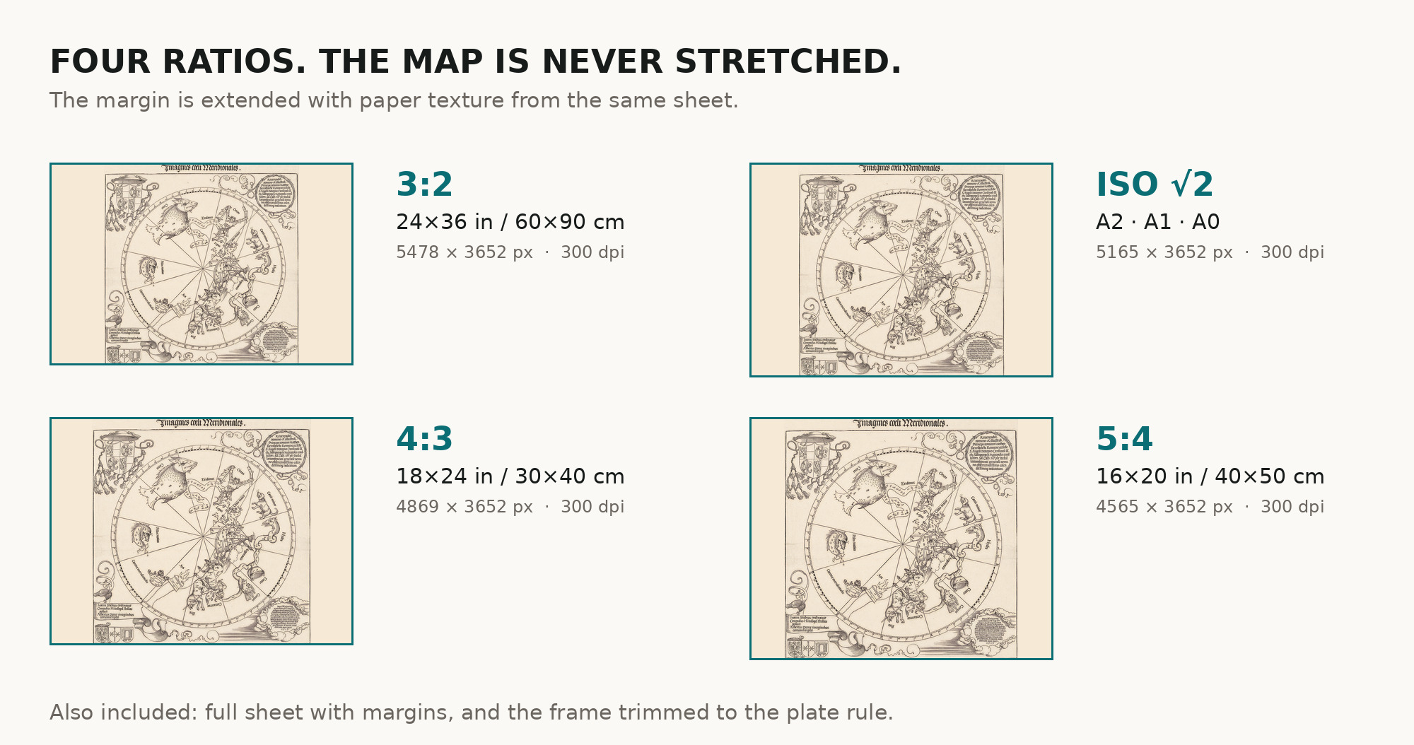
An antique constellation map of the southern sky, 1515
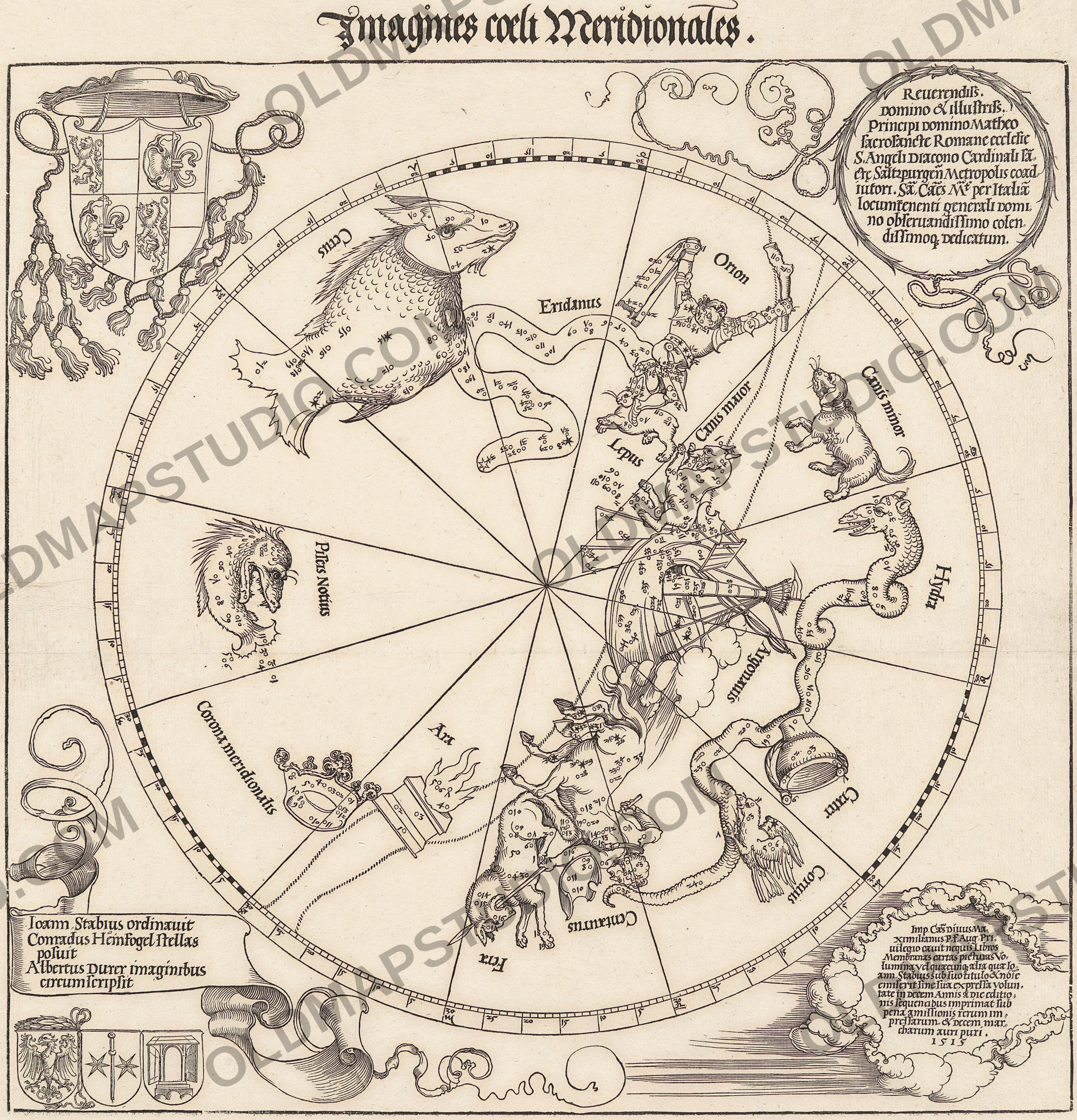
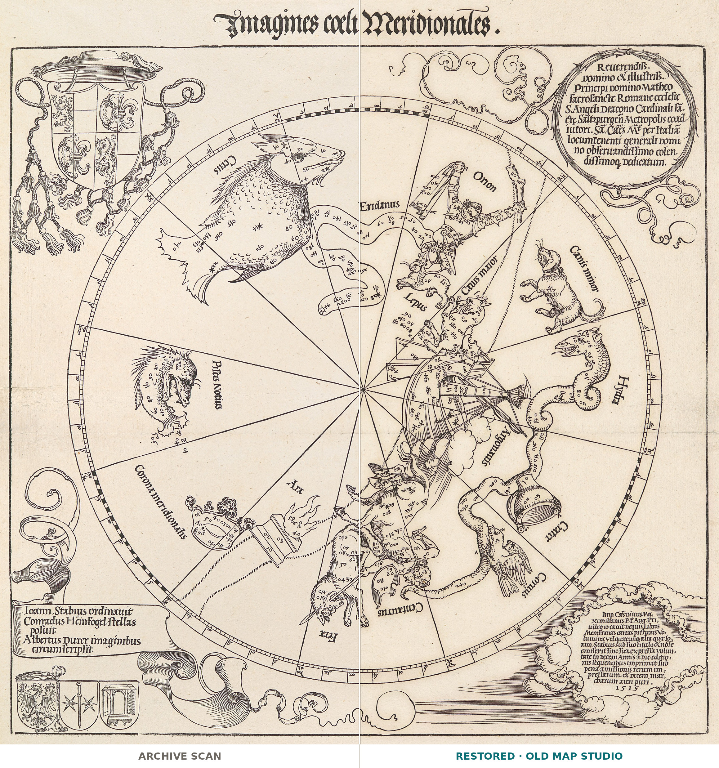
In 1515 three men working in Nuremberg put the sky into print in a way nobody had before. This woodcut and its northern companion, Imagines coeli Septentrionales, were, in the Metropolitan Museum’s words, “the first ever published” celestial maps — the first printed star maps in Europe. The Met holds both sheets. Printed books already had pictures of the constellations, but their stars were scattered at random. Here each star is plotted from Ptolemy’s catalogue, and the small number beside it is its number in that catalogue.
Three makers, named on the sheet
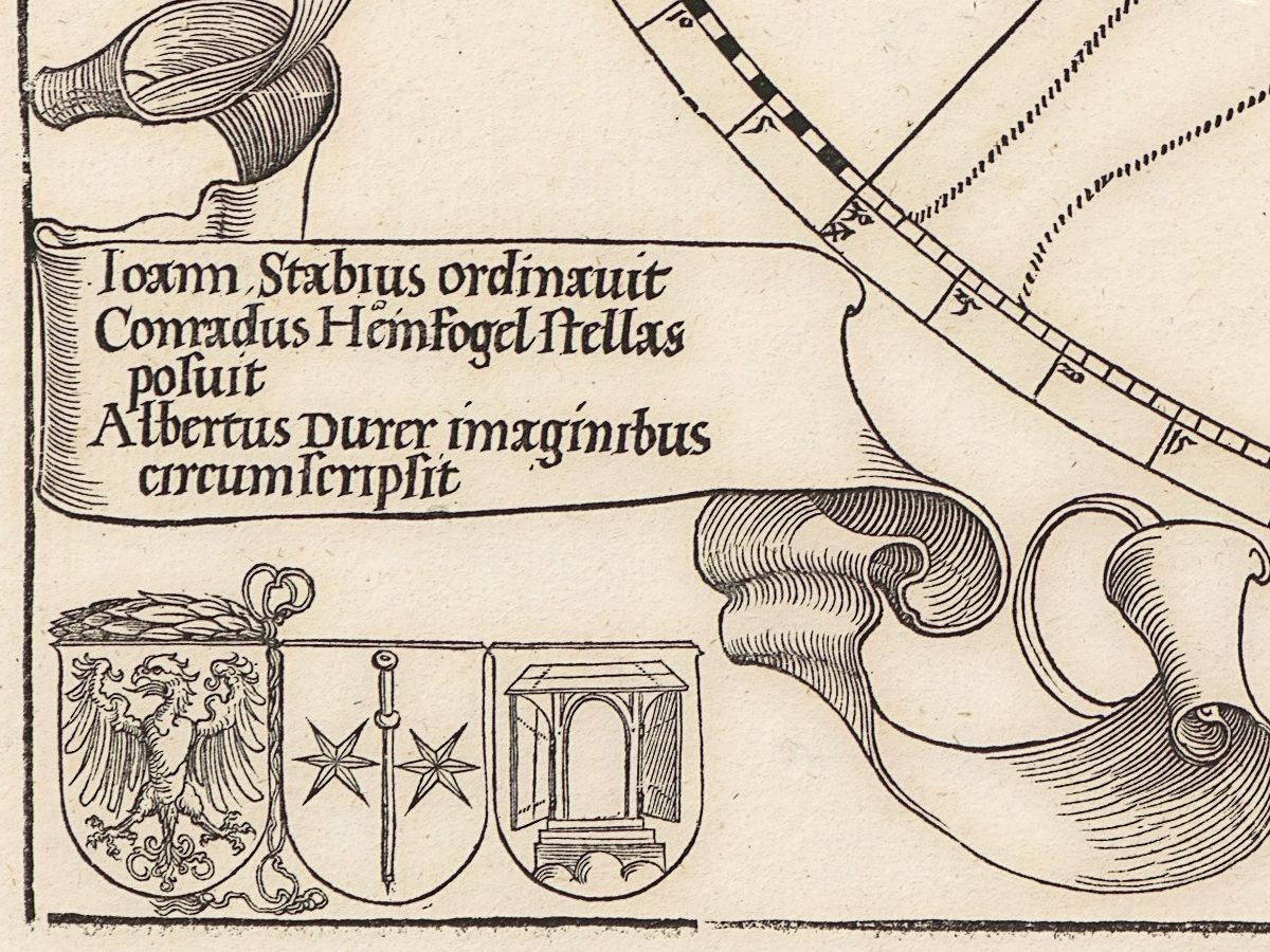
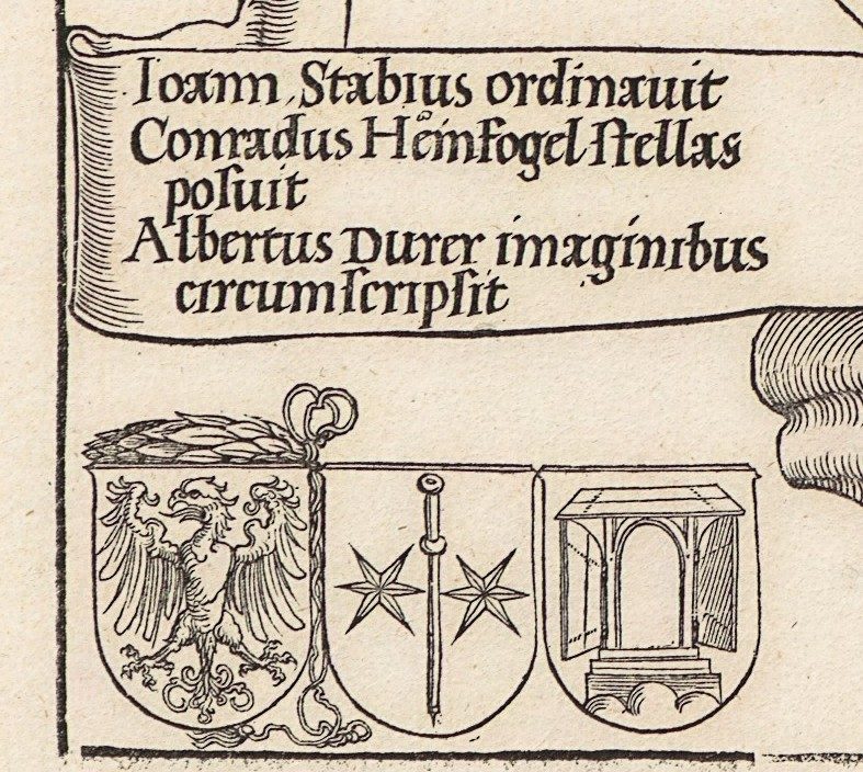
The lower left corner says in Latin who did what: Ioann. Stabius ordinavit, Conradus Heinfogel stellas posuit, Albertus Durer imaginibus circumscripsit — Johannes Stabius arranged it, Conrad Heinfogel placed the stars, Albrecht Dürer drew the figures around them. Their three coats of arms stand beneath. The model was a pair of star charts painted on parchment in Nuremberg in 1503, devised by Heinfogel; both survive in the Germanisches Nationalmuseum.
Why the far southern sky is empty
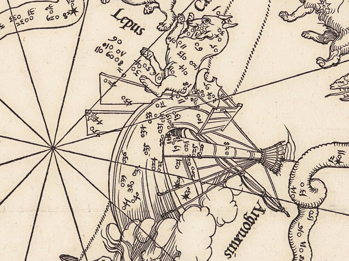
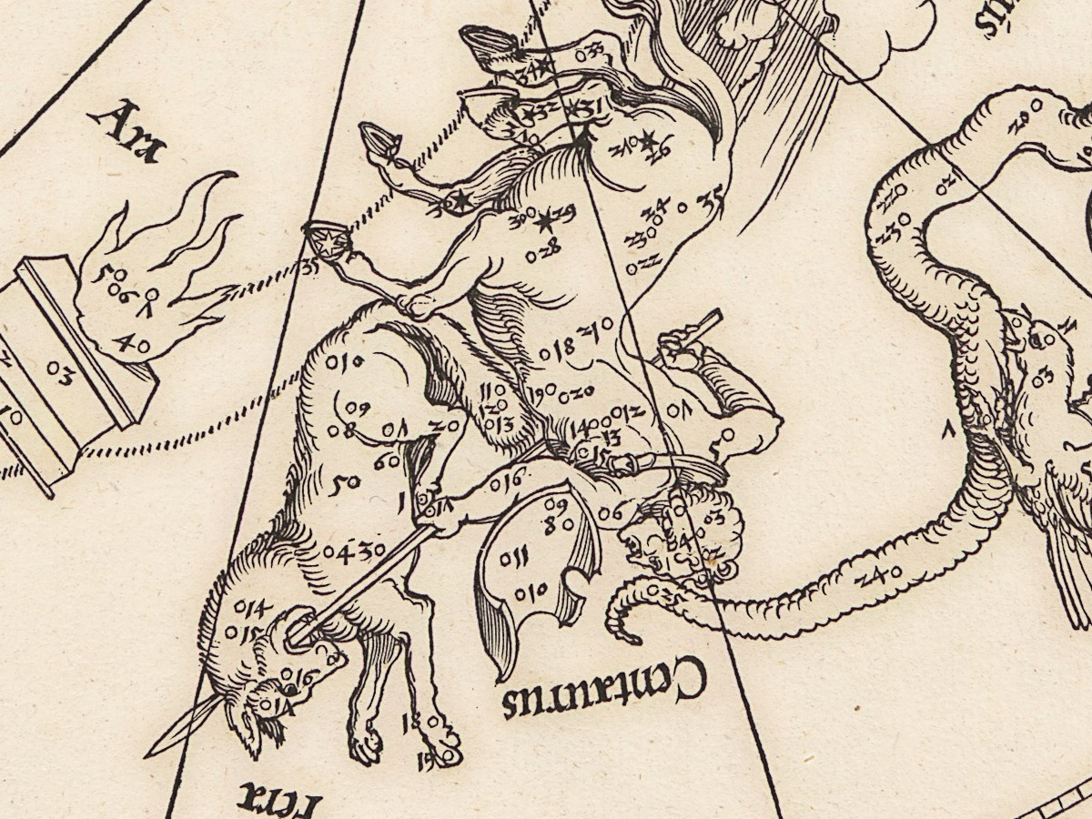
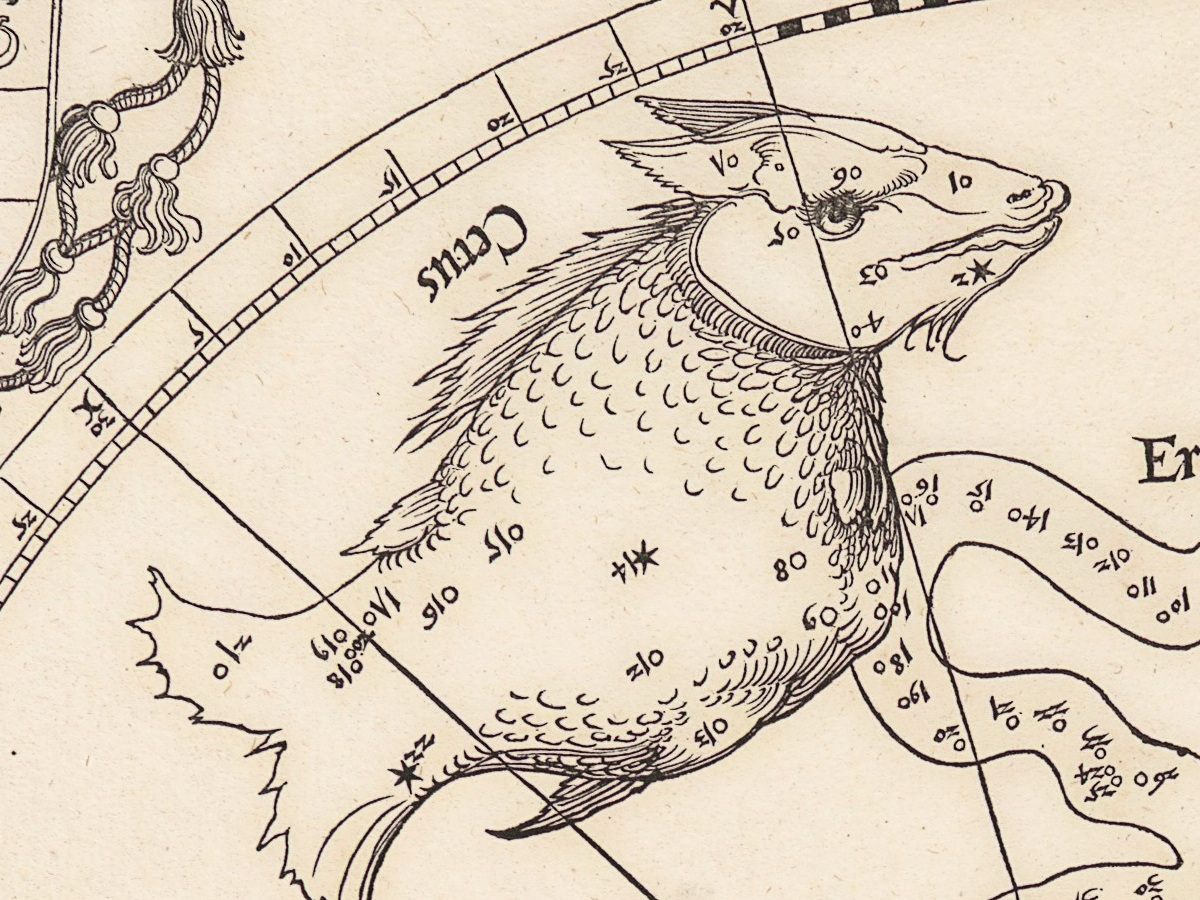
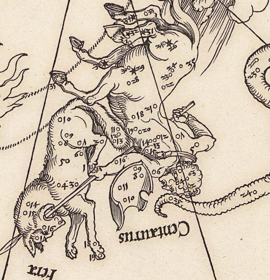
The circle holds the fifteen classical constellations south of the Sun’s yearly path: Cetus the sea monster, Orion, the river Eridanus, the Hare, the Great and Little Dog, the ship Argo, the Water Snake with the Cup and the Crow on its back, the Centaur, the Wolf, the Altar, the Southern Crown and the Southern Fish. The sky around the south pole is missing: no Magellanic Clouds, no Achernar at the mouth of the River. Ptolemy worked in Alexandria, where those stars never rise. Even the Southern Cross is not here as a cross: Ptolemy counted its stars as the hind legs of the Centaur. The new southern constellations were charted mainly on the Dutch voyage of 1595–97 and first appeared on a Dutch celestial globe of 1597/98. The map stops where the knowledge of 1515 stopped.
The figures are drawn as if seen from outside the sky, the way they stand on a celestial globe, not as you see them looking up at night. Johann Bayer drew many of his figures from behind as well, in his atlas of 1603 — perhaps following Dürer.
What to look for on the sheet
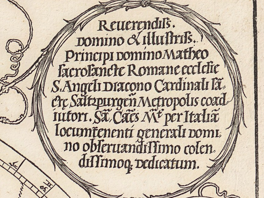
- Upper left, the arms of Cardinal Matthäus Lang under a cardinal’s hat with tassels; upper right, in a wreath, the dedication to him, which styles him coadjutor of the church of Salzburg.
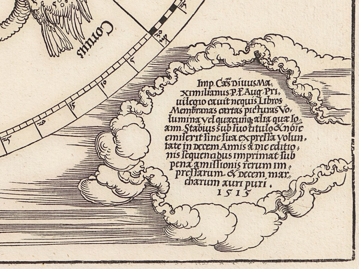
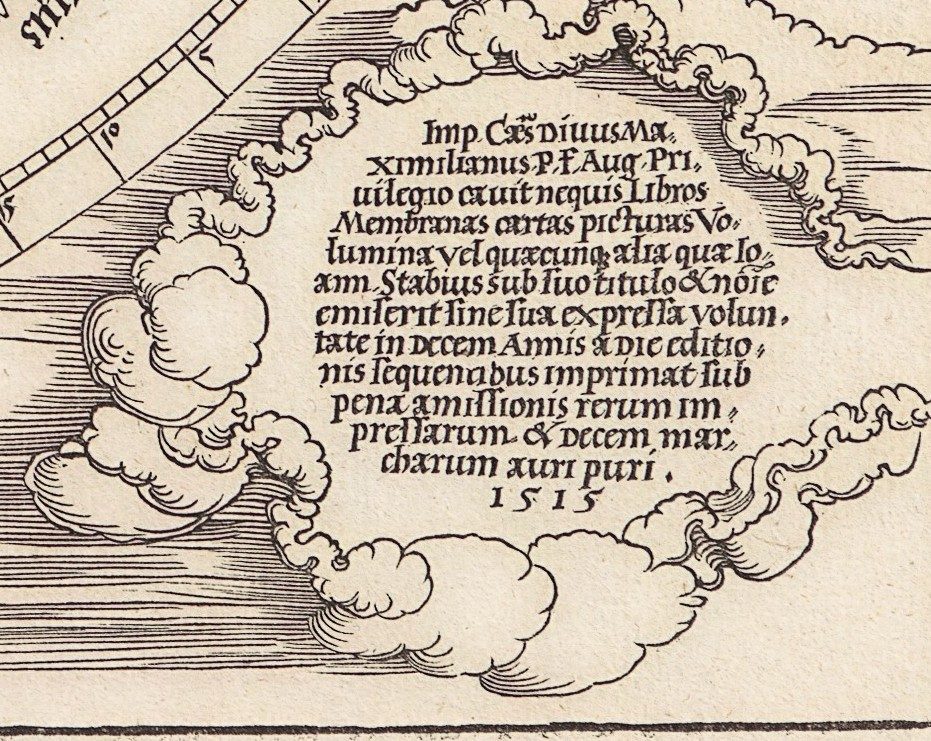
- Lower right, in a ring of clouds, the printing privilege of Emperor Maximilian I, dated 1515. It forbids anyone to reprint Stabius’s works for ten years, on pain of losing the copies and paying ten marks of pure gold — an early form of copyright, printed on the map itself.
- The Centaur, carrying a shield, drives a spear into the Wolf, which the sheet calls Fera, the wild beast.
- The Southern Fish is labelled Piscis Notius, and only the stern of the ship Argo is drawn, rising out of a cloud.
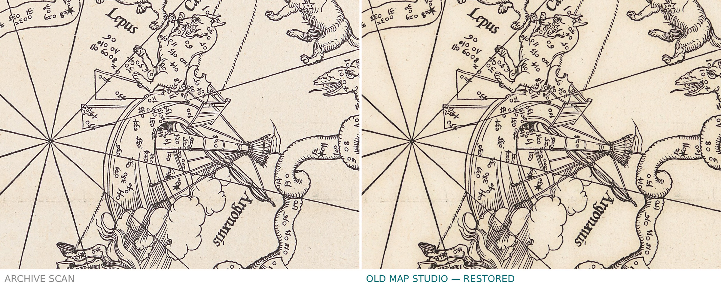
- Beside every star, a tiny number: its number in Ptolemy’s catalogue, which lists 1,022 stars in all.
Gemma Frisius copied both sheets almost exactly for a celestial globe in 1537, and many later star maps and globes followed their style.
Your file
| Original | woodcut, 1515, sheet 42.5 × 43.2 cm, The Metropolitan Museum of Art 51.537.2 |
| Scan | full sheet 3580 × 3706 px; the map inside the trimmed border 3512 × 3652 px |
| Print size at 300 dpi | the map prints to 30 cm (12 in), the full sheet with margins to 31 cm (12 in) |
| You download | six ZIP archives: full sheet, trimmed, 3:2, 4:3, 5:4 and ISO A |
| Inside each one | one JPEG at 300 dpi, the restoration passport as a PDF, a READ ME |
How to print
- The sheet is almost square, slightly upright. Pick the archive whose proportions match your frame; ask for matte fine-art paper in sRGB with auto-enhancement off.
- Where to print it: print shops near you and checked prices at online labs.
Source and rights
The file is made from the Met's own image of object 51.537.2 (Harris Brisbane Dick Fund, 1951), which the museum marks as public domain. The record does not state a place of publication or any coloring. There is no TIFF master in the package. Catalogue record: The Metropolitan Museum of Art →
- Latin
No reviews found
See also
-
 Chinese Constellation Map 1601–1633 — Fen ye yu tu Manuscript
-
Antique Star Chart 1708 — Orbits of Mars, Jupiter and Saturn
-
Antique Constellation Chart 1829 — Reissig, St Petersburg
-
Antique Star Chart 1708 — Planisphaerium Arateum
-
Constellation Map 1909 — Dilks, Stars of the First 5 Magnitudes
-
Antique Star Chart 1708 — Planisphaerium Braheum