Antique World Map 1570 — Donato Bertelli, Universale Descrittione

Description
An antique world map from Venice, 1570
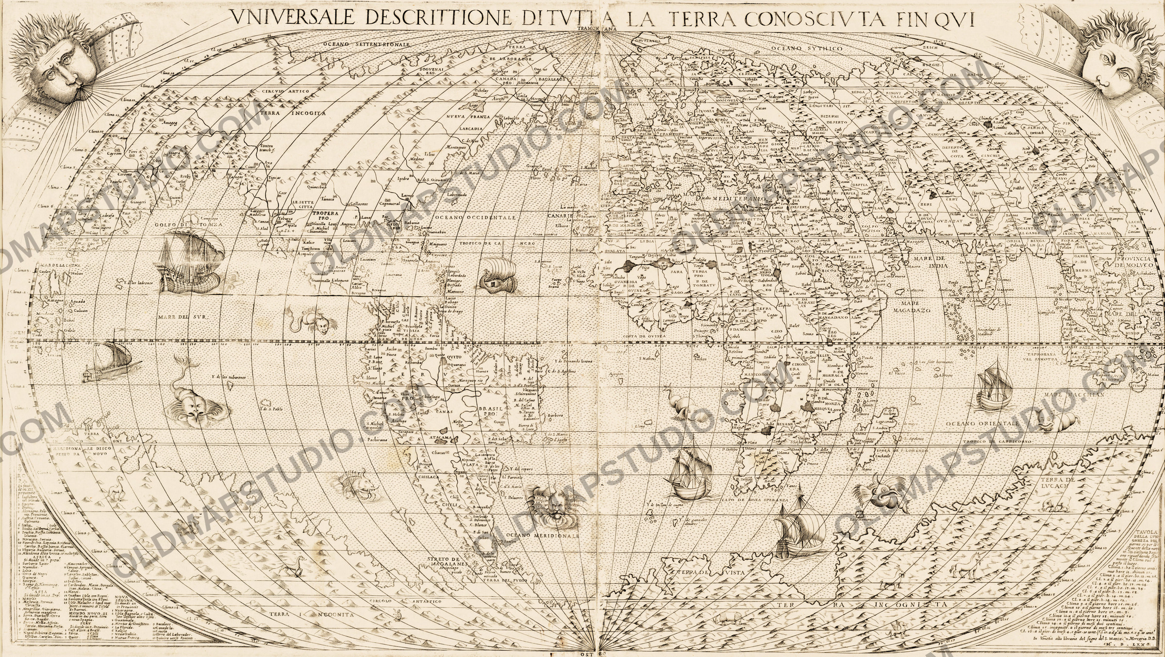
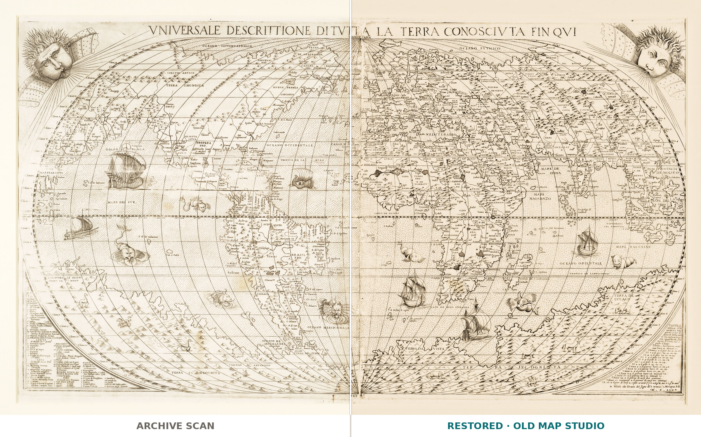
The title runs in large capitals across the top of the sheet: VNIVERSALE DESCRITTIONE DI TVTTA LA TERRA CONOSCIVTA FIN QVI, a “universal description of the whole Earth known so far”. The National Library of Scotland records the map under Donato Bertelli, active 1558–1584, with the imprint “Venetia, 1570”: a map of 41 × 54 cm on a sheet of about 52 × 61 cm. The record describes the outlines as hand-colored, but on this scanned copy no coloring is visible: the file shows the sheet uncolored, in the tone of the paper.
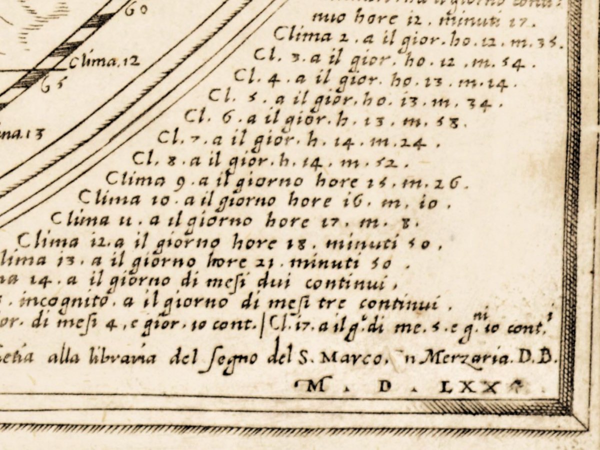
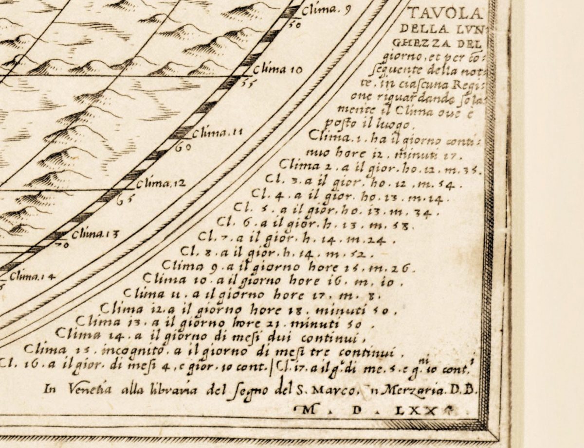
The sheet names its own shop. In the lower right corner, under a table of the length of the day, a line of italic reads In Venetia alla libraria del Segno del S. Marco. in Merzaria. D.B., with the year below in Roman numerals. Museum records place Donato Bertelli’s shop at the sign of Saint Mark in the Merceria, and note that he shared that address with Ferando Bertelli and took over plates Ferando had owned. The initials D.B. are Donato’s.
Bertelli worked in Venice, where, according to The History of Cartography, “by the 1560s, map engraving and printing were far more intense … than in Rome”, with a peak around 1566. From 1565 Venetian maps were gathered into custom-made collections, and among their publishers, “Bertelli’s name occurs the most frequently”; the Bertelli named in that passage is Ferando, who shared Donato’s shop.
The geography goes back to Giacomo Gastaldi, cosmographer to the Republic of Venice, whose “influential world map on an oval projection, the Universale” appeared in 1546. The National Maritime Museum in Greenwich holds a map of 1565 whose title begins the same way, signed “Paulo Forlani Veronese fecit” and “Ferando Bertelli Exe.”; the Museum describes it as a larger format of Gastaldi’s 1546 map, in which “America is joined to Asia”. The David Rumsey Map Collection records a Donato Bertelli world map of the same title, dated 1568 and signed D.B., as Shirley 118, a close copy of Forlani’s map. The Edinburgh record does not say how its 1570 sheet relates to these maps.
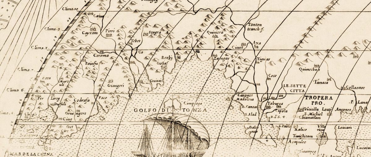
North America runs without a break into Asia: LE SETTE CITTA, the legendary Seven Cities, and Quiuiera lie on the same landmass as Tebet, Cayram and Amagog, and the only water between them is the GOLFO DI TONZA. Below, a vast southern continent fills the bottom of the oval, with animals drawn across it.
What to look for on the sheet
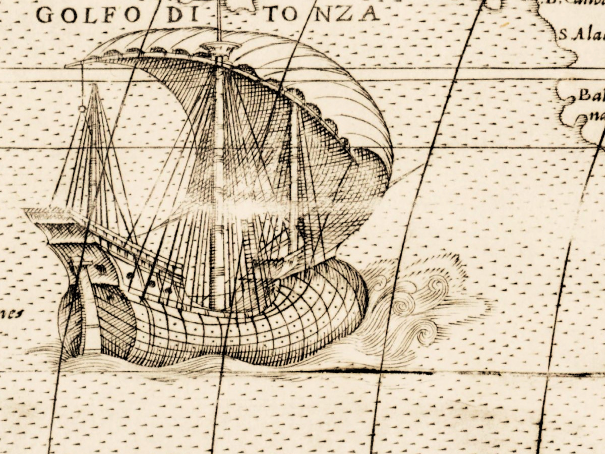
- Upper left: the GOLFO DI TONZA with a ship in full sail, between Asian provinces and LE SETTE CITTA.
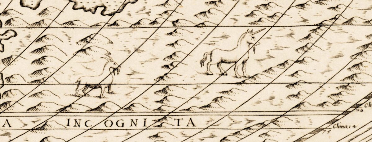
- Along the bottom, TERRA INCOGNITA: a camel, a lion and another long-necked beast at the left, a rhinoceros, a goat, a winged griffin and a unicorn further right, and an elephant in TERRA DE LVCACH below Java.
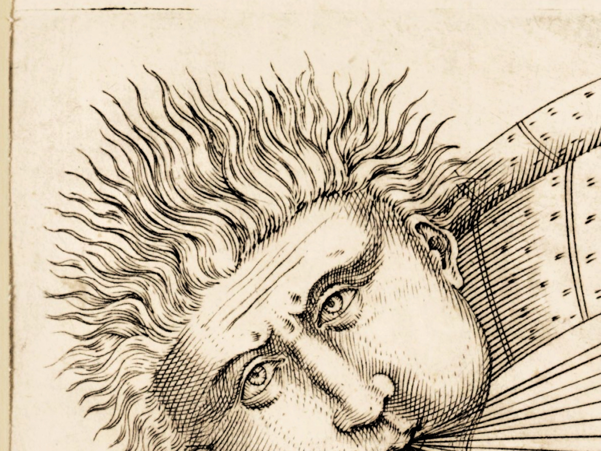
- Two wind heads in the upper corners, breath streaming across the oval.
- Lower left, a table that divides Europe into twelve provinces, Africa into seven, Asia into fifteen and the MONDO NOVO into Peru and New Spain.
- Lower right, the TAVOLA DELLA LVNGHEZZA DEL giorno: the length of the day in seventeen climates, from 12 hours 17 minutes to five months and ten days.
- The Spice Islands at both edges of the oval: Ambon appears once on the far right and again on the far left, beside a galley in the MARE DEL SVR.
Sheets like this one were bound into the composite atlases that collectors assembled to order, and the Gastaldi picture of the world, with America joined to Asia, kept circulating from shop to shop under new imprints.
Everything on this sheet: full record
Every inscription on the sheet
Inscriptions are given letter for letter as they appear on this scan, with the capitals, abbreviations and punctuation of the sheet; u and v are kept as engraved. The map carries several thousand place names, so outside the frame everything is listed, and inside the oval a selection of the ocean names, continent labels and larger region names. Italian and Spanish are translated in [square brackets] where the meaning is not obvious.
- Top margin, the title in capitals across both halves of the sheet: VNIVERSALE DESCRITTIONE DI TVTTA LA TERRA CONOSCIVTA FIN QVI [universal description of the whole Earth known so far].
- Upper corners: two wind heads among clouds, without names. At the top of the oval, where the meridians meet: TRAMONTANA [the north wind, north].
- Oceans and seas: OCEANO SETTENTRIONALE, OCEANO OCCIDENTALE, OCEANO MERIDIONALE, OCEANO ORIENTALE, MARE DEL SVR [the South Sea, the Pacific], MARE DE INDIA, MARE MACCHIAN, MAR DE LA CHINA.
- Circles and lines: CIRCVLO ARTICO, TROPICO DE CARRICORNO [sic, for Capricorno], CIRCOLO ANTARTICO; the equator is a graduated band numbered in fives of longitude, and Clima numbers with degrees of latitude run down both curved edges of the oval.
- North America and Asia, one landmass: TERRA DE LABORADOR, CANADA PRO:, BACALEAOS, NVEVA FRANZA, LARCADIA, LA FLORIDA, LE SETTE CITTA [the Seven Cities], Quiuiera, TROPERA PRO., Tonton teanch and, across the GOLFO DI TONZA, Tebet, Cayram and Amagog; above them TERRA INCOGITA.
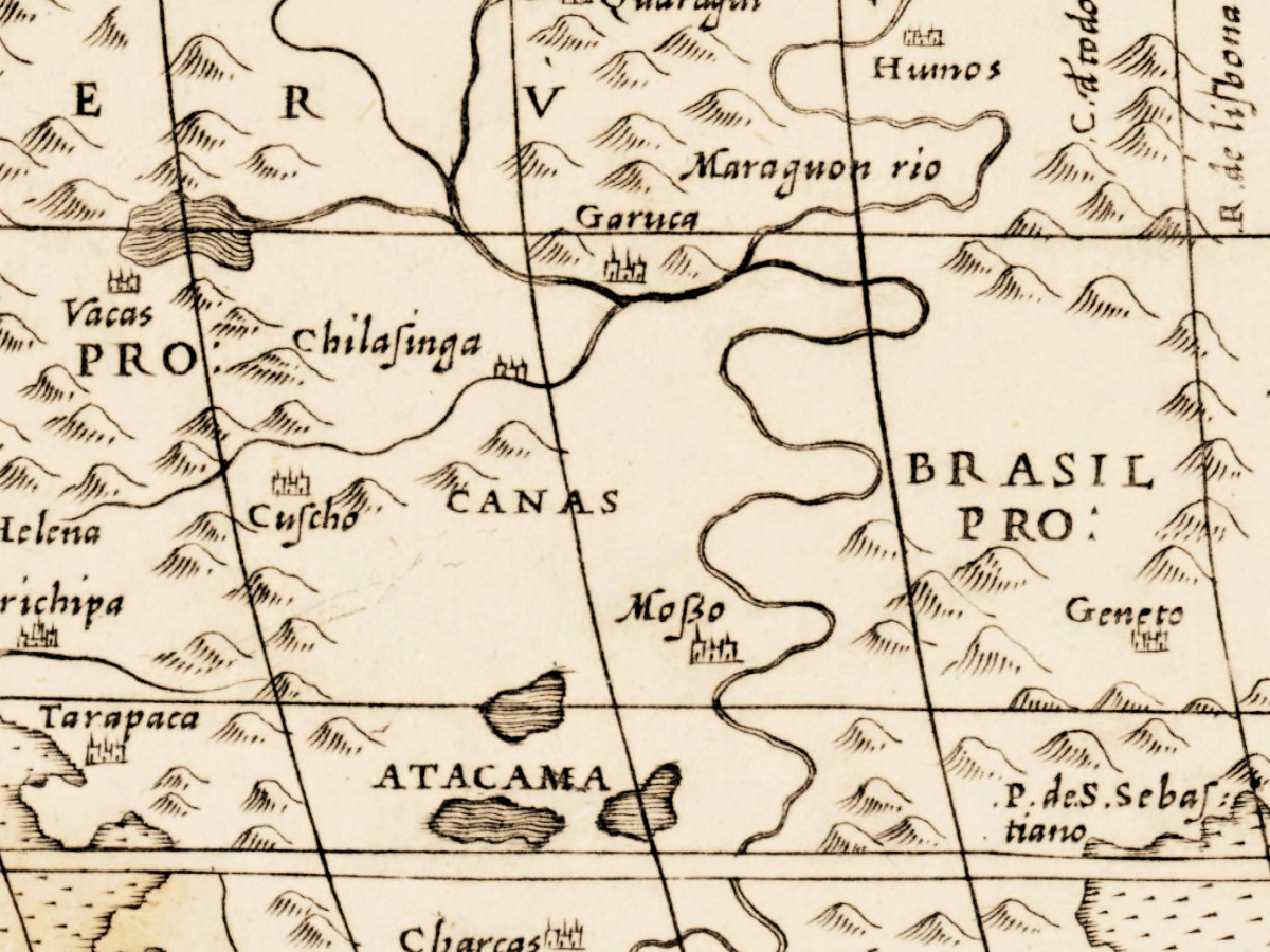
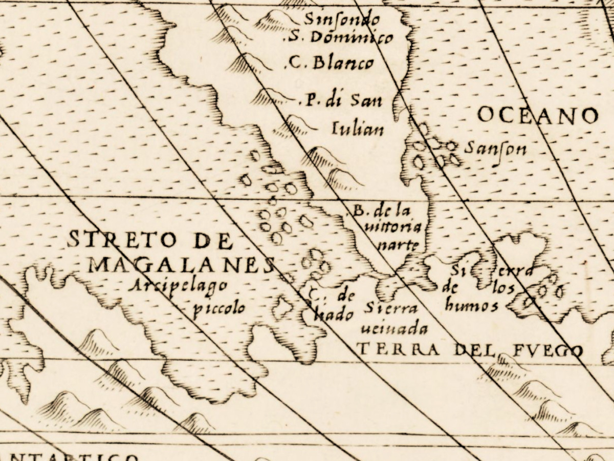
- South America: QVITO, PERV, BRASIL PRO:, ATACAMA, PLATA, CHILI, CHILACA, STRETO DE MAGALANES, TERRA DEL FVEGO.
- Asia and the islands: CATAYO, DESERTO DE COTA, Ceylan, TAPROBANA VEL SAMOTRA [Taprobana, or Sumatra], IAVA MAIOR, IAVA MINOR, PROVINCIA DE MOLVCO, TIMOR, Ambon.
- The southern continent: TERRA INCOGNITA along the bottom, its letters spread between the hills; at the left MERIDIONA LE DISCO: PERTO DA NOVO [southern, newly discovered]; TERRA DE VISTA south of Africa; TERRA DE LVCACH south of Java. Animals drawn on it: a camel, a lion, a second long-necked beast, a rhinoceros, a goat, a winged griffin, a unicorn and an elephant, with a small human figure near the CIRCOLO ANTARTICO.
- Lower left, in a ruled panel: EVROPA Si diuide in XII prouincie (broken over several lines) [Europe is divided into twelve provinces], numbered 1 to 12 from Inghiltera con Irlanda to Macedonia detta Grecia, co molte Isole; AFRICA Si diuide in 7. prou.; ASIA Si diuide in.15. Pro:; MONDO NOVO, SI diuide in due parti, Peru e noua Spagna, with PERV Si diuide in.7. Prouincie and NOVA SPAGNA Si diuide in 13 Prouincie, ending with Quiuira uerso Ponente [Quivira, toward the west].
- Lower right, in a ruled panel: TAVOLA DELLA LVNGHEZZA DEL giorno, et per coseguente della notte, in ciascuna Regione riguardando solamente il Clima oue e posto il luogo [table of the length of the day, and therefore of the night, in each region, looking only at the climate where the place lies], then seventeen lines, from Clima. 1. ha il giorno continuo hore 12. minuti 17. [climate 1 has a day of 12 hours 17 minutes] to the seventeenth climate, a day of five months and ten days (di me. 5. e g.ni 10 cont.).
- Below the table, the imprint: In Venetia alla libraria del Segno del S. Marco. in Merzaria. D.B. [in Venice, at the bookshop at the sign of Saint Mark, in the Merceria; D.B.], and beneath it the year M . D . LXX, followed by a blurred mark.
Discrepancies on the sheet itself. The northern unknown land is engraved TERRA INCOGITA, without the second N, while the southern one reads TERRA INCOGNITA. The Spice Islands appear twice, because they lie on the 180th meridian where both edges of the oval end: Ambon stands at the right edge beside Timor and again at the left edge beside Bacca, below Gilolo. Sumatra is named TAPROBANA VEL SAMOTRA, while Sri Lanka has its own label, Ceylan. The last character of the date is not legible on this scan; the year 1570 comes from the library record.
Editions and other known copies
- National Library of Scotland, Edinburgh, shelfmark EMW.s.16, map image 74440030 (this copy): Bertelli, Donato, active 1558–1584; “Venetia, 1570”; “1 map : hand col. outlines ; 41 x 54 cm., on sheet, ca. 52 x 61 cm.” The record gives no notes or references.
- David Rumsey Map Collection, list no. 10009.000: a Donato Bertelli world map of the same title, dated 1568, 53 × 81 cm, catalogued as Shirley 118; the note reads the initials D.B. as Donato Bertelli’s and calls the plate a close copy of Forlani’s world map.
- Related map, not this plate: National Maritime Museum, Greenwich, PBC3995(4), signed “Paulo Forlani Veronese fecit” and “Ferando Bertelli Exe.”, dated 1565, printed area 760 × 430 mm, item 4 of an Italian composite atlas; described by the Museum as a larger format of Gastaldi’s 1546 map.
None of these records names states of the plate. The Edinburgh record dates its copy 1570, while the Rumsey copy of the Donato Bertelli map is dated 1568; whether they are two states of one plate is not stated in any record opened for this page.
Catalog entries and sources
National Library of Scotland EMW.s.16, image 74440030; David Rumsey Map Collection 10009.000; Shirley 118 (as cited by the Rumsey record); National Maritime Museum PBC3995(4). Sources for the story and this record: the National Library of Scotland map record; David Woodward, “Italian Composite Atlases of the Sixteenth Century” and the chapter on Italian map trade in The History of Cartography, volume 3; the collection records of the National Maritime Museum, the David Rumsey Map Collection, the University of the Arts London collections and museum-digital for Donato and Ferando Bertelli.
This copy
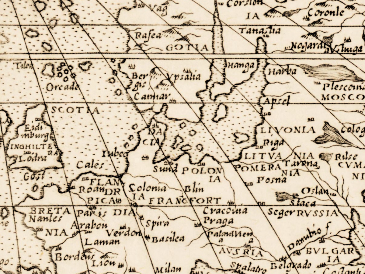
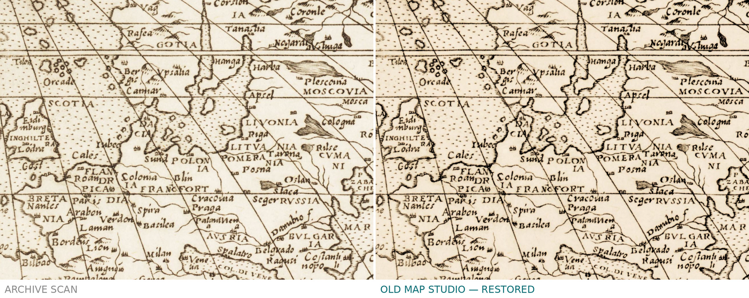
The scan shows the sheet uncolored, in the tone of the paper, although the library record speaks of hand-colored outlines. The map is printed from two plates joined down the middle: a vertical join runs through the title between TVTT and A and down through TRAMONTANA. The plate border is visible on all sides, with a narrow paper margin beyond it. A few light brown spots lie near the west coast of South America; otherwise the impression is clean and the fine hatching of the wind heads and sea creatures is sharp.
Your file
| Original | Donato Bertelli, Universale Descrittione di tutta La Terra conosciuta finqui, Venetia, 1570; map 41 × 54 cm on a sheet of about 52 × 61 cm |
| Scan | full sheet 12382 × 7337 px; the map inside the trimmed border 11806 × 6660 px |
| Print size at 300 dpi | the map prints to 99 cm (39 in), the full sheet with margins to 104 cm (41 in) |
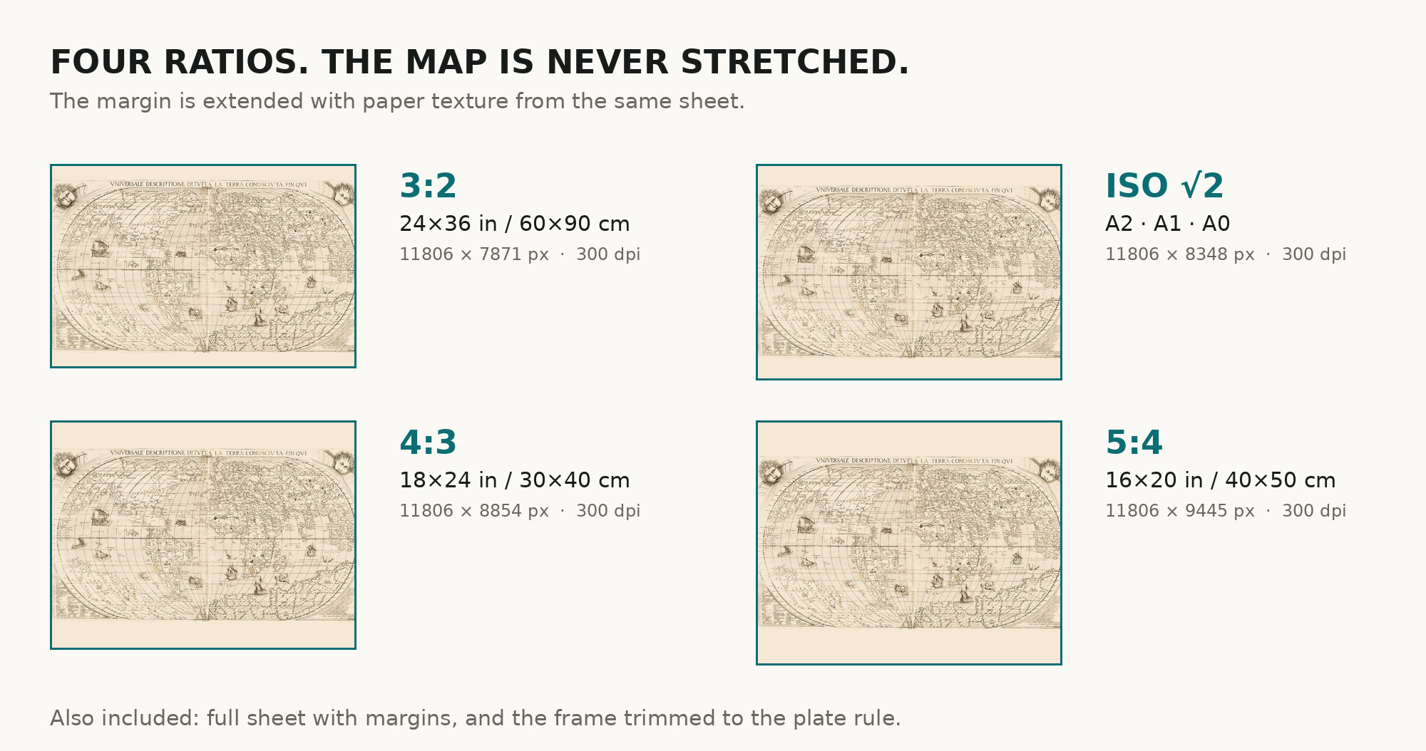
| You download | six ZIP archives: full sheet, trimmed, 3:2, 4:3, 5:4 and ISO A |
| Inside each one | one JPEG at 300 dpi, the restoration passport as a PDF, a READ ME |
How to print
- The sheet is horizontal. At 300 dpi the map prints to 99 cm, so it suits a large frame. Pick the archive whose proportions match your frame; ask for matte fine-art paper in sRGB with auto-enhancement off.
- Where to print it: print shops near you and checked prices at online labs.
Source and rights
The scan comes from the National Library of Scotland, shelfmark EMW.s.16 (map image 74440030). The Library publishes it under the Creative Commons Attribution (CC BY) licence and asks re-users to credit “Reproduce with the permission of the National Library of Scotland”. The record does not name the printing technique. There is no TIFF master in the package. Catalogue record: National Library of Scotland →
Features
- Italian
Attachments
Reviews
No reviews found
More maps from the 1500s
-
 Antique Map of Europe 1570 — Ortelius, Europae
-
Antique Map of Asia 1570 — Ortelius, Asiae Nova Descriptio
-
Antique Map of Africa 1570 — Ortelius, Africae Tabula Nova
-
Antique Map of America 1570 — Ortelius, Americae sive Novi Orbis
-
Old World Map 1570 — Ortelius, Typus Orbis Terrarum, Colored
-
Antique World Map 1564 — Mercator, Quam Hic Vides Orbis Imaginem