
Maps from Abraham Ortelius’s Theatrum orbis terrarum of 1570, the atlas Britannica calls the first modern atlas: the world map Typus orbis terrarum and the maps of the four continents. Each is restored from a named library scan and ready to print at 300 dpi.
Abraham Ortelius and the first modern atlas
Abraham Ortelius (1527–1598) was born and died in Antwerp. He began as an afsetter van carten, an illuminator of maps, and about 1560, under the influence of Gerard Mercator, turned to mapmaking. On 20 May 1570 he published the Theatrum orbis terrarum, the “Theatre of the World”, which Britannica calls the first modern atlas: the Library of Congress copy of the first edition has 53 map sheets, each with text on the back, and its list of authorities names 87 mapmakers whose work Ortelius used. Nearly all the plates were cut by Frans Hogenberg and his assistants, and in 1575 Ortelius was appointed geographer to Philip II of Spain.
The atlas opened with the world, an oval map titled Typus orbis terrarum, followed by one map for each of the four continents; most of the rest showed the countries and provinces of Europe. The geography was largely Mercator’s — Royal Museums Greenwich calls the world map a simplified version of Mercator’s world map of 1569 — with Giacomo Gastaldi’s maps behind those of Asia and Africa. The Library of Congress counts twenty-five editions between 1570 and Ortelius’s death, and the atlas went on being reissued after it.
Ortelius maps in this collection
- Typus orbis terrarum, 1570, coloured: the world map of the first edition, with a line of Cicero in the bottom cartouche — what can seem great in human affairs to one who knows all eternity and the size of the whole world?
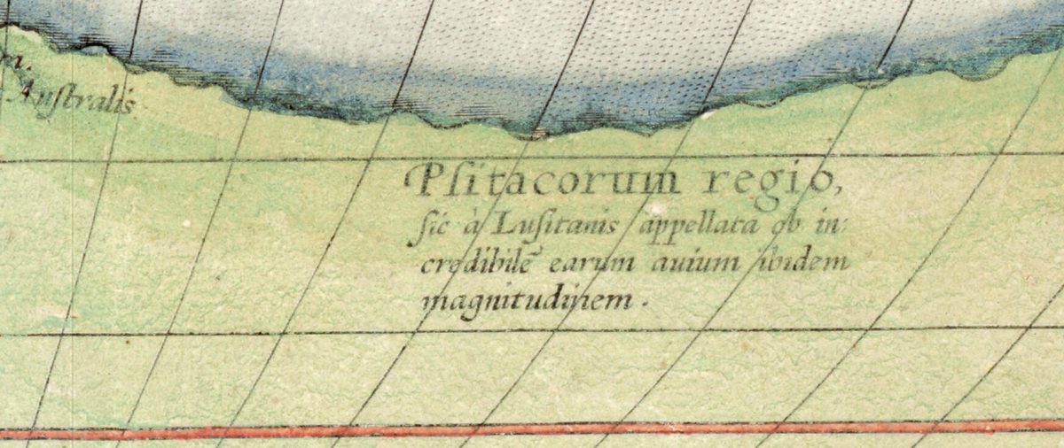
- Typus orbis terrarum, impression of 1579 or later: the same oval plate, signed by Frans Hogenberg, from a Latin edition, with TERRA AVSTRALIS NONDVM COGNITA, the southern land not yet known, along the bottom.
- Europae, 1570: Europa on the bull above the title, Iceland “once Thule”, and Muscovy after Anthony Jenkinson’s map of 1562.
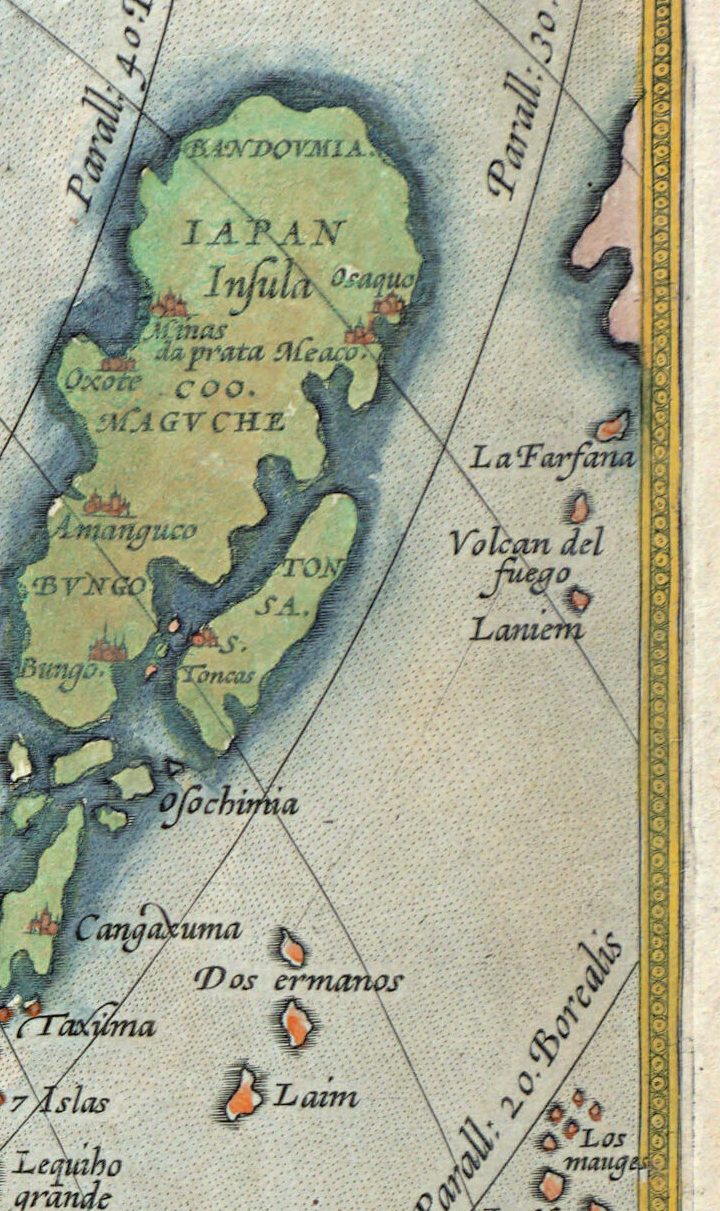
- Asiae nova descriptio, 1570: Japan as one island, Quinsai with its twelve thousand bridges after Marco Polo, and New Guinea.
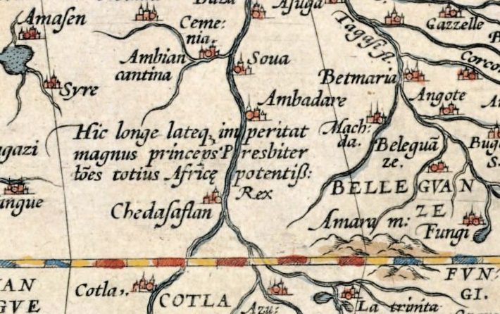
- Africae tabula nova, 1570: after Gastaldi’s eight-sheet map of Africa of 1564, with the Nile rising from two lakes, Prester John and a sea battle in the southern ocean.
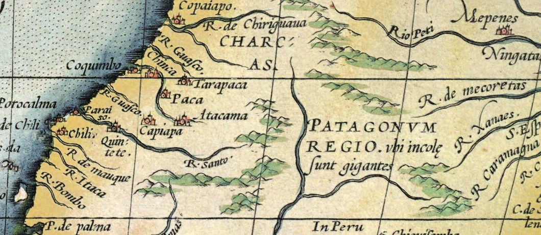
- Americae sive novi orbis nova descriptio, 1570: in Marcel van den Broecke’s words “the first depiction of the Americas in a regular atlas”, with the west coast bulging below Peru and the land of the Patagonian giants.
Telling the impressions apart
The world plate changed as it was reprinted. In van den Broecke’s catalogue of Ortelius’s maps, bolts appear in its lower left corner in 1575 to repair a crack; in 1579 the crack is partly mended and the clouds reworked; in 1584 the date was added after Hogenberg’s signature. The Library of Congress dates our second impression to 1579 or later for that reason, and on it the signature still stands alone. All six sheets also appear among the world maps of the 1500s; for the world before printed atlases see mappae mundi and medieval maps.
Choosing and printing an Ortelius map
Sizes run from 34 cm for the map of Europe to 87 cm for the coloured world map of 1570; the impression of 1579 prints cleanly to 49 cm and the continents to 34–44 cm. Each listing states the largest size the sheet prints cleanly at 300 dpi, and each is a scan of a real copy in a named library; nothing is redrawn.
Questions
Who was Abraham Ortelius?
A mapmaker of Antwerp (1527–1598) who began as an illuminator of maps and in 1570 published the Theatrum orbis terrarum, the atlas Britannica calls the first modern atlas. In 1575 he was appointed geographer to Philip II of Spain.
What is the Typus orbis terrarum?
The world map that opens Ortelius’s Theatrum orbis terrarum: an oval plate engraved by Frans Hogenberg, largely after Mercator’s world map of 1569, with a vast southern continent along the bottom. This collection has it twice, in a coloured copy of 1570 and in an impression of 1579 or later.
Was the Theatrum orbis terrarum the first atlas?
Britannica calls it the first modern atlas, and the Leventhal Map & Education Center describes it as the first time a set of current maps was designed, drawn and engraved to be published together in one bound volume. Ortelius himself did not call it an atlas: his title means “Theatre of the World”.
How large can I print an Ortelius map?
From 34 cm to 87 cm at 300 dpi, depending on the sheet. Each listing gives the largest clean size, calculated from the scan and never from an upscale.